ENERGY: Aloha


“Waikiki Beach, Diamond Head, Oahu,” by D. Howard Hitchcock, Hawaii 1928. Image: wikimedia in the public domain. Included with appreciation to D. Howard Hitchcock.

Aloha means both hello and goodbye. It’s a fitting word for transitions. Here are two case examples of solar policy changes in Hawaii and in Australia.

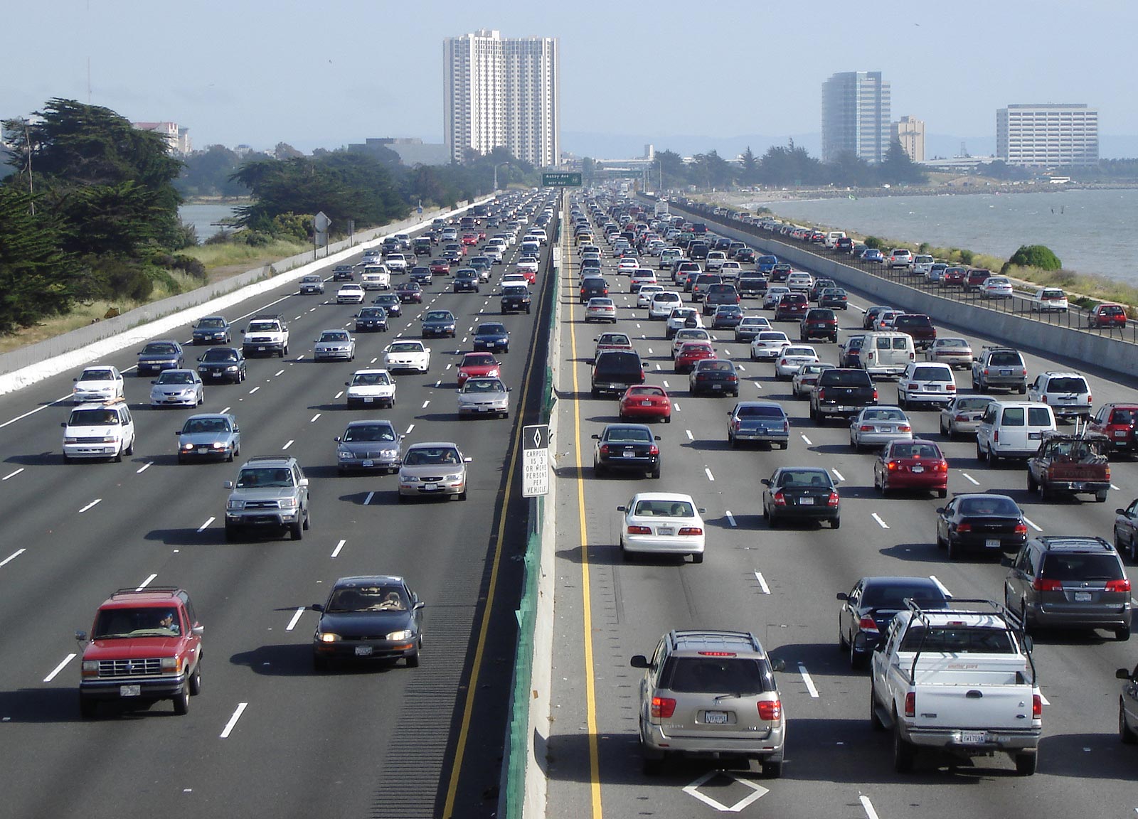
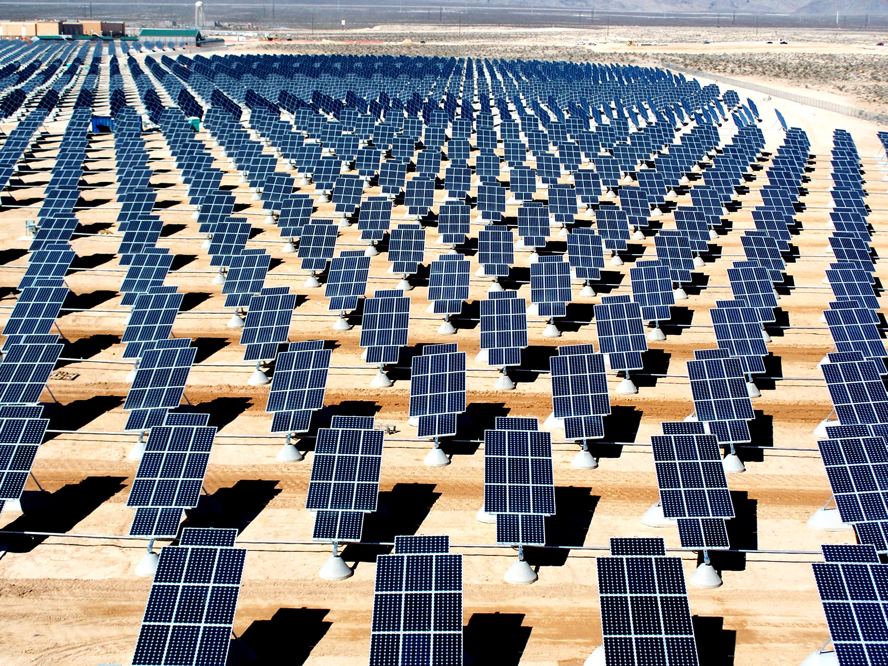
Hawaii is a perfect location for renewable energy: sunshine and wind are abundant. Yet, even with its natural advantages of sun and wind, Hawaii has been slow to move away from fossil fuels. But when electricity rates increased by 34% (from April 2021 to April 2022), homeowners who pay those hiked rates began to install solar. Now, more than one-third of all residential buildings in Hawaii have solar roofs. Could Hawaii serve as a case example of the challenges, and paths, to transitioning from fossil to renewable energy?

“Hawaii solar: a photovoltaic power station.” by photographer Reegan Moen, U.S. Department of Energy, 2017. Wikimedia public domain. Included with appreciation to Reegan Moen and U.S. Department of Energy.

Policy matters. Just a few years ago, Hawaiian Electric, the largest power provider in the island state, lobbied to reduce rebates for rooftop solar. In 2015, utilities slashed revenues for excess energy sent to the grid by homeowners. But Hawaii has changed policies now, offering incentives up to $4,000 for Oahu residents to install home batteries for solar systems: the utilities now siphon excess power between 6pm – 8:30 pm, when demand peaks. Policy has encouraged solar adoption: legislating a Performance Based Regulation (PBR) for Hawaiian Electric now makes renewable sources easier to adopt and link, further aiding homeowners in their rooftop systems. Kauai has made the most progress: 70% of the island’s electricity is carbon-free and expected to increase to 90% with more solar and a hydroelectric plant that both creates and stores energy.

How will geopolitics hasten the clean energy transition? “Top Oil Producing Countries,” by U.S. Department of Energy, 2022. Image: wikimedia, public domain. Included with appreciation.

Geopolitics recently hastened the transition. In 2021, oil-supplied power plants delivered two-thirds of Hawaii’s electricity. Most of that oil (80%) was imported from Russia (as well as Argentina and Libya), while 20% was obtained from Alaska. Further, Hawaii is about to close its major coal plant. Forces of war and threats to supply have turned Hawaii in the direction of the sun. There is still debate over what kind of solar is best: utilities prefer large-scale options; but macro-scale means large tracts of land, something Hawaii does not have in abundance. Hawaii has set a new goal to achieve 100% renewable energy sources: it is the first American state to do so. Recently, other states have set the same goal. Cities are making solar decisions ahead of states. Hawaii’s Honolulu has three solar panels per person; California’s Los Angeles ranked number one of 57 cities surveyed for total installed solar capacity in 2019, while Nevada’s Las Vegas is close behind. In 2019, more solar capacity was added to the U.S. grid than any other energy source.

“The Famous Bondi Beach, Australia,” by photographer Alex Proimos, 2012. Image: creative commons 2.0. Included with appreciation to Alex Proimos.

Another place in the sun? Bondi Beach, Australia, home of  Snowy Mountains Hydroelectric.  Australia drew 76% of its total energy from fossil fuels in 2020 with a mix of coal (54%), gas (20%), and oil (2%). Australia plans to close its largest coal plant in 2025 (seven years earlier than scheduled) and is now picking up the pace in solar. Australia increased rooftop solar installations by 28% from 2019 to 2020 – one in four homes there have solar panels: incentives and grants, contributed to the change. By 2020, renewable energy reached 24% of Australia’s power array. How much did the Renewable Energy (Electricity) Act of 2000 accelerate the change? Will the 2022 election of a new Australian government advance climate action?

“Sunlight on the face of Earth,” by NASA Earth Polychromatic Imaging Camera (EPIC) that tracks sunlight , from Deep Space Climate Observatory (DSCOVR)” by NASA 2017. Image: wikimedia public domain. With appreciation to NASA.

Hawaii and Australia may serve as examples of how natural resources like sun and wind interact with policy and geopolitics in a dynamic system influencing factors driving the transition from fossil fuels to renewable energy. What kinds of laws and policies are needed to encourage change?

Australia, Federal Register of Legislation. “Renewable Energy (Electricity) Act 2000.” C2019C00061. https://www.legislation.gov.au/Details/C2019C00061/Html/Text

Australian Government of Industry, Science, Energy, and Resources. “Australian electricity generation – fuel mix.” 2020. https://www.legislation.gov.au/Details/C2019C00061/Html/Text

Environment America Research and Policy Center, and Frontier Group. “Shining Cities 2020: The Top U.S. Cities for Solar Energy.” 2020. https://environmentamerica.org/feature/ame/shining-cities-2020

Harlow, Casey. “Honolulu tops national list for solar energy generation.” 19 April 2022. Hawaii Public Radio. https://www.hawaiippublicradio.org/local-news/2022-04-19/honolulu-tops-national-list-for-solar-energy-generation

Hawaii Public Utilities Commission (PUC). “Performance Based Regulation (PBR).” Decision and Order No 37787, 17 May 2021. https://puc.hawaii.gov/energy/pbr/

Paul, Sonali. “Australia’s biggest coal-fired power plant to shut in 2025.” 16 February 2022. Reuters. https://www.reuters.com/business/energy/origin-shut-australias-biggest-coal-fired-power-plant-225-2022-02-16/

Penn, Ivan. “Hit Hard by High Energy Costs, Hawaii Looks to the Sun.” 30 May 2022. The New York Times.

Building the World Blog by Kathleen Lusk Brooke and Zoe G. Quinn is licensed under a Creative Commons Attribution-NonCommercial-NoDerivs 3.0 Un

TRANSPORT: Highways and Wildflowers

“Balsamroot and lupine wildflowers near Tom McCall Preserve along the highway.” by photographer Gary Halvorson, Oregon State Archives, 2014. CC 3.0. Included with appreciation.

On Memorial Day weekend, 34 million Americans will travel by car. It’s the first long weekend of spring: a time of flowers, especially wildflowers. Parks play a role, and so do household and campus lawns participating in No Mow May. But highways can also provide miles of sustenance for spring pollinators like bees.

Highways will be an area of innovation in climate change. “Interstate 80, Eastshore,” by photographer Minesweeper 30. CC3.0. Included with appreciation.

Concrete is efficient, but highways could be improved. In 1965, the United States passed the Highway Beautification Act, providing funding for planting and protection of wildflowers along median and shoulder strips of American highways. President Lyndon B. Johnson signed the bill into law, stating “We have placed a wall of civilization between us and the beauty of the countryside. Beauty belongs to all the people.” (Johnson, 1965) Encouraged by his wife, Lady Bird Johnson who advocated the program to beautify American roads. The Lady Bird Johnson Wildflower Center also honors her vision.

“Highways UK-EI.” by SPUI, dedicated to the public domain. Image: wikimedia. Included with appreciation.

In the United Kingdom (UK), the Construction Industry Research and Information Association (CIRIA) launched the “Big Biodiversity Challenge” with Highways England. Realizing that the UK has lost 97% of its wildflower meadows since 1930, road construction crews finish highways by preparing a side strip or verge for wildflower planting. Highways England plants the flowers. Recently, a section of the A38 from Ashburton to Ivybridge in Devon won the Biodiversity Pollinator Award. France places stormwater ponds every two kilometers along major roads: a recent survey found the ponds have welcomed many amphibian species. Across the UK, B-Lines have mapped a kind of bug highway across England, Northern Ireland, Scotland, and Wales.

Belt and Road Initiative. “One-belt-one-road,” by Lommes. Creative Commons 4.0 International. Included with appreciation.

As the world builds more roads, including space for wildflowers and wildlife is an opportunity to be noted. Will China’s Belt and Road Initiative  (BRI) connecting China, Central and West Africa, parts of Europe, Indian sub-continent, Indo-China, Mongolia, and Pakistan may be the largest road building project in history. Now, as 37,000 miles (60,000 kilometers) of roads are designed and built, would offer an un-precedented chance for environmental inclusion. Should environmental provisions be stipulated by banks, including multilateral development banks and the National Development and Reform Commission (NDRC), funding and overseeing the BRI? What of the roads of India? Africa? The Pan-American Highway?

“Wild-flower” by photographer Anilmahajan19, 2017, in Nagpur, India. GNU license. Included with appreciation.

It has been the practice of some highway systems to seed the median strip between divided highways with grass. But grass can be thirsty, and yet yields relatively sparse benefits. In fact, some states in the Colorado River Compact are outlawing non-functional turf due to the shrinking of Lake Mead and Lake Powell, water reservoirs for the river that supplies both drinking water and electricity to 40 million people. Drought in the area is causing water shortages and also wildfires.

“Lake Mead and Hoover Dam with water intake towers, seen from Arizona side of Hoover Dam,” by photographer Cmpxchg8b, 2010. Generously dedicated to the public domain by the photographer.Image: wikimedia. Included with appreciation.

Should highways be planted, instead, with wildflowers? If you hit the road this weekend, take a look at the wildflowers along highways and also country roads. It’s a natural resource, not often noticed, but increasingly important to the future of climate and environment.

What if all highways and roads hosted wildflowers? Could the world look like this? “Bitterwater Road Wildflowers,” by photographer Alan Schmierer, generously dedicated to the public domain CC1.0. Wikimedia. Included with appreciation.

Conniff, Richard. “Green Highways: New Strategies To Manage Roadsides as Habitat.” 10 June 2013. Yale Environmental 360, Yale University School of the Environment.

Construction Industry Research and Information Association (CIRIA).  https://www.ciria.org

Forman, Richard T.T., et al., Road Ecology: Science and Solutions. Island Press, 2003. ISBN: 1559629326 and 1559639334.

Highways England. https://www.gov.uk/government/organisations/highways-england/

Lady Bird Johnson Wildflower Center. https://www.wildflower.org

Organisation for Economic Cooperation and Development (OECD). “China’s Belt and Road Initiative in the Global Trade, Investment, and Finance Landscape.” OECD Business and Finance Outlook 2018. https://www.oecd.org/finance/Chinas-Belt-and-Road-Initiative-in-the-global-trade-investment-and-finance-landscape.pdf

United States Highway Beautification Act of 1965. Public Law 89-285, 22 October 1965. https://www.govinfo.gov/content/pkg/STATUTE-79/pdf/STATUTE-79-Pg1028.pdf

Building the World Blog by Kathleen Lusk Brooke and Zoe G. Quinn is licensed under a Creative Commons Attribution-NonCommercial-NoDerivs 3.0 Un

WATER: Mapping YOUR Climate Risk

What is your climate risk? Animation created by SaVi software from Geometry Center, University of Minnesota by Grand DixenceWikipedia for view of Iridium coverage. Image animation edicated to the public domain (CC1.0) by its creator, and included here with appreciation.

Climate change brings risk. For some, it is water: floods, storms, and sea-rise. For others, it is drought: water shortages, crop losses, and wildfires. Floods killed 920 people in Belgium and Germany, 192 in India, 113 in Afghanistan, and 99 in China – in one month (July) of 2021. Deaths from floods and related landslides took the lives of people in Bangladesh, Japan, Nepal, Pakistan, and Yemen that same year. (Davies 2021)

“Flooding in Cedar Rapids, Iowa, USA.” Photographed by Don Becker, USGS, 2008. Dedicated to the public domain (CC1.0) by United States Geological Survey and included here with appreciation.

Previous data from weather sources tracked flood risk, resulting in flood insurance for many properties (and denial of such insurance for locations too vulnerable to merit rebuilding). Water damage will only increase with climate warming, as storms grow more powerful. Rising sea levels will escalate floods and coastal inundations. Those who live in the territories of the Colorado River know well another risk related to water: drought. Water scarcity has ravaged crops, parched residential landscapes, reduced drinking water supplies, and now threatens hydropower created by the Hoover Dam. Australia, the most arid continent on Earth, is vulnerable crop loss, and electricity reduction in facilities like Snowy Mountains Hydroelectric Power.

California Fires in 2021. “Erber Fire in Thousand Oaks,” by Venture County Fire Department Public Information Office. Dedicated to the public domain (CC1.0) and included here with appreciation.

Drought also brings another danger: wild fire. Fire risk is growing with climate warming. In 1980, fire damage in the United States tallied $10 billion; in 2021, costs reached $300 billion. Worldwide, fire affects 1.5 million square miles (four million square kilometers) of Earth – each year. To picture that, the area would measure one-half of the continental United States, or more than the entirety of India. Using data from satellites like the Copernicus Sentinel-3, and the European Space Agency (ESA). the Centre for Research on the Epidemiology of Disasters tracked 470 wildfire disasters (incidents affecting more than 100 people) since 1911, totaling $120 billion in damages. The 2021 Dixie Fire in California devoured 626,751 acres (253,647 hectares); that same year, in Siberia, wildfires destroyed 3.7 million acres (1.5 million hectares) to become the largest wildfire in documented history. In 2022, the Calf Canyon-Hermits Peak fire in New Mexico continues burning over 270,00 acres and is still (at this writing) only 29% contained. The cumulonimbus flammagenitus cloud ( or CbFg or pyroCb) from the fire could be seen from space on NASA’s Aqua satellite via MODIS.

What’s your property’s climate risk? Photography by Antan0, 2010. Image of magnifying glass. CC4.0; included here with appreciation.

Would you like to know what the future looks like in your area? Now, a new mapping technology from the First Street Foundation can help you determine your risk. If you live in the United States, enter your street address, or your zip code, and you will see if you are one of 30 million properties vulnerable to flooding or wildfire. To assess your own property’s risk, click here.

Aqua Mission. Earth Observing System, NASA. https://aqua.nasa.gov/content/aqua-earth-observing-satellite-mission

Centre for Research on the Epidemiology of Disasters. https://www.cred.be

Copernicus Sentinel-3. “Measuring Earth’s oceans, land, ice, and atmosphere to monitor and understand global dynamics.” European Space Agency (ESA). https://www.esa.int/Applications/Observing_the_Earth/Copernicus/Sentinel-3

Davies, Richard. “Worldwide – Over 920 People Killed in Floods and Landslides in July 2021.” 2 August 2021. Floodlist. https://floodlist.com/asia/world-floods-july-2021

First Street Foundation. “Make climate risk accessible, easy to understand, and actionable for individuals, governments, and industry.” https://firststreet.org/mission/

Haddad, Mohammed and Mohammed Hussein. “Mapping Wildfires around the World.” 19 August 2021. Al Jazeera. https://www.aljazeera.com/news/2021/8/19/mapping-wildfires-around-the-world-interactive

Risk Factor. “A property’s flood or fire factor.” https://riskfactor.com

Building the World Blog by Kathleen Lusk Brooke and Zoe G. Quinn is licensed under a Creative Commons Attribution-NonCommercial-NoDerivs 3.0 Un


CITIES: Fast Forward Food

“Noodle Bowl for Lunch” by Tran Mau Tri Tam, 2016. Wikimedia/Unsplash: CC0 1.0. Dedicated to the public domain by the photographer. Included with appreciation.

Cities are known for fast food: the drive-through, the grab and go, the snack stop, pop-up restaurants, food trucks, street cafes and food stalls. Fast food can also be found on shelves of urban convenience and grocery stores. One of the world’s favorite quick treats is the instant noodle. In 2020, 116 billion servings of instant noodles were enjoyed. (Cairns 2022)

“Singapore Skyline at Night with Blue Sky.” Merlion444, 2009. Wikimedia Creative Commons 1.0 public domain. Dedicated to the public domain by the photographer, Included here with appreciation.

Singapore, a city created with trade and diversity as founding principles, is home to the launch of new kind of instant noodle  –  good for taste and for the environment, too. Based in Singapore, WhatIF Foods has introduced a noodle made from the Bambara Groundnut.

“Vigna subterranea” as illustrated by A. Engler in Die Pflanzenwelt Ostafrikas und der nachbargebiete. Volume 2, 1895. This work is the public domain and is included with appreciation.

Bambara (Vigna subterranea) is in the legume family and grows underground (like peanuts): it originated in West Africa and is now grown across the world. It’s what is known, nutritionally, as a complete food: offering protein, carbohydrates, amino acids, minerals, vitamins, and fiber. WhatIF Foods produces “BamNut” flour made into noodles. The noodles are a bit pricier than the cheapest brands, but many people may value their superior nutrition.

Map of West Africa by Mondo Magic, 2009. Dedicated by the artist to the public domain (CC 1.0) and included here with appreciation.

Bambara Groundnut, or Vigna subterranea, currently comprises a very small part of food supply market (production in Africa is 0.3 million tons) versus the more traditional noodle dough made from wheat (776.6 million metric tons per year globally). But that may change – because Bambara is drought-tolerant. Many areas of the world already suffering drought (from states served by the Colorado River in the United States, to African and Australian areas experiencing drought and expecting more due to climate change and warming). Crops that can survive in dry soil will be in demand. Recent figures from the United Nations reveal that dry soil chokes 40% of agricultural land, and 56 acres (23 hectares) of arable land are lost to drought EVERY MINUTE.

“Corn shows the effects of drought in Texas,” by USDA’s Bob Nichols, 20 August 2013. This photo is the public domain and included here with appreciation to USDA and Bob Nichols.

There are 300,000 edible plant species, but just three (rice, maize, wheat) comprise 86% of all exports. According to Professor Victoria Jideani of Cape Peninsula University of Technology in South Africa, governments should subsidize agricultural diversity, such as the bambara groundnut, that can resist drought, support food security, and broaden the plant-based dietary options for a future-forward table. By 2050, 68% of the world’s people will live in cities. Land is limited, not only by population growth demands but also by agricultural needs. Optimal use of arable land will be one of the factors in balancing population, food security, and environment.

Bangkok, Thailand is a global megacity offering some of the tastiest food in the world, including legendary noodles. Image: “Food Stalls Bangkok,” by Ian Grattan, 2012. Wikimedia CC2.0. Included here with appreciation to Ian Grattan and Bangkok.

WhatIF Foods are currently sold in Singapore and produced in factories located in Australia and Malaysia, are sold in Asia, and in the regulatory approval process in the European Union. Privately financed, the company is now attracting investors. In the United States, you can purchase WhatIF products (noodles are just one of the products) online. Looking for instant noodle recipes? Here’s eight from eight countries.

Adetokunboh, Adeola, Anthony Obilana, Victoria Jideani. “Enzyme and Antioxidant Activities of Malted Bambara Groundnut as Affected by Steeping and Sprouting Time.” March 2022. Foods 11 (6): 783. DOI:10.3390/foods11060783

Cairns, Rebecca. “This Singaporean startup has reinvented the instant noodle.” 9 May 2022. CNN Business. https://www.cnn.com/2022/05/08/business/whatif-bamnut-sustainable-instant-noodles-climate-hnk-intl-spc/index.html

Cheetham, Peter and Christoph Langwallner, co-founders of WhatIF Foods. https://whatif-foods.com/

Jideani, Victoria. Cape Peninsula University of Technology, South Africa. https://www.researchgate.net/profile/Victoria-Jideani

United Nations Environment Programme. “#FridayFact: Every minute, we lose 23 hectares of arable land worldwide to drought and desertification.” 12 February 2018. https://www.unep.org/news-and-stories/story/fridayfact-every-minute-we-lose-23-hectares-arable-land-worldwide-drought

Building the World Blog by Kathleen Lusk Brooke and Zoe G. Quinn is licensed under a Creative Commons Attribution-NonCommercial-NoDerivs 3.0 Un

CITIES: No Mow May

NO MOW MAY. This month, let your lawn grow with wildflowers to feed seasonal pollinators like bees. Photo: “Wildflowers” by Richard Croft, 2007. Wikimedia CC 2.0. Included with appreciation.

Public parks like Boston’s Greenway or New York City’s Central Park might be the lungs of the city, but urban and suburban yards may be the pop-up restaurants for seasonal pollinators like bees that will help the world through climate change. American lawns occupy 40 million acres, and may be the largest irrigated “crop” in the United States – three times more than irrigated corn. (Milesi, University of Montana and NOAA National Geophysical Data Center)

“Automaton Lawn Mower by Ransomes, Sims & Jeffries of Ipswich, England,” advertisement circa 1867. Public Domain.

No Mow May is an organization in the United Kingdom advocating the absence of lawn mowing, letting lawns grow wild, for this month, offering a spring habitat and feeding ground of wildflowers and clover critical for emerging bees and early pollinators. In addition to homes, colleges are included: Lawrence University recently joined the organization Bee City, USA, and its affiliate: Bee Campus USA.

Fewer lawns, more bees. “Abeille” by Jean-Raphaël Guillaumin, 2010. Wikimedia, CC 2.0. Included with appreciation.

Yards, and campuses, participating in No Mow May noted three times more bee species abundance and five times more bee attendance than in lawn areas.

Another benefit of No Mow May? Water retention. People water lawns. In an era of drought and water scarcity, lawns may be phased out. That what happened in Las Vegas, Nevada.

Lake Mead, water reservoir of the Colorado River, supplies Las Vegas with water. A new law by the Southern Nevada Water Authority prohibits lawns, and watering of nonfunctional turf, in response to drought conditions on the Colorado River. Image: “Lake Mead” by Kjkolb, public domain. Included with appreciation.

A new law, related to water shortages in the Colorado River, enacted by the Southern Nevada Water Authority, decreed first-ever permanent prohibition of non-functional turf (soccer fields are functional, household lawns are not). Residents are digging up grass and replacing it with rocks and cactus, creating xeriscapes, a kind of landscaping reducing or eliminating need for irrigation.

Do you have grass in your yard or on your campus? Participate in No Mow May: for a printable yard sign, click here

Bee City USA. https://beecityusa.org

Bee Campus USA. https://beecityusa.org/current-bee-campus-use-affiliates

Del Toro, Israel and Relena R. Ribbons. “No Mow May lawns have higher pollinator richness and abundances: An engaged community provides floral resources for pollinators” 22 September 2020. National Library of Medicine: National Center for Biotechnology Information. doi: 10.7717/peerj.10021

Milesi, Cristina. “More Lawns than Irrigated Corn.” 8 November 2005. Earth Observatory, NASA.gov. https://earthobservatory.nasa.gov/features/Law/lawn2.php

No Mow May. Plantlife.  https://www.plantlife.org.uk

Osann, Ed. “Toward Sustainable Landscapes: Restoring the Right NOT to Mow.” 6 May 2016. Natural Resources Defense Council. https://www.nrdc.org/resources/toward-sustainable-landscapes-restoring-right-not-mow

Southern Nevada Water Authority. “An Act relating to water; prohibiting, with certain exceptions, the use of water from the Colorado River to irrigate nonfunctional turf on certain properties.” Assembly Bill No. 356, 22 March 2021. https://www.leg.state.nv.us/Session/81st2021/Bills/AB/AB356_R1.pdf

Building the World Blog by Kathleen Lusk Brooke and Zoe G. Quinn is licensed under a Creative Commons Attribution-NonCommercial-NoDerivs 3.0 Un


CITIES: Parks – Lungs of the City

Olmsted’s “Emerald Necklace” in Boston. “Boston Public Garden panorama.” by Rick Harris, 30 April 2006. Creative Commons CC2.0. With appreciation.

Boston’s Emerald Necklace, Chicago’s Jackson Park, the U.S. Capitol Grounds in Washington, D.C., and New York’s Central Park: these were some of the public parks and landscapes that Frederick Law Olmsted (born 200 years ago this week) created. One of Olmsted’s seven principles of a successful public landscape was sanitation: below the surface and woven into the soil are drainage and engineering innovations that serve to enhance health and well-being of the environment, and those who visit it for refreshment and renewal. Olmsted believed public parks could give a city ‘lungs,’ and those who visited a place to breathe. In fact, this year’s bicentennial events include “Lungs of the City: Olmsted’s Parks in Music” with the American Wild Ensemble performing works inspired by outdoor spaces and parks. Before practicing landscape architecture full-time, Olmsted had been director of the U.S. Sanitary Commission, an organization that later became the Red Cross. Public health was a life-long passion for Olmsted, along with a belief that clean air, plants, and a beneficial environment were essential to human, and natural, health.

Parks are Lungs for Cities. “An aerial view of Central Park, Central Park Conservancy: Aerial Summer 2,” by Centralparknyc, 2008. Creative Commons 3.0, wikimedia. With appreciation.

Olmsted’s vision of a city’s need for green space developed at a time when urban areas were becoming unhealthily crowded. Central Park, in New York City, result of a design competition won by Frederick Law Olmsted and Calvert Vaux, was the first landscaped public park in the United States. For its time, it was a macro project: 20,000 workers carved a new landscape enhancing existing terrain (and sadly relocating some groups dwelling there). Over 270,000 shrubs and trees were planted, along with sculpting of a new reservoir from what had formerly been a swamp. Built in 1858, a time before air-conditioning, Central Park provided urban denizens with a literal breath of fresh air. Olmsted stressed the value of “the feeling of relief experienced by those entering them, on escaping from the cramped, confined and controlling circumstances of the streets of the town. In other word, a sense of enlarged freedom is to all, at all times, the most certain and the most valuable gratification afforded by a park.”(Wilson 2020).

“Hiking on Appalachian Trail,” by Chewonki Semester School, 2009. Creative Commons 2.0. With appreciation.

Similarly, the Appalachian Trail, suggested by architect Benton MacKaye in a 1921 article in the Journal of the American Institute of Architects, for the purpose of preserving original land, in the form of a protected trail of great length (it can take five-to-seven months to hike the whole Appalachian Trail), so that people could experience true wilderness. The earlier 1911 Weeks Act granted the United States government authority to buy private land to establish national forests (Hanson 2022). Later, the Wilderness Act encouraged acquisition of land in original nature: since its founding, mover than 100 million acres have been so dedicated. MacKaye suggested, in the seminal article, “new approach to the problem of living.” (MacKaye 1921)

“Street Restaurant during COVID-19 Emergency Rules,” by Eden, Janine and Jim, 1 September 2020. Creative Commons 2.0. With appreciation.

The importance of outdoor space was re-experienced during the recent pandemic. Families held outdoor reunions; restaurants opened up sidewalk cafes, parks welcomed those who needed a break from home isolation. Central Park, 153 years after its opening, proved Olmsted right.

Buenos Aires, world megacity with a population of 16 million (megacities are 10 million+): the name of the city means “Good Airs.” This photo features the Puerto Madero section of Buenos Aires. Image: “High-Rises of Puerto Madero” by Deensel 2018. Creative Commons 2.0, wikimedia. With appreciation.

Cities are home to over half of the world’s population; by 2050, that percentage will grow to 68%. As cities grow, so can parks. Olmsted’s Emerald Necklace, a circle of parks surrounding Boston, gained a new jewel when the Central Artery Project rebuilt the highway underground and replaced surface land with the Greenway, including a carousel.

Ride a carousel in the middle of the city – Boston’s latest jewel in Olmsted’s Emerald Necklace. “Greenway Carousel, Rose Kennedy Greenway,” by Daderot 2014. Dedicated to the public domain (CC0) by the photographer. With appreciation.

To participate in one of the many events celebrating the 200th birthday of Frederick Law Olmsted, click here.

Appalachian Trail Conservancy. https://appalachiantrail.org

Henson, Alex. “The Founder of the Appalachian Trail Imagined Something Even Grander: Utopian vision of a Harvard forestry grad.” November/December 2014, Volume 35, Number 6.  Humanities Magazine, National Endowment for the Humanities. https://www.neh.gov/humanities/2014/novemberdecember/statement/the-founder-the-appalachian-trail-imagined-something-even

MacKaye, Benton. “An Appalachian Trail: A Project in Regional Planning,” 9 October 1921, pages 325-30, Journal of the American Institute of Architects.

Blackmar, Elizabeth and Roy Rosensweig. “Central Park History.” https://centralpark.org/hiistory-of-central-park/

Davidson, Frank P. and K. Lusk Brooke, “National Trails System,” Building the World. Greenwood: 2006.

National Association for Olmsted Parks.” https://olmsted200.org

Weeks Act of 1911. https://www.fs.fed.us/land/staff/Documents/Weeks%20Law.pdf

Wilderness Act of 1964. https://www.fsa.usda.gov/Assets/USDA-FSA-Public/usdafiles/Environ-Cultural/wilderness_act.pdf

Wilson, Michael. ” ‘It Sort of Gives You Hope,’ One Place New Yorkers Go to Escape Their Homes. New Yorkers have headed outdoors to the parks to enjoy sunshine and nature – as long as they are 6 feet away from each other.” 19 March 2020. New York Times. https://www.nytimes.com/2020/03/19/nyregion/nyc-parks-coronavirus.html?referringSource-articleShare

Building the World Blog by Kathleen Lusk Brooke and Zoe G. Quinn is licensed under a Creative Commons Attribution-NonCommercial-NoDerivs 3.0 Un

ENERGY: Earth Day 2022

TAKE ACTION NOW. “Earth seen from Space” photograph by Nasa.gov. Wikimedia commons.

As the world transitions from fossil fuels, some say the change of direction was caused by an oil spill. April 22 is celebrated around the world as Earth Day. Begun in 1970, Earth Day was proposed by Senator Gaylord Nelson (Wisconsin) when the senator was among those who witnessed a damaging oil spill in Santa Barbara, California. Nelson reached out to leaders of the future – students – and across the political aisle to Congress leader Pete McCloskey, as well as to student activist Denis Hayes (who later became president of the Bullitt Foundation). Together, the three proposed a day for a teach-in about the environment. April 22 was chosen because it was between Spring Break and Graduation. Hayes recruited a team of 85 who recommended that April 22 receive a special name: Earth Day.

That first Earth Day was so successful that many trace the birth of the environmental movement to the raised awareness. Another factor: NASA landing people on the moon the year before, in 1969, giving everyone on the planet a sense of Earth’s community.

1970 became a turning point. The Environmental Protection Agency was created, and new legislation passed: Environmental Education Act, Occupational Safety and Health Act (OSHA), and the Clear Air Act. 1972: the Clean Water Act. 1973: Endangered Species Act (co-authored by Pete McCloskey, who also worked with Climate One ), and that same year, the Federal Insecticide, Fungicide, and Rodenticide Act.

What began in the United States soon went global, as befits Earth Day. In 1990, Earth Day reached 141 countries, raising a movement that led to the United Nations Earth Summit in Rio de Janeiro in 1992. Now, Earth Day is honored by 193 countries. As Earth Day notes, it is the “largest secular observance in the world.”  (earthday.org)

Are you ready to help? There are many ways you can participate in Earth Day’s TAKE ACTION NOW

Hayes, Denis. “50 Years: Earth Day” 23 April 2020. https://youtu.be/YVJufelR5Aw

McCloskey, Pete. “Oil and Smokes” Climate One. https://www.climateone.org/video/pete-mccloskey-oil-and-smokes

Nelson, Gaylord. “A Vision For The Earth,” speech on Earth Day 1970. https://youtu.be/y3RCPAtmpv8

Pazzanese, Cristina. “How Earth Day gave birth to environmental movement: Denis Hayes, one of the event’s founders, recalls the first and how its influence spread,” 17 April 2020. The Harvard Gazette. https://news.harvard.edu/gazette/story/2020/04/denis-hayes-one-of-earth-days-founders-50-years-ago-reflects/

Thulin, Lila. “How an Oil Spill Inspired the First Earth Day,” 22 April 2019. Smithsonian Magazine. https://www.smithsonianmag.com/history/how-oil-spill-50-years-ago-inspired-first-earth-day-180972007/

Building the World Blog by Kathleen Lusk Brooke and Zoe G. Quinn is licensed under a Creative Commons Attribution-NonCommercial-NoDerivs 3.0 Un

WATER: Noah’s Ark for Marine Life

“Noah’s Ark,” by Edward Hicks. Philadelphia Museum of Art. Public Domain, USA. Image: wikimedia

Coral reefs cover just 1% of the ocean floor but support 25% of all marine life. According to The Ocean Agency’s founder Richard Vevers, even if we meet the targets of the Paris Agreement, we may lose 90% of our coral reefs by mid-century due to ocean warming and acidification that causing coral reef bleaching. Working with the Centre for Excellence in Environmental Decisions at the University of Queensland, The Ocean Agency and a team of scientists selected 50 coral reefs that are most likely to survive climate change with a little help. The reefs chosen are a sample “large enough to allow protection of reefs in all major regions” (UQ 2017).

“Coral planting and reef restoration,” by Profmauri, 2011. Creative Commons 3.0, wikimedia.

Given this ‘Noah’s Ark’ for coral and marine life, how can this precious resource be preserved? Much like the examples of humans helping Nature as in the National Trails System, Roman Aqueducts or the New River, natural coral reefs may get a boost from engineering innovations. Coral can be grown in a lab, where growth that could take 100 years in the ocean can be accomplished in two years under laboratory conditions. Once the tiny corals are ready for transplanting, they can be placed on reefs that are suffering but still able to recover; it’s a process known as “reskinning.”

“The Silent Evolution” by James deCaires Taylor. Photographer, allenran 917, 2014. Creative Commons 2.0.

Another option: forming new coral reefs using underwater sculptures like those created by James deCaires Taylor for the Australia’s Museum of Underwater Art on Great Barrier Reef, and Mexico’s Mesoamerican Reef, largest in the Western Hemisphere, for the Museo Subacuático de Arte. Some debate whether such sculptures are helping or harming marine life. Similar underwater sculpture gardens created by Angeline Chen and Kyle Block, founders of Global Coralition, are located in Koh Tao, Thailand, and in the Dominican Republic, where art honors the traditional water deities of the Arawak/Taino cultures of the Caribbean.

“Blue Spotted Stingray in Koh Tao, Thailand coral reef,” photographer Jan Derk, 2004. Generously dedicated to the public domain by Jan Derk. Creative Commons. With appreciation to Jan Derk.

Vevers worried that coral is an emergency that is invisible to all but divers and the denizens of the ocean. To make the invisible visible (coincidentally the theme for World Water Day 2022 referencing groundwater), The Ocean Agency reached out to Jeff Orlowski and Larissa Rhodes to collaborate on a Netflix film: “Chasing Coral.” During filming, the most dangerous coral bleaching event in history occurred. The film debuted at Sundance and has helped to make coral’s plight more accessible. Watch the film here.

“Coral reef locations,” by NASA, 2006, from Millennium Coral Reef Landsat Archive. Public Domain. 50 are chosen for “Noah’s Ark” preservation. For information on each reef, visit http://seawifs.gsfc.nasa.gov/landsat.pl

Art may help to raise awareness, and respect, for the world’s coral reefs. In addition to nurturing 25% of marine life, coral provides 1 billion people with food, jobs, and income that generates $375 billion in economic benefits. Coral reels are not visible to most of us, so they may be out of mind. But there is much each of us can do. Recycling plastic that can harm reels and marine life, being cautious about the use of some sunscreens when enjoying the beach, or by supporting ocean sustainability and coral reef regeneration, we have an opportunity to build a modern-day Noah’s Ark for coral.

Beyer, Hawthorne L, et al., “Risk-sensitive planning for conserving coral reefs under rapid climate change.” 27 June 2018. Conservation Letters, Volume 11, Issue 6, e12587. https://doi.org/10.1111/conl.12587

DeCaires, Jason Taylor. “An underwater art museum, teeming with life.” TED talk. December 2015. https://www.ted.com/talks/jason_decaires_taylor_an_underwater_art_museum_teeming_with_life?language-en

Drury, Madeleine. “Are giant underwater sculptures helping or harming marine life?” 07/09/2021. Euronews.com. https://www.euronews.com/green/2021/o7/13/are-giant-underwater-sculptures-helping-or-harming-marine-life

Global Coralition. https://www.globalcoralition.org

Netflix and Exposure Labs: “Chasing Coral,” Film. https://www.youtube.com/watch?v=aGGBGcjdjXA

The Ocean Agency, “50 Reefs.” Video: https://youtu.be/pFfVpO_q4sg

University of Queensland, Global Change Institute. “Which reefs are the most important to save?” 24 February 217. https://www.uq.edu.au/news/article/2017/02/which-reefs-are-most-important-save

Vevers, Richard. “Interview,” https://youtu.be/8hMAgr4p7Sg

Wilson, Amy. “Microfragmentation: a breakthrough for coral reef restoration.” 18 September 2018. Medium.com. https://medium.com/@amykwilson/microfragmentation-a-breakthrough-for-coral-reef-restoration-6a2e86c4e2

Building the World Blog by Kathleen Lusk Brooke and Zoe G. Quinn is licensed under a Creative Commons Attribution-NonCommercial-NoDerivs 3.0 Un

ENERGY: Nuclear to Solar in Ukraine

Chernobyl may transition from nuclear to solar energy. Image: “Nellis Solar Power Plant,” photograph by Nadine Y. Barclay, 2007, of U.S. Air Force. Nellis Solar covers 140 acres and supplies power to Nellis Air Force Base. Public Domain. Included with appreciation to Nadine Y. Barclay.

Russian troops invading Ukraine recently attempted to seize Chernobyl, a nuclear facility built when Ukraine was part of the Soviet Union. Chernobyl was the site of one of the world’s most devastating nuclear disasters in 1986, years before Ukraine gained independence on 24 August 1991. After the accident, the plant was shuttered, but radioactivity remains, blanketed by a concrete and steel barrier reinforced by a 35,000 ton confinement system added in 2016. Further protection was established when with the Chernobyl Exclusion Zone, 1000 square miles wide, with its inner core of the most dangerous area termed the Red Forest.

The Red Forest. “Radioactive hot spot” by photographer Jorge Franganillo, 2017. Image: CC by 2.0, wikimedia. Included with appreciation to Jorge Franganillo.

In February 2022, when Russian troops entered the zone, crossfire hit a laboratory building, causing a fire that was quelled, but not without concern of potential radioactive energy released. Additionally, Russian troops dug trenches to lay landmines, likely disturbing radioactive land and then spreading contamination as tanks rolled through. Ukraine fought off the Russian troops who left the Chernobyl area in March 2022. Ukraine retook the plant on 3 April 2022. But worries about radioactive contamination remain.

“The Dangerous View – Pripyat – Chernobyl,” by photographer Ben Fairless, 2008. Image: CC 2.0 Creative Commons wikimedia. Included with appreciation to Ben Fairless.

Chernobyl’s nuclear disaster occurred during a 1986 routine power check. Operators turned off the automatic safety systems to evaluate a steam turbine when the plant’s power suddenly plummeted. The automatic system could not function to restore power, but the operators were not too worried because power was supposed to decline. Then, suddenly, the reactor entered into a chain reaction that melted the core, triggered two more explosions and blew a 1,000 ton roof off the building. Radioactive contamination spewed into the air for the next nine days. The International Nuclear and Radiological Event Scale (INES) rated Chernobyl a 7, the most dangerous level. In 2011, Fukushima Daiichi would reach a similar rating.

The Manhattan Project developed atomic energy, and bombs. Image: “Atomic bombing of Hiroshima and Nagasaki.” by photographers George R. Carson, and Charles Levy. Courtesy of United States Department of Energy. Image: public domain. With appreciation to George Carson, Charles Levy, and U.S. Department of Energy. Image: Wikimedia.

Atomic energy, developed during the Manhattan Project, came into the world with an initially deadly effect: bombs dropped during World War II destroyed lives and cities, leaving behind radioactivity lingering for generations. After the war, the Atomic Energy Act of 1946 established principles for the development of this new form of power. Recently, while accidents like Chernobyl and 2011’s Fukushima confirmed fears of the danger of nuclear power generation, some energy experts noted that because nuclear energy is carbon-free (except during construction or decommissioning of reactors and plants), and because nuclear power is available over 90% of the time, it may be a necessary support to intermittent renewables like solar or wind. Fission energy, such as that developed by the Manhattan Project, leaves considerable radioactive waste: disposal and storage remain a contentious problem. Another form of nuclear power, fusion energy created when two atomic nuclei are combined into one larger nucleus, is now under active development: ITER in France and England’s Joint European Torus (JET) are reaching rapid advancements. Fusion energy promises many advantages, among them the impossibility of an unintended chain reaction such as destroyed Chernobyl. ITER is scheduled to begin operation in 2027. It might be noted that nuclear fusion is the same energy process as the sun.

“ITER Tokamak and Plant Systems” drawing by Oak Ridge National Laboratory, USA. Creative Commons 2.0 wikimedia. Included with appreciation to Oak Ridge.

If nuclear fusion enters the energy mix, what will happen to decommissioned fission plants? Chernobyl may offer one response. In 2017, a Ukrainian-German joint venture announced construction of a new facility on the Chernobyl Exclusion Zone that will host a different kind of power: Solar Chernobyl.

The sun generates energy by nuclear fusion. Image by NASA, Solar Dynamics Observatory (SDO), 2010. Wikimedia, public domain. Included with appreciation to NASA and SDO.

Hallam, Jonny. “Video shows Russian forces dug trenches in highly radioactive off-limits area near Chernobyl.” 7 April 2022. CNN. https://www.cnn.com/europe/live-news/ukraine-russia-putin-news-04-07-22/index.html

International Atomic Energy Agency (IAEA). “Fusion: Frequently asked questions.” https://www.iaea.org/topics/energy/fusion/faqs

McFadden Brendan. “Chernobyl: Russia troops disturbed radioactive soil by digging trenches and laying landmines, Ukraine claims.” 3 March 2022. Inews. https://inews.co.uk/news/chernobyl-russia-troops-disturbed-radioactive-soil-by-digging-trenches-and-laying-landmines-ukraine-claims-1554854

Rhodes, Richard. Energy: A Human History. New York: Simon & Schuster 2018. ISBN: 9781501105357

Solar Chernobyl. https://solarchernobyl.com

The Conversation. “Nuclear fusion hit a milestone thanks to better reactor walls – this engineering advance is building towards reactors of the future.” 4 April 2022. The Conversation. https://theconversation.com/nuclear-fusiion-hit-a-milestone-thanks-to-better-reactor-walls-this-engineering-advance-is-building-toward-reactors-of-the-future-178870

United States Congress. “Atomic Energy Act of 1946,” https://www.atomicarchive.com/resources/documents/deterrence/atomic-energy-act.html

World Nuclear Association. “Chernobyl Accident 1986,” updated April 2022. https://world-nuclear.org/information-library/safety-and-security/safety-of-plants/chernobyl-accident.aspx

Yergin, Daniel. The Quest: Energy, Security, and the Remaking of the Modern World. New York: Penguin 2011. ISBN: 9781594202834

Appreciation to Shira P. White for research on Ukraine, and to Jean-Louis Bobin and Lucien Deschamps for research on nuclear fusion energy.

Building the World Blog by Kathleen Lusk Brooke and Zoe G. Quinn is licensed under a Creative Commons Attribution-NonCommercial-NoDerivs 3.0 Un

TRANSPORT: Ten Mile Markers on the Road to the Future

Ten Mile Markers to the Future. Image” Numbers 1 to 10 Rotation Illusion” by Nevit Dilmen, 2012. Wikimedia: Creative Commons 3.0. Included with appreciation .

Many governments, and most scientists, are clear that we need to stop using fossil fuels to halt climate change (and perhaps geopolitical conflict). But transitioning from today’s energy sources and systems to a new energy paradigm is not as clear. Where and how to start?

“500 Series Shinkansen train at Tokyo Station,” 2005. Photographer ⊃ Wikimedia: CC 3.0. With appreciation.

Let’s start with transport, because it is a sector already altered by the recent viral pandemic. Can we preserve some of the energy-saving practices as we move into the future? Here are ten steps recommended by the International Energy Agency:

TEN MILE MARKERS ON THE ROAD TO THE FUTURE

REDUCE SPEED: cut speed limit on highways by 10 kilometers (6.2 miles) per hour

TELECOMMUTE: work from home 3 days per week if possible

CAR-FREE DAY: large cities could ban cars from central urban roads one day per week

MICRO MOBILE: build bikeways, skating lanes, and walking paths

CAR SHARE: take an Uber; get a Lyft; commute with buddies

DELIVER THE GOODS: redesign freight trucks and trains for better energy use

EV: accelerate use of electric vehicles by financial incentives and supportive infrastructure

ZOOM: cut all non-essential business travel in favor of teleconferencing

TRAIN: incentivize high-speed, maglev, and hyper-loop trains with overnight sleeper cars

If the above actions were achieved, “Full implementation of these measures in advanced economies alone can cut oil demand by 2.7 million barrels a day within the next four months.” (IEA 2022)

Logo of International Energy Agency. www.iea.org. Image: wikimedia. With appreciation to IEA.

The International Energy Agency was founded (November 1974) to set up a collective action system to respond to disruptions in energy (then, mainly oil) supply. The IEA was created with a treaty: “Agreement on an International Energy Program.” Today, the IEA represents 75% of global energy consumers.

Can highways change energy use? “Car dashboard on highway,” by Arkady Lifshits, photographer. Generously dedicated to the public domain. Wikimedia: Creative Commons 1.0. With appreciation.

While the IEA can act collectively (It did in 1991, 2005, and 2011: could there be another soon?), countries often set energy-saving policies during shortages. In 1973, the United States Federal Highway Interstate System reduced speed limits to 55 mph (89 km/h) by passing the National Maximum Speed Law. As a result, lives were saved as well as energy: road fatalities declined by 16% (Friedman 2009).

England’s New River has walking paths. “New River Bowes Park,” by Nick Cooper, 2009. Creative Commons 3.0 with appreciation.

Walking paths were installed alongside England’s New River in 1603. Japan’s high-speed rail system, Shinkansen, (see above) built for the Tokyo Olympics in 1964 (and upgraded for the recent Summer Olympics in 2021), was profitable from day one.

“Eurotunnel: Folkestone Terminal,” by Ed Clayton, 2012. Creative Commons 2.0. With appreciation.

The Channel Tunnel, providing train transit from London to Paris, has brought increased economic and environmental benefits. Every new form of transport has caused changes in civilization: from the Silk Road to the Lunar Landing. Transport has the opportunity, and perhaps obligation, to develop mile makers on the road to the future. 


Buttigieg, Pete, United States Secretary of Transportation, and Cristiano Amon, President and CEO of Qualcomm. “The Future of Transportation is Driven by Tech.” CES 2022. VIDEO: https://www.youtube.com/watch?v=59HgM5gwmFI

Friedman, Lee S. el al., “Long-Term Effects of Repealing the National Maximum Speed Limit in the United States.” September 2009. American Journal of Public Health: 99(9): 1626-1631. https://www.ncbi.nlm.gov/pmc/articles/PM2724439/ and doi: 10.2015/AJPH.2008.153726

International Energy Agency (IEA). “A 10 Point Plan to Cut Oil Use.” March 2022. https://www.iea.org/reports/a/10-point-plan-to-cut-oil-use

United Nations. “Agreement on an International Energy Program (with annex).” and “Accord relatif à un programme international de l’énergie (avec annexe).” Number: 15664, 18 November 1974. https://treaties.un.org/doc/Publication/UNTS/Volume%201040/volume-1040-A-15664-English.pdf

United States. “National Maximum Speed Limit (NMSL)” as part of the “Emergency Highway Energy Conservation Act.” Public Law 93-239 – Jan. 2, 1974. https://www.govinfo.gov/content/pkg/STATUTE-87/pdf/STATUTE-87-Pg1046.pdf

Building the World Blog by Kathleen Lusk Brooke and Zoe G. Quinn is licensed under a Creative Commons Attribution-NonCommercial-NoDerivs 3.0 Un