Will drones replace fireworks? Image: Nagaoka Festival 2006 by ZorroIII. Creative Commons 3.0. Included with appreciation.
Many cities light up the sky during festive occasions. In the United States, today marks a holiday often celebrated with fireworks. But with drought plaguing some areas, the risk of igniting wildfires is causing an innovation: sky art with drones. Instead of traditional fireworks, the city of Boulder, Colorado will feature a drone show (the Marshall Fire of 2021/22 killed two people and devastated 6000 acres/2,428 hectares). Galveston, Texas will also illumine the holiday with a drone display. California towns of La Jolla and Ocean Beach will flash the night sky with animations. It’s a new idea for La Jolla: the city has forgone any fireworks for five years.
Drone aerial display during coronation of King Charles III. Image: Department for Culture, Media and Sport, by SkyMagic Drone Shows, May 2023. Creative Commons 1.0 Public Domain. Included with appreciation.
Drones replacing fireworks on this holiday will not be a first. Tokyo used drones during their most recent Olympics; during their first Olympian experience, the city launched the innovation of Shinkansen. And, in 2023, the coronation of King Charles III featured an artistic drone light display.
Drones are an innovation that has grown to a $1 billion market in the past decade. Image: Drone Flying Eye, 2011 by Drone Flying Eye. Creative Commons 3.0. Included with appreciation.
For sky art,drones have advantages over fireworks: no smoke, no falling particles, and a quieter display. Drones are an innovation that has grown impressively over the past ten years from almost nothing to a $1 billion market in 2021.
Has your city used drones instead of fireworks? What do you think of this new trend? For a sample of drone light shows, click here.
Hirsch, Lauren and Michael J. de la Merced. “Fireworks Have a New Competitor: Drones.”1 July 2023. The New York Times.
Wildfires are increasing due to climate change. Image: “Burning Mangum Fire” in Arizona. Public Domain.Included with appreciation.
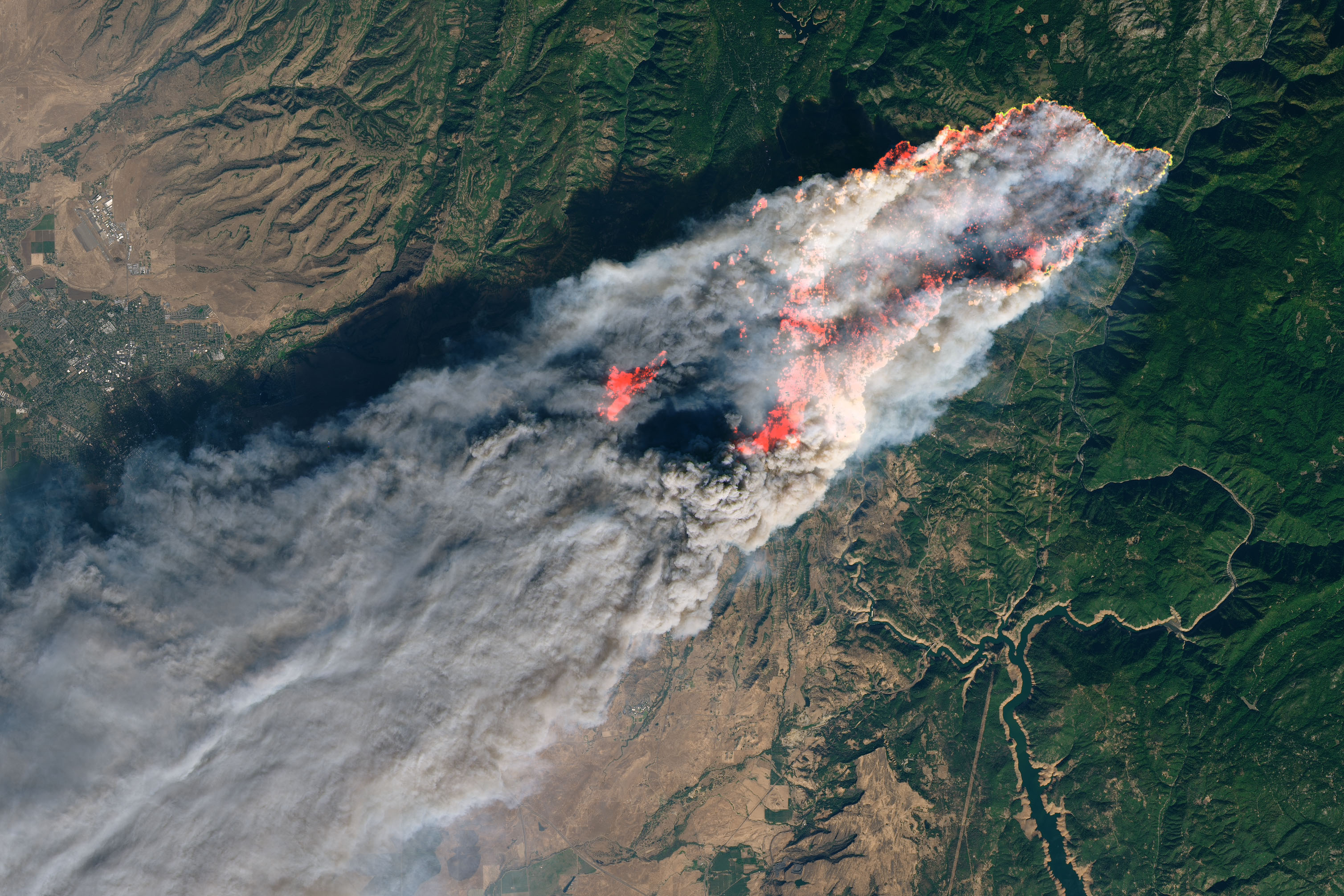
June 2023: Canada is on fire (below are links to help). Canadian wildfires have consumed 9.4 million acres (3.9 million hectares) – 15 times the average over the past decade. Quebec fires forced 11,000 residents from their homes; Nova Scotia suffered the largest blaze in its history. The East coast is not alone: Western British Columbia battled the second-biggest wildfire on record for the area. In Central Canada, Alberta issued evacuation orders and heat directives. Canadian railway CN is adjusting trains in several provinces. Why? Drought dries forests and heat sparks blazes. While wildfires are normal in nature, hence the term “wildfire season,” climate change is intensifying the threat to land, cities, and public health.
New York City’s Empire State Building as seen through smoke-haze from Canadian wildfires. Image “Empire State Building June 7 2023” by Aethemplaer on Twitter. Creative Commons 4.0. Included with appreciation.
No longer are fires, and related smoke, a local danger. Just south of Canada, winds blew smoke into the air of Vermont to New York to South Carolina, and then westward to Ohio and Kansas. New York City’s iconic skyline was cloaked in soot. Satellite images show the movement of smoke over Manhattan.
Smoke from Canadian wildfire blowing over New York City on June 7, 2023. Image: by NOAA. Public Domain. Included with appreciation.
The year 2023’s fire season is just beginning in North America. If recent years are a warning, it is time to take precautions. In 2022, wildfires in California, Oregon, and Washington state consumed thousands of acres, destroyed homes and agricultural land. Canadian British Columbia battled 193 wildfires in 2022, sending smoke to Vancouver and also to Seattle, Washington. Wildfires have become so frequent that they often have names: Sandia, Red, Tower, Mountain, Dixie, Camp. The latter, in 2018, burned 153,000 acres (62,000 hectares), killed 85 people, and destroyed the entire town of Paradise, California.
Camp Fire of 2018 engulfed Paradise. Image: photograph by Landsat and Joshua Stevens, NASA. Public Domain. Included with appreciation.
Copernicus satellite system: “Europe’s eyes on Earth.” Image: Copernicus logo courtesy of European Union. Creative commons fair use. Included with appreciation.
As global space-based observation progresses, we may be able to predict wildfires. The European Forest Fire Information System (EFFIS) reports on European Union countries. EFFIS uses satellites in concert with the Copernicus Atmosphere Monitoring Service (CAMS) to observe active wildfires and estimate air quality pollution. Then, CAMS coordinates with the Global Fire Assimilation System (GFAS) to predict where the wind will blow fire pollution, sending warning to cities. Another space-based monitoring system is CAMS Biomass Burning Aerosol Optical Depth measuring how much sunlight can pass through the air (or not), indicating concentrations of particulate matter.
Image: “Grain size dependence of penetration of airborne particulate matter.” Graphic by Dr. Claire Horwell, Durham University, UK and Ken Donaldson, USGS. Creative commons public domain. Included with appreciation.
Particulate matter (PM) is the term for mixture of solid and liquid drops of pollutants suspended and carried in the air. Particles can be made of inorganic and organic compounds including soot, metal, dust, soil, pollen, mold, and little flakes of burnt matter. Small particles can be inhaled, enter the lungs and pass into the bloodstream. The tiniest particles, those less than 2.5 micrometers in diameter and known as PM2.5, are the most dangerous.
How can you tell if your local air’s PM2.5 might be at high levels? Look out any window. If air is hazy, and wind is relatively still, there is danger. Here are actions to take:
Preventing Wild Fires and Related Damage – manage forests, limit residential plantings needing extensive water, build new construction with fire-proof or fire-resistant materials, use satellite data to anticipate fire-prone areas and take preventive action.
Preventing Health Risks due to Fire and Smoke – remain indoors, do not open windows, use an air-filter device if available, cancel unnecessary outdoor exposure. If you do need to venture outdoors, wear an N95 mask (or two), and when returning, remove and launder outerwear garments that may harbor toxic residue.
Providing Help to Those Impacted by Canadian Wildfires – fires have displaced 20,000 people, destroyed property, and sent many to the hospital for smoke inhalation. Here’s some ways to help:
Donate a Mask – help a charity that distributes free N95 masks.
In the future, climate response will mean addressing, especially, the shared resources of the global commons. These include areas that lie beyond national jurisdiction: the high seas, outer space, and the atmosphere – the very air we breathe. Wildfires may erupt in a specific place, but winds that circle the globe bring “there” to “here.” As we respond to problems we face today, let us keep an eye on a better, cleaner, more equitable future.
But still, like air, I’ll rise. -Maya Angelou
Brooke, K. Lusk. “Designing residential and commercial communities in the age of drought and wildfires.” Renewing the World: WATER. Success Casebook. 2023. ISBN: 9798985035933.
Waves and sea level rise will affect low-lying cities, but what about coastal cliffs? Image: “Porto” by photographer/videographer Sergei Gussev, 2016. Creative Commons 2.0. Included with appreciation.
It’s obvious that sea level rise will threaten low-lying coastal areas. But more than 50% of all Earth’s coasts are cliff-lined. Are these higher elevations safe? Not really.
Climate scientists and city planners worrying about sea level rise have mostly focused on immediately vulnerable low-lying cities. That’s appropriate and urgent: more than one billion people may be displaced. It is also important to note that many of the world’s most important cities began as ports, at a time when shipping was the main means of global commerce. What will happen to powerful port cities like Amsterdam, Boston, Lagos,Rio de Janeiro, or Singapore – great port cities that continue to attract businesses and residents? Lagos leads Africa in the number of innovation start-ups. But building more offices and apartments stresses already-dense ports, making these cities more vulnerable to sea level rise and coastal flooding.
But rocky, cliff-lined coasts have been neglected. Because cliffs make up more than 50% of the world’s coasts, their erosion is also of importance. It’s just been harder to see. Until now.
New techniques using geochronology and cosmogenic radionuclide dating can tells us what has happened to world cliffs 8,000 years ago – and predict what may occur in the future. It’s a technology as useful in space as on Earth. Image: “Geochronology/cosmogenic radionuclide dating” by COMPTEL, 2012. Public Domain. Included with appreciation.
Recent studies show that sea level rise will likely accelerate rock coast cliff retreat rates. A team including Bethany Hebditch, Matthew Piggott, Dylan Rood, Alexander Seal, and Jennifer Shadrick, from the Department of Earth Sciences and Engineering, Imperial College, London, UK, as well as Klaus Wilcken of the Centre for Accelerator Science, Australian Nuclear Science and Technology Organization (ANSTO), Sydney, Australia, and Martin Hurst of the School of Geographical and Earth Sciences, University of Glasgow, UK developed a coastal evolution model based on cosmogenic radionuclide (CRN) and topographic data that quantified cliff retreat rates. With a Janus-like long view, the model gazes back 8,000 years and uses that data to forecast the next 100 (and beyond).
“Cliffed coast” by graphic artist Salino. Dedicated to the public domain and included with appreciation.
Models can be helpful. Developed by Alan Trenhaile, Department of Earth Sciences, University of Windsor, Windsor, Ontario, Canada, one model looks at cliff retreat and broken waves attacking the coastal cliff, resulting in erosion. Another model by a team including Lorenzo Mentashi and Luc Feyen and Jean-Francois Pekel of the European Commission, Joint Research Centre (JRC), Directorate for Space Security and Migration, in Ispra, Italy, as well as Michalis Vousdoukas, of the JRC and the Department of Marine Sciences, University of the Agaean, Mitilene, Lesbos, Greece, and Evangelos Voukouvalas of the Engineering Ingegneria Informatica, Rome, Italy is the Soft Cliff And Platform Erosion (SCAPE) that predicts erosion of soft cliffs. Other models like 1-D examine wave force, but they are based on historical observations and we all know that things are changing. Actually, no one thing causes cliffs to erode and retreat: it’s a combination of tides, currents, waves, air and water temperatures.
Bideford, England may be changed by sea level rise and cliff retreat. Image: “Tantons Hotel in Bedeford” by photographer Steve Daniels, 2009. Creative Commons 2.0. Included with appreciation.
The UK/Australia study team focused on two sites in the United Kingdom (UK): Bideford in north Devon and Scalby in Yorkshire. Here’s what they found. At both sites, cliff retreat matched late-Holocene sea level rise. They also noted that cliff retreat is more sensitive to the rate of sea level rise increase than to its magnitude. Conclusion? Cliff erosion is “dominated” by waves; cliff retreat is linked to the rate of sea level rise. As climate change drives sea level rise, “cliff positions are likely to retreat by at least (10-14 meters) at Bideford and (13-22 meter) at Scalby. These rates of cliff retreat are two times greater than any previous estimates and as an order of magnitude greater when compared with the past half millennium.
Will cliff erosion threaten California’s Big Sur and the Pacific Coast Highway? Image” Big Sur and the Pacific Coast Highway” by photographer Astronautilus, 1995. Creative Commons 2.0. Included with appreciation.
We once thought of rock cliff coasts as unchangingly stable. They are just slower. From the White Cliffs of Dover, England, made of finely grained, chalky limestone, to the coastline of the Santa Lucia Mountains in Big Sur, California, iconic cliff coasts may be changed through sea level rise. Some locations, like Puerto Escondito, Oaxaca, Mexico have both low-lying beaches like surfing favorite Playa Zicatela not far from cliff-lined beaches like Playa Carrizalillo. Protective measures for seaside cliffs include anchoring (by means of terraces, planting, or even wiring) or dewatering (draining water flowing into nooks and crannies), or engineered smoothing at the base reinforced by granular material. Most coastal cliff erosion happens at the bottom where waves attack and weaken the structure.
How can we protect coastal cliffs? What are your ideas? Image: “Ocean shaped coastline and silhouette person” by photographer MontyLov, 2017. Dedicated to the public domain, creative commons 1.0. Included with appreciation.
The next time you enjoy a panoramic ocean view from atop a promontory, consider your ideas for shoring up coastal cliffs.
Shadrick, Jennifer R., et al., “Sea-level rise will likely accelerate rock coast cliff retreat rates” 18 November 2022. Nature Communications 13, 7005 (2022). https://doi.org/10.1038/s41467-022-34386-3
Trenhaile, Alan.S. “Modeling the development of wave-cut shore platforms.” 15 May 2000. Marine Geology 166,163-178.
Trenhaile, Alan.S. “Predicting the response of hard and soft rock coasts to changes in sea level and wave height.” 22 February 2011. Climactic Change 109-599-615. http://doi.org/10.1007/s10584-011-0035-7 and https://link.springer.com/article/10.1007/s10584-011-0035-7
Young, A. and Carilli, J. “Global distribution of coastal cliffs and retreat rates.” EP23C-EP22336(2018)
Young, A. and Carilli, J. “Global distribution of coastal cliffs. Earth Surf Process Landforms 44:1309-1316. https://doi.org/10.1002/esp4574
Note: we have named all the team members, above in the post, to value each one’s contribution that is seldom recognized when listed as “et al.”
Building the World Blog by Kathleen Lusk Brooke and Zoe G. Quinn is licensed under a Creative Commons Attribution-NonCommercial-NoDerivs 3.0 U
Floating cities have long captured our imaginations, and may become a reality with sea level rise. Image: “Sky City in Flash Gordon Serial” 1936. Public Domain Creative Commons. Included with appreciation.
Sea level rise is coming – how much depends upon the extent of melting glaciers and coastal inundations. Coasts often harbor cities: the earliest urban centers developed because of sea access. By 2050, 68% of the world will live in cities, many of them ports. How can coastal cities prepare for sea level rise? The Netherlands has long led the world in city design for low-lying coastal areas. Now, many cities are considering preparation for rising seas. Here are some examples.
Seoul is building floating sections of the city. Image: “Seoul at Night,” by traveloriented, 2014. Creative Commons 2.0. Included with appreciation.
Seoul announced plans for a floating public swimming pool and art pier space, featuring a concert hall and a marina. Designed for Inchon Han River Park, the 5,000 square meters development will feature the Han River by floating upon its coastal waters. Seoul Mayor Oh Se-hoon announced the budget of $30 million (30 billion won).
Image: “Islands Brygge Waterfront” in Copenhagen, Denmark by photographer Jacob Friis Saxberg. Creative Commons 2.0. Included with appreciation.
Copenhagen inspired Seoul’s Mayor Oh, who announced Seoul’s new vision while visiting the Danish capital’s Harbour Bath. Denmark also built Havnebadet Islands Brygge, a floating public swimming pool that opened in 2003. Copenhagen worked on another project with Bjarke Ingels Group to build “Urban Rigger,” a floating residential district.
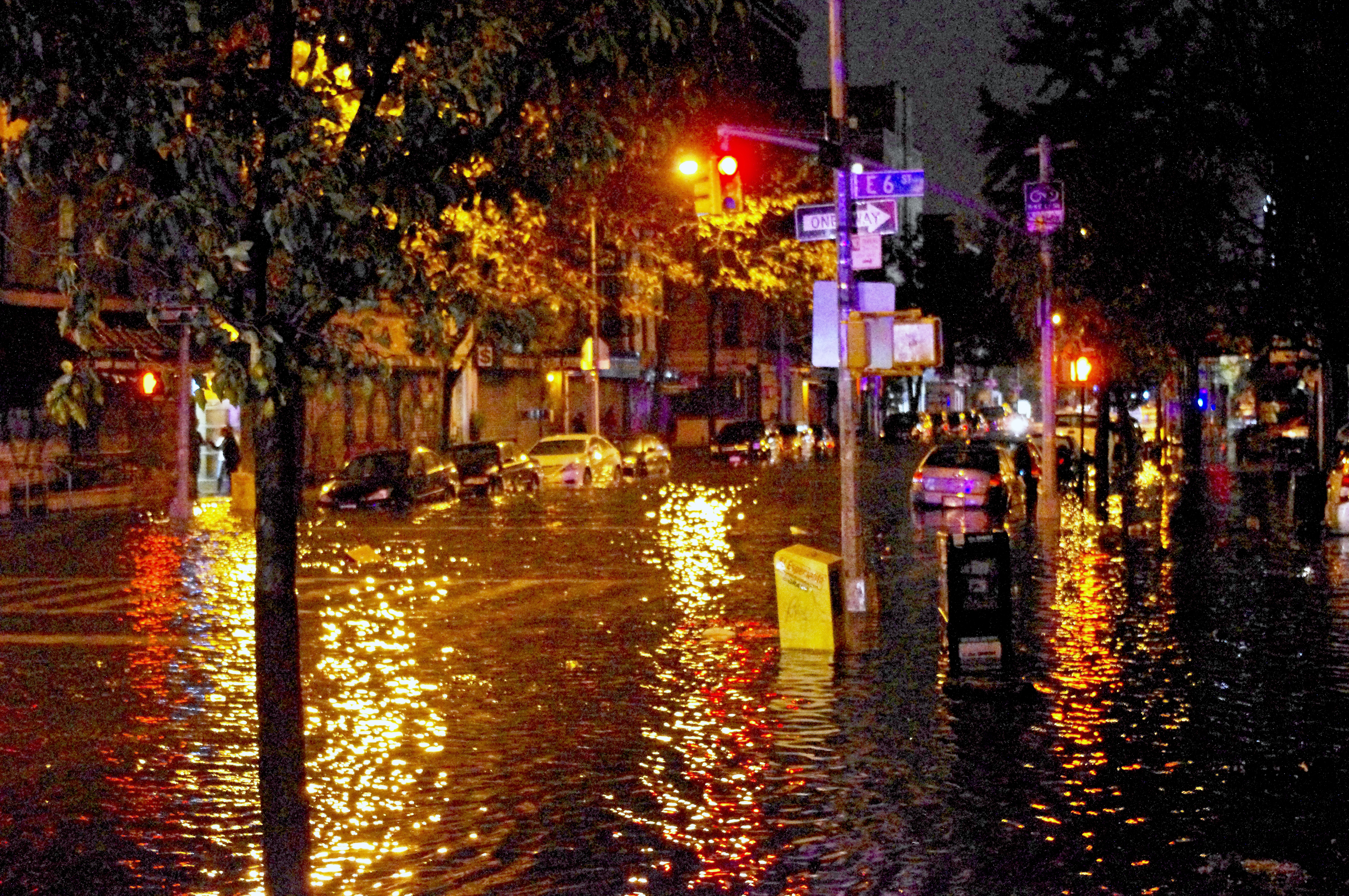
New York suffered damage and flooding during Hurricane Sandy, leading to a proposal to rebuild the Big U of Lower Manhattan. Image: “Flooded Avenue C at East 6th Street” taken right before Con Edison lost power during Hurricane Sandy. Photograph by David Shankbone, 2012. Creative Commons 3.0. Included with appreciation.
New York suffered $19 billion in damage after Hurricane Sandy (2012). A new city design for lower Manhattan followed. Bjarke Ingels Group (BIG) is presently developing a future vision for New York City. The BIG U proposes a protective system around the area of Manhattan from West 57th Street, down to the Battery, and then up again to East 42nd Street. The area is vulnerable to sea level rise. New York may consider options for aquatic construction as well as protective barriers. Will Wall Street soon float more than bonds and floating rate funds?
Should New York City consider floating architecture in anticipation of sea level rise? “Lower Manhattan from Jersey City 2014 Panorama” by King of Hearts. Wikimedia 3.0 creative commons. Included with appreciation.
One of the joys of city living is availability and variety of take-out food. From cheesy fries to pizza by the slice, urban snacks are legendary. But most of these treats come in plastic containers that eventually end up in landfills.
“Chili cheese fries served in a foam containers with a plastic fork.” Photograph by Charles Severance. Creative Commons 2.0. Included with appreciation.“Landfill” by Michelle Arseneault. Creative commons 3.0. Included with appreciation.
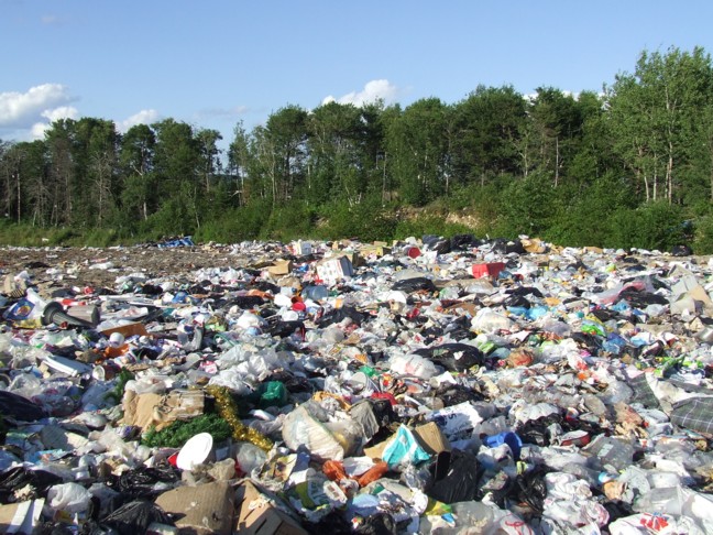
Cities are filled with discarded plastic, from single-use containers to bottled water. Every year, 400,000,000 tons of plastic are produced; that’s equivalent the weight of all the people on the planet.
Every year, the amount of new plastic produced is equivalent to the weight of all the people on the planet. Photo: “London’s Liverpool Street Station” by photographer Roger Carvell, 2012. Creative Commons 3.0 Included with appreciation.
Only 15% of plastic is recycled; most sits in urban landfills. One of the world’s largest landfills is the Apex Regional in Las Vegas, Nevada, not far from the Colorado River and Hoover Dam, stretching over 2,000 acres. Apex is filled with take-out food containers and many other kinds of plastic.
Apex Landfill near Las Vegas, Nevada, is one of the world’s largest. Image: “Las Vegas Skyline at night North,” by Curimedia. Creative Commons 2.0 Included with appreciation.
Time (and money) at slot machines may go fast, but landfill plastics have a long life. Plastic is designed to be durable. It degrades very slowly; it can take over 1,000 years. Even if we pull plastics out of landfills, not all are recyclable. Plastics containing even a bit of food (take-out fries, plastic forks) are not recyclable. And most people who toss food containers into trash, or even into recycling bins, do not, or cannot, wash them first.
What if landfill plastic, especially food containers, were actually buried treasure?ReisnerLab at Cambridge University may have found a way to turn discarded plastic into fuel; the process is powered by sunlight, and produces syngas. Much syngas currently produced requires non-renewable energy, but the ReisnerLab process uses solar. Another benefit? Cambridge University’s nascent system can handle recycled plastic with food waste stuck to the containers. It’s a problem for most recycling, but the Cambridge system uses the leftover food as a substrate, making the process work even better. ReisnerLab’s innovation is at an early stage, and shows promise. Some investors tracking developing innovation may take note.
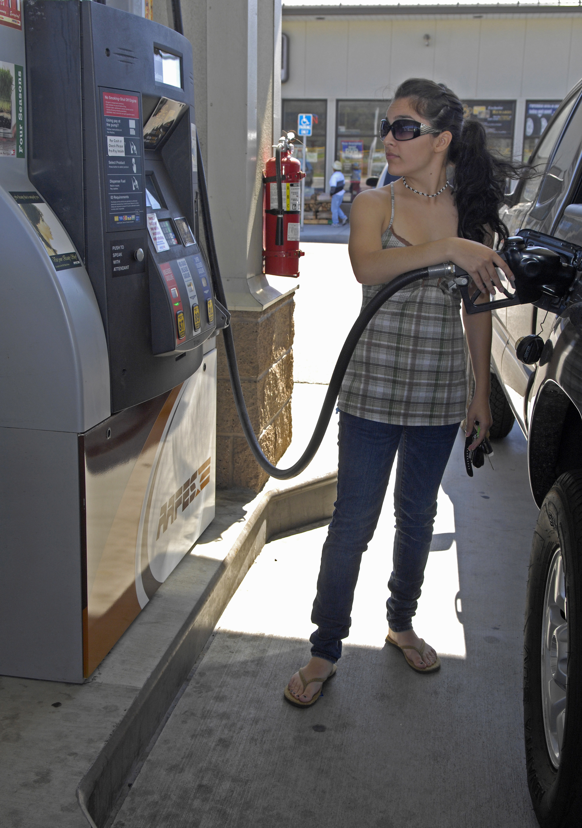
Syngas can use the same infrastructure but is cleaner than traditional fossil fuels. Image: “Pumping Gas” by photographer Airman 1st Class Lee. Photographed at Vandenberg Airforce Military Base, 2009. Public Domain. Included with appreciation.
Benefit of syngas – it can be pumped. Professor Erwin Reisner observes that “effectively plastic is another form of fossil fuel, rich in energy.” Unlocking that energy to use as fuel could replace traditional fossil fuels and yet not pose the extent of pollution and emission problems caused by coal, oil, and gas. Being able to use the same distribution and delivery infrastructure, plastic-produced syngas could be helpful in fueling the future. One of the difficulties that slows down energy transition is switching to new delivery and distribution systems from existing infrastructure.Re-using gas pipelines, delivery trucks, pumps, and hoses for syngas is a great advantage. And getting rid of food-coated un-recyclable plastic clogging city landfills? A bet as good as Las Vegas.
Mexico City is built on the foundation of Tenochtitlan. “Foundation of Tenochtitlan” by Roberto Cueva Del Rio (1908-1988), 1986. Photograph by Jujomzx. Creative commons, public domain. Included with appreciation.
Building an urban transit system in an already dense city is a case study in retrofitting. But what happens when cities dig deep and uncover archeological treasures? During the construction of Boston Central Artery (known at the time as “The Big Dig”) uncovered a 17th century home and a 19th century glass factory.
“Amsterdam: construction of subway station Rokin.” by A. Bakker. Creative commons 3.0. Included with appreciation.
México City’s metro goes right to one of the greatest urban archeological discoveries in history: the Templo Mayor at Tenochtitlan. On 21 February 1978, electrical workers digging near the city’s main plaza, called the Zócalo, hit a stone. It was no ordinary stone. The object was carved in the shape of disk measuring 10 feet in diameter. On its surface, a relief could be traced to reveal a portrait of Coyolxauhqui, warrior sister of Huizilopochtli, deity of the ancient Mexicas.
On 21 February 1978, Mexico dug for electrical installation and unearthed this treasure, a stone disk carved in the image of Coyolxauhqui. Photo by miguelao,2009, creative commons 2.0. Included with appreciation.
An archeological team led by Eduardo Matos Moctezuma excavated the site for the next four years, when the endeavor received presidential support as the Templo Mayor Project. More than 7,000 objects were unearthed, bearing witness to the glories of Tenochtitlan, the Templo Mayor, and a series of temples that once stood as evidence of the great civilization. When Tenochtitlan fell in 1521 to the invasion of Cortés and troops, Aztec temples were destroyed. But now, they are once again part of México’s history and culture. To visit the site, take the México City metro Blue Line to the Zócalo stop, and step back in time.
Lewis, Ann-Eliza H., Editor. Highway to the Past: The Archaeology of Boston’s Big Dig. Commonwealth of Massachusetts and Massachusetts Historical Commission, 2001. Https://www.sec.state.ma.us/mhc/mhcpdf/Big_Dig_book, pdf
“Turkey-Syria Earthquake Damage 2023” by VOA (Voice of America). Image: Public Domain, wikimedia. Included with appreciation.
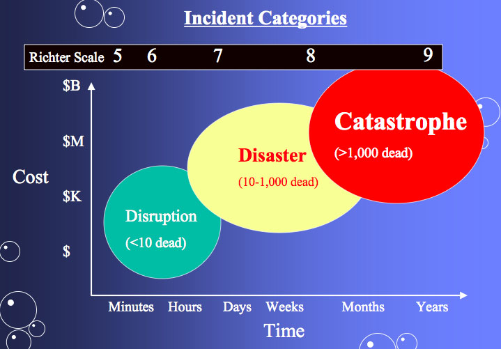
More than 21,000 people in southern Turkey and northern Syria have perished in this week’s tragic earthquake. While a newborn baby was rescued from the rubble, her mother who had just gone into labor when the quake struck but managed to deliver her baby, her father, and four siblings, did not survive the 7.9 magnitude temblor. Fatalities and injuries are still climbing. As the world races to rescue those still pinned beneath tumbled buildings, questions arise: how can such disasters made less dangerous in the future, how can we rebuild better, and how can we respond now to help?
“Earthquake Severity on the Richter Scale” by Webber 2007. Dedicated by the artist to the public domain, wikimedia. Included with appreciation.
Seismic science is relatively recent. It was in 1941 when Beno Gutenberg and Charles Richter, professors at the California Institute of Technology, defined what is known as the Gutenberg-Richter law that describes the magnitude of earthquakes – it is commonly referred to as the Richter Scale. The scale is logarithmic, meaning that each magnitude level is ten times stronger than the preceding one: a 7.0 earthquake is ten times stronger than a 6.0. temblor.
“Anatolian Plate” by Mike Norton, 2011. Wikimedia, creative commons 3.0. Included with appreciation.
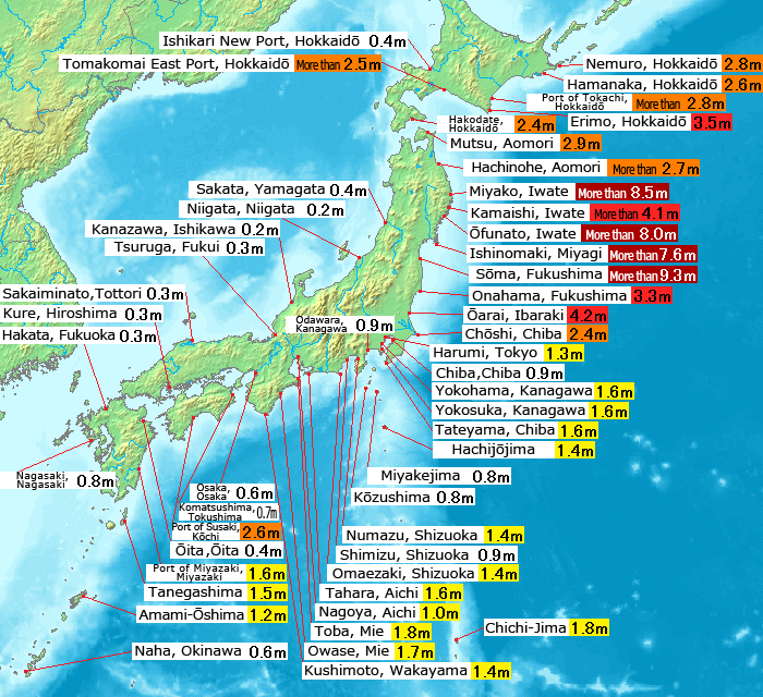
Many ancient cities and settlements were established long before scientific knowledge revealed the locations of tectonic fault lines. Earth is composed of a series of plates that are wedged alongside each other, and are slowing moving and readjusting. The area affected in Turkey and Syria was caused by the Arabian plate shifting against the Anatolian plate. The East Anatolian Fault is another area trouble spot under watch, according to Kandilli Observatory and Earthquake Research Institute at Bogazici University in Istanbul. It should be noted that some scientists also watch the San Andreas fault in California. One of the world’s destructive earthquakes in recent history was the 2004 9.1 magnitude off the coast of Indonesia that initiated a tsunami sweeping away whole communities along the Indian Ocean, taking 228,000 lives. In 2011, a 9.0 magnitude temblor struck off the coast of Japan, causing a tsunami that led to the Fukushima nuclear plant disaster.
An earthquake in Japan triggered a tsunami that caused the Fukushima nuclear disaster. Image: “Tohoku (Sendai) earthquake observed tsunami height” by Pekachu, 2011. Donated into the public domain by the artist, included with appreciation.
We know where the danger zones are, but what can be done? Certainly, building safety codes can and must be strengthened. Turkey instituted seismic building codes but some older structures are vulnerable because they were built before these regulations existed; retrofitting is difficult. Also to be considered, alternate access routes when roads and bridges suffer damage: there are proposals worth exploring. Another approach to earthquake preparedness and disaster prevention is identifying dense cities built on seismic ground. Some of these cities include national capitals:
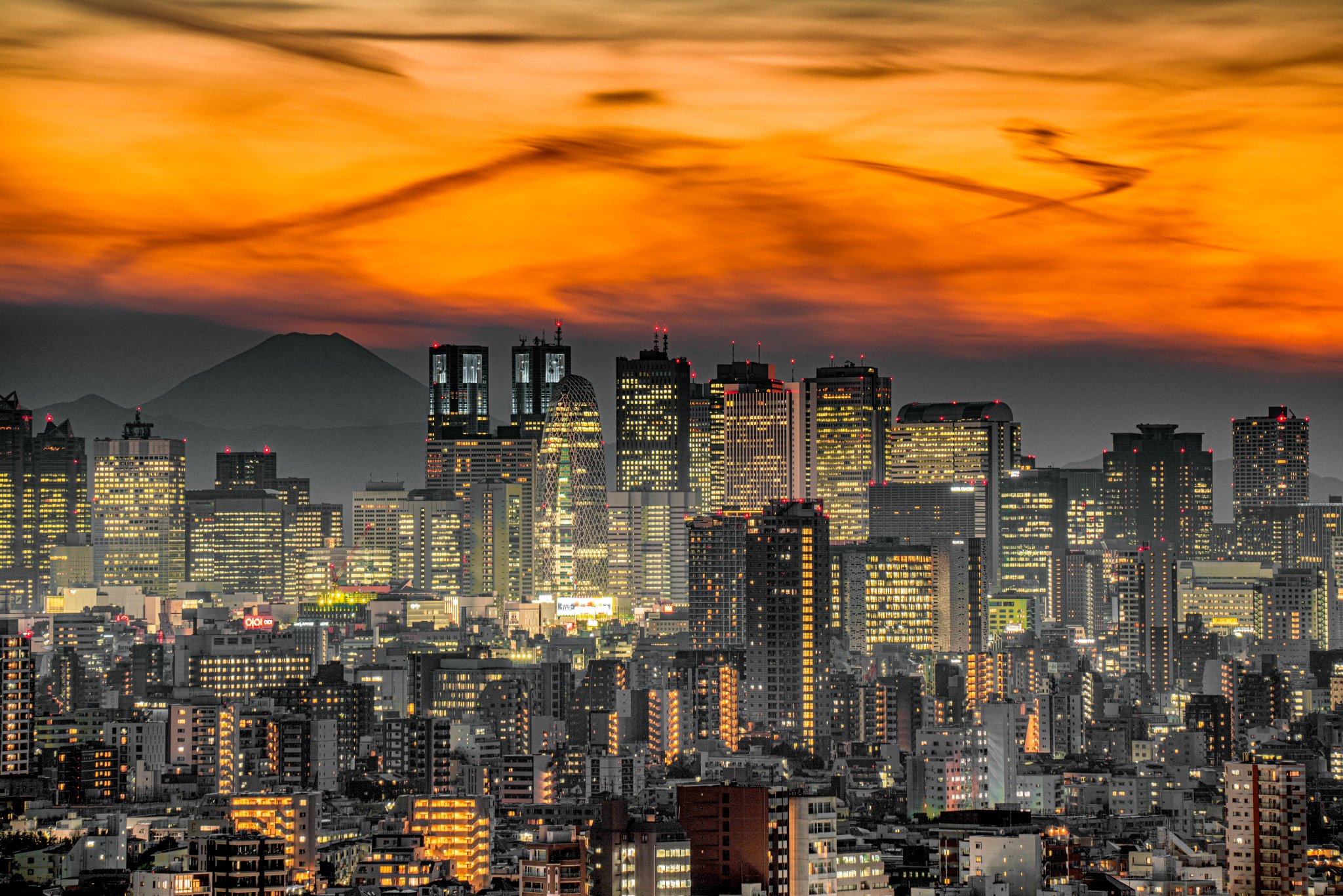
“Tokyo Skyline” by Nryate 2021. Creative commons 4.0. Included with appreciation.
Cities that are earthquake prone – and their populations in greater metro area:
Tokyo, Japan – 37, 468,000
Shanghai, China – 23,019,000
Mexico City, Mexico – 21,804,500
Istanbul, Turkey – 15,455,000
Los Angeles, California – 15,250,000
Cities that contain the center of government are especially problematic when damaged by earthquakes or other disasters. When Haiti suffered a 2010 earthquake, the Presidential Palace in Port-au-Prince was damaged: government relief response was severely affected.
When earthquakes hit capital cities, government response is severely affected. Image: “Haitian National Palace in Earthquake of 2010” by United Nations Development Programme (UNDP). Public domain image included with appreciation.
Some countries vulnerable to earthquake are building “spare-battery” capitals. Japan has already redesigned its train system, Shinkansen, with earthquakes in mind. But after the 2011 quake and tsunami, Japan began plans to develop Itami Airport, Osaka’s older airfield, to become a National Emergency Management International City. Should other capital cities develop alternate sites?
Agora of Smyrna, rebuilt by Marcus Aurelius after the 178 ce earthquake in Izmir, Turkey. Photograph by Carole Raddato, 2015. Creative commons 2.0. Included with appreciation.
Earthquakes demand rebuilding: this post-disaster recovery can be an opportunity to rebuild with a more sustainable view of the future. Working in partnership and research worldwide, the Center for Rebuilding Sustainable Communities after Disasters, founded by Adenrele Awotona and located at the University of Massachusetts Boston, offers guidance through a community-based approach. Earthquakes, and other catastrophic disasters, demand a unique form of rebuilding: everything all at once. Water systems, electricity generation and distribution, the built environment from residences and businesses to hospitals and schools, food supply, roads – all must be rebuilt at the same time. It is a significant opportunity.
Sign language for “Help.” Developed for those threatened by violence, this gesture can signal a need for help in any perilous situation. Image by Lord Belbury, 2021. Donated by the artist to the public domain, Creative Commons 1.0. Included with appreciation.
The most urgent question – how can we help now? To offer help to those affected by the Turkey/Syria earthquake, here are three sources:
How can you help? Image: “Helping hands icon, working together” by AlphaZeta, 2014. Dedicated by the artist to the public domain, Creative Commons 1.0. Included with appreciation.
Awotona, Adenrele. Planning for Community-based Disaster Resilience Worldwide: Learning from case studies in six continents. Routledge, 2017. ISBN: 9781472468154.
“Indigenous Peoples Day,” image courtesy of National Indian Council on Aging – NICOA.org. Included with honor and appreciation.
Indigenous Peoples’ Day, recognized in 2021 by U.S. President Biden, and honored as a holiday this weekend in the United States, reminds us that new worlds are not discovered, just met. Leif Erikson associated by some with Greenland, is thought to have sailed off course en route to that location, instead reaching what he called Vinland and what we now call North America. Erickson spent the winter, and in spring returned to Greenland. This was four hundred years before Columbus. But even before Columbus, and before Erikson, the first humans arrived 26,000 years ago, before the Last Glacial Maximum in the Pleistocene epoch. From those earliest humans are descended those whom we call our original people, those who were here first. One group is the Cherokee Nation.
“Trail of Tears” by Ocmulgee National Mounds Park, nps.gov, by photographer TradingCardsNPS, 2012. Creative Commons 2.0, wikimedia. Included with honor and appreciation.
By 1830, the Cherokee Nation had established significant land in what became known as Georgia (state established in 1788): until the Treaty of New Echota. On 29 December 1835, 500 representatives of the Cherokee Nation, at that time numbering 16,000, met with representatives of the United States government at New Echota, Georgia, to accept terms of $5 million and land in Oklahoma in exchange for their 7 million acres of homeland. Sadly, the forced move 1,200 miles west proved so tragic as to give name to the Trail of Tears. But the Treaty remains unfulfilled: Article 7 of the Treaty of New Echota states: “Cherokee Nation shall be entitled to a delegate in the House of Representatives of the United States whenever Congress shall make provision for the same.”
“Map of George showing Cherokee Nation, 1830.” Original by Anthony Finley Co. of Philadelphia, 1830. Creative Commons Public Domain. Included with honor and appreciation.
Two centuries later, it is time to fulfill the treaty, make that provision, and recognize rights of those who were here first. Cherokee Nation’s Principal Chief Chuck Hoskin, Jr. has nominated Kimberly Teehee to serve as inaugural Cherokee Delegate to Congress. If you support this nomination, Indigenous Peoples’ Day is a good time to take action here.
Davidson, Frank P. and K. Lusk Brooke, “The National Trails System.” Building the World. Volume Two, pages 641-668. Greenwood: 2006. ISBN: 9780313333743.
Will Los Angeles be the first American city to name heat waves? Image: “Sunset on the city of Los Angeles, California.” by Censor, 2016. Wikimedia/Unsplash – CC0 1.0 dedicated to the public domain. Included with appreciation.
We name hurricanes and cyclones. Putting a face and name on the alert of coming danger helps people to prepare. We name wildfires for the same reason. Now, in this new normal of climate change, we are beginning to name heatwaves – in and for cities.
Cities are hotter, forming “heat islands.” Image: NOAA, public domain, wikimedia. Included with appreciation.
Because heatwaves are felt most vividly in cities, the idea of naming heatwaves is now being considered by Los Angeles, California. That city experienced 6 dangerous heatwaves between 1998 – 2000; now, there will be more, with 22 annually from 2020 to 2050. In 2020, hospitals saw a tenfold increase in emergency room visits during heat spells in Los Angeles.
How would heatwaves be named? Using the model of hurricanes, a number of factors would be assessed: heat overall, night-time heat, and temperature trends. With these factors, an impending heatwave would be declared along a 1-3 scale.
“3rd” no ascribed author. Public Domain. From wikimedia commons. Included with appreciation.
Cities of London and Manchester suffered extreme heat in July 2022. Image: “UK heatwave weather warnings July 2022.” from Met Office, Open Government Licence v3.0. Included with appreciation,
Seville, Spain, where heat is common, has begun to name heatwaves. Seville is the first global city to do so. Seville decided to start at the end of the alphabet, rather than at the beginning as is traditional with hurricanes. Accordingly, “Zoe” arrived in July, with temperatures of 109F (43C), she was considered a category 3 – the highest designation. In the United States, four states are testing the heatwave naming system: Kansas City, Missouri; Los Angeles, California; Miami, Florida; Minneapolis, Minnesota.
Will Seville, Spain lead the way? Image: “La Plaza de Espana de Sevilla,” by Francisco Colinet, 2013. Wikimedia Creative Commons CC by SA 3.0 es. Included with appreciation.
Seville’s system was developed with the Atlantic Council’s Adrienne Arsht-Rockefeller Foundation Resilience Center. Seville’s former mayor Juan Espadas praised the system “encouraging other cities in the world to also undertake this great endeavor.” (Arsht-Rockefeller Foundation Resilience Center) What do you think about naming heatwaves? How should names be chosen?
“Noodle Bowl for Lunch” by Tran Mau Tri Tam, 2016. Wikimedia/Unsplash: CC0 1.0. Dedicated to the public domain by the photographer. Included with appreciation.
Cities are known for fast food: the drive-through, the grab and go, the snack stop, pop-up restaurants, food trucks, street cafes and food stalls. Fast food can also be found on shelves of urban convenience and grocery stores. One of the world’s favorite quick treats is the instant noodle. In 2020, 116 billion servings of instant noodles were enjoyed. (Cairns 2022)
“Singapore Skyline at Night with Blue Sky.” Merlion444, 2009. Wikimedia Creative Commons 1.0 public domain. Dedicated to the public domain by the photographer, Included here with appreciation.
Singapore, a city created with trade and diversity as founding principles, is home to the launch of new kind of instant noodle – good for taste and for the environment, too. Based in Singapore, WhatIF Foods has introduced a noodle made from the Bambara Groundnut.
“Vigna subterranea” as illustrated by A. Engler in Die Pflanzenwelt Ostafrikas und der nachbargebiete. Volume 2, 1895. This work is the public domain and is included with appreciation.
Bambara (Vigna subterranea) is in the legume family and grows underground (like peanuts): it originated in West Africa and is now grown across the world. It’s what is known, nutritionally, as a complete food: offering protein, carbohydrates, amino acids, minerals, vitamins, and fiber. WhatIF Foods produces “BamNut” flour made into noodles. The noodles are a bit pricier than the cheapest brands, but many people may value their superior nutrition.
Map of West Africa by Mondo Magic, 2009. Dedicated by the artist to the public domain (CC 1.0) and included here with appreciation.
Bambara Groundnut, or Vigna subterranea, currently comprises a very small part of food supply market (production in Africa is 0.3 million tons) versus the more traditional noodle dough made from wheat (776.6 million metric tons per year globally). But that may change – because Bambara is drought-tolerant. Many areas of the world already suffering drought (from states served by the Colorado River in the United States, to African and Australian areas experiencing drought and expecting more due to climate change and warming). Crops that can survive in dry soil will be in demand. Recent figures from the United Nations reveal that dry soil chokes 40% of agricultural land, and 56 acres (23 hectares) of arable land are lost to drought EVERY MINUTE.
“Corn shows the effects of drought in Texas,” by USDA’s Bob Nichols, 20 August 2013. This photo is the public domain and included here with appreciation to USDA and Bob Nichols.
There are 300,000 edible plant species, but just three (rice, maize, wheat) comprise 86% of all exports. According to Professor Victoria Jideani of Cape Peninsula University of Technology in South Africa, governments should subsidize agricultural diversity, such as the bambara groundnut, that can resist drought, support food security, and broaden the plant-based dietary options for a future-forward table. By 2050, 68% of the world’s people will live in cities. Land is limited, not only by population growth demands but also by agricultural needs. Optimal use of arable land will be one of the factors in balancing population, food security, and environment.
Bangkok, Thailand is a global megacity offering some of the tastiest food in the world, including legendary noodles. Image: “Food Stalls Bangkok,” by Ian Grattan, 2012. Wikimedia CC2.0. Included here with appreciation to Ian Grattan and Bangkok.
WhatIF Foods are currently sold in Singapore and produced in factories located in Australia and Malaysia, are sold in Asia, and in the regulatory approval process in the European Union. Privately financed, the company is now attracting investors. In the United States, you can purchase WhatIF products (noodles are just one of the products) online. Looking for instant noodle recipes? Here’s eight from eight countries.
Adetokunboh, Adeola, Anthony Obilana, Victoria Jideani. “Enzyme and Antioxidant Activities of Malted Bambara Groundnut as Affected by Steeping and Sprouting Time.” March 2022. Foods 11 (6): 783. DOI:10.3390/foods11060783