“Train Tunnel Anim” by Barbetorte, 2008. Creative Commons 4.0. Included with appreciation.
Fehmarnbelt Tunnel, connecting Denmark and Germany, will be an important advance in transport. In fact, it will set world records. Dual highways, both offering two lanes, as well as two electric rail lines, will transit a tube snaking beneath one of the world’s major shipping lanes. It will become the world’s longest immersed tunnel, and take first place for global rail and road tunnel length. Fehmarnbelt will be constructed by piecing together concrete tube sections prefabricated on land (Solomon’s Temple was one of the earliest uses of prefab technology). The factory where the sections are produced is purpose-built and the biggest tunnel-making facility in history: it is the size of 300 soccer fields. With six reduction lines busy 24/7, turning out one section every nine weeks, it is manufacturing on a macro scale.
Each tube section is the weight of 10 Eiffel Towers; the Paris landmark is another feat of macro engineering. Image: “Eiffel Tower” by mikebrice, 2005. Public domain. Included with appreciation.
Each tube section is the weight of 10 Eiffel Towers. Tube sections are pre-fitted with sensors, communication devices, and all manner of monitoring equipment (the Alaska Pipeline was similarly pre-equipped with sensors called “smart pigs”) to give updates on safety status during immersion and then during actual operation. Once complete, tube sections will be deposited onto the sea floor, buckled together, and then the whole tube will be buried. Fehmarnbelt’s water seals are designed to stay tight for 120 years: smart sensors will keep watch.
Fehmarnbelt Tunnel will cut travel time from Denmark to Germany from 5 hours to 2.5. Image by Bowser, 2008. Creative Commons 3.0. Included with appreciation.
Tunnels reduce travel time. The present journey from Hamburg, Germany to Copenhagen, Denmark takes five hours by train: Fehmarnbelt Tunnel will cut that in half. While many environmentalists recommend train trial or air or vehicle, dredging the seabed for the tunnel has prompted protests, court hearings, and applications for halting the project. But Femern A/S declared plans to mitigate environmental impacts by using dredged seabed material to build new reclaimed land with marshes, meadows, and wetlands.
“Marshland green landscape” by Steve Hillebrand, photographer, US Fish and Wildlife Service, 2013. Public domain Included with appreciation.
Comparisons to the Channel Tunnel are attracting interest. One of the world’s most successful macro projects, the Chunnel (a term coined by Frank P. Davidson often called the “Father of the Channel Tunnel”) was dug through solid land, and stretches 31 miles (50 kilometers).
Channel Tunnel is a precedent macro engineering marvel that crosses the waterway between England and France. Image: “Channel Tunnel Geological Profile” by Commander Keane. Creative Commons 4.0. Included with appreciation.
Tunnels like the Mount Blanc, or the Seikan that is part of Shinkansen, bring new kinds of connection, encouraging communication and trading partners. Gotthard Base Tunnel (presently the world’s longest) and Songshan Lake Tunnel may soon be joined by the Sichuan-Tibet railway and the Naples-Foggia railway.
Gotthard Base Tunnel is presently the world’s longest. Photograph by Zacharie Grossen, 2016. Creative Commons 4.0. Included with appreciation.
Moving transport underground has noted environmental benefits as well as cultural opportunities; when Boston, Massachusetts, US placed its Central Artery underground, a greenway extension of Olmsted’s “Emerald Necklace” encircling the city, was fashioned atop that now hosts gardens, art installations, a carousel, highly-acclaimed food trucks, and dance parties in lighted fountains.
Revelers dance in the Rings Fountain on Boston’s Greenway while cars and trucks zoom through a tunnel below. Image: “Wharf District Park Rings Fountain” by photographer Newton Court, 2015. Creative Commons 4.0. Included with appreciation.
Davidson, Frank P. and K. Lusk Brooke. “The Channel Tunnel” Chapter 39, pages 761-804, Volume II. Building the World (Westport: Greenwood, 2006). ISBN: 9780313333743.
Dancing in a club may generate electricity – in more ways than one – and now data, too. Image: “How to Moonwalk like Michael Jackson” by Allan Watson, 2020. Creative Commons 4.0; included with appreciation.
Dancing in a club? Strolling to class? Hurrying across a hospital lobby? Running an indoor track at your gym? Entering a transit station on your commute? You could be generating electricity – and data.
Boston’s South Station circa 1900. From a postcard, artist unknown: courtesy of South Station. Public Domain.
Boston’s transport nexus, venerable South Station, has seen many a commuter step across its hallowed floors since opening in 1899. Terminus of public transportation on the Central Artery, South Station lit up when MIT students James Graham and Thaddeus Jusczyk demonstrated a piezoelectric floor with kinetic tiles generating both electricity and data in the transport hub welcoming 75,000 T-riders daily.
Pavegen installed kinetic floors in the West Ham Tube Station during the London 2012 Olympics: visitors’ footsteps generated electricity to light the station. Image: “Olympic stadium and The Orbit: Opening Ceremony” by Alexander Kachkaev, 2020. Creative Commons 2.0. Included with appreciation.
During London’s 2012 Olympics, some visitors marveled at London Bridge, and then headed for the Games, accessed via the West Ham Tube Station. There, a piezoelectric floor designed by Laurence Kemball-Cook, then a student at Loughborough University, generated electricity from footfalls of arriving visitors to illuminate the station. Kemball-Cook soon started a company called Pavegen Systems that designs floors for high traffic environments like sports stadiums.
In Rotterdam, dancers can generate electricity in some clubs. Will the transit station, pictured here, follow suit? Photo: “Rotterdam Centraal Station” by Spoorjan, 2014. Creative Commons. Included with appreciation.
In the Netherlands‘ shipping hub of Rotterdam, Club Watt commissioned Energy Floors to install kinetic flooring in its dance club. Result? Electricity bills decreased by 30%. Will the transport station (pictured above) install piezoelectric floors, too?
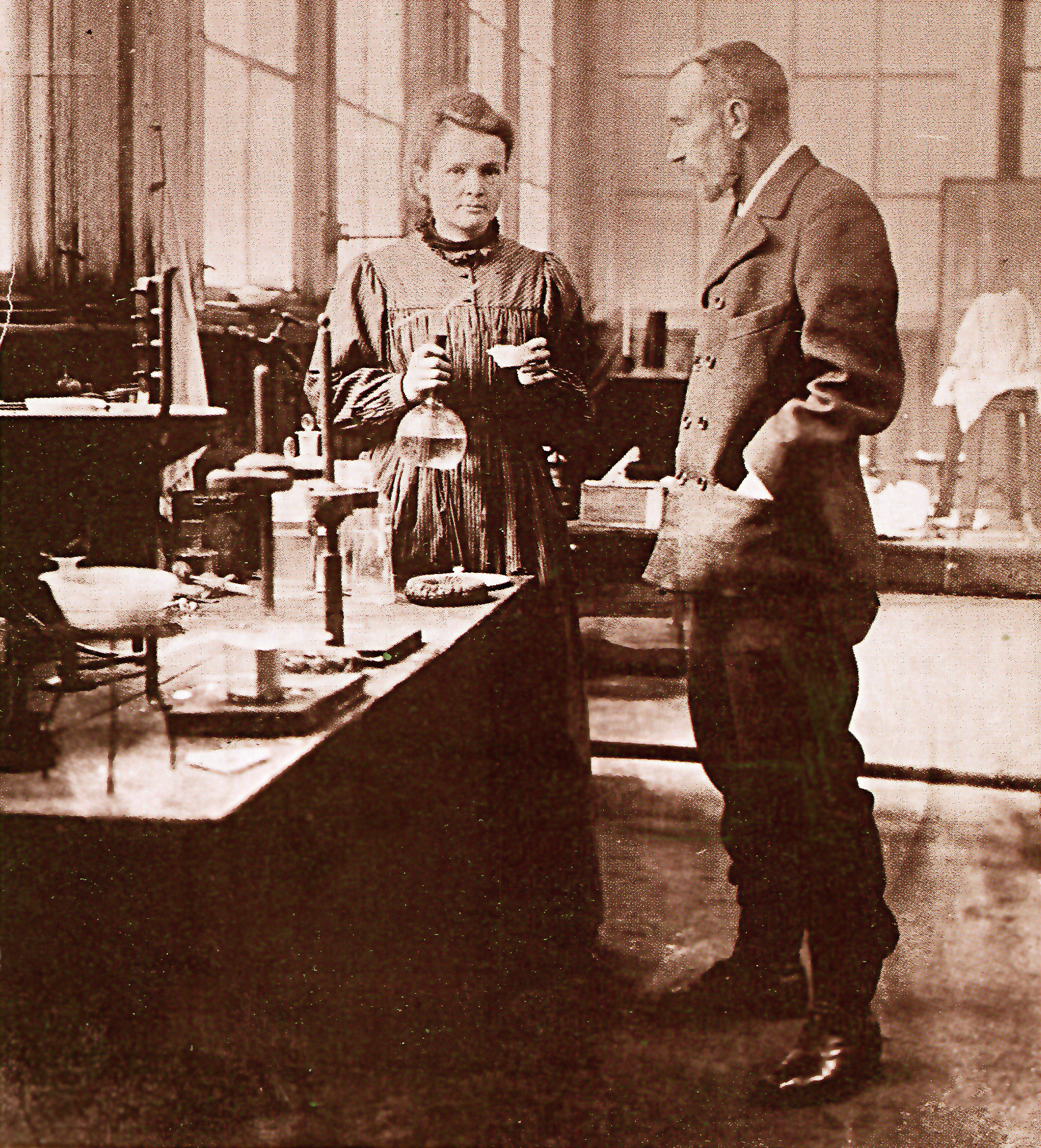
Marie and Pierre Curie used piezoelectricity in their Nobel Prize work. The electric phenomenon had just been discovered by Pierre and brother Jacques. Image: “Marie et Pierre Curie” in 1900 in their Paris lab. Public Domain.
Piezoelectricity (a term coined by Wilhelm Gottlieb Hankel in 1881 from the Greek “to squeeze or press”) refers to release of an electric charge found in materials such as crystals or ceramics. A year before, Jacques and Pierre Curie discovered the effect using cane sugar, Rochelle salt, quartz, topaz, and tourmaline. Marie and Pierre Curie, Nobel Laureates (and the first married couple to win the prize jointly) used piezoelectricity in their work on radium with Henri Becquerel.
What if you could charge your phone by walking? University of Birmingham, UK, installed a kinetic floor that powers students’ phones and computers. Image: “Charging smartphone” by Santeri Viinamāki, 2016. Creative Commons 4.0. Included with appreciation.
Uses for electricity generated by kinetic flooring are varied. UK’s University of Birmingham found students were constantly having to charge their phones. When they installed a floor (designed by Pavegen), the steps students walked generated enough power for phone charging. Pavegen also developed a digital app with “redeem or donate” options for energy currency: users can claim benefits to special events or support causes. Coldplay’s Music of the Spheres World Tour (MOTS: 2022-2025) now travels with a portable dance floor composed of 44 kinetic tiles made from recycled plastic.
Chris Martin of Coldplay during MOTS World Tour that also features a kinetic piezoelectric dancefloor. Photo: Stevie Rae Gibbs, 2022. Creative Commons 4.0. Included with appreciation.
Best installed during initial or refurbished construction, kinetic floors may provide a new source of energy for high traffic environments like schools, sports and entertainment venues, office buildings, hospitals, and – of course – dance floors.
Floors that generate electricity and data may see you, know you were there – and why. Image: Rapidreflex, 2023. Creative Commons 4.0. Included with appreciation.
Another option? Tracking. Adding wireless communication devices uses only 1% of the power generated to transmit collected data. Floors of the future may see you, know you were there – and why.
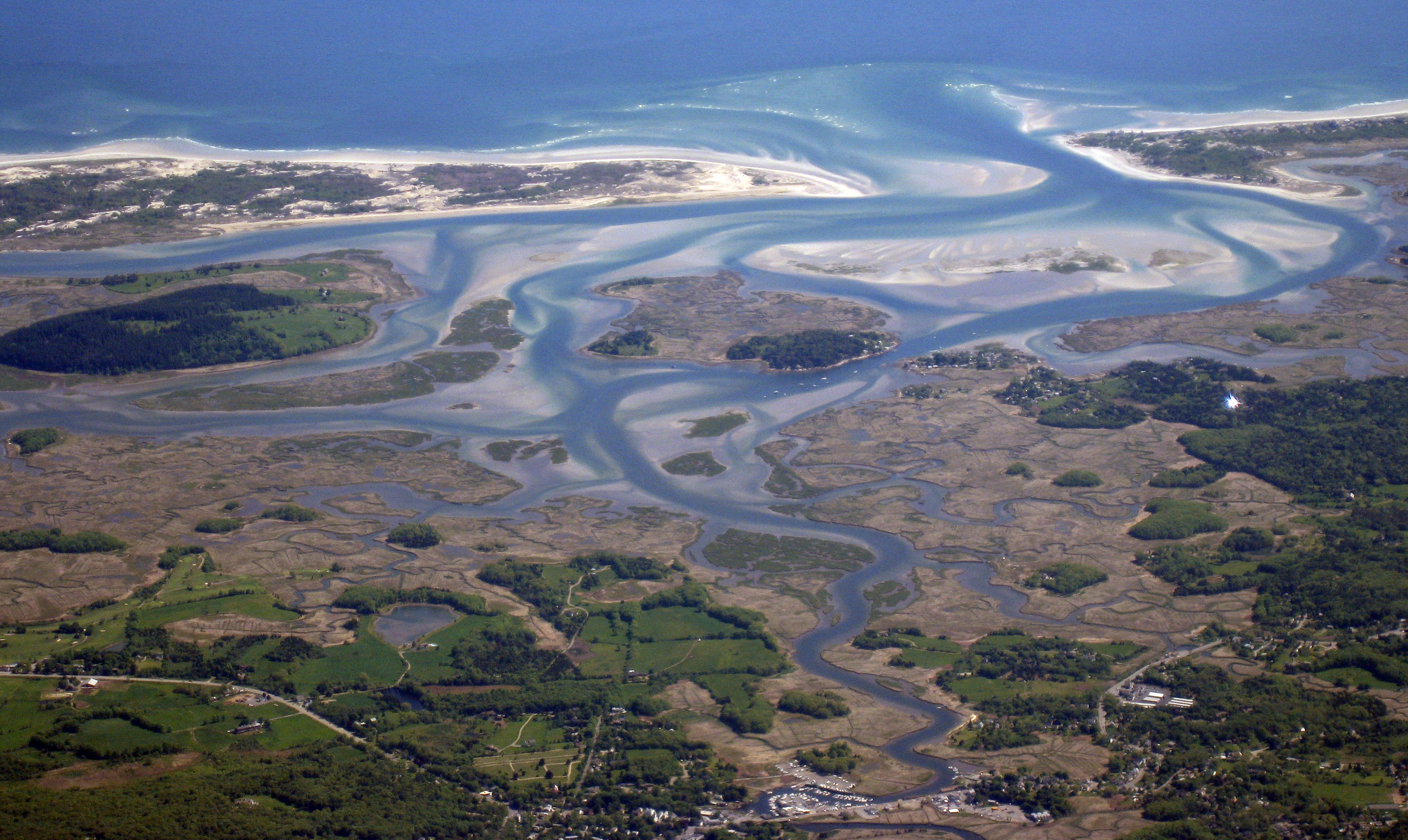
Peatlands occupy just 3% of Earth yet contain 30% of land-based carbon – more than all the world’s forests combined. Image: “North Liscups, Firth above old peat banks” by photographer John Comloquoy, 2005. CC2.0. Included with appreciation.
Just 3% of global land but holding 30% of its carbon, peatlands sequester more than all the world’s forests. Yet peatlands don’t often make news, and can go by many local names: bogs, fens, marshes, moors, swamps. By any name, they are part of our climate future.
Peat is home to microorganisms that help to generate more peat, and to sequester even more carbon. Image: “Testate amoebae common in peat bogs” by Katarzyna Marcisz, et al., in doi.10.3389/fevo.2020.575966. CC4.0. Included with appreciation.
Peat grows in wetlands. When plants wither, the watery environment prevents them from decomposing completely. They become home to microorganisms that produce – more peat. Peat is very valuable to our future because it can regenerate, retain increasingly scarce water, serve as wildlife habitat, and hold carbon.
Nobel Laureate Seamus Heaney wrote about Ireland’s peat bogs. Listen to the poet read “Bogland.” Image: Seamus Heaney in 1982 by photographer Goffryd Bernard. Public Domain. Included with appreciation.
Seamus Heaney, Nobel Laureate in Poetry, wrote: “They’ll never dig coal here/Only the waterlogged trunks of great firs, soft as pulp.” (Heaney, “Bog,” 1969.) There are two hemispheric types of peat: northern and tropical. In northern climes, especially in lands without coal or oil, like Ireland or Finland, peat was cut for use as fuel. All that carbon flames cheerily in a hearth. But peat burns less efficiently than coal while releasing higher carbon dioxide emissions. In tropical locations like Indonesia and Malaysia, peatlands may be cut to clear land for agriculture, especially palm oil, or to meet food shortages by growing rice.
GLOBAL PEATMAP by Jiren Xu, et al., https://doi.org/10.5518/252. Creative commons 4.0 Included with appreciation
But harvesting peat does more than reduce peatlands. Cut peat leaves holes in connected peatlands, triggering a process in which peat dries and becomes vulnerable to wildfires that pollute the atmosphere, devastate habitat (in some locations, as many as 900 species call peat bogs home), and release greenhouse gases that drive climate change.
When cut, peat dries out the surrounding bog that is then vulnerable to fire. Image: “Borneo fires and smoke from burning peatland, 2002.” by Jacques Descloitres, MODIS Land Rapid Response Team of NASA/GSFC. Public Domain. Included with appreciation.
Peatlands are only 3% of the landmass on Earth yet hold 30% of land-based carbon. Can we find ways to keep these climate-essential treasures undisturbed, and restore those that have been damaged? Irelands’s Bord na Móna, owner of vast expanses of peatlands, began a transition strategy in 2020 called “Brown to Green” to move from a peat-based business to a climate solutions enterprise with a strategy to store 100 million tons of carbon in perpetuity. England’s Paludiculture (term for wetland agriculture) Exploration Fund) launched CANAPE (Creating a New Approach to Peatland Ecosystems) in the North Sea region. Cumbrian Bogs LIFEaims to regenerate peat bogs in a short time frame.
Scotland’s estate manor houses may host eco-tourism that preserves peatlands. “Taymouth Castle” by James Norie, 1733. Public Domain. Included with appreciation.
In Scotland, Anders Holch Polvsen bought up 200,000 acres of peatlands near noble estates to welcome eco-tourists who will sip tea in the manor house while watching the fields of peat bloom undisturbed. The program is part of Polvsen’s company Wildland; one of the grand hotel homes is Glenfeshie, familiar to Netflix viewers as site of “The Crown.” Japan’s Suntory whiskey brand acquired Jim Beam and set up peat restoration projects as part of a strategic plan to use peat sustainably to flavor spirits while regrowing the same amount to achieve a modern-day equivalent to the Biblical “ever-normal” granary.
Peatlands can yield carbon credits. Image: “Euro coins and backnotes” by Avij, 2023. Public Domain. Included with appreciation.
Peatlands hold carbon; they can provide carbon credits. That’s why some countries like Scotland and the Netherlands are offering carbon credits. 80% of the cost of rewetting and regenerating peat may be reimbursed. When the regeneration process is verified, carbon credits are issued. Germany’s Moor Futures was the first carbon credit exchange for peatland rewetting. CarePeat and CarbonConnects are other trading systems. While some worry that carbon credits will slow progress on climate response, peatlands may benefit.
Fenway Park reminds us that Boston was built on fens. Image: Fenway by photographer Kelly , 2013. CC2.0. Included with appreciation.
Fenway Park reminds us that Boston’s heralded fens, preserved by Frederick Law Olmsted whose “Emerald Necklace” surrounds the city with parks now extended by the Central Artery’s Greenway, may be part of a trend. While usually rural, peatlands can be restored in some cities, too. Peatlands may help us reach our climate goals: that is a home run.
Born na Móna. “Bord na Móna announce formal end to all peat harvesting on its lands.” https://www.bordnamona.ie
Creating a New Approach to Peatland Ecosystems (CANAPE). “Intereg North Sea Region.” European Regional Development Fund. https://northsearegion.eu/canape/
Waves and sea level rise will affect low-lying cities, but what about coastal cliffs? Image: “Porto” by photographer/videographer Sergei Gussev, 2016. Creative Commons 2.0. Included with appreciation.
It’s obvious that sea level rise will threaten low-lying coastal areas. But more than 50% of all Earth’s coasts are cliff-lined. Are these higher elevations safe? Not really.
Climate scientists and city planners worrying about sea level rise have mostly focused on immediately vulnerable low-lying cities. That’s appropriate and urgent: more than one billion people may be displaced. It is also important to note that many of the world’s most important cities began as ports, at a time when shipping was the main means of global commerce. What will happen to powerful port cities like Amsterdam, Boston, Lagos,Rio de Janeiro, or Singapore – great port cities that continue to attract businesses and residents? Lagos leads Africa in the number of innovation start-ups. But building more offices and apartments stresses already-dense ports, making these cities more vulnerable to sea level rise and coastal flooding.
But rocky, cliff-lined coasts have been neglected. Because cliffs make up more than 50% of the world’s coasts, their erosion is also of importance. It’s just been harder to see. Until now.
New techniques using geochronology and cosmogenic radionuclide dating can tells us what has happened to world cliffs 8,000 years ago – and predict what may occur in the future. It’s a technology as useful in space as on Earth. Image: “Geochronology/cosmogenic radionuclide dating” by COMPTEL, 2012. Public Domain. Included with appreciation.
Recent studies show that sea level rise will likely accelerate rock coast cliff retreat rates. A team including Bethany Hebditch, Matthew Piggott, Dylan Rood, Alexander Seal, and Jennifer Shadrick, from the Department of Earth Sciences and Engineering, Imperial College, London, UK, as well as Klaus Wilcken of the Centre for Accelerator Science, Australian Nuclear Science and Technology Organization (ANSTO), Sydney, Australia, and Martin Hurst of the School of Geographical and Earth Sciences, University of Glasgow, UK developed a coastal evolution model based on cosmogenic radionuclide (CRN) and topographic data that quantified cliff retreat rates. With a Janus-like long view, the model gazes back 8,000 years and uses that data to forecast the next 100 (and beyond).
“Cliffed coast” by graphic artist Salino. Dedicated to the public domain and included with appreciation.
Models can be helpful. Developed by Alan Trenhaile, Department of Earth Sciences, University of Windsor, Windsor, Ontario, Canada, one model looks at cliff retreat and broken waves attacking the coastal cliff, resulting in erosion. Another model by a team including Lorenzo Mentashi and Luc Feyen and Jean-Francois Pekel of the European Commission, Joint Research Centre (JRC), Directorate for Space Security and Migration, in Ispra, Italy, as well as Michalis Vousdoukas, of the JRC and the Department of Marine Sciences, University of the Agaean, Mitilene, Lesbos, Greece, and Evangelos Voukouvalas of the Engineering Ingegneria Informatica, Rome, Italy is the Soft Cliff And Platform Erosion (SCAPE) that predicts erosion of soft cliffs. Other models like 1-D examine wave force, but they are based on historical observations and we all know that things are changing. Actually, no one thing causes cliffs to erode and retreat: it’s a combination of tides, currents, waves, air and water temperatures.
Bideford, England may be changed by sea level rise and cliff retreat. Image: “Tantons Hotel in Bedeford” by photographer Steve Daniels, 2009. Creative Commons 2.0. Included with appreciation.
The UK/Australia study team focused on two sites in the United Kingdom (UK): Bideford in north Devon and Scalby in Yorkshire. Here’s what they found. At both sites, cliff retreat matched late-Holocene sea level rise. They also noted that cliff retreat is more sensitive to the rate of sea level rise increase than to its magnitude. Conclusion? Cliff erosion is “dominated” by waves; cliff retreat is linked to the rate of sea level rise. As climate change drives sea level rise, “cliff positions are likely to retreat by at least (10-14 meters) at Bideford and (13-22 meter) at Scalby. These rates of cliff retreat are two times greater than any previous estimates and as an order of magnitude greater when compared with the past half millennium.
Will cliff erosion threaten California’s Big Sur and the Pacific Coast Highway? Image” Big Sur and the Pacific Coast Highway” by photographer Astronautilus, 1995. Creative Commons 2.0. Included with appreciation.
We once thought of rock cliff coasts as unchangingly stable. They are just slower. From the White Cliffs of Dover, England, made of finely grained, chalky limestone, to the coastline of the Santa Lucia Mountains in Big Sur, California, iconic cliff coasts may be changed through sea level rise. Some locations, like Puerto Escondito, Oaxaca, Mexico have both low-lying beaches like surfing favorite Playa Zicatela not far from cliff-lined beaches like Playa Carrizalillo. Protective measures for seaside cliffs include anchoring (by means of terraces, planting, or even wiring) or dewatering (draining water flowing into nooks and crannies), or engineered smoothing at the base reinforced by granular material. Most coastal cliff erosion happens at the bottom where waves attack and weaken the structure.
How can we protect coastal cliffs? What are your ideas? Image: “Ocean shaped coastline and silhouette person” by photographer MontyLov, 2017. Dedicated to the public domain, creative commons 1.0. Included with appreciation.
The next time you enjoy a panoramic ocean view from atop a promontory, consider your ideas for shoring up coastal cliffs.
Shadrick, Jennifer R., et al., “Sea-level rise will likely accelerate rock coast cliff retreat rates” 18 November 2022. Nature Communications 13, 7005 (2022). https://doi.org/10.1038/s41467-022-34386-3
Trenhaile, Alan.S. “Modeling the development of wave-cut shore platforms.” 15 May 2000. Marine Geology 166,163-178.
Trenhaile, Alan.S. “Predicting the response of hard and soft rock coasts to changes in sea level and wave height.” 22 February 2011. Climactic Change 109-599-615. http://doi.org/10.1007/s10584-011-0035-7 and https://link.springer.com/article/10.1007/s10584-011-0035-7
Young, A. and Carilli, J. “Global distribution of coastal cliffs and retreat rates.” EP23C-EP22336(2018)
Young, A. and Carilli, J. “Global distribution of coastal cliffs. Earth Surf Process Landforms 44:1309-1316. https://doi.org/10.1002/esp4574
Note: we have named all the team members, above in the post, to value each one’s contribution that is seldom recognized when listed as “et al.”
Building the World Blog by Kathleen Lusk Brooke and Zoe G. Quinn is licensed under a Creative Commons Attribution-NonCommercial-NoDerivs 3.0 U
Mexico City is built on the foundation of Tenochtitlan. “Foundation of Tenochtitlan” by Roberto Cueva Del Rio (1908-1988), 1986. Photograph by Jujomzx. Creative commons, public domain. Included with appreciation.
Building an urban transit system in an already dense city is a case study in retrofitting. But what happens when cities dig deep and uncover archeological treasures? During the construction of Boston Central Artery (known at the time as “The Big Dig”) uncovered a 17th century home and a 19th century glass factory.
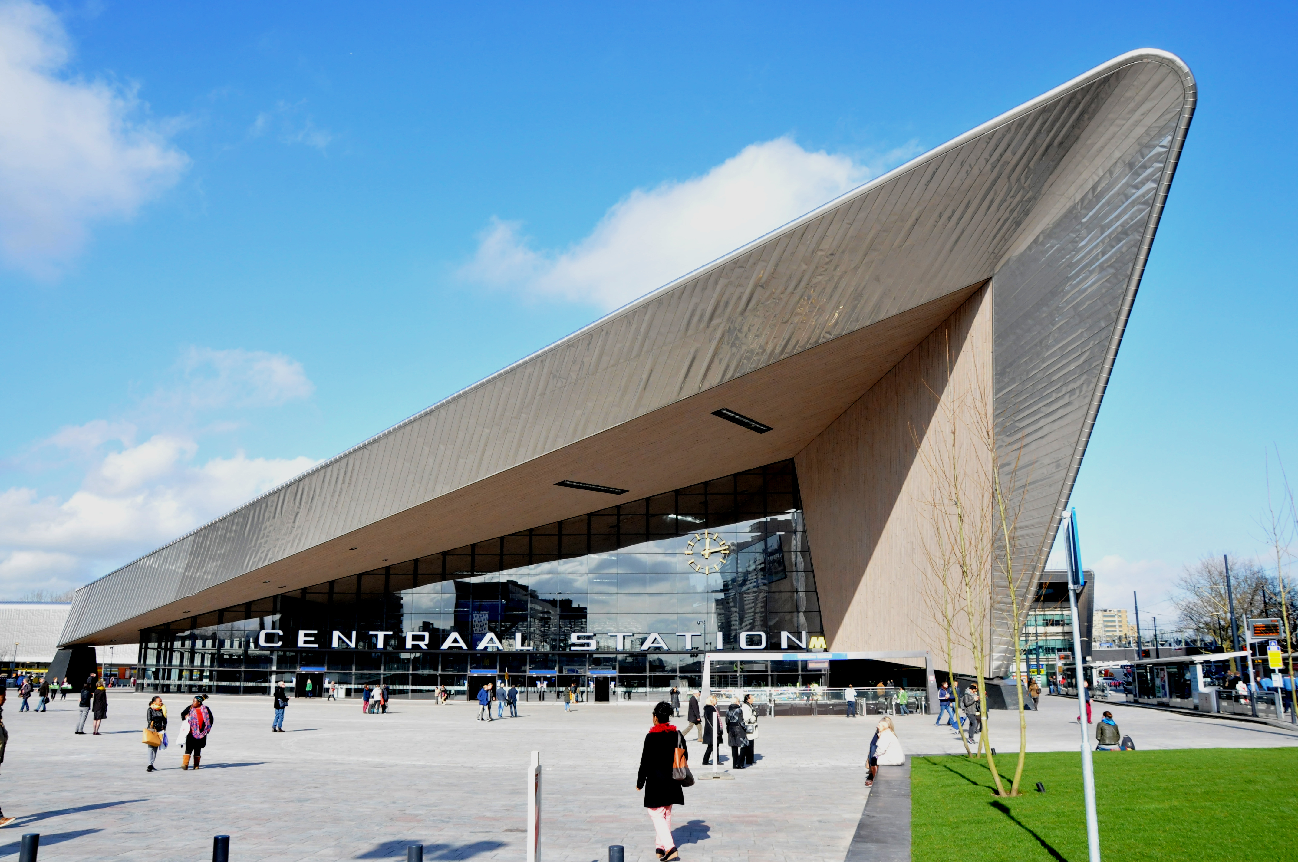
“Amsterdam: construction of subway station Rokin.” by A. Bakker. Creative commons 3.0. Included with appreciation.
México City’s metro goes right to one of the greatest urban archeological discoveries in history: the Templo Mayor at Tenochtitlan. On 21 February 1978, electrical workers digging near the city’s main plaza, called the Zócalo, hit a stone. It was no ordinary stone. The object was carved in the shape of disk measuring 10 feet in diameter. On its surface, a relief could be traced to reveal a portrait of Coyolxauhqui, warrior sister of Huizilopochtli, deity of the ancient Mexicas.
On 21 February 1978, Mexico dug for electrical installation and unearthed this treasure, a stone disk carved in the image of Coyolxauhqui. Photo by miguelao,2009, creative commons 2.0. Included with appreciation.
An archeological team led by Eduardo Matos Moctezuma excavated the site for the next four years, when the endeavor received presidential support as the Templo Mayor Project. More than 7,000 objects were unearthed, bearing witness to the glories of Tenochtitlan, the Templo Mayor, and a series of temples that once stood as evidence of the great civilization. When Tenochtitlan fell in 1521 to the invasion of Cortés and troops, Aztec temples were destroyed. But now, they are once again part of México’s history and culture. To visit the site, take the México City metro Blue Line to the Zócalo stop, and step back in time.
Lewis, Ann-Eliza H., Editor. Highway to the Past: The Archaeology of Boston’s Big Dig. Commonwealth of Massachusetts and Massachusetts Historical Commission, 2001. Https://www.sec.state.ma.us/mhc/mhcpdf/Big_Dig_book, pdf
NO MOW MAY. This month, let your lawn grow with wildflowers to feed seasonal pollinators like bees. Photo: “Wildflowers” by Richard Croft, 2007. Wikimedia CC 2.0. Included with appreciation.
Public parks like Boston’s Greenway or New York City’s Central Park might be the lungs of the city, but urban and suburban yards may be the pop-up restaurants for seasonal pollinators like bees that will help the world through climate change. American lawns occupy 40 million acres, and may be the largest irrigated “crop” in the United States – three times more than irrigated corn. (Milesi, University of Montana and NOAA National Geophysical Data Center)
“Automaton Lawn Mower by Ransomes, Sims & Jeffries of Ipswich, England,” advertisement circa 1867. Public Domain.
No Mow May is an organization in the United Kingdom advocating the absence of lawn mowing, letting lawns grow wild, for this month, offering a spring habitat and feeding ground of wildflowers and clover critical for emerging bees and early pollinators. In addition to homes, colleges are included: Lawrence University recently joined the organization Bee City, USA, and its affiliate: Bee Campus USA.
Fewer lawns, more bees. “Abeille” by Jean-Raphaël Guillaumin, 2010. Wikimedia, CC 2.0. Included with appreciation.
Yards, and campuses, participating in No Mow May noted three times more bee species abundance and five times more bee attendance than in lawn areas.
Another benefit of No Mow May? Water retention. People water lawns. In an era of drought and water scarcity, lawns may be phased out. That what happened in Las Vegas, Nevada.
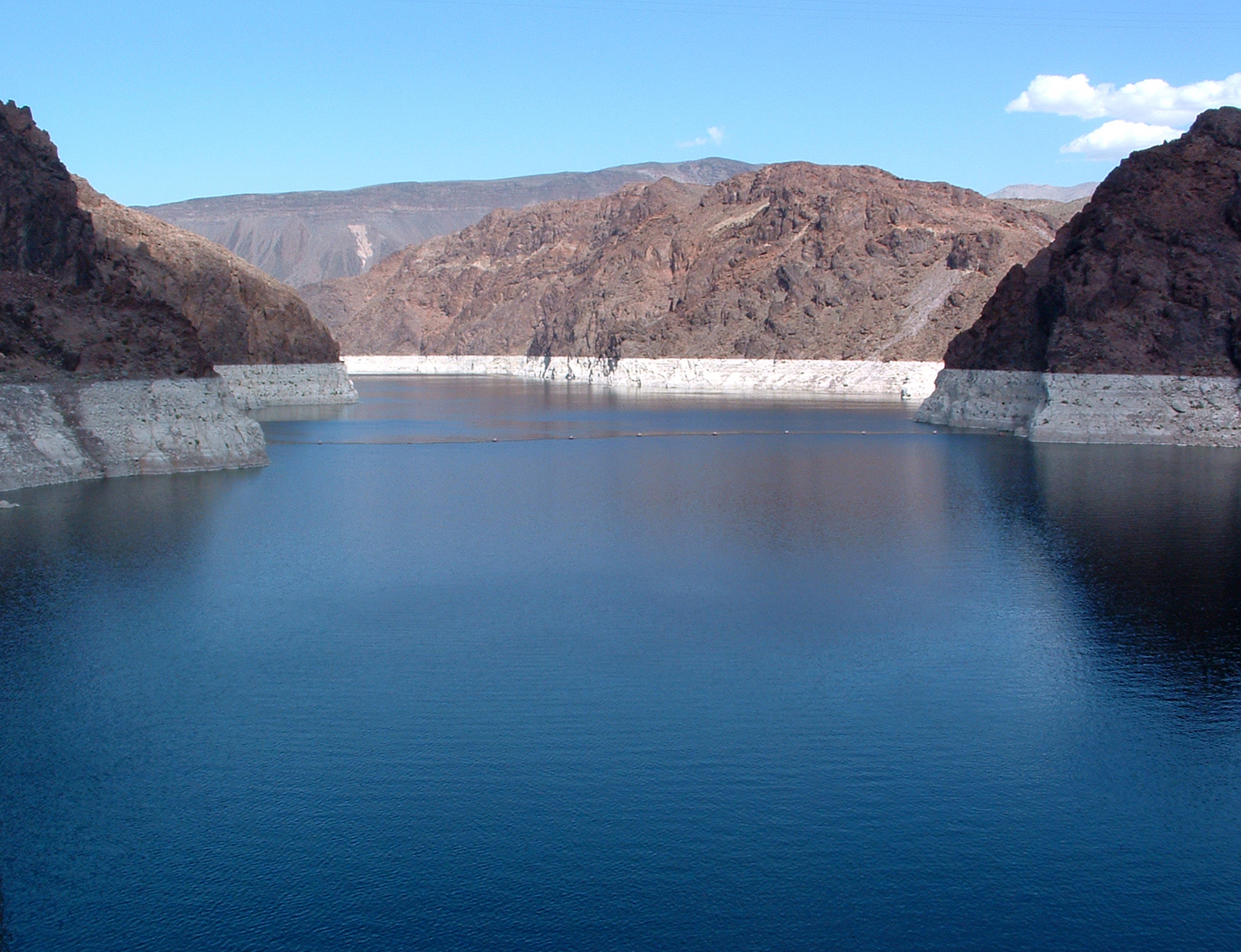
Lake Mead, water reservoir of the Colorado River, supplies Las Vegas with water. A new law by the Southern Nevada Water Authority prohibits lawns, and watering of nonfunctional turf, in response to drought conditions on the Colorado River. Image: “Lake Mead” by Kjkolb, public domain. Included with appreciation.
A new law, related to water shortages in the Colorado River, enacted by the Southern Nevada Water Authority, decreed first-ever permanent prohibition of non-functional turf (soccer fields are functional, household lawns are not). Residents are digging up grass and replacing it with rocks and cactus, creating xeriscapes, a kind of landscaping reducing or eliminating need for irrigation.
Del Toro, Israel and Relena R. Ribbons. “No Mow May lawns have higher pollinator richness and abundances: An engaged community provides floral resources for pollinators” 22 September 2020. National Library of Medicine: National Center for Biotechnology Information. doi: 10.7717/peerj.10021
Southern Nevada Water Authority. “An Act relating to water; prohibiting, with certain exceptions, the use of water from the Colorado River to irrigate nonfunctional turf on certain properties.” Assembly Bill No. 356, 22 March 2021. https://www.leg.state.nv.us/Session/81st2021/Bills/AB/AB356_R1.pdf
Building the World Blog by Kathleen Lusk Brooke and Zoe G. Quinn is licensed under a Creative Commons Attribution-NonCommercial-NoDerivs 3.0 Un
Olmsted’s “Emerald Necklace” in Boston. “Boston Public Garden panorama.” by Rick Harris, 30 April 2006. Creative Commons CC2.0. With appreciation.
Boston’s Emerald Necklace, Chicago’s Jackson Park, the U.S. Capitol Grounds in Washington, D.C., and New York’s Central Park: these were some of the public parks and landscapes that Frederick Law Olmsted (born 200 years ago this week) created. One of Olmsted’s seven principles of a successful public landscape was sanitation: below the surface and woven into the soil are drainage and engineering innovations that serve to enhance health and well-being of the environment, and those who visit it for refreshment and renewal. Olmsted believed public parks could give a city ‘lungs,’ and those who visited a place to breathe. In fact, this year’s bicentennial events include “Lungs of the City: Olmsted’s Parks in Music” with the American Wild Ensemble performing works inspired by outdoor spaces and parks. Before practicing landscape architecture full-time, Olmsted had been director of the U.S. Sanitary Commission, an organization that later became the Red Cross. Public health was a life-long passion for Olmsted, along with a belief that clean air, plants, and a beneficial environment were essential to human, and natural, health.
Parks are Lungs for Cities. “An aerial view of Central Park, Central Park Conservancy: Aerial Summer 2,” by Centralparknyc, 2008. Creative Commons 3.0, wikimedia. With appreciation.
Olmsted’s vision of a city’s need for green space developed at a time when urban areas were becoming unhealthily crowded. Central Park, in New York City, result of a design competition won by Frederick Law Olmsted and Calvert Vaux, was the first landscaped public park in the United States. For its time, it was a macro project: 20,000 workers carved a new landscape enhancing existing terrain (and sadly relocating some groups dwelling there). Over 270,000 shrubs and trees were planted, along with sculpting of a new reservoir from what had formerly been a swamp. Built in 1858, a time before air-conditioning, Central Park provided urban denizens with a literal breath of fresh air. Olmsted stressed the value of “the feeling of relief experienced by those entering them, on escaping from the cramped, confined and controlling circumstances of the streets of the town. In other word, a sense of enlarged freedom is to all, at all times, the most certain and the most valuable gratification afforded by a park.”(Wilson 2020).
“Hiking on Appalachian Trail,” by Chewonki Semester School, 2009. Creative Commons 2.0. With appreciation.
Similarly, the Appalachian Trail, suggested by architect Benton MacKaye in a 1921 article in the Journal of the American Institute of Architects, for the purpose of preserving original land, in the form of a protected trail of great length (it can take five-to-seven months to hike the whole Appalachian Trail), so that people could experience true wilderness. The earlier 1911 Weeks Act granted the United States government authority to buy private land to establish national forests (Hanson 2022). Later, the Wilderness Act encouraged acquisition of land in original nature: since its founding, mover than 100 million acres have been so dedicated. MacKaye suggested, in the seminal article, “new approach to the problem of living.” (MacKaye 1921)
“Street Restaurant during COVID-19 Emergency Rules,” by Eden, Janine and Jim, 1 September 2020. Creative Commons 2.0. With appreciation.
The importance of outdoor space was re-experienced during the recent pandemic. Families held outdoor reunions; restaurants opened up sidewalk cafes, parks welcomed those who needed a break from home isolation. Central Park, 153 years after its opening, proved Olmsted right.
Buenos Aires, world megacity with a population of 16 million (megacities are 10 million+): the name of the city means “Good Airs.” This photo features the Puerto Madero section of Buenos Aires. Image: “High-Rises of Puerto Madero” by Deensel 2018. Creative Commons 2.0, wikimedia. With appreciation.
Cities are home to over half of the world’s population; by 2050, that percentage will grow to 68%. As cities grow, so can parks. Olmsted’s Emerald Necklace, a circle of parks surrounding Boston, gained a new jewel when the Central Artery Project rebuilt the highway underground and replaced surface land with the Greenway, including a carousel.
Ride a carousel in the middle of the city – Boston’s latest jewel in Olmsted’s Emerald Necklace. “Greenway Carousel, Rose Kennedy Greenway,” by Daderot 2014. Dedicated to the public domain (CC0) by the photographer. With appreciation.
To participate in one of the many events celebrating the 200th birthday of Frederick Law Olmsted, click here.
MacKaye, Benton. “An Appalachian Trail: A Project in Regional Planning,” 9 October 1921, pages 325-30, Journal of the American Institute of Architects.
“Leonard P. Zakim Bunker Hill Memorial Bridge” by Eric Vance, United States Environmental Protection Agency (EPA), 2011. Image: Public Domain, Wikimedia.
Transportation infrastructure is one of the paths to a better future. From electric vehicle charging stations, to bridge repair or replacement, American roads will soon experience the biggest rebuilding project since the US Federal Highway System of 1956. Here’s a summary of what to expect over the next five years (Lobosco and Luhby, 2021):
Roads – $110 billion for road repair and upgrades. It is estimated that 173, 000 miles of US roads are in bad condition;
Trains -$66 billion for passenger and freight trail, modernizing the Northeast corridor, and upgrading intercity rail to high-speed capability, with additional funds of $12 billion;
Broadband – $65 billion to improve reach and signal strength of Internet;
Bridges – $40 billion to repair or replace the 45,000 bridges in poor shape;
Public Transit – $39 billion to modernize and upgrade subways and buses;
Airports – $25 billion to repair aging airports and upgrade to low-carbon tech;
Marine Ports – $17 billion for improving marine ports, a major part of the supply chain;
Safety – $11 billion for better protection for cyclists and pedestrians;
Buses and Ferries – $7.5 billion for zero or low-emission ferries and school bus transport;
Electric Vehicles – $7.5 billion for a national network of electric charging stations;
Communities – $1 billion to reconnect neighborhoods divided by highways. This was one of the goals of the Central Artery Project in Boston.
In addition to the transport upgrades, the American Infrastructure Bill will begin rebuilding the electric grid ($65 billion) and correct water infrastructure problems from Flint to Benton Harbor and beyond, replacing lead service lines and old pipes. Finally, uncapped gas wells and abandoned mines will be remedied with a $21 billion fund. The Infrastructure Investment and Jobs Act (HR 3684) passed on 6 November 2021, as nations gather in Glasgow to address response to climate change at COP26. It is now time to rebuild the world.
“Seattle, Washington, as seen from Bainbridge Island ferry 2016.” Photo by Dicklyon. Image: wikimedia commons.
Waterfront property is causing real estate prices to rise – but not in the usual places. Miami’s 2017 Hurricane Irma caused billions of dollars in damage to beachfront properties. Just after that storm, real estate further inland saw price increases. A new term, coined by Professor Jesse Keenan of Tulane University, has entered the lexicon: “climate gentrification.” Three forms of climate gentrification may be considered:
HIGHER GROUND, RISING VALUES – neighborhoods that suffer less damage in storms are becoming desirable, even if such areas were formerly not considered elite;
WATERFRONT PROTECTIONS – property owners of waterfront real estate are investing in weather-proofing measures, spurring rebuilding innovations;
COMMUNITY ACTION – areas with resilience improvements such as elevated infrastructure, flood barriers, and storm drains, are increasing in value.
Miami is one of the cities seeking higher ground. Image: wikimedia commons.
While home-owners may take action, so can government. Galveston, Texas, raised the city up 16 feet with sand and ground development. The city also built a 10-mile-long seawall. Miami drew $200 million from the Miami Forever Bond to improve flood-mitigation infrastructure. New Jersey increased insurance premiums for coastal neighborhoods. Rebuilding coastal cities will cause redesign of canals, harbors, and ports. Boston may experience sea-level rise from a conservative estimate of two feet by 2050, to over six feet by 2100. As coastal cities like Boston, Jakarta, New Orleans and others pump drinking water from reservoirs and aquifers, subsidence of land intensifies the effects of sea rise.
“Panoramic Boston” by photographer Henry Han, 2011. Image: wikimedia commons.
The Sustainable Solutions Lab of the University of Massachusetts Boston suggests state and local government could help with new zoning laws. According to David W. Cash, Dean of the McCormack Graduate School of Policy and Global Studies, “As we watched hurricanes and extreme weather events hit various parts of the United States, it became really clear that Boston was very vulnerable to both flooding and sea level rise.” (Moran 2018). Another important initiative, from the School for the Environment, recommends strengthening and updating the state’s Wetlands Protection Act.
“Aerial View of Great Marsh in Massachusetts.” Image: wikimedia commons.
The future may be safeguarded by a Regional Coastal Flood Protection Agency for Massachusetts. Perhaps broader regional efforts may include Canada and México: rising seas will not stop at national borders. Might there be a regional CCC – Climate Conservation Corps? Could cooperation, and funding, be found with USMCA? How can the world’s regions protect shared coasts through environmental justice and preservation, seeking higher ground?
Are regions the new nations? Image: “North America from Space, based on NASA satellite views.” Artist: Przemek Pietrak, 2015. Image: Nasa/wikimedia commons.
Aune, Kyle T. et. al., “A spatial analysis of climate gentrification in Orleans Parish, Louisiana post-Hurricane Katrina. Environ. Re. 2020 Jun; 185:109384. https://pubmed.ncbi.nlm.nih.gov/32240840/
Kreul, Stephanie, et.al., “Governance for a Changing Climate: Adapting Boston’s Built Environment for Increased Flooding.” September 2018. Sustainable Solutions Lab, University of Massachusetts Boston https://www.umb.edu/editor_uploads/images/centers_institutes/sustainable_solutions_lab/Governance-for-a-Changing-Climate-Full-Report-UMB-SSL.pdf
Boston is going carbon neutral. You can help. Image: “Traffic streaming through downtown Boston” by photographer Robbie Shade. Wikimedia commons.
Boston suffers some of the worst traffic in the United States. City of the ‘Big Dig’ or Central Artery Project, Boston has set the goal of becoming carbon neutral by 2050. Innovative ideas for that achievement can be discovered at the Museum of Science where students from around New England are presenting proposals and videos in Go Carbon Neutral: A Transportation Challenge. Winners will be announced on April 30. Take a look at these ideas for building a better Boston, and vote for your favorite here.