TRANSPORT: Interoceanic Connections

Geography is destiny, some observe. Timing accelerates the pace. And now, climate might be changing both. It is Mexico’s time?

Mexico’s Isthmus of Tehuantepec connecting Pacific to Atlantic might complement the Panama Canal, and offer a number of opportunities for transport. Image: “Isthmus of Tehuantepec” by Kbh3rd, 2007. Creative Commons 3.0. Included with appreciation.

Mexico’s Isthmus of Tehuantepec, spanning the Pacific Ocean from Oaxaca to the Atlantic Gulf at Veracruz, has always fascinated visionaries who could see a highway, a railway, or a canal opening a transoceanic route of 188 miles (303 kilometers). Archival records show 16th century sketches of a connection. In 1811, a canal was proposed by Alexander von Humboldt who had traveled to the isthmus from 1799-1804: he also proposed another connective site that is now the Panama Canal. The route chosen by von Humboldt made clear the advantage of geography that can offer connection.

Map of Alexander von Humboldt’s expedition: 1799-1804. Image by Alexrk2, 2009. Creative Commons 2.5. Included with appreciation.

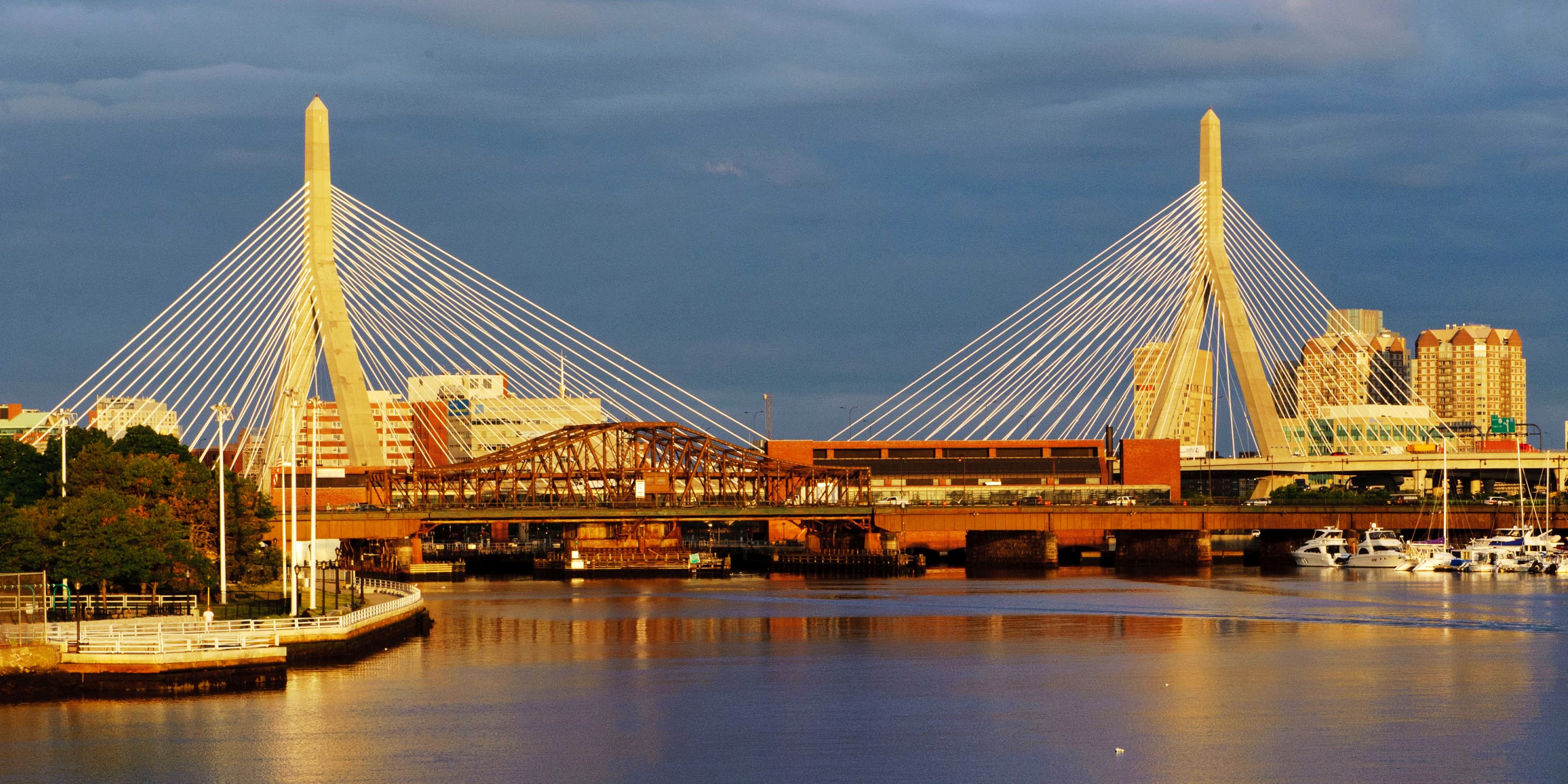
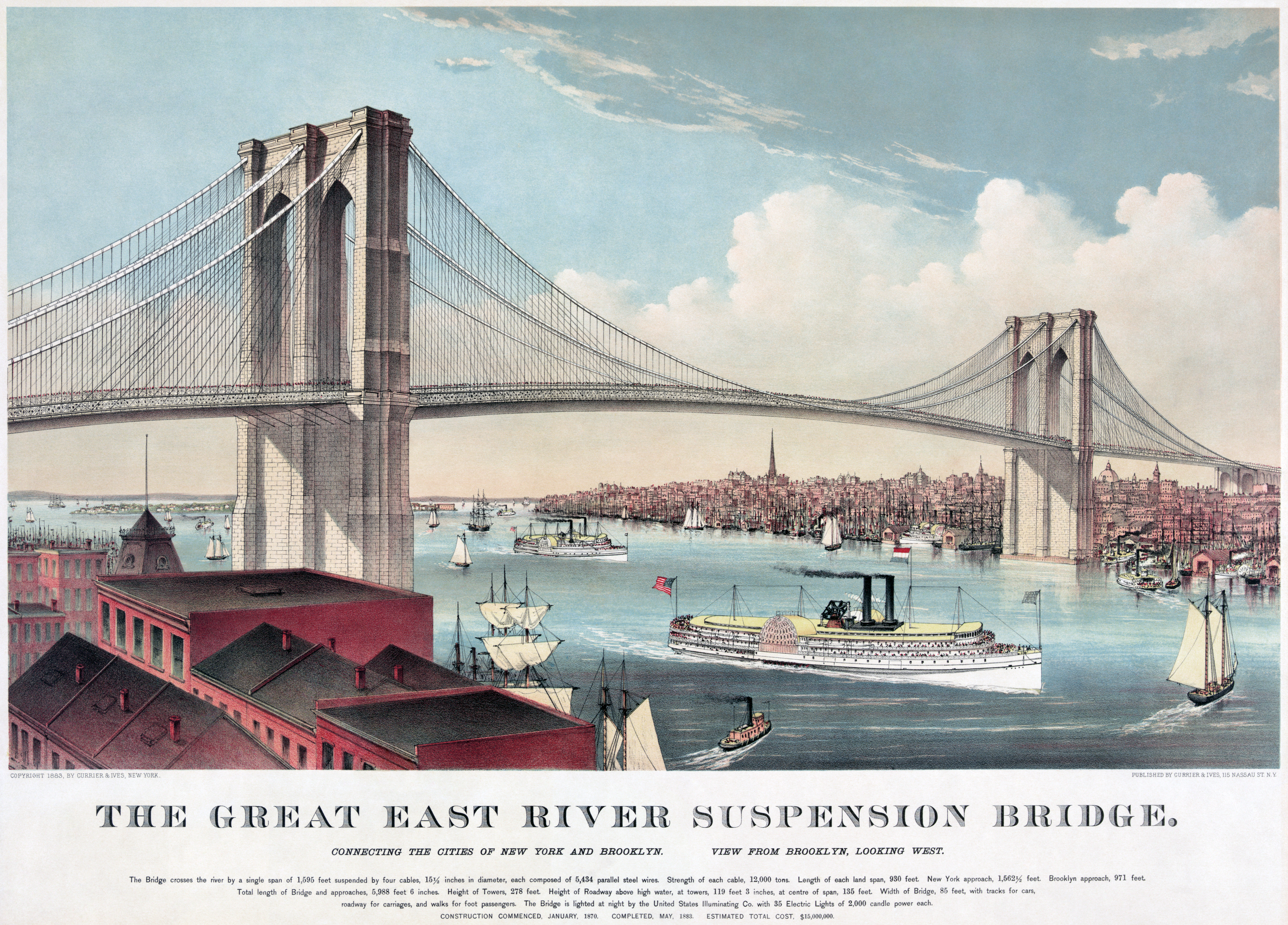
Macro engineering needs the right time and the right leader. The Channel Tunnel, linking England and France, had been envisioned by Napoleon, resisted by General Wolseley, but finally achieved in a design initiated by Frank P. Davidson along with a team of diplomats, engineers, and financiers: it is now the site of Eurotunnel.

Not everyone seeks closer connection. General Wolseley, seen here riding the fleeing lion, opposed the Channel Tunnel. Image: F. Graetz, 1885, from Puck Magazine. Public Domain.

Many tried to optimize the connective advantage of Mexico’s Isthmus of Tehuantepec. Mexico’s President Anastasio Bustamante proposed an 1837 plan for a railway. In 1842, the government (provisional) of Antonio López de Santa Anna granted José de Garay a fifty-year toll collection privilege in return for a survey leading to construction. (A similar provision was granted to Ferdinand de Lesseps who then built the Suez Canal.) When Porfirio Díaz, who hailed from Oaxaca, rose to the Mexican presidency, he inaugurated the first operation of the Railway from the port of Santa Cruz, carrying sugar from Hawaii. Six years of success ensued: 850,000 tons of cargo traversed the isthmus.

Railway won: Mexico launched the first railway in 1850. More would follow. Image: Announcement of Mexico’s first railway, 1850. Public Domain.

But then, in 1914, disruptive new technology happened: the opening of the Panama Canal. Isthmus rail traffic plummeted by one third; the next year, by 77%. Panama was shorter (just 40 miles or 65 kilometers), easier, and more cost effective because cargo loaded on a ship could remain onboard the same vessel that would carry it on to global ports. As many as 32 -37 ships passed through the Panama Canal every day – in just 8 hours. The Panama Canal widened the route; container ships grew in size and capacity.

Panama Canal, NASA image, 2002. Public Domain.

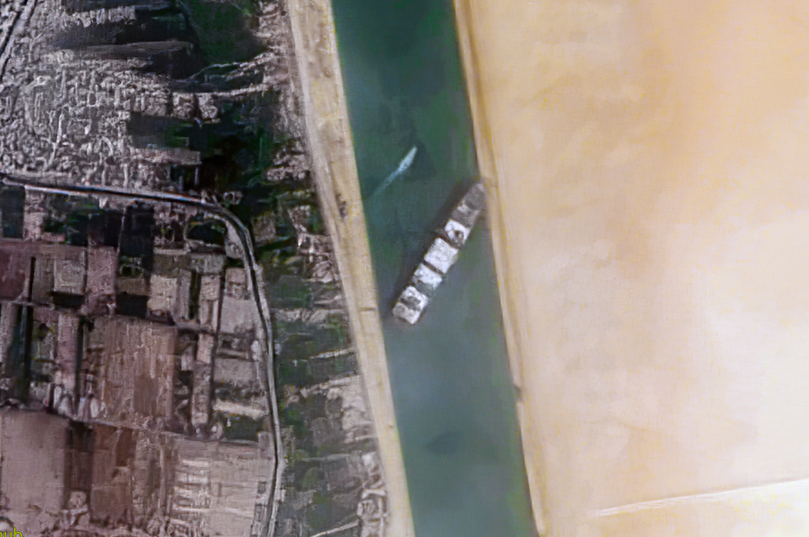
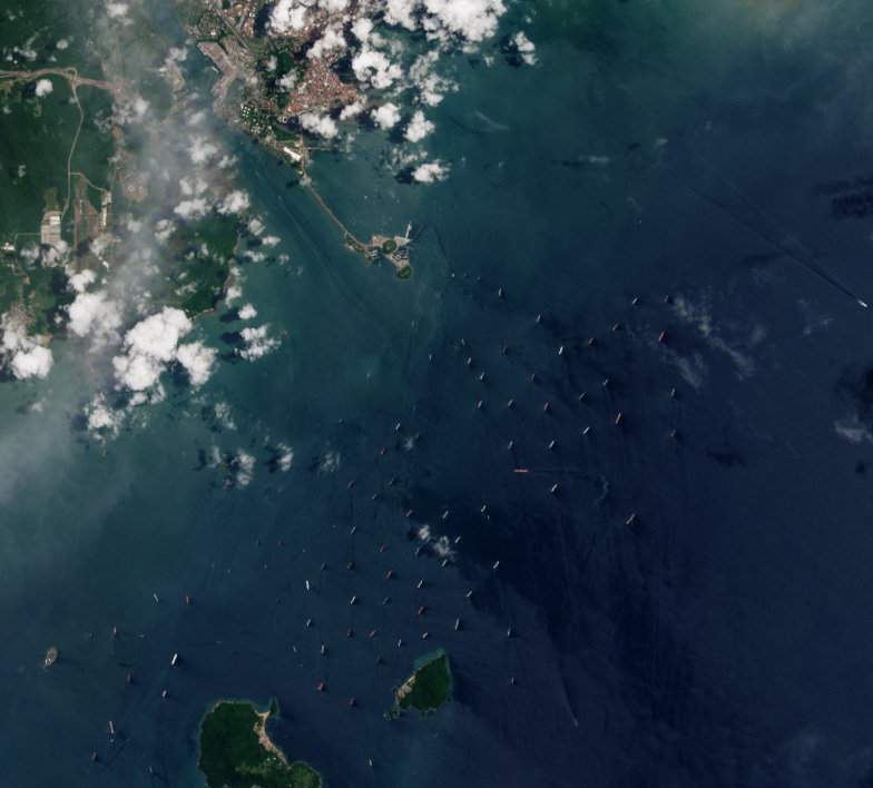
In 2023, a new situation threatened the Panama Canal: climate change. Drought threatens the region. The waterway, widened to accommodate ever-larger ships, may no longer support the heaviest behemoths. Limiting the number of ships per day began in 2023. If drought is severe, ships have to wait offshore for longer (and more expensive) periods; some buy their way up the line. Image below shows ships queuing up to traverse the Canal in 2023.

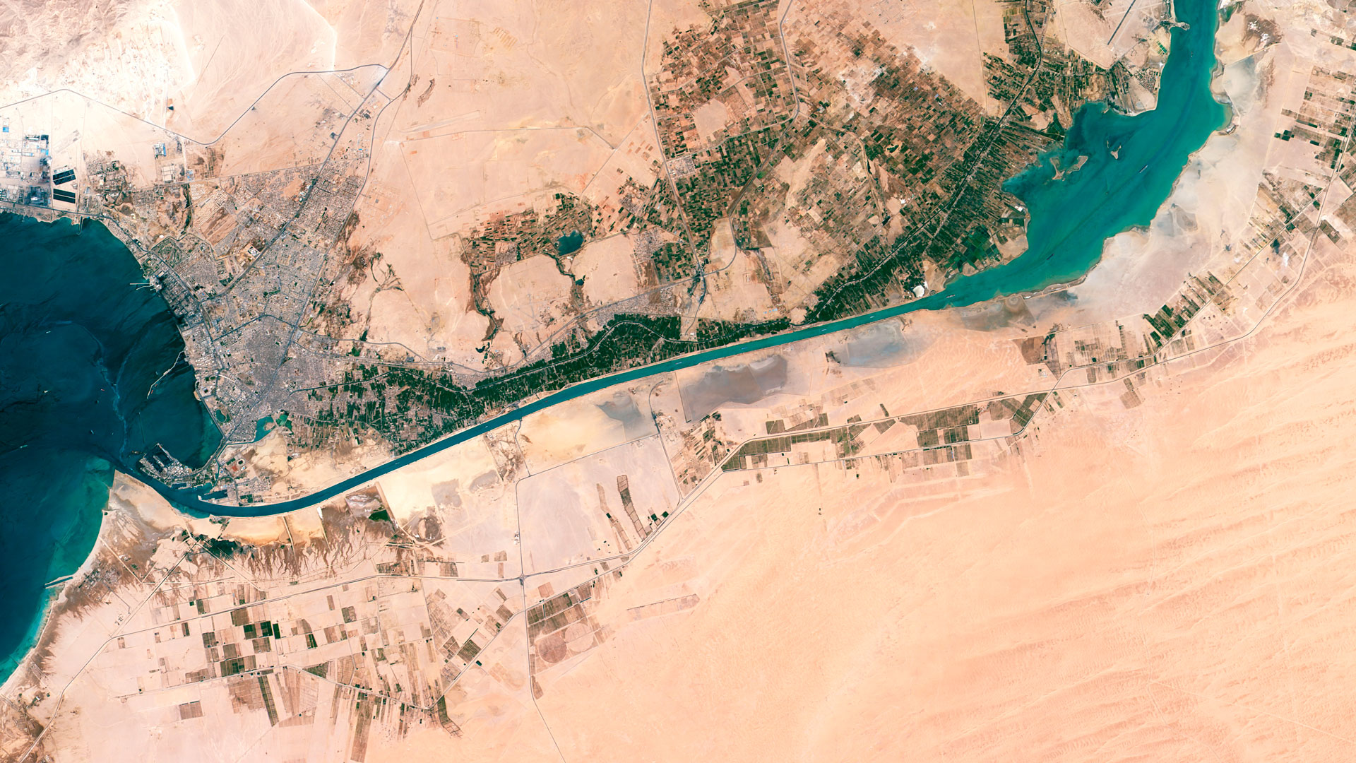
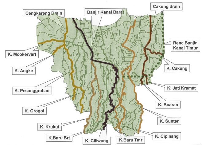
Enter Mexico. Observing an opportunity, the government began modernization of the Tehuantepec Railway and Oaxacan port of Salina Cruz. New tracks, re-laying of supportive basalt, advanced welding improved the railway. Construction of a breakwater outside the Salina Cruz strengthened the port. A new name was the cap that would announce a global vision: Corredor Multimodal Interoceánico (Interoceanic Multimodal Corridor). The railway is a centerpiece, both historic and futuristic. But much more is planned.

Railway is central but much more is planned. Image: Logo of Ferrocarril Interoceánico, CIIT, 2024. Public Domain.

The project will include a trans-isthmus pipeline connecting the two ports. In response, Salina Cruz will host a liquified natural gas (LNG)  plant; that gas will then power ten new industrial parks. Businesses signing on will reap tax breaks for meeting job creation goals. Mexico’s commitment to natural gas expanded the network of pipelines nationally by 50% in the past decade; yet the South and Southeast receive less of that energy. Along with LNG, an existing oil refinery will turn residue into additional petroleum increasing the fossil fuel production by 70,000 barrels. In an area of the world were solar, wave, and wind may offer more environmentally sustainable opportunities, some question the direction of investment. But new partners like Copenhagen Infrastructure Partners will pursue green hydrogen, as well.

Some of the businesses moving to CIIT industrial parks may include those producing green hydrogen. Image: “NGC 604, ionized hydrogen in the Triangulum Galaxy” by Hui Yang, University of Illinois and NASA, 1995. Public Domain.

While a canal is not planned, cargo ships are invited to offload their cargo on the Pacific side, carry the containers across the railway stretch, and then re-load on the Atlantic side, probably to a partner vessel. With drought compromising the Panama Canal, Mexico may attract maritime shipping traffic, perhaps picking up 5% of Panama’s commerce. That would be a small percentage of a big number: in 2023, the Panama Canal’s revenues reached $4, 968 billion.

Zapotec civilization flourished in Oaxaca from 700bce – 1521ce. Zapotec culture and values remain strong. Here, Cocijo, Zapotec deity of water. Image: photograph by Yavidaxiu, 2011. Creative Commons 3.0. Included with appreciation.

In all of the activity initiated by the Corridor, as it is known in English, and its potential to offer opportunity to southern Mexico, not everyone is sanguine: the First Nation and indigenous communities have expressed concern. Zapotec leaders won a lawsuit protesting land purchase for one of the planned industrial parks. Land payments also troubled a Zapotec activist who had protested the distribution of the funds: when he was found dead, such violence raised more concern – and fear. Human rights violations began to be raised. Mixe community leaders blocked progress on their section of the Railway: arrested protestors were released in response to demands by the National Indigenous Council. Indigenous concerns include disturbance of agricultural soil health and biodiversity.

Mexico’s new President Claudia Sheinbaum, climate scientist, takes office 1 October 2024. Image: “President Elect Claudia Sheinbaum, 2 June 2024” by photographer EneasMx, 2024. Creative Commons 4.0. Included with appreciation.

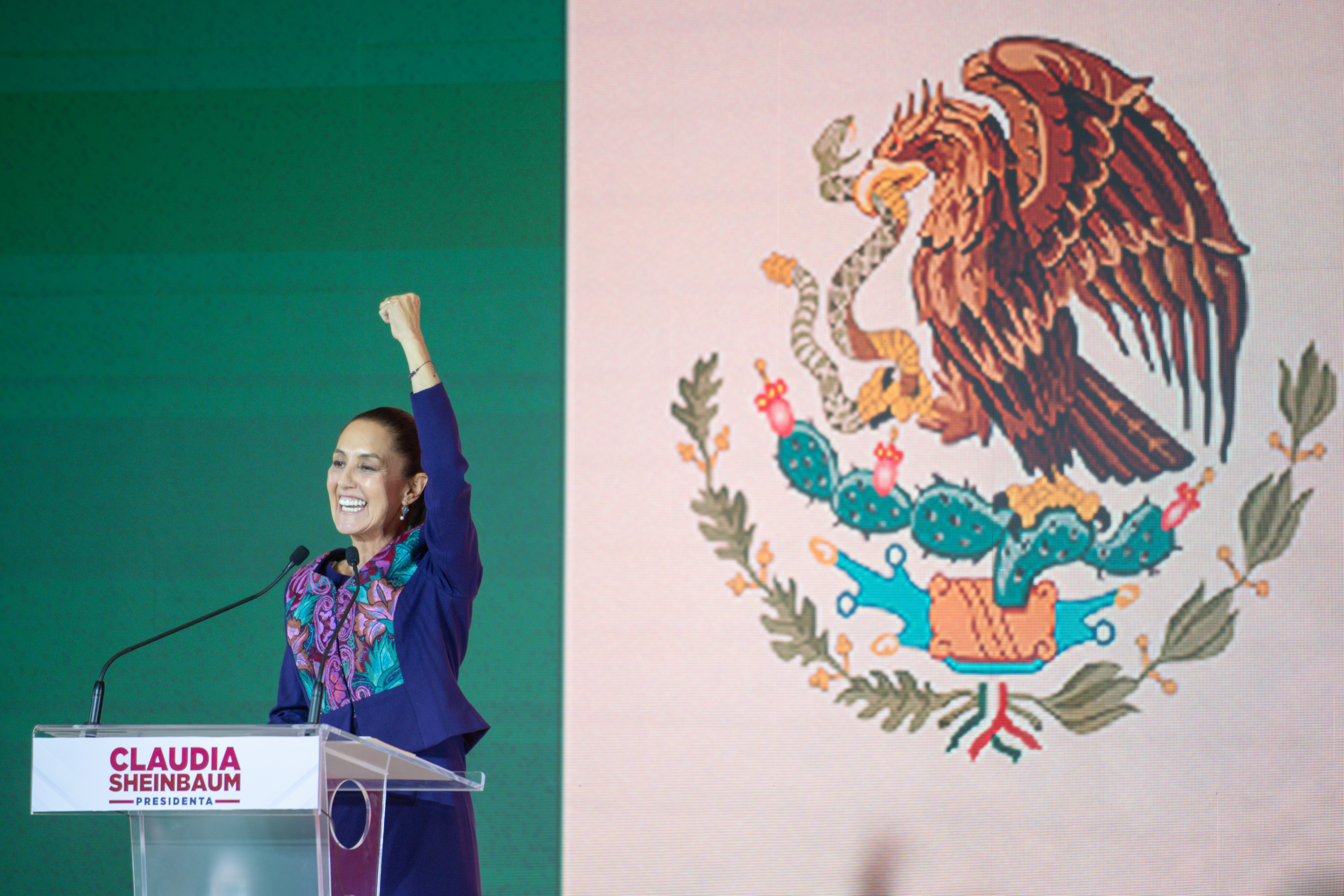
Geography, destiny, and climate change may speed the future of the Interoceanic Corridor of the Isthmus of Tehuantepec (CIIT). How will environmental scientist Claudia Sheinbaum, PhD, Mexico’s new president who begins a six-year term on 1 October 2024, work with Oaxaca, and its unique geographical and cultural gifts, to build Mexico’s future?

Bourke, India. “Claudia Sheinbaum: What a climate-scientist turned president might mean for global efforts to tackle climate change” 7 June 2024. BBC. https://www.bbc.com/future/article/20240607-claudia-sheinbaum-mexicos-new-climate-minded-president

Davidson, Frank P. and K. Lusk Brooke. “The Channel Tunnel: England and France,” Chapter 39, pages 761 – 804. Volume II. Building the World. Westport: Greenwood Press, 2006. ISBN: 978313333743.

Matheiros, Gabriel. “Panama Canal’s revenue up 14.9% in 2023 despite lower cargo.” 23 February 2024. Datamar News. https://www.datamarnews.com/noticias/panama-canals-revenue-up-14-9-in-2023-despite-lower-cargo/

Mexico, Government of. “DECRETO por el que se crea el organismo público descentralizado, con personalidad juridica y patrimonio propio, no sectorizado, denominado Corredor Interoceánico del Istmo de Tehuantepec.”14 June 2019. Diario Oficial de la Federación. https://dof.gob.mx/nota_detalle.php?codigo-5562774&fecha=14/06/2019#gsc.tab=0

Wall Street Journal. “Mexico’s Interoceanic Corridor.” 2024. VIDEO. https://www.youtube.com/watch?v=NMDCKpmc-uo

Appreciation to Charles E. Litwin for sharing research.

Building the World Blog by Kathleen Lusk Brooke and Zoe G. Quinn is licensed under a Creative Commons Attribution-NonCommercial-NoDerivs 3.0 U


TRANSPORT: Bridges

Baltimore’s Francis Scott Key Bridge disaster is a tragedy. You can help here and here. Image: ‘Cable stayed suspension bridge” by Wikideas1, 2024. Pubic Domain CC0 1.0. Included with appreciation to the artist and support for Baltimore’s families who have suffered loss.

The tragedy of the Francis Scott Key Bridge brings deep sorrow for those lost and injured, as the search for those still missing continued after the accident. The Baltimore bridge was slammed by cargo vessel Dali after the 984 foot (299 meters) ship lost power and could not avoid collision. A MayDay call was sent, but it was too late. Citizens in the area rushed to help, forming a human blockade to prevent oncoming traffic from entering the bridge access.

“Francis Scott Key Bridge and Cargo Ship Dali” tragic accident photograph by NTSBgov, March 2024. This image is in the public domain.

While using waterways for transport is an ancient idea, and has recently been championed by European transport experts as more environmentally beneficial, the size of cargo ships must be considered. Europe has 23,000 miles (37,014 kilometers) of waterways: using canals and rivers for cargo transport could reduce emissions from trucks. Presently, 6.5 million trucks deliver goods across Europe, while rail carries just 5% and rivers 2%. European port operator Haropa proposed rivers and canals as a means of cargo delivery. But when European canals, as well the American Erie Canal were built, and the bridges that span these waterways, cargo vessels carrying goods were smaller.

The Ever Given cargo ship, stuck in the Suez Canal in 2021, was so large it could be seen from the International Space Station. Photo: NASA/ISS 27 March 2021. Public Domain.

Now, the size of the average cargo ship is considerably larger. Ships that have problems can cause major trouble, like the container ship Ever Given that got stuck in the Suez Canal. In the first three months of 2024, cargo ships have hit bridges in Argentina, China, and the United States. Some would question if waterways, and bridges, are ready for the size of cargo vessels now used. The Port of Baltimore is the 11th largest in the United States. It is an important transport center, but what are the limits of the ships that traverse its waters? What safety measures need to be in place in the world’s ports? Coastal cities around the world are some of the most important ports. Baltimore is one; Boston is another. Will sea level rise threaten the safety of ports?

Zakim Bridge in Boston, Massachusetts, USA, completed in 2002, named to honor Leonard P. Zakim. It is the largest asymmetrical cable-stayed bridge in the world. Photograph by Eric Vance, U.S. Environmental Protection Agency, 2019. Public Domain Creative Cpmmons0 1.0. Included with appreciation.

While the Francis Scott Key bridge was not structurally deficient (although there has been comment on its structural redundancy, a term for extra support that can compensate for damage preventing collapse, as well as pier protection) and was certified as completely up-to-code, too many of our spans are in need of strengthening. Bridges last about 50 years before showing problems. The age of the average bridge in the United States is 42. A study by the American Road and Transport Builders Association (ARTBA) revealed that 36% of U.S. bridges – 222,000 – are in need of repair. The total cost? $319 billion. How much is currently allocated? $3.2 billion.

Roman aqueducts and bridges utilized the famous Roman Arch. Image: “Roman Aqueduct in Tarragona, Spain” by Cruccone. Creative Commons 3.0. Included with appreciation.

Bridges were once, and remain, so important to city planning and security that in ancient Rome, only the Pope and a small cadre of bishops had the right to authorize a bridge. From that historic beginning, we get our word “pontiff” (Latin “pontifex” from “pons” (bridge) + “facere” (to do or make). Only the Pontiff of Rome could issue a bridge permit. In olden days of China, there was a bridge over which only the Emperor could walk.

“London Bridge” by Claes Van Visscher, 1616. This image, in the public domain, was offered by Mahagaja. It is included with appreciation.

Many transport historians might mark stages of civilization by connections formed via bridges. London Bridge changed the commerce of the city. Its span was the location of what may be one of the first shopping malls: retail stalls built along the structure paid rent that helped support bridge repairs. London Bridge is significant, too, for what was perhaps the first worker’s compensation plan, according to King John’s document of authorization to the Lord Mayor of London.

“Brooklyn Bridge, originally the Great East River Suspension Bridge” by Currier and Ives, 1883. Public Domain. Included with appreciation.

Bridges can raise the spirit: the Brooklyn Bridge has inspired more poetry than any other bridge in history. Hart Crane’s “To Brooklyn Bridge,“offers reflections upon the span. The bridge is also connected to philosophy: it began in the mind of John Roebling who contemplated teachings of his professor at the Royal Polytechnic in Berlin: the philosopher Hegel. It was one of Hegel’s theories that gave Roebling the idea: it came to him in a flash during a hike in Bamberg. He sat down on a rock and sketched what would become the Brooklyn Bridge.

“Hammersmith Bridge” by photographer Alex Muller, 2008. This image is licensed by Creative Commons 3.0. It is included with appreciation to Alex Mulller.

British spans were recently studied: 17 were found to be in danger of collapse and 37 were on the watch list. The Hammersmith Bridge across the Thames River showed cracks in the 100+ year-old structure, causing the banning of vehicles since 2019.

“Morandi Bridge” by photographer Davide Papalini, 2010. This image is licensed under Creative Commons 3.0. It is included with appreciation to Davide Papalini.

European Union bridges tend to be on the older side: many were built as part of the Marshall Plan, just after World War II in the mid 1940s. Germany’s Leverkusen Bridge developed concrete cracks and was closed to heavy vehicles in 2012. In 2018, Italy’s Morandi Bridge connecting Genoa to France collapsed in a drenching rain storm. Built with only one pair of cable stays to support each section, vulnerability may have been inherent in the design.

Will bridges, many built in earlier times for different conditions, withstand the stronger storms of climate change? Britain’s Tay Rail Bridge washed out and collapsed in a strong storm in 1879. Image: Tay Bridge Catastrophe, 1879. Image origin: public domain, author unknown.

Climate change and attendant extreme weather, including intense winds and storms creating waves and floods, may affect bridges. In areas with drought subject to wildfire, bridges might need protection in parts of the span that may contain fiberoptic cable. Concrete may seem strong, but it cracks at 500 degrees Fahrenheit and melts at 2,500 degrees. Innovations like “First Line Fire Blankets” can be applied to bridges, power cables, and even gas pipelines. Make of E-glass fiber that resists thermal conductivity, “fire blankets” can be retrofitted to protect critical infrastructure.

China’s Belt and Road Initiative (BRI) is building many new bridges. Are there opportunities for innovation that can respond to climate change?  The Mohammed VI Bridge, Morocco, was a BRI project. Image courtesy of Ministry of Equipment and Transport, Morocco, 2016. Creative Commons 3.0. Included with appreciation.

Older bridges may be supported by vigilance and retrofitting. Newer construction has opportunities for innovation. China’s Belt and Road Initiative, connecting Asia all the way to Africa and Europe, may tally $8 trillion. Financed in part by loans to countries that agree to the building of bridges, ports, roads, railways, China’s debts-owed increased 20% since 2013 when the project launched. More than 68 countries have signed on to participate in the project that will involve 65% of the world’s entire population. Bridges in the plan include the China-Maldives Friendship Bridge, Maputo Bay Bridges in Mozambique, Mohammed VI Bridge in Morocco, and the Peljesac Bridge in Croatia. Decisions made about bridge design, strength, maintenance, and technology may determine the future of the much of the world’s connectivity over water, and also over terrain needing aerial bypass. What are some ways bridges can be improved?

A view of Baltimore’s Key Bridge in 2011 by photographer Sarnold17. This image is licensed in Creative Commons 3.0.

Meanwhile, Baltimore mourns. If you would like to help those affected, you may help here and here.

ARTBA. “2023 Bridge Report: 222,000 U.S. Bridges Need Major Repairs.” 18 August 2023. https://www.artba.org/news/artba-2023-bridge-report-222000-u-s-bridges-need-major-repairs/

Bridge Masters, Inc (BMI). “First Line Fire Blankets: Superior Bridge Utility Protection.” 15 September 2017. https://bridgemastersinc.com/first-line-fire-blankets-superior-under-bridge-utility-protection/

Brooke, K. Lusk. “Brooklyn Bridge.” Building the World Blog. https://blogs.umb.edu/buildingtheworld/bridges/1480-2/

Brooke, K. Lusk. “TRANSPORT: Suez Canal.” 31 March 2021. Building the World Blog. https://blogs.umb.edu/buildingtheworld/2021/03/31/transport-suez-canal/

Jester, Julia. et al., “At least 6 people unaccounted for after cargo ship crash levels Baltimore bridge.” 26 March 2024. NBC News. https://www.mbcnews.com/news/us-news-maryland-bridge-collapse-francis-scott-key-bridge-boat-baltimore-rcna145047

McBridge, James, et al., “China’s Massive Belt and Road Initiative.” 2 February 2023. Council on Foreign Relations. https://www.cfr.org/backgrounder/chinas-massive-belt-and-road-initiative

Topham, Gwyn. “More than 3,200 UK bridges need repair, local authorities say.” The Guardian. 25 March 2022. https://www.theguardian.com/world/2022/mar/25/more-than-3200-uk-bridges-need-repair-local-authorities-say

Yeung, Jessie. “Three ships have hit bridges in different countries – in just three months. Should we be worried?” 27 March 2024. CNN. https://www.cnn.com/2024/03/27/world/bridge-accident-dangers-baltimore-collapse-intl-hnk?cid=ios_app

Building the World Blog by Kathleen Lusk Brooke and Zoe G. Quinn is licensed under a Creative Commons Attribution-NonCommercial-NoDerivs 3.0 U

TRANSPORT: Suez Canal

Ever Given container ship stuck in the Suez Canal. What is the future of shipping? Image: wikimedia.

One ship 1,300 feet long (400 meters); 14 tug boats; 30,000 cubic meters of mud and sand cleared; 369 ships waiting in line behind the behemoth vessel: these are the elements that marked the reopening of the Suez Canal this week. When the Ever Given stopped traffic on 23 March, the Suez Canal Authority (SCA) estimated a $14 million revenue loss for each day of the blockage. Moreover, trade along the waterway that contributes 2% to Egypt’s GDP also stopped – costing $6.7 million per minute. (Russon 2021) Alianz insurer reported the Suez Canal March 2021 blockage cost between $6 billion and $10 billion.

Ever Given earlier in March in the port of Rotterdam. Image: wikimedia.

Almost everything we touch has reached us, at some stage in the supply chain, via ship. Suez averages 106 container vessels and cruise ships per day. Trends in the container shipping industry reveal continuous pressure for size increase: since 1968, container ship capacity has increased 1,200%. (World Shipping Council, 2021) Why the pressure for bigger? One reason is because shipping is twice as energy efficient as rail and seven times more than vehicle. Shipping emits 3.1% of global CO2, but that percentage could rise as other industries decarbonize. The Energy Efficiency Design Index (EEDI) is a globally-binding design standard established by the International Maritime Organisation (IMO) to reduce climate damage caused by shipping: ships built from 2020-2024 will be required to improve energy efficiency by 15-20%, and by 30% after 2025. Many of those ships will transit the Suez Canal.

Suez Canal, southern part, as viewed by Hodoyoshi satellite, 2015. Image: Axelspace Corporation, via wikimedia commons.

As container ships get bigger, canals will too. In 2015, Suez built a parallel waterway deepened by dredging one million cubic meters of sludge daily. Six companies did the work: Great Lakes Dredge and Dock Company (USA), Jan de Nul Group and Deme Group (Belgium), National Marine Dredging (UAE), Royal Boskalis Westminster and Van Oord (Netherlands). The Panama Canal, begun by Ferdinand de Lesseps but completed by the US, recently installed new locks on the Atlantic and Pacific sides that are 70 feet wider and 18 feet deeper than the originals. American ports like Baltimore, Charleston, Miami, Philadelphia, and Virginia have seen increased container traffic from the Panama expansion, according to the Supply Chain Management Program at MIT. The current US proposal “American Jobs Plan” allocates $42 billion for ports (air and sea) that may spur improvements.

Aida performed in the Arena di Verona, Italy, 2006. How can we celebrate great infrastructure in our times? Photographer: Christian Abend. Image: wikimedia commons.

Egypt’s famous waterway opened in 1869; 1.5 million people worked on the canal’s construction, evidence that infrastructure building creates jobs. Ferdinand de Lesseps, retired diplomat, visited his childhood friend now the khedive and viceroy of Egypt, in 1854 and gained concession to build the canal. Diplomacy remained a central value: the Suez contract Article VI states “tariffs of dues for passage…shall be always equal for all nations.” (Building the World, p. 193) To mark the inaugural opening of the Suez Canal, Giuseppe Verdi composed the opera Aida.  Should the “American Jobs Plan,” aimed at rebuilding infrastructure, include funding for art?

Davidson, Frank P. and Kathleen Lusk Brooke. Building the World: Great Engineering Projects in History. Volume 1, Chapter 16, “The Suez Canal,” pages 187-204. Greenwood/ABC-CLIO, 2006. ISBN: 9780313333736

DC Velocity. “Has the Panama Canal expansion changed anything?” 20 December 2018.  https://www.dcvelocity.com/articles/30335-has-the-panama-canal-expansion-changed-anything.

Edwards-May, David, and Li Denan. China’s Grand Canal: Mirror of Civilisation. Xanadu Publishing 2020. ISBN: 9781784591830.

Gooley, Toby. “Has the Panama Canal expansion changed anything?”

Inland Waterways International (IWI).  https://inlandwaterwaysinternational.org/

Navigating a Changing Climate Partnership and World Association for Waterborne Transport Infrastructure. “Mitigation: Moving towards low carbon navigation infrastructure.” @NavClimate.  https://navclimate.pianc.org

Russon, Mary-Ann. “The cost of the Suez Canal blockage.” 29 March 2021. BBC News. https://www.bbc.com/news/business-56559073

Street, Francesca. “What’s it’s really like steering the world’s biggest ships.” 29 March 2021. CNN.com. https://www.cnn.com/travel/article/steering-worlds-biggest-ships-suez-canal-cmd/index.html

Tankersley, Jim. “Biden Details $2 Trillion Plan to Rebuild Infrastructure and Reshape the Economy.” 31 March 2021. The New York Times.

Transport & Environment. “Shipping and Climate Change.” https://www.transportenvironment.org/what-we-do-/shipping-and-environment-shipping-and-climate-change

Verdi, Giuseppe. Aida. Performance by Pavarotti. LISTEN: https://www.youtube.com/watch?v=b8rsOzPzYr8

World Shipping Council. “Container Ship Design.” https://www.worldshipping.org/about-the-industry/liner-ships/container-ship-design.

Building the World Blog by Kathleen Lusk Brooke and Zoe G. Quinn is licensed under a Creative Commons Attribution-NonCommercial-NoDerivs 3.0 Unp

Hearing (and Listening to) the Voices of the Future

I

Greta Thunberg: TIME Person of the Year 2019. Image: wikimedia

It is the world’s youth who must face consequences of decisions made now. Youth4Nature sent a COP25 delegation, and sailing across the Atlantic to get there, the world heard the message of Greta Thunberg, founder of Fridays for Future. Voices of youth may be louder than dicta of governments. UN Secretary General Guterres states: “The technologies that are necessary to make this possible are already available. Signals of hope are multiplying. Public option is waking up everywhere. Young people are showing remarkable leadership and mobilization. We need political will to put a price on carbon, political will to stop subsidies on fossil fuels, and start taxing pollution instead of people.”

Youth Climate Strike, San Francisco, March 2019. Image: wikimedia

Many macro achievements, throughout history, can be traced to the genius and innovation of youth. A 12-year old conceived of a canal joining the Atlantic Ocean with the Mediterranean Sea, the Canal des Deux Mers of France. Even younger, 10 year-old Ferdinand de Lesseps formed a friendship that would later turn into the Suez Canal. At COP25, it was the youth who insisted and persisted until a draft agreement on responses to climate change could be strengthened by contracts fulfilling promises made in Paris 2015. There is much to be agreed and achieved, including carbon contracts; now that debate awaits Glasgow. Meanwhile, it is hoped the world is not only hearing, but also listening to, the Voices of the Future, Greta Thunberg is TIME Person of the Year.

Irfan, Umair. “‘We are desperate for any signs of hope,’ Greta Thunberg tells UN climate negotiators.” 11 December 2019, Vox. com. https://www.vox.com/2019/12/11/21010673/cop25-greta-thunberg-climate-change-un-meeting-madrid

McGrath, Matt. “Climate change: Longest talks end with compromise deal.” 15 December 2019. BBC: Science & Environment.

Time. “Greta Thunberg: TIME Person of the Year 2019.”https://time.com/person-of-the-year-2019-greta-thunberg/

Building the World Blog by Kathleen Lusk Brooke and Zoe G. Quinn is licensed under a Creative Commons Attribution-NonCommercial-NoDerivs 3.0 Unpor

CITIES Underwater – Venice

St. Mark’s, Venice, underwater again. “Aqua Alta Venise,” Image: wikimedia

Venice, UNESCO World Heritage Site, has suffered the worst flood in 50 years, attributed in its severity to climate change. Inside the city’s venerable buildings are paintings by Francesco Guardi, J.M.W.Turner, and many other priceless treasures. St. Mark’s Basilica, flooded just six times in nine centuries, shows inundation-damaged marble floors; there is fear the iconic columns may also be weakened. Modern art is also affected: Banksy’s “Shipwrecked Girl” mural on the Rio di Ca’Foscari canal is now underwater.

What can be done to prevent the loss of life, property, and infrastructure that cities like Venice must anticipate in the future? Coastal cities may soon have more accurate information about sea-rise. As Venice flooded in November 2019, Sentinel-6a entered testing in the final stage before expected launch in November 2020. Sea-rise is accelerating: five-year span 2014 – 2019 revealed a 4.8mm/year increase.  Copernicus Sentinel’s Jason-2 Poseidon Altimeters will map ocean floor peaks and valleys, reading temperature, salinity, gravity, currents and speed.

Coperniicus Sentinel-2A Satellite, 8 August 2017. “Greenland, wildfire.” Image: wikimedia commons.

A global system like COMSAT, Sentinel coordinates orbiting devices. Sentinel-6 moves between 66 degrees North and South; Sentinel-3 goes to 82 degrees. Sentinel-6 repeats its cycle every 10 days, monitoring big areas like the Gulf Stream or the Kuroshio Current; Sentinel-3 repeats every 27 days, focusing on smaller ocean eddies that move more slowly. Earth Science Division of NASA may link Landsat to Sentinel-2, completing the circle.

Meanwhile, Venice’s regional council may be having second thoughts about their recent veto to fund a proposal to combat climate change. Just minutes later, their Ferro Fini Palace offices flooded, sending the fleeing officials into the flooded streets, with  70% of Venice engulfed. From St. Mark’s Square, Venice’s mayor Brugnaro expressed hopes that the Mose system, a series of barriers consisting of mobile gates located at inlets, will soon protect the city from inundations. Venice is not alone: Boston and other cities may build harbor barrier systems. Worldwide, hundreds of cities  face the same fate: what are some of the ways cities can respond, from Amsterdam to Jakarta to Yangon?

The once and future Venice: “Piazza San Marco with the Basilica,” 1720. Image: wikimedia.

Amos, Jonathan. “Sentinel for sea-level rise enters testing.” 15 November 2019. BBC Science & Environment.

Cerini, Marianna. “Venice is flooding — what lies ahead for its cultural and historical sites?” 16 November 2019. CNN. https://www.cnn.com/style/article/venice-flooding-st-mark-damages/index.html.

Giuffrida, Angela. “Venice council flooded moments after rejecting climate crisis plan: proposals rejected as lagoon city faces worst flooding in 53 years.” 15 November 2019. The Guardian. https://www.theguardian.com/world/2019/nov/15/venice-council-flooded-moments-after-rejecting-climate-crisis-plan/.

Kirshen, Paul, et. al. “Feasibility of Harbor-wide Barrier Systems: Preliminary Analysis for Boston Harbor.”   2018. Sustainable Solutions Lab, University of Massachusetts Boston.

Lemperiere, Francois and Luc DeRoo. “Peut-on éviter les inondations a Paris?” Symposium du CFBR, 25 janvier 2018 a Chambery. Thanks to David Edwards-May.

Mazzel, Patricia. “82 Days Underwater: The Tide Is High, but They’re Holding On.” 24 November 2019, The New York Times. https://www.nytimes.com/2019/11/24/us/florida-keys-flooding-king-tide.html?smid=nytcore.ios.share.

MOSE SYSTEM: The mobile barriers for the protection of Venice from high tides.” https://www.mosevenezia.eu/project/?lang-en

Building the World Blog by Kathleen Lusk Brooke and Zoe G. Quinn is licensed under a Creative Commons Attribution-NonCommercial-NoDerivs 3.0 Unpor

Jakarta: first capital to move due to sea rise

Rivers and canals of Jakarta, Indonesia. Image: wikimedia.


MOVING THE CAPITAL DUE TO SEA RISE: Jakarta, Indonesia is the fastest sinking city on earth. Sea rise threatens the city, located on land intersected by 13 rivers. A busy port, Jakarta is congested and dense; heavy port buildings weigh down the terrain. As the capital, Jakarta also supports government, industry, and a burgeoning population. Residential and industrial water needs result in considerable pumping from the rivers, further draining the land mass. Another burden of density: traffic – Jakarta’s is among the world’s worst. And then there’s the residential buildings: 10 million people call Jakarta home, making it one of the world’s megacities. Skyscrapers dot the skyline, adding weight. Jakarta has sunk eight feet in the past decade, and the subsidence continues. Half of the city is below sea level.

Baghdad, surrounded by the Tigris River. Image: wikimedia.

NEW CAPITAL, NEW VISION: Changing the capital of a country is not unique in history. Baghdad was founded with a new vision, drawn as three concentric circles with a stroke of the Caliph’s sword marking the new capital. As Baghdad rebuilds, will Frank Lloyd Wright‘s plans and drawings bring Al Mansur’s vision to life as Madinat as-Salam, “City of Peace?” Other times, capitals moved inland from ports: Lagos, a port city, begat Abuja, moving Nigeria’s capital to a central location designed with vision and values including Haussmann’s Paris and L’Enfant’s and Banneker’s Washington, D.C. Rio de Janeiro ceded its position as capital to Brasilia, in part because the city of Ipanema beach became too dense; coastal location also meant vulnerability. The new capital, Brasilia, was central to the diverse country, representing a wider vision. Lucio Costa designed the new capital to be built in the shape of an airplane; Brasilia was the first city built to be seen from the air.

Costa’s Plan for Brasilia, in the shape of an airplane. Image: Library of Congress.

NEW BALANCE OF POWER: Just as Brazil chose an inland location, and Nigeria selected Abuja to relate to the center of the country, so Indonesia’s possible choice of an area of Borneo might represent a wider view. Palangka Raya is in consideration, in part due to a previous proposal by first president (1945-1967) Sukarno.

FUTURE OF COASTAL LOCATIONS IN CLIMATE CHANGE: Jakarta is a case example of the future. Rising seas may inundate some of the greatest cities in the world, many built as ports. As Indonesia begins to move its capital away from Jakarta, it will rebuild the coastal metropolis to defend from sea rise: “By 2050, about 95% of North Jakarta may be submerged,” according to Heri Andreas, Bandung Institute of Technology. Can innovations such as those proposed by Lempérière and Deroo to use canals, and rivers, to combat rising seas, help Jakarta and other port cities build a safer, better future? Will the Belt and Road Initiative build very different kinds of ports, using rivers, canals, and urban harbors to address sea rise?

Afra Sapiie, Marguerite. “Jokowi wants to move capital out of Java.” 29 April 2019. The Jakarta Post. https://www.thejakartapost.com/news/2019/04/29/jokowi-wants-to-move-capital-of-java.html/.

BBC. “Indonesia’s planning minister announces capital city move,” 29 April 2019.

Lemer, Andrew C. “Foreseeing the Problems of Developing Nigeria’s New Federal Capital.” In Macro-engineering and the Future: A Management Perspective. edited by Frank P. Davidson and C. Lawrence Meador. Boulder,  CO: Westview Press, 1982.

Lempérière, François and Luc Deroo. “Peut on éviter les inondations à Paris?” January 2018. Symposium du DCBR : comité français des barrages et réservoirs. http://www.barrages-cfbr.eu/IMG/pdf/symposium2018_10_deroo_lemperiere_peut-on_eviter_les_inondations_a_paris.pdf

Litwin, Evan T. “The Climate Diaspora: Indo-Pacific Emigration from Small Island Developing States.” 2011. University of Massachusetts Boston. https://papers.ssrn.com/sol3/papers/cfm?abstract?id=1912859.

Kennedy, Merrit. “Indonesia plans to move its capital out of Jakarta, a city that’s sinking.” 29 April 2019. NPR. https://www.npr.org/2019/04/29/718234878/indonesia-plans-to-move-its-capital-out-of-jakarta-a-city-thats-sinking.

Toppa, Sabrina. “These cities have the worst traffic in the world, says a new index.” 4 February 2016. Jakarta, Istanbul, Mexico City, Surabaya, and St. Petersburg top the world’s cities among 78 surveyed. Time Magazine. http://time.com/3695068/worst-cities-traffic-jams/

Appreciation and recognition: David Edwards-May, Inland Waterways International, Andrew C. Lemer, Evan Litwin, and Cherie Potts for contributions to this post.

Building the World Blog by Kathleen Lusk Brooke and Zoe G Quinn is licensed under a Creative Commons Attribution-NonCommercial-NoDerivs 3.0 Unported Licen

Sinking Cities

Jakarta: originally Jayakarta or “Victorious City.” Muhammad Rashid Prabowo, photographer, Wikimedia commons.

Jakarta is sinking; sections of Indonesia’s capital city have lost 2 inches per year. Buildings in this dense city of 10 million people weigh down coastal land. Residential and business development increased demand for drinking water. Drilled wells, legal and illegal, caused the city to sink further. Draining urban underground aquifers is “like deflating a giant cushion.” Experts warn Jakarta must fix the problem within this decade. Climate change is worsening the situation: sea-rise could bring water even closer, as much 36 inches. Other cities may take note. Subsidence plagues Mexico City, built on a drained lakebed. Boston, shaped by landfill, contends with subsidence as well as sea-rise. New York is vulnerable to storm surge. The Erie Canal linking New York to the Great Lakes may hold promise as inland waterways play a new role in water protection. Inland Waterways International may offer innovations.  Coastal cities might find guidance from the Urban Harbors Institute in Boston. The East Coast of the United States is particularly vulnerable to sea-rise because of the steep sea-level slope just offshore that keeps the Gulf Stream channeled. Climate scientists place New  York, Boston, Norfolk, Ft. Lauderdale, and Miami on the watch list. Put a price on it? Coastal storm “Sandy” flooding New York and New Jersey in 2012 cost $50 billion. Sea-level rise brings inundation, flooding, erosion, wetlands loss, saltwater intrusion, and damaged sanitation systems. Meanwhile, Jakarta is sinking faster than any city on the planet. As goes Jakarta, so may go other coastal communities. When the problem is solved, Jakarta will give new meaning to its original Javanese name: Jayakarta or “Victorious City.”

Brown, Sally, Robert J. Nicholls, Collin D. Woodroffe, Susan Hanson, Jochen Hinkel, Abiy S. Kebede, Barbara Neumann, Athanasios T. Vafeidis. “Sea-Level Rise Impacts and Response: A Global Perspective.” Coastal Hazards, edited by Charles W. Finkl. Springer, 2013.  http://www.springer.com/us/book/9789400752337/.

Climate Central. “These U.S. Cities Are Most Vulnerable to Major Coastal Flooding and Sea Level Rise” 25 October 2017. http://www.climatecentral.org/news/us-cities-most-vulnerable-major-coastal-flooding-sea-level-rise-21748. 

Crowell, Mark, Jonathan Westcott, Susan Phelps, Tucker Mahoney, Kevin Coulton, Doug Bellow. “Estimating the United States Population at Risk from Coastal Flood-Related Hazards.” Coastal Hazards, edited by Charles W. Finkl, pp. 245-66. Springer. DOI:10.1007/978-94-007-5234-4.

Kemp, Andrew C. and Benjamin P. Horton. “Contribution of relative sea-level rise to historical hurricane flooding in New York City.” Journal of Quaternary Science 28.6:537-541.

Kimmelman, Michael. “Jakarta Is Sinking So Fast, It Could End Up Underwater.” 21 December 2017. The New York Timeshttps://www.nytimes.com/interactive/2017/12/21/world/asia/jakarta-sinking-climate.html

Special Initiative for Rebuilding and Resiliency (SIRR). “A Stronger, More Resilient New York.” 11 June 2013. http://www.nyc.gov/html/sirr/html/report/report.shtml/

Yin, Jianjun, Michael E. Schlesinger, ad Ronald J. Stouffer. “Model projections of rapid sea-level rise on the northeast coast of the United States.” Nature Geoscience. 15 March 2009. DOI:10.1038/NGEO462. http://www.meteo.mcgill.ca/~huardda/articles/yin09.pdf

Building the World Blog by Kathleen Lusk Brooke and Zoe G Quinn is licensed under a Creative Commons Attribution-NonCommercial-NoDerivs 3.0 Unported License

Canals: building the future

Caño Martín Peña  may offer a vision for the future. Help Puerto Rico now. Image: wikipedia.

Caño Martín Peña stretches 3.75 miles linking wetlands and canals to rivers meeting the sea of San Juan Bay, Puerto Rico. In 2004, eight communities along the canal incorporated to protect the canal, and dredge the channel; in 2015, the Environmental Protection Agency and the Urban Waters Federal Partnership issued a nueva vida – new life- vision for the canal. Rebuilding Puerto Rico, after recent hurricane destruction, may increase awareness of canals in flood mitigation. According to Inland Waterways International, canals create economic and environmental benefits, as well as locally-generated electric power. The World Canal Cities Organization recently met in Shaobo, China to explore the Grand Canal, busiest in the world, and building block of the Belt and Road InitiativePanama and Suez are also notable. The Erie Canal opened the United States to a new era of development; the New York Canal Corporation worked with the World Canals Conference to host the 2017 conference on the Erie Canal in Syracuse, New York. What should the future hold for the world’s canals? How might Puerto Rico lead the way? Enlace and the Caño Martín Peña Ecosystem Restoration Project aim to improve 6,600 acres of the San Juan Bay, and the lives of those near its waters. In the future, canals may help coastal cities weather rising seas, allowing the water in as in Rotterdam. Meanwhile, Puerto Rico looks for help now, and leadership in the future, perhaps including a new vision of canals.

To help Puerto Rico:https://www.consumerreports.org/charitable-donations/how-you-can-help-hurricane-victims-in-puerto-rico/ and http://www.pbs.org/newshour/rundown/can-help-hurricane-victims-puerto-rico/

Urban Waters Federal Partnership, “New Life for the Martín Peña Channel.”https://www.epa.gov/sites/production/files/2015-09/documents/martinpenabackgrounder_0.pdf

Building the World, “A River Runs Through It.” https://blogs.umb.edu/buildingtheworld/2017/06/16/a-river-runs-through-it/

Kimmelman, Michael. “Going With the Flow.” http://www.nytimes.com/2013/02/17/arts/design/flood-control-in-the-netherlands-now-allows-sea-water-in.html?mcubz=3

Inland Waterways International, “World Wide Waterways.” http://inlandwaterwaysinternational.org/blog/

New York Canal Corporation, http://www.canals.ny.gov

Building the World Blog by Kathleen Lusk Brooke and Zoe G Quinn is licensed under a Creative Commons Attribution-NonCommercial-NoDerivs 3.0 Unported License

Wedding of the Waters (Engagement Announcement)

Erie Canal in Lockport, NY. Image: W.H. Bartlett, 1839, wikimedia commons.

The waters announced their engagement in 1817 but would not be wedded until 1825. Upon the bicentennial of the Erie Canal, concert tours by water will ring celebratory along the route credited with shaping the economic and political destiny of the United States. Historians say the Erie Canal may have been inspired by Robert Fulton, of steamboat fame, who admired the Canal des Deux Mers in France. Once the engagement’s union was fulfilled, in the “wedding of the waters,” the Erie Canal was an instant success. Shipping goods from Buffalo to New York City before, required two weeks; via the canal, three days. Similarly, the cost of transporting goods by land, formerly $100 per ton, was now reduced to $10 per ton. What are the waterways of the future? Such considerations will be explored at the World Canals Conference, convening this year in Syracuse, New York, on the Erie Canal.

More:

New York State Museum http://www.nysm.nysed.gov/exhibitions/enterprising-waters-erie-canal

Erie Canal Museum: http://eriecanalmuseum.org

Bike the canal route: https://www.ptny.org/cycle-the-erie-canal/trail-map

See the art: https://www.albanyinstitute.org/spotlight-erie-canal.html

Hear the music: http://www.albanysymphony.com/journeybegins/

Building the World Blog by Kathleen Lusk Brooke and Zoe G Quinn is licensed under a Creative Commons Attribution-NonCommercial-NoDerivs 3.0 Unported License.


The Deep Frontier

Mulloidichthys vanicolensis, Coral reef, Guam, Mariana islands. NOAA Coral Kingdom Collection: Photographer, David Burdock. Wikimedia commons.

World oceans may be the deep frontier; we have explored just 5% of the seas that give name to the water planet. Great cities were built for ocean access: Amsterdam, port of the Netherlands; Singapore, hub of the trade winds; New York, joined inland by the Erie Canal, celebrating its 200th anniversary. Other ocean to inland waterways include the Grand Canal of China, the world’s longest; Suez and Panama, both led by Ferdinand de Lessups. Will the Channel Tunnel inspire a TransAtlantic HyperloopOcean Portal, by the Smithsonian National Museum of Natural History, offers educational resources for teachers and students. June 8 marks World Oceans Day, when over 100 countries honor, and protect, our oceans.

For the 5% of the oceans we have explored, and the future of our oceans: http://oceanservice.noaa.gov/facts/exploration.html

For World Oceans Day: http://www.worldoceansday.org

Building the World Blog by Kathleen Lusk Brooke and Zoe G Quinn is licensed under a Creative Commons Attribution-NonCommercial-NoDerivs 3.0 Unported Licen