Water


A drop of water. Image: wikimedia commons.


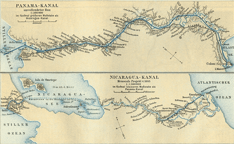
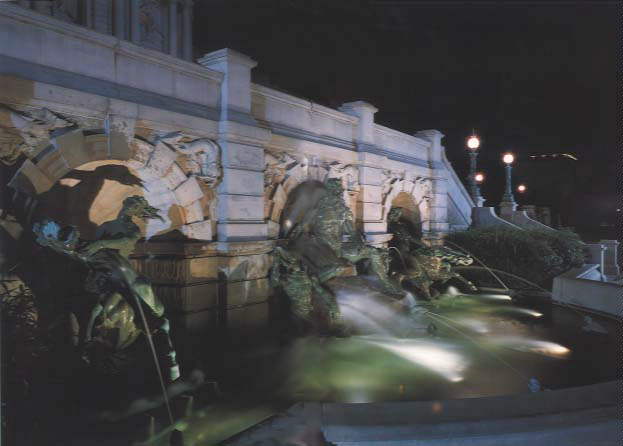
Ancient Rome had more water per person than most of today’s cities. And there was enough for fountains, celebrated in Ottorino Respighi’s “Fontane di Roma.” Water is a limit to growth: Tiber threatened, Rome sent expeditions to the hills to find new sources, and built aqueducts to bring water to the city. Waters had brands: one spring was named “Aqua Virgo” after a little girl, with a particularly clear complexion (this was thought to be an indication of abundant clean water), who guided experts to a hidden spring. There is still a cafe, near the Vatican, where cappuccino is made with this special exilir. Water is recognized as a critical need for the world’s future. Actor Matt Damon‘s vision, and film “Running the Sahara,” may see Africa lead.

For more:

Hargreaves, Steve. “Greatest urban projects of all time,” Oct 7, 2014, CNN. http://money.cnn.com/gallery/news/economy/2014/10/07/greatest-urban-projects/4.html

Running the Sahara: http://www.runningthesahara.com/

Building the World Blog by Kathleen Lusk Brooke and Zoe G Quinn is licensed under a Creative Commons Attribution-NonCommercial-NoDerivs 3.0 Unported License.


Summertime Blues: Lake Mead

Lake Mead Marina. Image: wikimedia commons.

Once a fabled boating mecca, the oasis formed by the Hoover Dam’s intervention in the Colorado River is drying up. Lake Mead‘s shoreline is changing; areas formerly underwater now battle dust. Drought that challenges California can be traced in part to Lake Mead’s shrinking. A similar problem exists in Africa due to changes in Lake Chad. How can lakes supplying water to an increasingly thirsty world be better preserved and protected?

For more: http://www.bostonglobe.com/news/nation/2014/08/12/southwest-braces-lake-mead-water-levels-drop/wnQ6rWqEYmDYMwuQsdoEFP/story.html

Building the World Blog by Kathleen Lusk Brooke and Zoe G Quinn is licensed under a Creative Commons Attribution-NonCommercial-NoDerivs 3.0 Unported License.

Water and Leadership

University of Massachusetts Boston. Image courtesy of www.umb.edu.

Should coastal universities, cities, and communities take the lead regarding the future of water? A breakthrough almost achieved by the Tennessee Valley Authority (TVA) might be realized. Archives of Senator Morris K. Udall reveal issues considered by the United States’ Interior Committee during the 1930s’: scientists and engineers envisioned a way to desalinate water at cost of one cent per kilowatt-hour; this prediction has yet to achieved, although Singapore/Siemens may soon succeed. Another consideration: power and environment. Yet another – urban portals. Massachusetts’ great universities might consult the plan by Richard Williams, completed in 1775, now at Oxford University’s Bodleian Library, for Boston‘s leadership.

For Senator Udall’s archives: http://speccoll.library.arizona.edu/collections/papers-morris-k-udall

For “A Plan of the city of Boston” by Richard Williams, 1775: Building the World, p. 824.

Building the World Blog by Kathleen Lusk Brooke and Zoe G Quinn is licensed under a Creative Commons Attribution-NonCommercial-NoDerivs 3.0 Unported License.

Water, Power, and Art

Water, power, and art: Hoover Dam. Image: wikimedia.

Hoover Dam is not only an achievement of hydroelectric engineering but a work of art. After the dam was designed from an engineering standpoint, architect Gordon B. Kaufmann joined the project to rework the design to add an artistic dimension: a pattern of plain surfaces relieved by carefully placed shadows. In addition, Oskar W. Hansen was commissioned to create two large cast concrete panels depicting flood control, irrigation, power, and the history of the area. It was Hansen who set, in the dam’s floor, a star map comparing the Hoover Dam to the pyramids. Water is central to earth and civilization; the Romans built aqueducts – and fountains. Now, how might water’s future be honored, and perhaps protected, by art?

Building the World Blog by Kathleen Lusk Brooke and Zoe G Quinn is licensed under a Creative Commons Attribution-NonCommercial-NoDerivs 3.0 Unported License.

Nicaragua v. Panama

Panama and Nicaragua will both offer canals. Image: wikimedia.

Nicaragua, once intended site for a canal that changed location due in part to a postage stamp, has announced the building of a waterway that will challenge the Panama Canal. The controversial decision weighs benefits of employment and commerce with environmental and other concerns. What might Nicaragua learn from Panama and Suez?

For more on the proposed Nicaraguan canal:

http://www.bbc.com/news/world-latin-america-28206683

http://www.huffingtonpost.com/2013/12/14/nicaragua-canal-repercuss_n_4445707.html

Building the World Blog by Kathleen Lusk Brooke and Zoe G Quinn is licensed under a Creative Commons Attribution-NonCommercial-NoDerivs 3.0 Unported License.


23% Solution

Lake Baikal, southern shore. Image: wikimedia commons.

Lake Baikal, world’s deepest lake, contains 23% of the world’s freshwater reserves. The size of Switzerland, Lake Baikal posed an almost insurmountable challenge to builders of Russia’s Trans-Siberian Railway. At first, travelers traversed the 250-meter (400-mile) lake by boat; during winter, traditional sleighs were used. Finally, 200 bridges and 33 tunnels completed the rail route, hugging the Baikal’s southern shore. The Trans-Siberian Railway inspired Wallace Hickel, twice governor of Alaska, and Mead Treadwell, current lieutenant governor, to visit Russia to consider development of a link across the Bering Strait. In 2012, Ernst Frankel described the potential of such a route. How can the environmental integrity of lakes, rivers, and oceans be preserved while exploring transport options?

Building the World Blog by Kathleen Lusk Brooke and Zoe G Quinn is licensed under a Creative Commons Attribution-NonCommercial-NoDerivs 3.0 Unported License.

45.3N x 34.4E: Power of Ports

The Crimea. Image courtesy of wikimedia.

Popular with the ancient Greeks, who called its main river Borysthenes, favored by the Romans, Bulgars, Goths and Huns, the Crimea offers port access on the northern border of the Black Sea, with the advantage of also being on the western shores of the Sea of Azov. In medieval times, the Crimean Khanate united the area, but later it became the Taurida Oblast in 1783, and still later the Soviet Crimean Oblast, transferred to Ukraine in 1954. Finally, in 1991, the Autonomous Republic of Crimea was born, only to be challenged in 2014. Why so many changes ? Advantageous port territory, milder winters, access to the Dnieper River (fourth largest in Europe). Today operating more than 12 seaports, the Crimea demonstrates the power of ports. The importance of waterways and ports can also be seen in the Canal des Deux Mers and the Erie Canal. Another famous port,  St. Petersburg, once the capital and Russia’s largest seaport, still carries the cultural imprint of its founder, Czar Peter the Great, in 1703. Can present day Crimea take inspiration from aspects of St. Petersburg’s success, including business monopolies? Perhaps in partial explanation of why the game’s greats are often Russian, St. Petersburg was once the only source of chessboards. What strategies for economic and cultural success should the Crimea envision for coordinates 45.3N by 34.4E?

Building the World Blog by Kathleen Lusk Brooke and Zoe G Quinn is licensed under a Creative Commons Attribution-NonCommercial-NoDerivs 3.0 Unported License.

Disappearing Coastlines

Amsterdam, a city that knows how to build upon water. Image: wikimedia commons

Amsterdam, named for a dam built in the Amstel River, was once the richest city on earth. Dutch prosperity and success may have developed because of urban ports, but waterfront harbors bring challenges of land erosion, flooding, pollution, and other environmental challenges. The Dutch have been protecting their sinking coastline since Pliny wrote about their ingenious methods, many still in use today, as they manage the intermittent overflows of the rivers Meuse, Rhine, and Scheldt, as well as the sea. With a coastal defense safeguarding 65% of the land surface, the system of protective dikes and land reclamation of the Netherlands might offer answers to today’s disappearing coastlines, from the Maldives to Manhattan.

Building the World Blog by Kathleen Lusk Brooke and Zoe G Quinn is licensed under a Creative Commons Attribution-NonCommercial-NoDerivs 3.0 Unported License.

Water: How Much is Enough?

Neptune Fountain. Image: wikimedia.org.

Ancient Rome had more fresh water available to its people than present-day New York: about 200 gallons (750 liters) per person per day, compared to average per capita consumption in the United States of 150 gallons (563 liters). Rome’s fountains, over 1000 gracing the city, were evidence of abundance of aqua vitae, water of life overflowing. Originally dependent upon the Tiber River for all things aquatic, from drinking to sanitation, Rome quickly encountered limits to growth. Answers lay beneath the ground in the form of springs, channeled by the famed Roman Aqueducts built by a peacetime Roman army. Without abundant water, ancient Rome could not have grown to its population of over one million. The same is true for cities today: water is a limiting factor, made more precious by demands upon its availability for industry, agriculture, and of course drinking. By 2025, half of the world’s people will suffer water deprivation. What can, and should, we do about the destiny of water?

Building the World Blog by Kathleen Lusk Brooke and Zoe G Quinn is licensed under a Creative Commons Attribution-NonCommercial-NoDerivs 3.0 Unported License.

Agua – Colorado River

Colorado River in Mexico. Library of Congress, United States, LC-DIG-stereo-1s00953.

Minute 319 might not solve the problem. Some say Mexico and the United States need to take a radically different approach. The November 10, 2012 decision of the International Boundary and Water Commission of the United States and Mexico tried to address effects of the 2010 earthquake in the Mexicali Valley, Baja California, on the Colorado River Basin (www.ibcw.gov/Files/Minutes/Minute_319.pdf). In 1922, the Colorado River was parceled among the Upper Basin United States of Wyoming, Colorado, Utah and New Mexico (9.25 billion cubic meters per annum) and the Lower Basin Arizona, California, Nevada (10.45 billion cubic meters. By 1944, Mexico claimed their, previously unspecified, water rights (1.85 billion cubic meters per annum). Rights of Native Americans, including the Navaho, would follow, determined decades later, perhaps advantageously in this age of water valuation. In 1922, it was not easy to estimate water needs; original allocation of the Colorado River was set above projected needs. Add to that the fact that in the 1920’s the river’s flow was above-normal (http://www.forbes.com/sites/stratfor/2013/05/14/u-s-mexico-the-decline-of-the-colorado-river/). Organizational structure and management of the river lacks basin-wide coordination. Many might agree with Professor of Law Gabriel Eckstein’s recommendation that Mexican and United States “subnational entities at the regional and local level pursue cooperation in the form of locally-specific, cross-border arrangements” (www.internationalwaterlaw.org). For example, Nogales, Sonora businesses have cooperated with the public water authority of Nogales, Arizona, for more than 40 years. Deciding sustainable use policies of transboundary water resources might be part of the future of Tratado de Libre Comercio de America del Norte (TLCAN) or also known as NAFTA, upon its 20th anniversary on January 1, 2014. What is the future of water rights in North America? Other regions? What is the destiny of water? Agua de mayo, pan para todo el año.

Building the World Blog by Kathleen Lusk Brooke and Zoe G Quinn is licensed under a Creative Commons Attribution-NonCommercial-NoDerivs 3.0 Unported License.