NASA launched the James Webb Space Telescope has successfully unfolded its gimbaled antenna assembly with the data dish that will beam back information about the earliest stars in the universe. Webb will take 29 days to reach the Lagrange Point 2 (L2) that is 1 million miles (1.6 kilometers) from the launch base on Earth. The Webb telescope, costing $10 billion, is considered the successor to Hubble. The upgrade is significant: Hubble could pick up only visible and ultraviolet light. James Webb Space Telescope (JWST) uses infrared detectors and spectroscopes.
An image from Hubble. James Webb is expected to offer even better views. Image: NASA.gov.
Developed by NASA, with contributions by European Space Agency and Canadian Space Agency, with manufacturers Northrop Grumman, and Ball Aerospace who built the primary mirror, the new telescope is named after James E. Webb, NASA administrator from 1961-1968 who played a pivotal role in the Apollo lunar program, directing advances to serve education and science. It is interesting to note that Webb was not a scientist, but an attorney and business leader who had served in the public and private sectors. Webb almost turned down the job, but President John F. Kennedy convinced him that he had the right skills for a broad program with significant missions. You can listen to the audio of President John F. Kennedy and James Webb as they discuss human spaceflight: here.
James Webb Space Telescope is on its way. Illustration by Kevin Gill. Creative Commons license CC by SA 2.0. Image: wikimedia.
The James Webb Space Telescope is expected to open a new era in space and science. What would you like to discover about the beginning of the universe? To track the Webb as it travels towards its goal, click here.
“Argo Temperature/Salinity Float Network” by Dmcdevit, 2007 for Global Warming Art. License GNU Free 1.2. Image: wikimedia.
Recent tornadoes, storms, floods caused loss of life and damage of property. While warmer temperatures are known to fuel and intensify tornadoes, scientists are uncertain if tornadoes that swept across four U.S. states were caused by climate change. What is certain is unseen, but even more troubling. Antarctic currents are changing. The above NASA illustration shows the movement of ocean currents including the Antarctic Circumpolar Current: at 1,200 miles (1,931 kilometers) wide and two miles (3 kilometers) deep, it is the globe’s largest current. Its motion draws the deepest water from the Atlantic, Indian, and Pacific oceans to swirl it to the surface. In the process, the water exchanges heat and carbon dioxide with the atmosphere. It’s called an upwelling.
“Upwelling” in an animation by NOAA. Image: public domain, wikimedia.
With a warming world, upwelling may release more carbon dioxide that had formerly been sequestered in the blue deep of the oceans. Oceans have sequestered 25% of carbon dioxide and 90% of excess heat from burning fossil fuels. What if that were to change? Moreover, the warming upwelling waters that travel through and beneath Antarctic are melting ice shelves like those near the Thwaites glacier. If those ice sheets melt into the ocean, sea rise could advance by as much as 12 feet (3.66 meters). Ice sheets act as a blockade, protecting glaciers: if that blockade breaks, glaciers will also melt more quickly and release even more water to rising seas. (Fountain and White, 2021) Watch a video about the Thwaites glacier here.
“Thwaits Glacier.” NASA, 2014. Public domain, wikimedia.
What can be done? Gathering more data is a first step. Robotic autonomous floats called ‘Argo Floats‘ are a small army of 3900 presently bobbing in the world’s oceans, sending back data. When below water for their ten-day shift, Argo Floats gather data; when they pop up to the surface, they transmit. The National Oceanic and Atmospheric Administration (NOAA) and the Global Ocean Monitoring and Observing (GOMO) program is named after the mythical Jason and the Argonauts who sailed to find the Golden Fleece.
“Scenes from the Story of the Argonauts” by Biagio d’Antonio, circa 1472-1516. From the Metropolitan Museum of Art, donated to wikimedia for public domain open access use.
Jason and the Argonauts may be one of the oldest myths of a hero’s quest. The present initiative references not only the ancient Greek myth, but also the ocean mission. The title also indicates its complementary relationship with the Jason satellite altimeters that study the situation from above. The instruments called ‘Argo Floats:’ the measurements of sea surface height are termed ‘Jason measurements’ that report temperature and salinity. (Brown 2019). In 2020, Antarctica observed a 200-year anniversary. Polar regions are among the most important places for climate change, due to a process termed polar amplification. The Antarctic Treaty, signed in 1959, offers some protections, but the ban on mining of Antarctic minerals expires in 2048. If or when the Antarctic Treaty is revised, what provisions should be upheld, changed, or added?
“Space Debris” Image: NASA Debris-GEO1280, 2005. Image: public domain. wikimedia and nasa.gov
Space just got more crowded, and dangerous. When Russia shot at one of its older, Soviet-era, satellites (Kosmos-1408 had been orbiting Earth since 1982) to test a space weapon, the hit on the target blasted over 1,500 shards of debris into space. While other nations quickly condemned the test, China, India, and the US have also tested antisatellite missiles: the practice is so established that it has its own acronym: ASAT.
“Animation of GPS satellite’s orbit from 15 May 2013 to 6 September 2018” by Phoenix7777, 2018. Based on data of NASA and JPL. Image: wikimedia commons. Included here with appreciation to Phoenix7777.
Why is space debris a problem? At 17,500 miles per hour, even a paint chip becomes a lethal weapon. There are more than 100 million pieces of space junk bigger than one millimeter, with 27,000 larger than a softball (NASA 2021) and therefore more dangerous. There is no current method for vacuuming up space junk: some developing innovations include giant nets to capture shards as demonstrated by the RemoveDEBRIS or shoving devices that could push the pieces high enough into the distant atmosphere where they could safely disintegrate.
If space debris hit the cupola of the International Space Station, there could be great danger. In 2021, ISS astronauts were commanded to take cover during the ASAT test. Photograph by Scott Kelly, astronaut, 4 June 2015. Image courtesy of NASA, included with appreciation to Scott Kelly.
When KOSMOS-1408 disintegrated into flying debris, International Space Station astronauts received warnings to duck and cover. No harm occurred – this time. But collisions with space junk could destroy satellites, space stations, and space vehicles: crashes between orbiting debris chunks are also ominous possibilities that grow, as orbiting pieces increase, into probabilities. NASA and US Department of Defense’s Space Surveillance Network tracks 8,000 pieces most likely to cause problems.
“Dome of Hale Telescope at Palomar Observatory,” by Coneslayer 2007. Image: wikimedia.
“Animation showing changes in Iris,” by Sagyxil, 6 February 2010. GNU open license. Image: wikimedia.
The Intergovernmental Panel on Climate Change (IPCC) confirmed our worst fears: the world may be losing the battle of climate. Some effects of global warming are permanent and irreversible, like sea-level rise. When the Greenland ice sheet melts, it will not refreeze. There are other effects that may ultimately reverse, but will take centuries to do so: oceanic acidification and deoxygenation, melting of permafrost, air pollution.
It’s not all totally bad news: there may still be a window. The question is how to use our limited remaining time most wisely? According to Peter Huybers, professor of earth and planetary sciences at Harvard: “There are notable opportunities to increase our rate of learning about the climate system by developing a constellation of satellites to monitor the flow of energy in and out of the Earth system. Another constellation of satellites could monitor greenhouse gas fluxes for purposes of better holding nations accountable for their emissions.” (Huybers and Mulcahy, 2021)
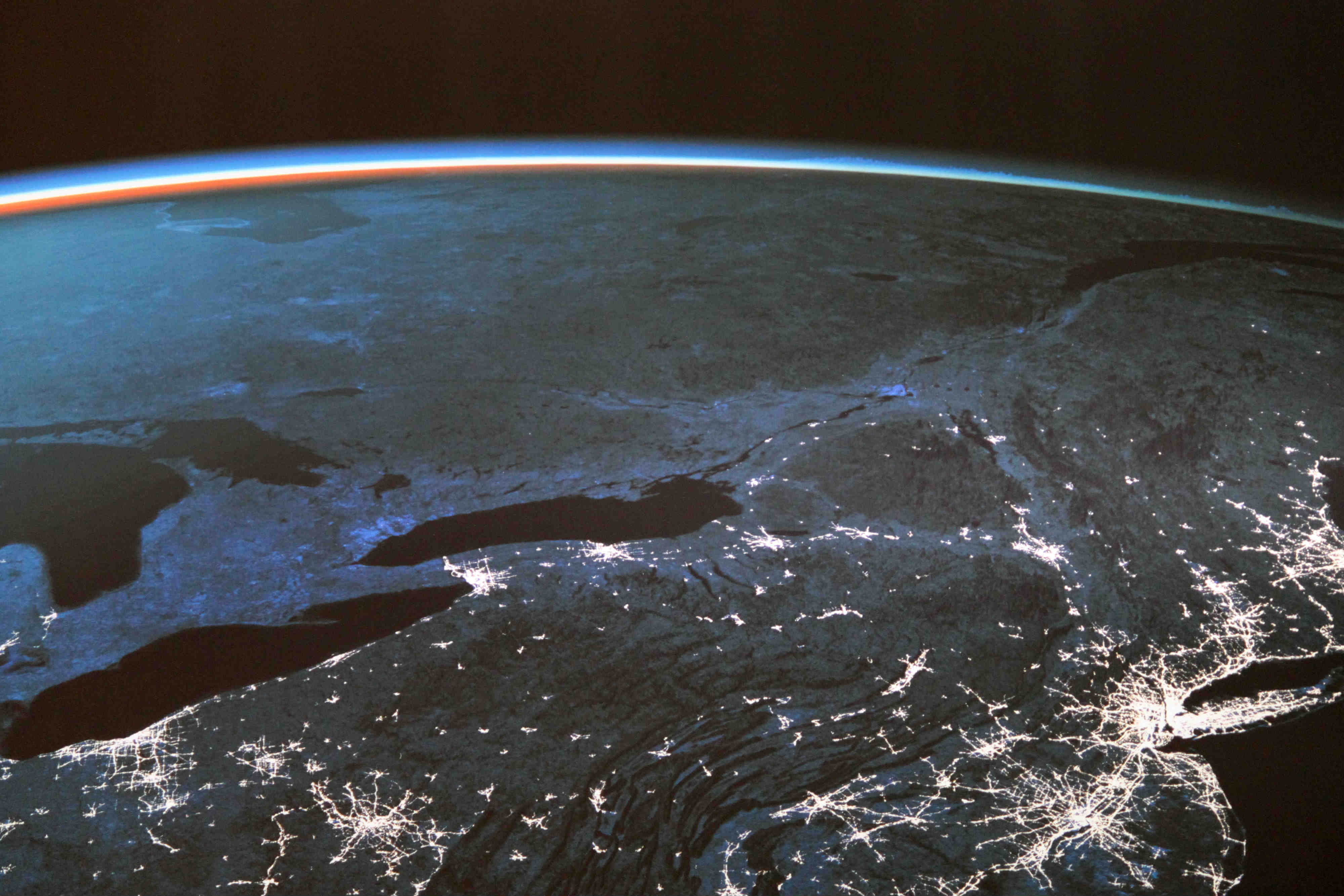
“Earth’s seasons, seen by satellite.” NASA.gov.
When Sputnik launched in 1957 and COMSAT followed in 1962 , we developed capability to see Earth as a whole, dynamic system. Science fiction always depicted space as a place to explore, maybe to inhabit, perhaps even an exit strategy from a failing Earth. But space may turn out to be the place from which T.S. Eliot’s words might come true in a new way:
“We shall not cease from exploration
And the end of all our exploring
Will be to arrive where we started
And know the place for the first time.”
T. S. Eliot
Eliot, T. S. “Little Gidding,” from Four Quartets. Originally published in 1943.
Ride with Bezos? Price still unknown – the only ticket was auctioned for $28 million: for a ten minute ride, Blue Origin’s meter runs fast as a rocket. Fly with Branson? Over 600 seats on Virgin Galactic are pre-sold, going for $200, 000 to $500, 000 for a hour’s excursion. Prefer a longer stay? A space vacay to the International Space Station by Elon Musk and SpaceX: $55 million. There are other costs – environmental.
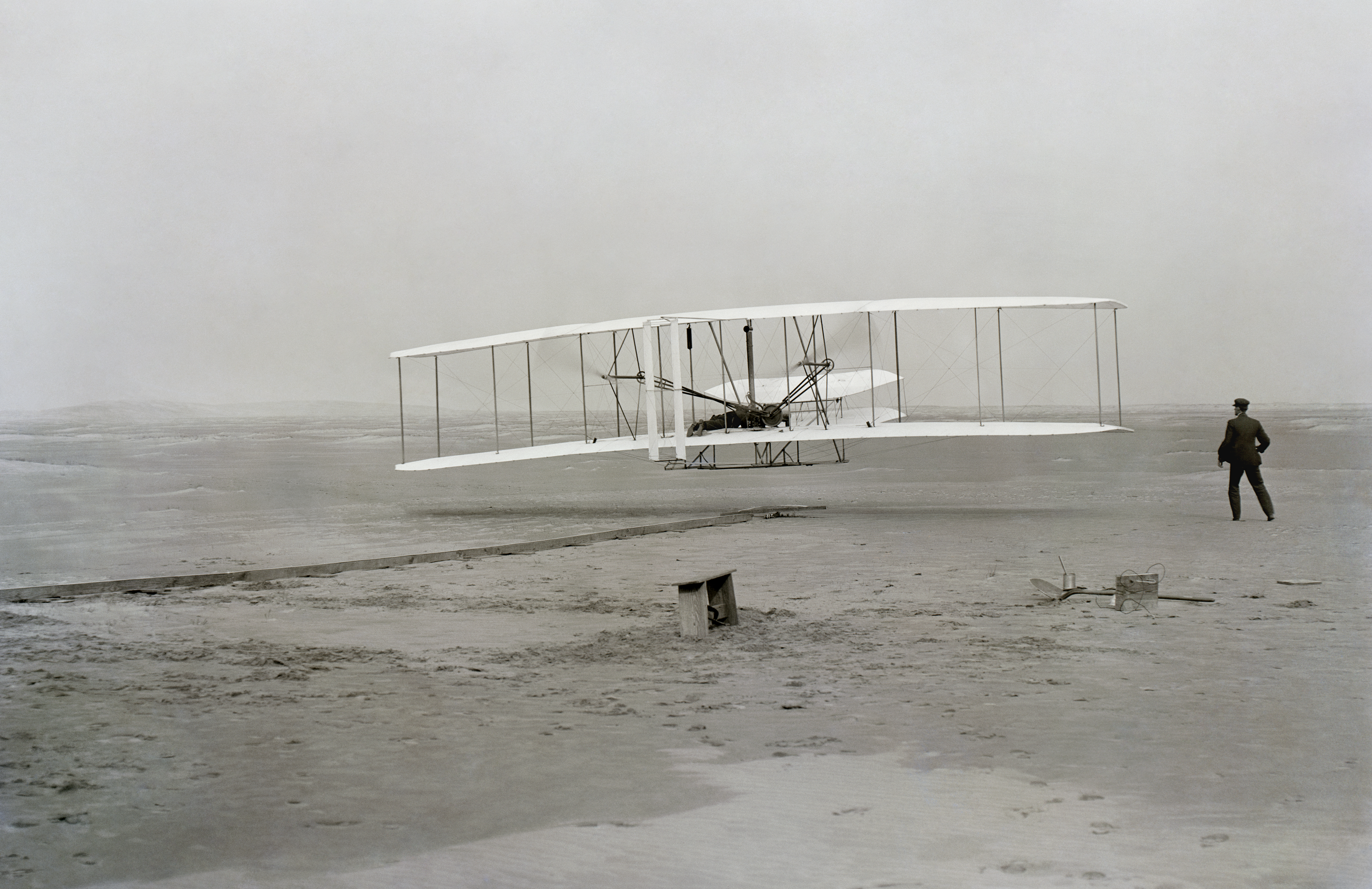
“First successful flight of the Wright Flyer: traveled 120 ft. (36.6m) in 12 seconds, on 17 December 1903. Image: Library of Congress, ppprs.00626
One way to evaluate financial, and environmental, costs of private space travel could be to look back to 17 December 1903 when the Wright Flyer took off from Kitty Hawk. In December 1944, the Convention on International Civil Aviation established rules for civil aviation: stated goals were safety and international cooperation. In 2004, the world had 900 airlines, tallying 22,000 aircraft serving 1,670 airports. (Spaceports, overseen by the Federal Aviation Administration, are now in high construction demand.) In 1960, civil aviation flew 100 million people; by 2017, 4 billion passengers. In 2019, revenues in the global aviation industry reached $838 billion. However, passenger air travel spikes the highest (and fastest) growth in individual emissions. Flight shaming (flygskam) is a resulting development. Branson and Bezos both drew criticism for spending funds on space tourism when there is a world in need below.
“A simulation of ACRIMSat (Active Cavity Radiometer Irradiance Monitor Satellite)” by NASA/JPL, 2006. Public domain.
Commercialization of space might also be examined through the development and expansion of satellites. COMSAT, the first commercial satellite operator, began with Intelsat and Inmarsat. When “Early Bird” launched in 1965, the Communications Satellite Act had just established a policy for a commercial communications satellite system open to many nations cooperatively. Comsat began with a $5 million line of credit. Sales by 1996 were $1 billion. Launching satellites produces carbon pollution, and also another kind of pollution: traffic. As of 1 August 2020, there were 2,787 satellites orbiting Earth – 1,364 of them communications satellites both government and commercial.
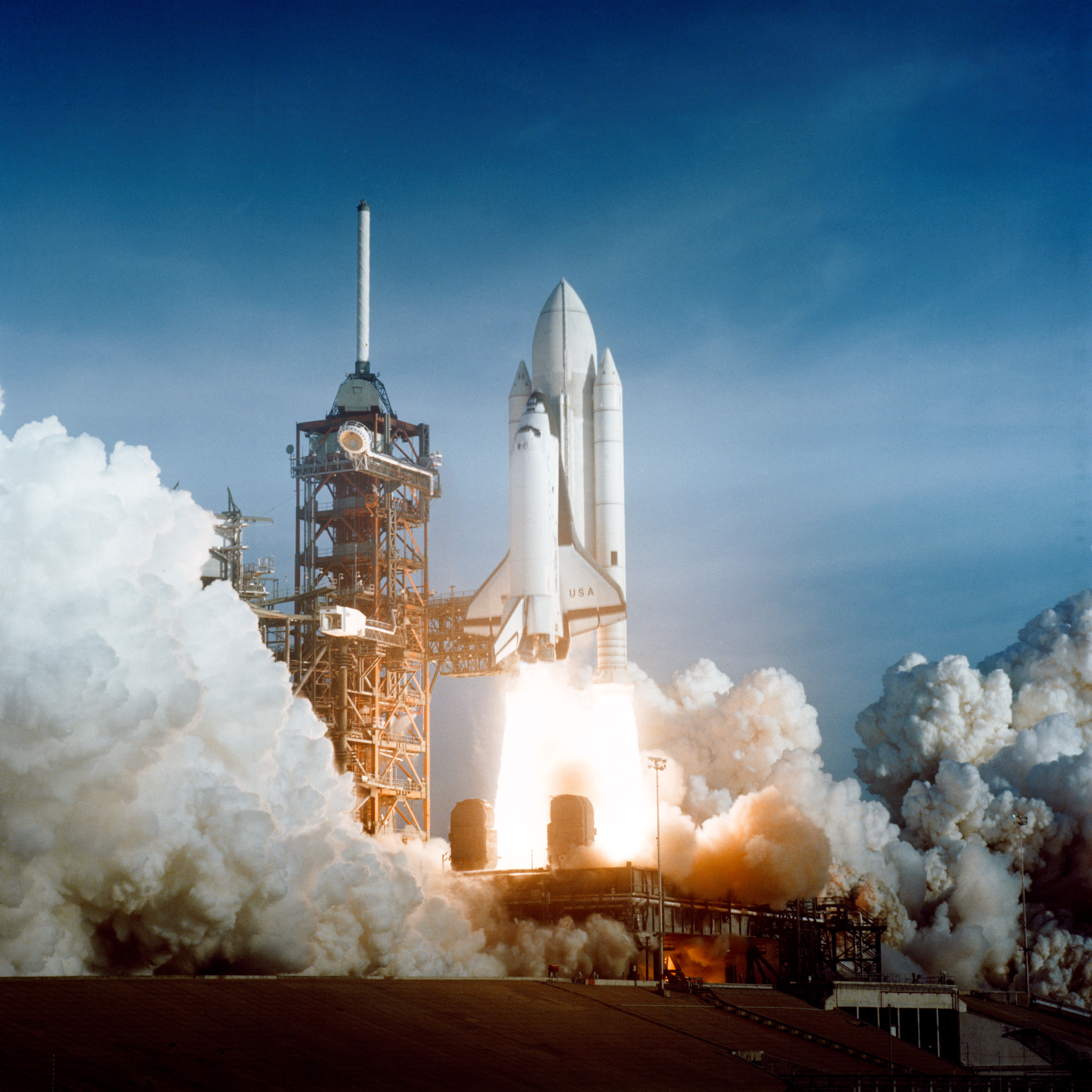
What can we do to reduce space emissions pollution? Image: “Space Shuttle launched with two solid-fuel boosters (SRB.” NASA, 1981, public domain.
Branson’s Virgin Atlantic, a commercial airline, ferries passengers worldwide, diluting the energy burden per seat. But Virgin Galactic carries just six, tallying a much higher per-person emissions cost; the one-hour flight is equivalent to driving a typical car around the Earth. One concern is the type of fuel used by Virgin Galactic: the system runs on a kind of synthetic fuel that burns with nitrous oxide, shooting black carbon into the stratosphere. Blue Origin uses liquid hydrogen and liquid oxygen, causing 750 times less climate-forcing magnitude than Virgin’s (Ahmed 2021). SpaceX will bring four passengers to space in September, causing the equivalent of 395 transatlantic flights worth of emissions.
“Image of depleted Ozone Layer at South Pole, Antarctica” by NASA, 2006. Image: public domain.
Space tourism projects market growth of 17% each year in the coming decade. Price-per-flight will be reduced, and innovations will increase. Just as SpaceX introduced reusable rockets, a game-changer for the space industry (landing 44 of 52 attempts), and Axiom is planning to launch its own commercial space station at the cost of $1.8 billion to NASA’s $150 billion for the International Space Station, privatization of space will streamline the industry. But because rockets emit 100 times more CO2 per passenger than flights (Marais 2021), and because rocket exhaust is released directly into the atmosphere from a higher point of entry, the ozone layer (earlier protected by the 1987 Montreal Protocol) may be again under threat.
Aviator Amelia Earhart and Purdue University President Edward C. Elliott, with Lockheed Electra, 1936. Image: public domain.
Some feel private space commercialization may be a misuse of resources more urgently needed on Earth; others predict important innovations will follow July 2021’s first commercial space tourism flights. Some of the most important developments must be in fuel options and emissions management. Will commercial space flight learn from civil aviation? Bezos’ Blue Origin space tourists brought little carry-on luggage, but two significant items hitched a ride: Amelia Earhart‘s goggles, and a piece of canvas from the Wright Flyer.
MacMartin, Douglas G. and Ben Kravitz. “Mission-driven research for stratospheric aerosol geoengineering.” 22 January 2019. Proceedings of the National Academy of Sciences of the United States of American (PNAS). https://www.pnas.org/content/116/4/1089
Ross, Martin N. and Dorin W. Toohey. 24 September 2019. “The Coming Surge of Rocket Emissions.” 24 September 2019. EOS, 100. https://doiorg/10.1029/2019EO133493
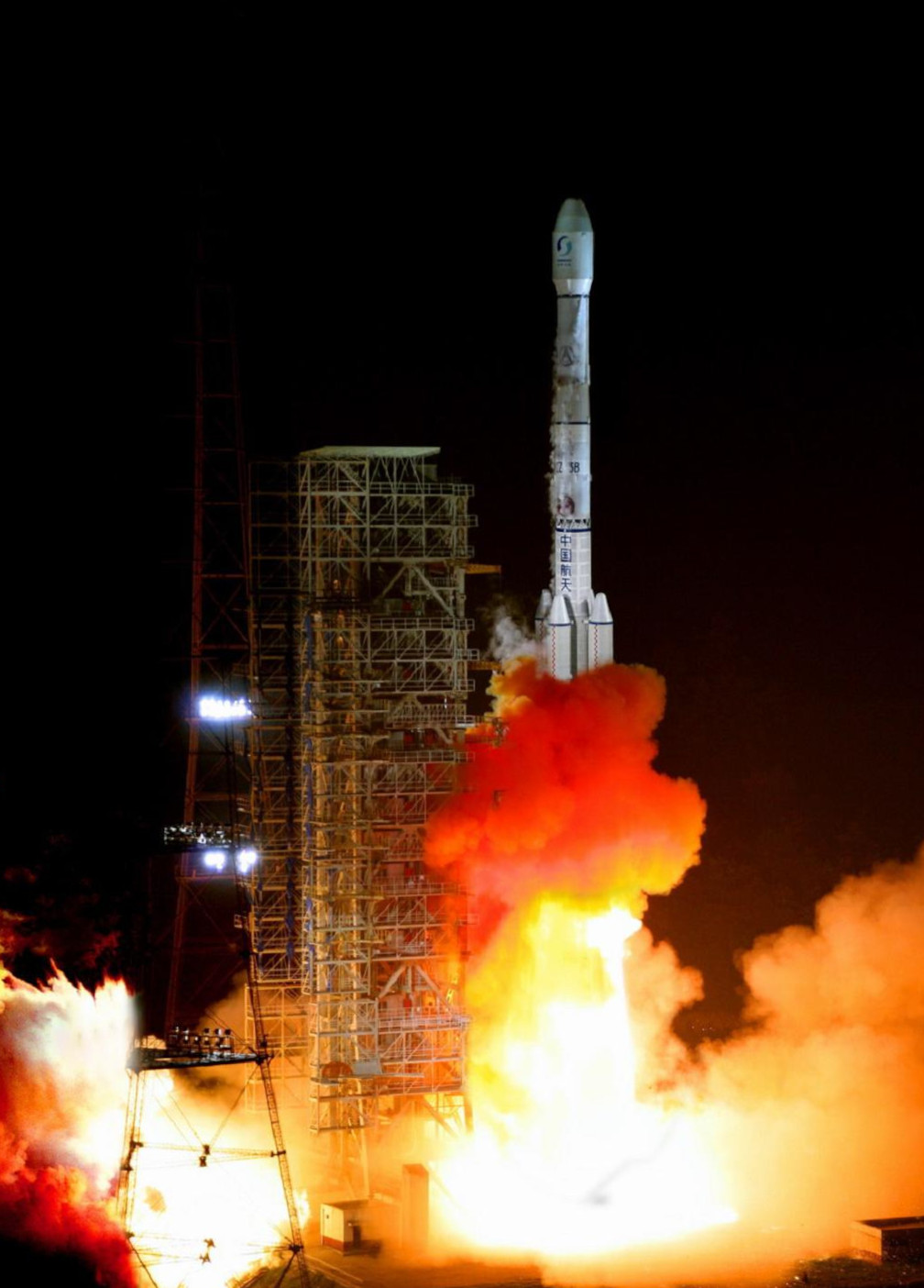
Long March 5b just missed the Maldives. Image: “Diamonds Thudufushi Beach and Water Villas, May 2017, Ari Atoll, Maldives.” by Martin Falbisoner, 2017. Wikimedia commons.
It was a long march and a splash entry. On 8 May, the Long March B5 fell from space into the Indian Ocean, thankfully missing the nearby 1, 192 islands of the Maldives. Long March 5B launched on 29 April 2021, conveying into orbit the hefty main module of the new space station that China is building, to open in 2022. Some questioned the decision not to fire the Long March 5B rocket engine after releasing its payload, therefore sending it into “uncontrolled reentry.”
“Long March 3B Launch,” by Aaxanderr, 2008, public domain creative commons.
Even if the odds were good, since 70% Earth happens to be water, dumping space debris in the ocean whether in controlled or uncontrolled reentry, may not the best practice. Just ask the marine life at 72.47 degrees East and 2.65 degrees North.
“It starts right here – in Maldives.” by Nattu, Male, Maldives, 2008. Image: Creative Commons 2.0, wikimedia.
Controlled reentry aims at a watery grave. Coordinates 48 degrees 52.6 minutes south latitude and 123 degrees 23.6 minutes west longitude mark Point Nemo, or the Oceanic Pole of Inaccessibility. It’s 1,450 nautical miles from anywhere, which is why it is the chosen splash-down spot for space detritus. Between 1971 and 2016, space agencies worldwide crashed 260 spacecraft into Point Nemo: there’s part of the MIR space station, a SpaceX rocket, and over 100 resupply vehicles. Over time we may regret that ditching strategy, no matter how much we believe Point Nemo or the Oceanic Pole of Inaccessibility poses no problems. As water rights develop, the International Seabed Authority (ISA) may rule on Point Nemo.
“Point Nemo or the Oceanic Pole of Inacessibility,” by Timwi 2007. Creative Commons Public Domain. Image: wikimedia.
But most space debris never gets to Point Nemo. There are an estimated 9,000 tones of material circling Earth. Many pieces like old satellites drop out of orbit and burn up before they hit the surface (that’s what happened to Sputnik, the first object in space in October 1957). But even such burning is cause for concern. Little has been done to assess effects on the upper atmosphere, especially consequences of alumina particles that remain trapped and can deplete the ozone layer. The protective layer that keeps Earth from ultraviolet radiation was the subject of the 1987 Montreal Protocol and 2016 Kigali Amendment.
“Image of Depleted Ozone Layer on South Pole Antarctica 2006.” Image credit: NASA. http://www.nasa.gov/vision/earth/lookingatearth/ozone_record.html
Space business is increasing faster than we can keep up in laws and treaties. For example, early laws and conventions spoke only of governments, on the assumption that space was just too expensive for private enterprise. Today, companies like SpaceX are rewriting that text. Space law’s founding documents include the 1967 Outer Space Treaty and the 1972 Space Liability Convention. The first regulates what people can do in space; the second considers how to assign responsibility for activities or objects that cause damage. With satellite constellations like SpaceX and OneWeb launching rapidly, the sky is suffering from traffic, some of it from dead satellites taking of space while waiting to drop, burn, or splash. And we’re putting more up there. As of August 2020, there were 2,787 satellites in orbit (1,364 of those are communication satellites used by business and government). In addition, there are 3,000 dead satellites (and 34,000 pieces of space junk bigger than 10 centimeters and who knows how many particles) still up there, and causing not only traffic but danger.
“Image of Space Debris and Human Spacecraft.” NASA.gov.
We’re only getting started. Since COMSAT began, we’ve sent more satellites, and spacecraft, each year. Estimates now predict 9,000 units by 2025. Some of those will burn, some will splash, and eventually some of them will be retrieved. It’s a new industry. Watch for more laws about what goes up and how it comes down, along with innovations in space sanitation.
Gorman, Alice. Dr. Space Junk Vs The Universe: Archaeology and the Future. Cambridge: The MIT Press, 2019. ISBN-13: 9780262043434; ISBN-10: 0262043432.
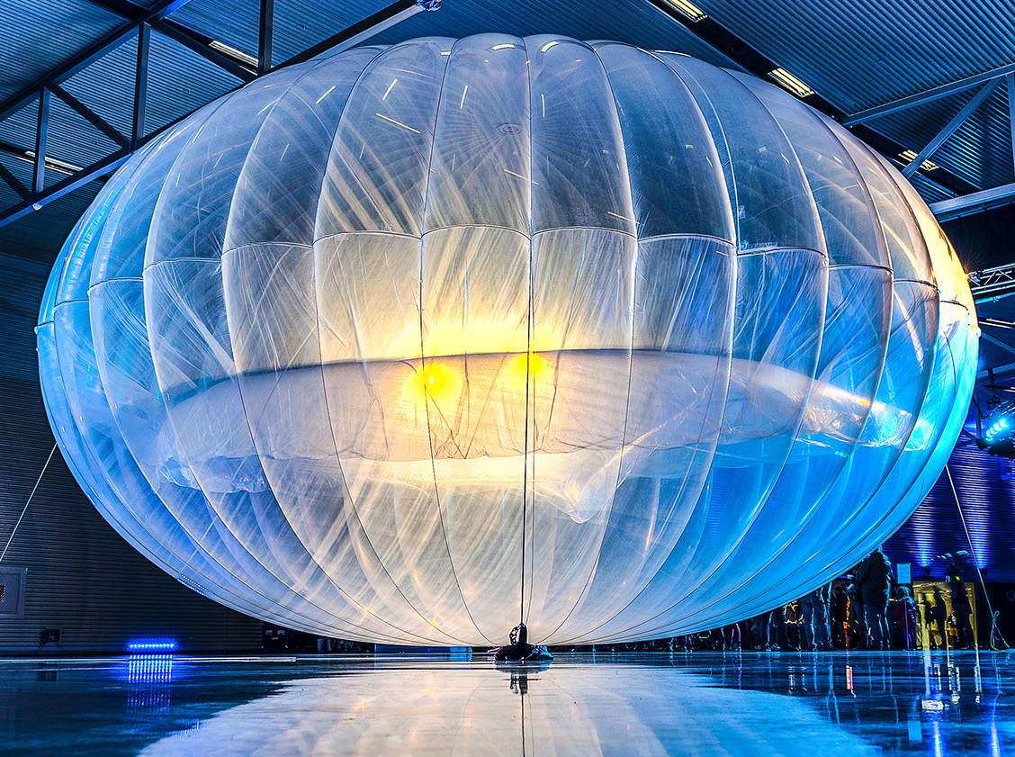
Wave Goodbye to Loon. The visionary project, to beam down the Internet from floating balloons, called it quits. For nine years, Google/Alphabet sent up as many as 35 floating globes – the size of tennis courts – with the goal of transmitting internet capability to areas where land-based infrastructure is not feasible. Of course, the balloons used Google autonomous navigation technology to steer themselves. But this week, the start up wound down. In 2017, when Hurricane Maria wiped out Puerto Rico’s telecommunications system, Loon helped to get the island back online. Another good outcome: Telkom, a telecommunications company in Kenya, inked a deal to bring 4G to remote areas. Because almost half the world does not yet have internet access, it’s a big market. Land-based technologies picked low-lying fruit, but there is still room for growth – above.
Starlink satellites stacked and ready to launch. Image: SpaceX and wikimedia commons.
Flying internet is a rapidly developing sector. Since early days of COMSAT, satellites are proving better vehicles for connectivity, even to what some call “notspots” (Kleinman 2021) with a vision of bringing the whole world online. It’s a movement that recalls the achievements such as the telephone and telegraph (connections were laid under the tracks of the Transcontinental Railroad). Here are some satellite enterprises delivering broadband internet today – and tomorrow:
FLYING INTERNET PROVIDERS
Apple – A plan to develop their own satellites prompted Apple to recruit two Google satellite experts: John Fenwick and Michael Trela will work with Greg Duffy, Dropcam founder who joined Apple recently. Apple may partner with Boeing to launch more than 1,00 low-orbit satellites.
Starlink – Elon Musk’s SpaceX Starlink will require 42,000 satellites. SpaceX launched 60 satellites on 20 January 2021 to tally 1,015 so far (only 951 are still in orbit). In 2020, SpaceX carried out 14 launches. Possible subscription: $99 monthly fee + $499 for hardware.
OneWeb – Founded in 2014 by Greg Wyler, OneWeb re-emerged from potential bankruptcy with help from Bharti Global and UK government. 648 satellites will form OneWeb network constellation. Development of terminals is with Intellian Technologies and Collins Aerospace. Customers? While at first it was rural folks (OneWeb promises they won’t be overlooked), now it is telecom companies. Second generation satellites will include intelligence and security capabilities. New funding from SoftBank Group Corp and Hughes Network Systems/EchoStar tallied $1.4 billion in funding to put first-generation fleet in place in 2022.
Project Kuiper Constellation – Funded by Jeff Bezos, Amazon’s satellite project plans to launch 3,236 satellites. In March 2019, Project Kuiper filed with the International Telecommunication Union (ITU), and Federal Communications Commission. The satellite array will orbit at three altitudes: 784 satellites at 367 miles (590 kilometers); 1,296 satellites at 379 miles (610 kilometers), and 1,156 satellites at 391 miles (630 kilometers). The plan is to provide coverage from latitude 56 degrees north to 56 degrees south – that’s where 95% of the world’s people live. (Boyle 2019)
Telesat – With priority Ka-band spectrum rights and a fifty-year history of technical prowess, Telesat Low Earth Orbit (LEO) will link to customer terminals and electronically steered antennas (ESAs) for commercial, government, and military use. The first launch happened in January 2018.
LeoSat – The vision was a constellation of 78 -108 satellites but in 2019 the company laid off its 13 employees after investors dropped support. The investors were Hispasat, Spanish satellite operator, and Sky Perfect JSat of Japan. LeoSat still exists but for now is dormant.
Viasat – This satellite system offers internet access from geosynchronous orbit. New entrants like Starlink, OneWeb, Kuiper, Telesat will use Low Earth Orbit (LEO) for lower latency and lower cost.
03b – Using medium Earth orbit (MEO), this constellation offers fiber-equivalent connection. The prime contractor is Arianespace for the operator SES Networks.
Athena – Facebook filed with the Federal Communications Commission to launch Athena to provide broadband access to “unserved and underserved” areas of the world. The filing included a new name: PointView Tech LLC.
Boeing – The aerospace giant plans to launch and operate 147 satellites for a broadband constellation. Apple may help.
Satellites: a traffic jam in the sky? Can astronomers still see the stars? Image: Starlink, initial phase – wikimedia.
PROBLEMS: Are satellite constellations the new Milky Way, or are we creating the same kind of traffic jam above that we suffer from on land? Some astronomers already report difficulty in seeing the sky. Negative comments from astronomers caused Starlink satellites to come up with a visor that prevents sun reflection, reducing glare – its a sub-company called VisorSat. OneWeb chair Sunil Bharti Mittal pledges environmental stewardship, working with astronomers on issues like reflectivity. (Amos, 2020) And then there is the problem of space debris: getting satellites up is easier than getting them down,
OPPORTUNITIES: Why are so many players entering the flying internet competition. Opportunity: Morgan Stanley projected that “the global space industry could generate revenue of $1.1 trillion or more in 2040, up from $350 billion today.” (Conroy 2019) Of that, $410 billion will come from satellite-based internet services.
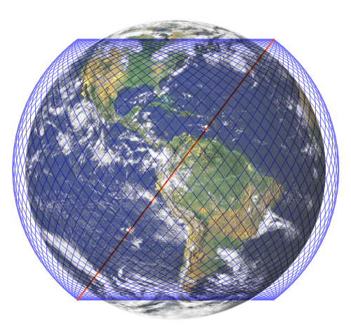
GPS Constellation. Image: wikimedia
Amos, Jonathan. “OneWeb satellite company launches into new era.” 18 December 2020. BBC.com
There’s a goddess on the moon and she’s a rock collector. China’s lunar explorer, Chang’e 5, named after the lunar deity, returned four pounds of rocks to Earth this week.
“The Moon Goddess Chang E.” Ming Dynasty Scroll, Metropolitan Museum of Art Acquisition number 1981.4.2. Image: Wikipedia
It’s been 44 years between rock collecting expeditions: for the first time since 1976 (Soviet Union’s Luna 24 returned 6 ounces (170 grams), humans reached the lunar surface, collected samples, and headed home with prize specimens. The USA returned moon rocks in 1972. Since making its first lunar landing in 2013, China has achieved notable milestones including the first space probe landing on the far side of the moon in 2019. Change’e 5 brought 4.4 pounds (2 kilograms) of lunar material back, landing in the Inner Mongolian Autonomous Region landing site on 16 December 2020. Some was surface rock, but a probe mechanism also collected material from 6.5 feet (2 meters) underground.
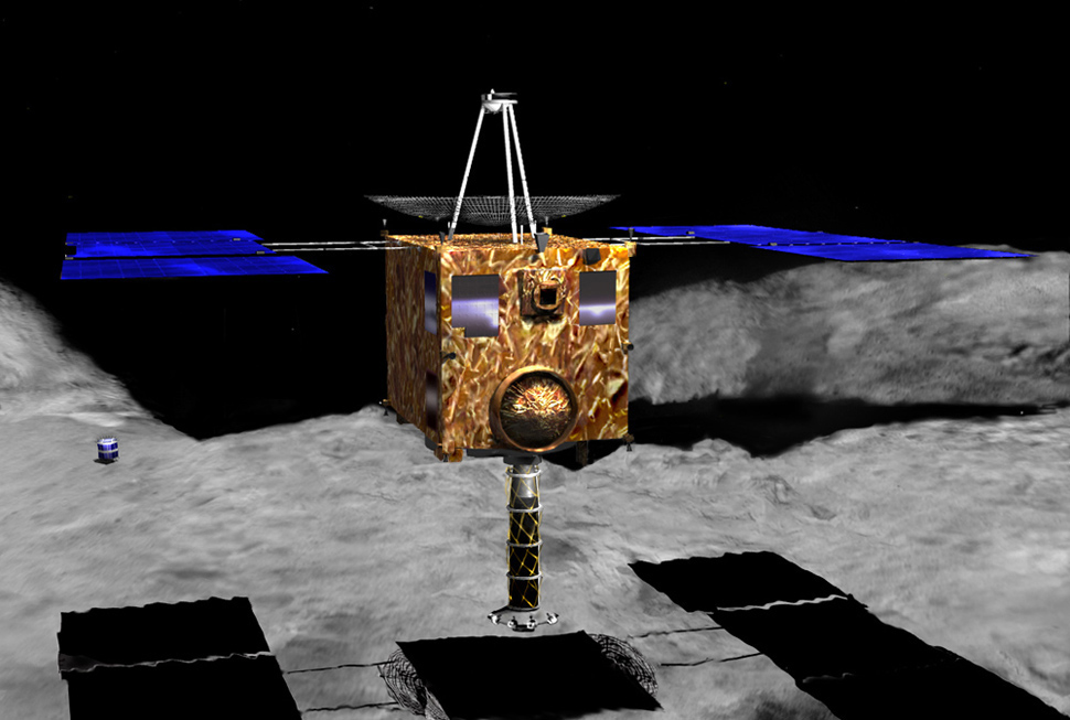
We may be in what some call a “golden age” of sampling from space. In addition to moon samples, we have retrieved interplanetary material from NASA‘s Stardust that returned samples from the tail of Comet 81P/Wild 2, and Genesis mission that sampled solar wind. JAXA’s Hayabusa that brought samples from asteroid Ryugu in December 2020; NASA’s OSIRIS-Rex visit to asteroid Bennu will return material (in 2023). Meanwhile, in 2021, we expect China’s Rianwen-1 to reach Mars, and Russia’s Lunar-24 to revisit the moon. JAXA’s Martian Moon Exploration (MMX) mission will soon return samples from Martian moon Phobos.
Hayabusa in hover mode. Image: JAXA. Wikimedia commons.
What did Chang’e find on the moon? The legendary goddess told a tale of global warming involving the heat of 10 suns. Perhaps rocks from the moon may shed light on Earth’s plight. As for the Chang’e mission, Pei Zhaoyu deputy director of China National Space Administration (CNSA) stated: “We hope to cooperate with other countries to build the international lunar scientific research station, which could provide a shared platform for lunar scientific exploration and technological experiments. ” Earlier, Johann-Dietrich Woerner, then director general of European Space Agency (ESA) suggested building a village on the far side of the moon to replace the aging International Space Station: “Partners from all over the world contributing to this community with robotic and astronaut missions and support communications satellites.” Frank P. Davidson, co-founder of Camp William James of the CCC, envisioned a program called Lunar U. Should there be a lunar study-abroad program for students, too?
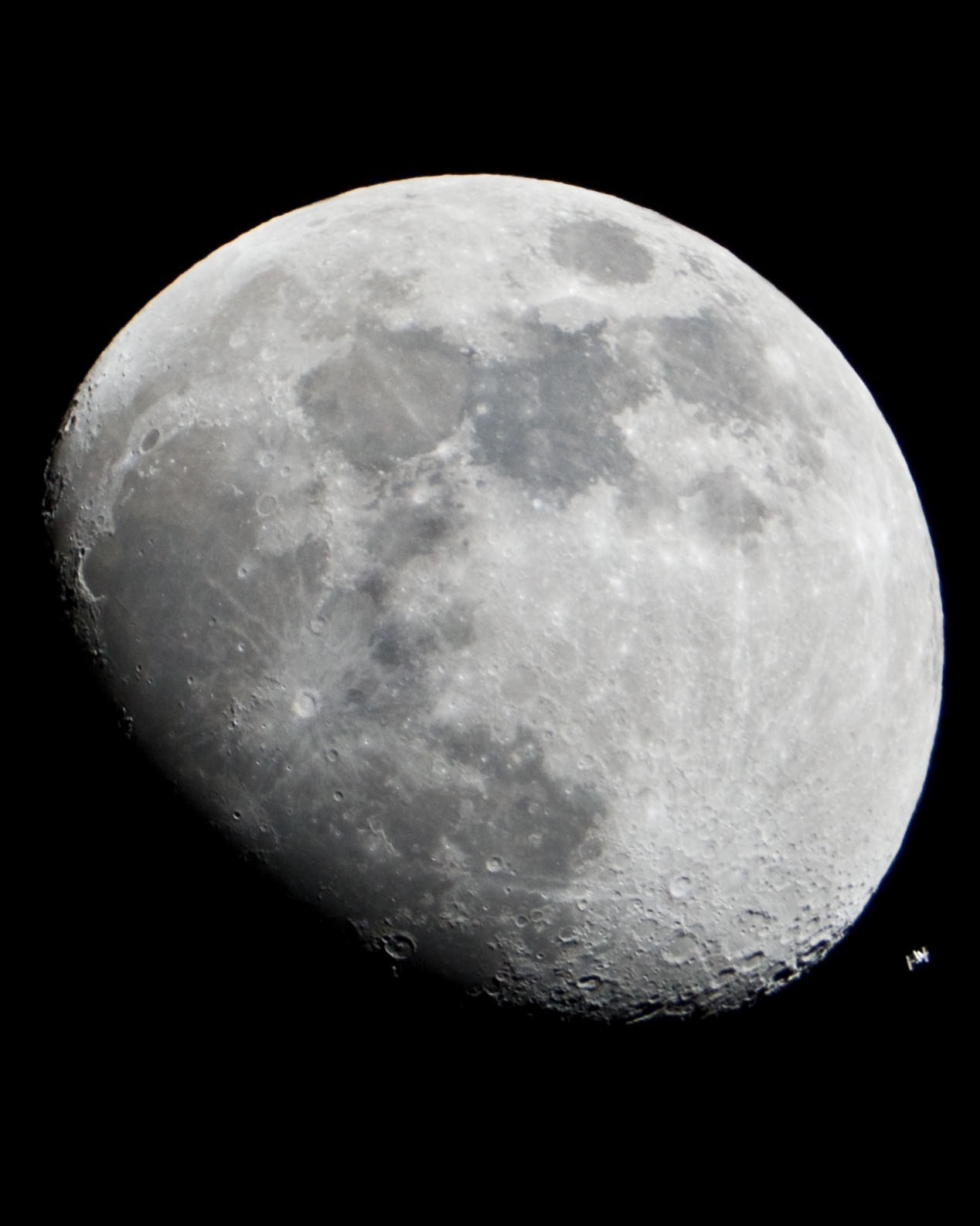
“Moon and International Space Station.” That’s ISS in the lower right of the photo. Image: NASA.gov. Wikimedia.
Quirke, Joe. “European Space Agency proposes village on far side of the moon.” 15 July 2015. Global Construction Review. https://www.globalconstructionreview.com/news/european-spa8ce-age6ncy-8p0r6o4p2os8e0s6-4v2i0l8la/
It all started with DARPA. Image: “Darpa – Big Data.” Wikimedia.
“Gee Whiz” is an old-fashioned phrase, first used in 1876, but the combo of astonishment + speed related to the saying may well describe 5G speed in telecommunications. In this case, the G is for generation. And whiz – it’s still about speed.
5G is fifth generation mobile technology. Back in the days of 2G, mobile phones and texting were new, 3G brought mobile broadcast data, and 4G was faster and came to be called Long Term Evolution (LTE). Now we are at the advent of 5G. Ericsson created the initial 5G platform in 2017, but it is only in 2020 that 5G is coming to market. 5G is a breakthrough because of a something called “latency.”
Will 5G advance human and other mobility? Image: wikimedia.
Latency is the time it takes for information sent to be received. While 4G seemed fast at the time, taking about 30 milliseconds from sender to receiver, 5G could travel that synapse in 1-2 milliseconds. That whiz of time is barely perceptible. Closing the gap of latency will enable leaps the “Internet of Things” (IoT) including:
Autonomous vehicles
Drone navigation
Gaming
Robotics
Will 5G allow next-generation bicycle helmets? Image: wikipedia.
Many breakthroughs in technology began with military or government research, including the Internet that stemmed from the Defense Advanced Research Projects Agency (DARPA), founded in 1958 by American President Eisenhower in response to Sputnik’s success the year prior. DARPA led to computer networking, the Internet, and graphical user interfaces – and also to the NASA lunar landing.
Now, government may again take the lead in connection. The United States Department of Defense is exploring sharing a new 5G wireless network with commercial enterprises. AT&T, T-Mobile, and Verizon are rolling out 5G upgrades, and Google’s Alphabet has advocated sharing the wireless spectrum. A shared network would keep military use, but add commercial partners. License bidding for spectrum access through a Federal Communications Commission (FCC) raised $4.6 billion recently; in December 2020, another auction will determine future power and access. While CTIA, trade association for the wireless industry, may favor private-sector decisions, some advocate sharing. Precedent may be found in FirstNet, AT&T’s $40 billion service for fire-fighters and public safety. In 2021, the Pentagon may direct 100 megahertz of spectrum towards the FCC for auction. What do you think of military and commercial interests – combined or separate?
Drones – both military and commercial – may benefit from 5G. Image “Drohnenflug im Abendrot.” Wikimedia
Meanwhile, 5G network leaders include Ericsson (ERIC) with a market capitalization of $25 billion, Nokia (NOK) with $18.5 billion, and Qualcomm, with $81 billion market capitalization. Ericsson created the first 5G platform in 2017. Huawei is among 35 global carriers active in 5G deployment. New chips will be needed: Qorvo (QRVO) and Skyworks Solutions (SWKS) are active. It will also mean new phones: Apple (AAPL) announced the 5G-capable iPhone 12 this week.
5G – fifth generation mobile network. Image: wikimedia
Speed has always driven advances in transport. Wheels were faster than walking; cars were faster than horses (we still use the term “horsepower” for speed); jets were faster than propeller-equipped aircraft. Now, a new era of connective transport is arriving, with the advent of 5G. But latency exists in more than signals; it’s also a roll-out timing factor. Full 5G capability requires new infrastructure. China, South Korea, and Switzerland made progress in 2019; in 2020, U.S. low-band is more available than mid-band or high-band, and only in some cities. By 2023, 5G may support more than 10% of the world’s mobile connections. Investors are betting on developing capacity, including chip-makers, with the next wave of significant activity from 2021-2022. Meanwhile, important policy issues regarding 5G access are in discussion: what do you think?
Fitzgerald, Drew. “Pentagon Considers Sharing 5G Network: Private businesses would get opportunity to use spectrum without an auction.” 22 September 2020, page B6. The Wall Street Journal.
“Prometeo trayendo el fuego,” Jan Cossiers, 1637. Museo del Prado. wikimedia.
Ever since Prometheus stole fire and gave it to humans, we’ve been the only species that can start and stop a fire. Darwin believed human capability to control fire was the greatest evolutionary achievement, second only to language. Now, that capability may be changing.
Wildfire Map of California, seen by NASA satellites. Image: nasa.gov.
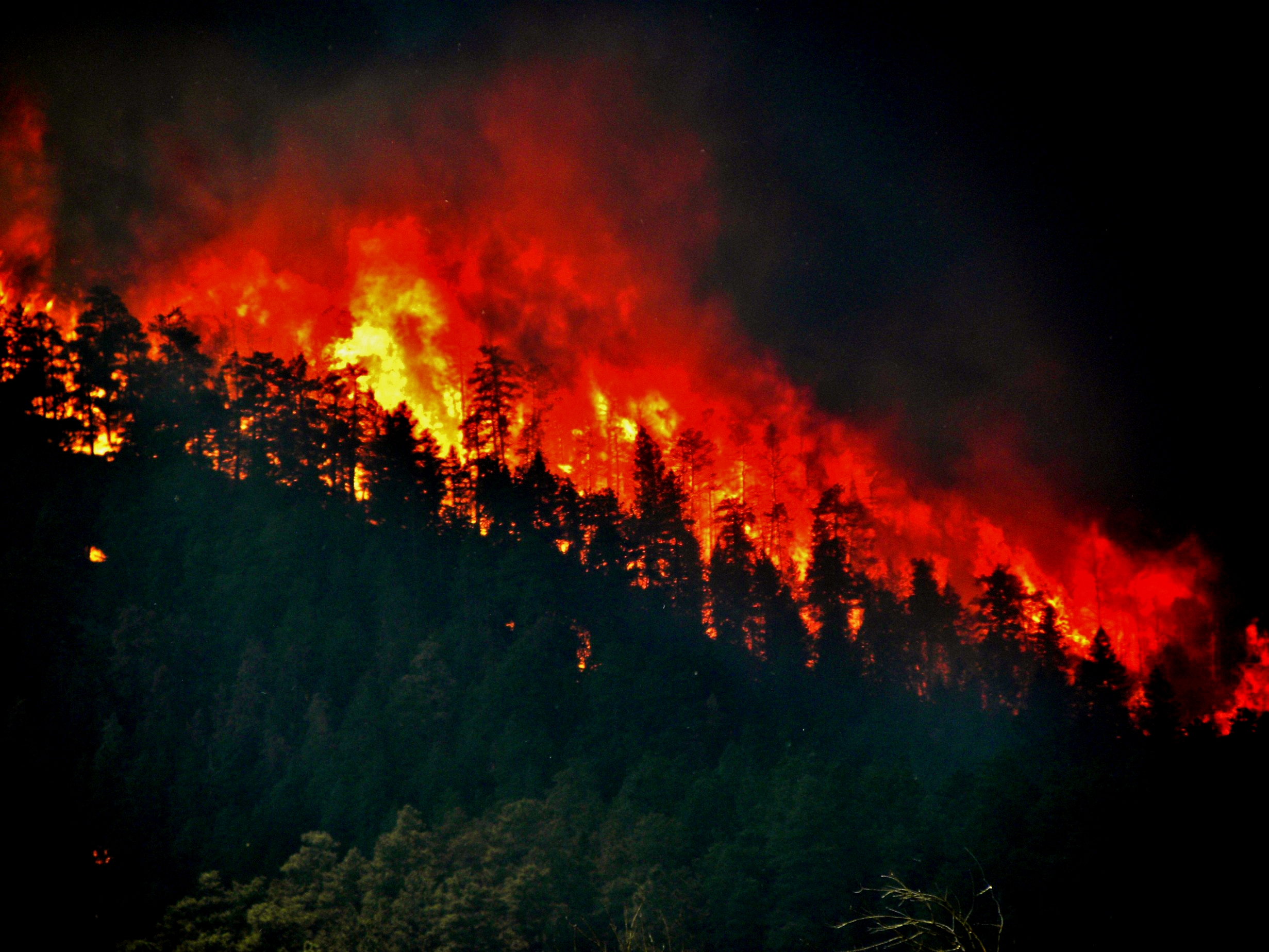
Increase temperatures by 1.8 degrees Fahrenheit, decrease rainfall by 30%: it’s a formula for fire risk. Add occurrence of lightning strikes, like those in California recently, and there is a predictable crisis. According to Berkeley Atmospheric Science Center, the area’s temperatures are 3.5 degrees higher than a century ago. Lightning strikes have also increased: up by 12% across the United States. According to California governor Gavin Newsom, California experienced 10,849 lightning strikes in 72 hours in August 2020, amid record temperatures. In 2020, California has battled 40 percent more fires than in 2019. It’s not just a California problem. In Alaska, temperatures are increasing faster than anywhere else in the USA, with four of the ten largest fire years on record occurring in the past fifteen years, with 2 million acres lost in each major fire year. In Colorado, over 1 million people receive drinking water from the Upper South Platte Watershed, northwest of Denver: in the past two decades, fires have threatened the water utility. In Colorado this week, wildfires burned across 135,423 acres, causing the state to warn residents about air quality and banning campfires: the Grizzly Creek Fire closed Interstate 70 for more than one week. Some warned that after the fires, landslides may increase. Water levees across the Colorado River Basin have decreased, including reservoirs of Lake Mead and Lake Powell. In South America, wildfires also pose dangers. It’s a global problem that will increase with climate change. What can we do?
“Trees Torching: High Park Wildfire” U.S. Department of Agriculture, 2017. Image: wikimedia.
World Weather Attribution (WWA), an international collaborative organization including the Environmental Change Institute at Oxford (ECI), Laboratories des Sciences du Climat et de l’Environment (LSCE), National Center for Atmospheric Research (NCAR), Red Cross Red Crescent Climate Centre, and Royal Netherlands Meteorological Institute (KNMI), uses satellite data and other sources to monitor atmospheric pressure patterns and levels of water vapor to predict heatwaves, fires, droughts, among other weather threats. Study data on every global region from 2014 – 2020 can be found here. These studies provide both warnings, and the basis for sustainability litigation.
Wildfire Propagation Model. Image: wikimedia.
Like sea-rise that will continue to some extent after we solve the climate crisis, temperature increases, with resultant drought and fires, can also be expected. There are some options: limit building and development in fire-prone areas, manage forests, combat insect-borne disease, improve our power grid, strengthen data analysis on climate change, and develop early warning systems for wildfire smoke that can pose air pollution and health risk. Future environmental decisions will need collaboration among biologists, fire scientists, and landscape ecologists, according to Professor Van Butsic of UCBerkeley, who states “land sits at the nexus of ecological conditions and human decisions.”
Wildfire protection innovations include Elevated Rain Induced Solution (ERIS) developed by Wildfire Innovations with targeted, moveable, suppression systems. Early detection innovations like SmokeD by IT for Nature can detect fires and alert nearby businesses and residents, via a phone app. Verisk Analytics Inc. developed a fire risk management tool to evaluate fuel, slope, and access, generating a hazard score. Will reforestation help? According to studies, the cost of replanting may bring promising returns: one reforested acre will be worth $191, 110; 30 acres, $5,733.300. Eden Projects and MillionTrees help restore land and lives. Private investment may see an opportunity, with investor capital innovations like Blue Forest Resilience Bond (FRB) and Encourage Capital.
Butsic, Van, A.D. Syphard, J.E. Keeley, and A. Bar-Massada. (2017). “Can private land conservation reduce wildfire risk to homes? A case study in San Diego County, California, USA.” Landsc. Urban Plan, 157, 161-169. LUC LAB: Researching Land Use and Land Use Change, University of California Berkeley.
Darwin, C. The Descent of Man. London: 1871.
Doer, Stefan H. and Cristina Santin. “Global trends in wildfire and its impacts: perceptions versus realities in a changing world. 5 June 2016. Philos Trans R Soc Lon B Biol Sci. 2016 Jun 5: 371 (1696): 20150345. doi: 10.1098/rstb.2015. 0345 PMCID: PMC4874420.
Finley, Bruce. “Climate change hits home in Colorado with raging wildfires, shrinking water flows and record heat: State faces continued increases in average temperatures for decades due to past burning of fossil fuels.” 25 August 2020. The Denver Post. https://www.denverpost.com/2020/08/19/colorado-climate-change-wildfire-drought/
Gowlett, J.A.J. “The discovery of fire by humans: a long and convoluted process.” 5 June 2016. https://doi.org/10.1098/rstb.2015.0164. Article ID: 20150164. Special issue on The Interaction of Fire and Mankind. https://doi.org/10.1098/rstb.2016.0149
Mulkern, Anne C. “Climate Change Has Doubled Riskiest Fire Days in California.” 3 April 2020, Scientific American. https://www.scientificamerican.com/article/climate-change-has-doubled-riskiest-fire-days-in-california/
Newsom, Gavin. “CA has experienced 10,849 lightning strikes in the last 72 hours.” 19 August 2020. Twitter: @GavinNewsom.
Temple, James. “Yes, climate change is almost certainly fueling California’s massive fires.” 20 August 2020, Technology Review. https://www.technologyreview.com/2020/08/20/1007478/california-wildfires-climate-change-heatwaves/
Union of Concerned Scientists. “The Connection between Climate Change and Wildfires” published 9 September 2011; updated 11 March 2020. https://www.ucsusa.org/resources/climate-change-and-wildfires
U.S. Global Change Research Program. “National Climate Assessment”. https://nca2018.globalchange.gov


