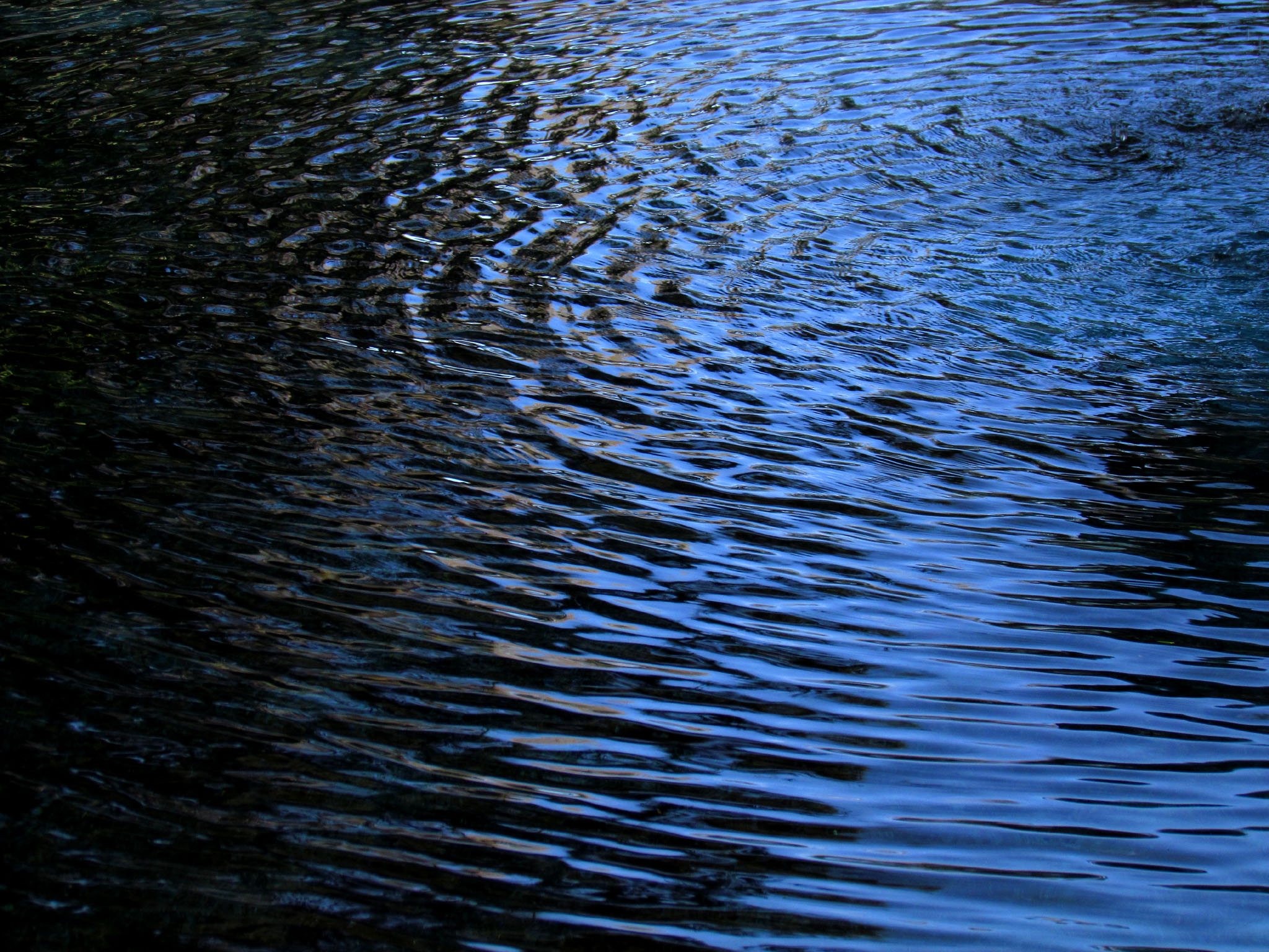
WHY WATER?
The history of civilization could be said to be the history of water. For example, Solomon’s Temple in ancient Israel could not have been built without the water on which cedars of Lebanon floated to the sacred site. Cyrene was founded because ancient Greek residents of Thera (now Santorini) were forced to set out from land choked by drought to seek more fertile ground in Libya; when they settled in an area endowed with abundant water and a mysterious local plant, a great culture flourished. The first map of the stars was drawn in Cyrene. And what would Rome be without fountains? The very word “pontiff” refers to authority for building bridges across the Tiber River – the pope alone was the pontifex (bridgemaker). Ironically, it was a threat to the Tiber that caused the Roman Army to find springs around the seven hills. Roman water even developed names, like bottled designer waters today. One spring, the Aqua Virgo, was said to be preferred for certain qualities.

But water is not just for drinking or agriculture; it is transport. Waterways such as China’s Grand Canal and France’s Canal des Deux Mers are forerunners of floating transport routes such as the Suez and Panama canals. Water is power: hydroelectric achievements from the Hoover Dam to Itaipu create new sources of energy. Water continues to be essential to energy, now as a critical, and debated, element in hydraulic fracturing. Environmental concerns may be the ultimate arbiter of the future of water and energy. And some would observe that water for sustaining life is the most critical factor.

Finally, water is a factor in space, with tests for the element on the Moon, Mars, and beyond. Such discoveries could lead to fulfillment of Gerard K. O’Neill’s vision of high frontier. But in 2015, water may be very much down to earth, as culmination of United Nations’ 2005-2015 Water for Life . At the turn of the year 2000, the United Nations formulated the Millennium Declaration, setting goals for the earth’s future. As a result, the UN General Assembly passed Resolution 58/217: International Declaration for Action, “Water for Life, 2005-2015.
- Earth has 273 underground aquifers, those in Africa among the largest;
- The weight of water held in China’s Three Gorges Dam causes earth’s axis to tilt by one inch;
- Oxygen is fairly soluble in water, which makes life in rivers, lakes, and oceans possible;
- Water may have been discovered on the planet Mars.
MYTHS AND LEGENDS ABOUT WATER
Elixir of life, water has been the subject of myth, element of blessing and purification in religions and rituals.
Water Spirits Earliest myths about water reveal living spirits within the element itself. Of type, these are two: beautiful or terrifying. Representing the former, the naiads of Greece were young ladies singing in magical tones while living in rivers (Potameides), lakes (Limnades), springs (Pagaeae), marshes (Eleiomomae), and even fountains (Crinaeae). Anyone who has ever relaxed by a stream has heard the music. Citizens where they were denizens, naiads were such a part of nature that if a spring dried up, its naiad died too. A bit freer were sprites, water spirits, also female, with skin the same hue as the sea. It was believed sprites could breathe both air and water, living in either land or sea.
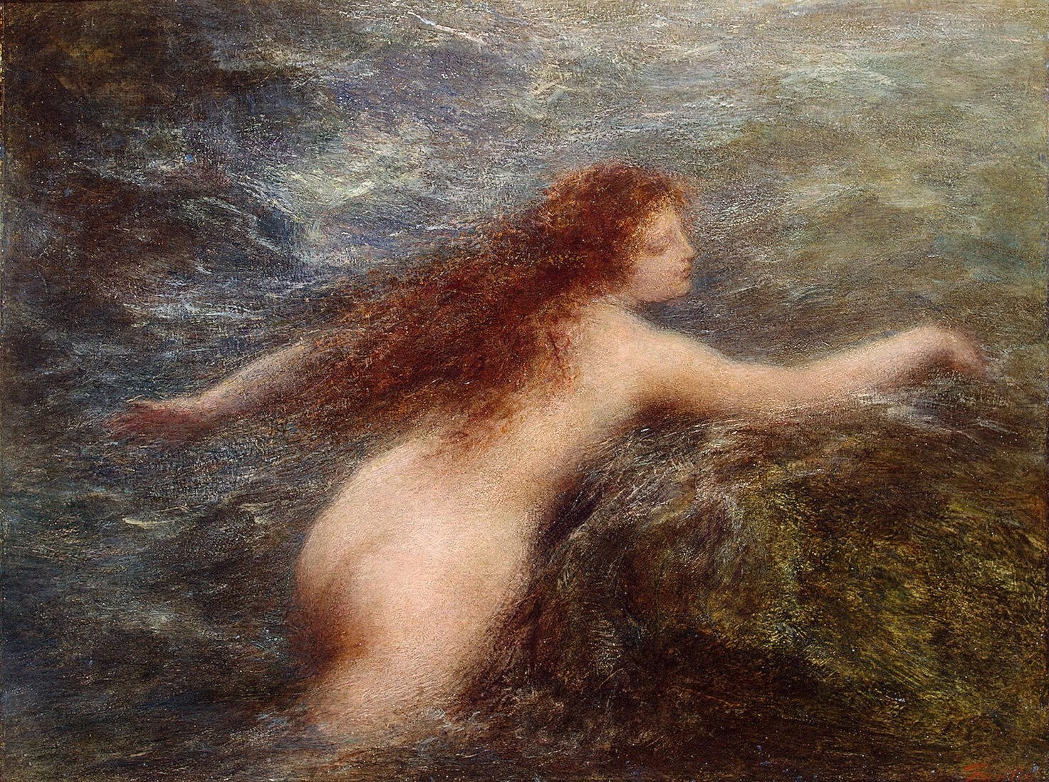
But there were other Greek water spirits, again female, who, while just as lovely as their naiad and sprite sisters, were rather more dangerous. Sirens’ songs, and comely physical appearance, combined into an irresistible allure that steered many a mariner off course. Sirens often reclined on rocks, beckoning ships close, causing vessels to be wrecked upon shoals. In Germany, the same story is set upon the River Rhine where dwelt a beautiful young maiden. Perched upon a rock located in a narrow passage of the river, Lorelei’s singing music was so beguiling that sailors became bewitched and sailed their ships onto the very rocks from which her melody streamed. Perhaps the most famous victim of the song of the siren was Ulysses. Male counterparts, spirits living in water, were not as alluring, although they also caught ships and sailors alike by trickery. Scotland, source of many a tale told around a fireplace, recounts stories of blue men residing in underwater caves in the Minch strait running between the Shiant Islands and Lewis, Long Island. As ships sailed through, the blue men conjured up storms, and taunted sailors with rhymes and riddles. Many believe the blue men of the Minch are creation’s fallen angels.

It is notable that many of the myths about water involve ship travel. One of the first ways in which humans differentiated themselves from the spectrum of mammals is by building water craft. While it is one thing to travel a river by canoe, it is quite another to set sail on the sea. The deeper the water, the darker the myth.
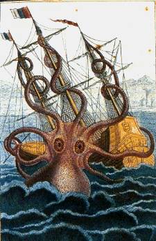
Oceans, Seas, Lakes and Monsters If you were an ancient Norwegian or sailed the coast of Iceland, you might have seen, or thought you’d spied, the Kraken, a sea monster that lurked at the water’s murky bottom but at any provocation might surface to attack a ship. In the volcanic area around Iceland, islands may appear, such as Surtsey in 1967. Other islands might rise and then be swallowed again by the sea, or perhaps by Kraken. Bubbles, a sign of underwater volcanic activity, were Kraken’s breath.
A bit more south, the Loch Ness monster is still being sighted in Scotland’s lake made famous by the supposed dragon. Grendel, another lake monster, is conquered by Beowulf, whose heroism inspired a saga sung in Anglo-Saxon meadhalls. The dangers of water, especially ocean and lake so dark and dangerous that lives could be lost, are all throughout mythology.
Floods Water dangers come not only from within the element but from its excess. Ancient people were clearly concerned about floods. Many have heard the story of Noah, who built an ark to float over the vast deluge that engulfed the region, killing all its unfortunate denizens, except the mating pairs of animals Noah carried to safety. Noah is from the Bible, familiar to those of Jewish and Christian tradition. But Noah is not alone as a hero of mythic floods. In Sumerian myth, it is Atrahasis, Ziusudra, and Utnapishtim; in India, Manu. In the Indian myth, Manu washed his hands in the river when a magical fish jumped into his grasp. He kept it, transferring the fish into larger and larger and still larger jars as it grew. Finally, the fish became so big that Manu placed it in the ocean. At their parting, the fish warned Manu a great flood was coming, so Manu built a boat and was floated and towed by Matsya, the fish that turned out to be the embodiment of a god, to safety atop a mountain. From these myths, it is clear that floods have been with our world for a very long time. How do floods of myth compare to the inundations that trouble our geography today?

Water turned to Desert Native American legends of the Lakota people tell of Uncegila who caused deserts by poisoning rivers with salt. A giant serpent, a large version of the common water snake, Uncegila caused her saline rivers to overflow, salty water killing surrounding fields. She herself is killed by two brothers, advised by an old woman who turns into a young girl when embraced. The twins seize the heart of the beast; but in a turn of fate, heart becomes ruler of their tribe. Now the people unhappily spend all their time serving whims of the disembodied heart. Finally, they reject their “ruler” and return to tribal governance. Then, Uncegila herself dries up in the beating sun, forming the desert. To this day, Uncegila’s desert remains and is known as the “Badlands.”

The Lakota myth is quite similar to a very real problem that affects dams and their water resources. Salinity can appear soon after a hydroelectric facility is built, affecting the irrigation of agricultural fields. Such is the problem in Australia’s Snowy Mountains Hydroelectric as well as Egypt’s High Dam at Aswan.
WATER RITUALS: ABLUTIONS AND BLESSINGS
Islam, Judaism, Christianity If a follower of Islam, you may be familiar with the practice of wudu, washing essential parts of the body before sacred prayer. Of course, it is also reverent to wash, or be certain one is clean, prior to handling the Quran. For even deeper cleansing, Muslims may practice full ablution: ghusl. Both Sunni and Shia recognize the ritual of washing the face, arms, head, and feet (up to the ankles). Imams may go further: rinsing the mouth and nose three times. Islam, a religion of desert origin, recognizes that one may not always be near an oasis, so in such cases the faithful may cleanse with dust, following a ritual called tayammum.

Judaism also practices sacred cleansing. Natilat yadayim, washing hands with a cup, is detailed and recommended before eating bread, before Yom Kippur and also every Sabbath. Washing is required after some special activities, including sex. Sometimes full immersion is recommended, called tevilah and performed in a mikveh (mikva). Ritual cleansing can be found among Christians in the sacrament of Baptism in which a new baby is blessed with water, or the foot-washing featured during the days preceding Easter. In 2013, newly elected Pope Francis sent a message to the world when he washed the feet of those downtrodden by society.
New Year Water Festival If you are Buddhist, you might observe certain times with water rituals, and if you are perhaps Burmese or Thai, you might follow such practices having more than a little fun. Celebrating Buddhist New Year, when the sun moves from Pisces to Aries, Burmese Thingyan comes to modern times through the practice of ancient kings enjoying a spring hairwashing ceremony with fine water from Gaungsay Kyan, “Headwash Island,” in the Gulf of Martaban. Venerable lords of olden days might be pleased to wake upon on a-kya nei, a day during the new year period when a cannon is shot to invite denizens of the village to come out of their homes with a pot of water to pour into the ground, praying for a fruitful growing season and healthy new year. But maybe if the same ancient regents awakened in today’s Yangon, they’d be shocked: rock bands blare music as teenagers blast everyone on the street with water guns. Dripping wet, singing and dancing, people soaked with aquatic rites of spring celebrate in joyous abandon. A similar scene might be found in Thailand, there known as Songkran. Might there be an echo, in the “Ice Bucket Challenge?”

From Birth to Nirvana Persia’s Anahita, water and fertility goddess, blesses rivers and lakes, and waters of birth. Japan’s Shinto religion recommends misogi, cleansing in running water, preferably waterfalls. The Cherokee practice “going to water.” And who could think of water rituals without picturing the Ganges, sacred river of India, where earthly remains of the departed burn on the banks of the waters in Benares/Varanasi, and then are released to the river, said to flow to Nirvana? Water is cleansing, purifying, and ultimately sanctifying.

Water of Peace An African water ritual may send the world a needed message of peace. At the entrance to a village sits a bench, and on it a pot of water. Every visitor is welcomed with this refreshment. Some say the presence of this pot of water is all the walls a village needs: if an intruder approaches and drinks the water, the liquid will turn to poison; but if a person is pure of heart and intention, the village refreshment will invite welcome. (Swaray, 2011) Prevalence of water to religious rituals around the world, throughout so many centuries and in every land and culture, leads one to note that water is considered an element essential to the sacred. Valued, honored, and praised by all peoples, water is surely central to the human experience. Can we be inspired by myth and ritual to find ways to honor and safeguard the element of which we are composed, the element in which, and by which, we live – water?
Let there be work, bread, water, and salt for all.
– Nelson Mandela
PART 2: WHAT HISTORY REVEALS
We drink it: our bodies are mainly water. We bathe in it: from the Mikva to Baptismal font, water symbolizes purification. We float upon it: water exploration expanded our horizons as well as united our boundaries; the Grand Canal of China transformed a region into a country. We harness water’s power: from the Tennessee Valley Authority that changed the American kitchen to Itaipu where the waters of Brazil and Paraguay join to generate electricity. Water is equally necessary for all animal and plant life. In fact, it might be argued that there may be nothing more important than water, for meeting life’s needs.
Beginning as a small city on a river, Rome grew to greatness due in large part to its series of aqueducts, which allowed citizens of the empire to enjoy more water per capita daily than the average New Yorker of today living in Manhattan in the shadow of the United Nations. The need for water continues to grow. In 1965, Americans used 355 billion gallons of water per day, which at that time was predicted to expand to 600 billion gallons by 1985. It might be surprising to learn, however, that residential water use actually accounts for only a small percentage of total use. According to a Texas A&M University study, it takes 770 gallons of water to refine one barrel of petroleum, 40,000 gallons to turn out a ton of steel, and 600,000 gallons to make a ton of synthetic rubber.

Consider the largest water resource in the world: Earth’s oceans. Will desalination efforts, like those of Singapore, prove effective in other regions? How will the ocean environment be preserved? What changes in shipping, in energy, in mineral exploration, in fishing, in coral reef protection, in many other aspects, will determine the destiny of the water planet? The need for water will only increase. But where might additional potable sources be found? Few have considered that driest of all land on earth¾the desert. Water indeed lies under the world’s deserts. The world has 273 aquifers identified to date: 68 in the Americas, 38 in Africa, 155 in Eastern and Western Europe, 12 in Asia. One of the largest underwater aquifers on earth is under the world’s most famous desert, the Sahara. Libya, Chad, Egypt, and Sudan have agreed to share the massive Nubian Sandstone Aquifer System, which covers 2 million square kilometers and contains 150,000 cubic kilometers of water. In 2006, the International Atomic Energy Agency, with the United Nations Development Programme and numerous other agencies, convened a meeting in Tripoli to plan the sharing and protection of this important African water source. One of the foremost examples of using Saharan water is Libya’s Great Man-Made River, which draws 90% of that country’s water from underground through pipes that rival Rome’s ancient aqueduct system. Lying beneath the land surface of Algeria, Libya, and Tunisia are two more important water sources: the Terminal Complex and the Intercalary Continental. Experts such as Mohand Ouali believe there is enough water in these two sources alone to supply Algeria for the next 120 centuries. But Algeria is concerned because over 90% of its population hugs the Mediterranean coast. Consequently, the Algerian government is trying to discourage further coastline density by making plans to transport underground water from the Sahara to Algeria’s northern steppes where new towns can be built a plan that will help as the population continues to grow. With 30% of Algerians currently under the age of 15, water is rapidly becoming a dominant issue. A lack of water remains a problem throughout Africa. Other regions of the world have developed solutions to mitigate the water shortage problem. For instance, around the turn of the twentieth century, George and William Chaffey were commissioned to irrigate a section of the California desert. The resulting area became what is known today as the Imperial Valley, one of the largest agricultural regions in the world. The productivity and resulting economic stimulation flowing out of the Imperial Valley far surpassed the economic benefits of the 1849 Gold Rush.

You could write the study of human growth
in terms of epic concerns with water.
―Bernard Frank
Imperial Valley, California, US Chaffey brothers led the formation of the Imperial Valley. George and William Chaffey’s engineering feat transformed the Sonoran Desert into one of the world’s most important agricultural resources. The Chaffeys first rose to prominence when they successfully established irrigation in Australia’s Cucamonga Plain, later forming the Etiwanda Water Company in which those who bought lots were awarded shares in the water. Leaving Australia because their engineering solutions were a technical success but not a financial one, the brothers came to California. Other eyes had looked on the California desert and envisioned farmland. In 1859, O. M. Wozencraft, who came west for the Gold Rush, received permission from the California state legislature to develop 1,600 square miles of the Salton Sink into a canal that would carry water from the Colorado River. When the U.S. Civil War forced Wozencraft to abandon the project, an engineer named C. R. Rockwood stayed on to do the survey work. Rockwood did his job, but the deal fell through, and he sued the failing Colorado Irrigation Company to gain title to his data. Ultimately, his plans fizzled.
Then came the Chaffeys. One look and it was clear to the brothers that Rockwood was on the right track. At least his proposal would be better than bringing water by rail, which was the current modus operandi. Dredging for the canal began in 1900, and a year later construction began. Thereafter things moved quickly. The area that had been a desert outpost with only a few lonely surveyors living hand to mouth on the worksite suddenly became a boomtown. In four years, there were 12,000 people; irrigated land went from 1,500 to 67,000 acres. It was not long before the railroads recognized impending success; the Southern Pacific built tracks into what was now known as the Imperial Valley. Lessons learned from the Imperial Valley could be replicated in other desert areas.
Colorado River Compact and Hoover Dam Built as much for a water source as for electric power generation, the project began with the Colorado River Compact of 1922. The river is impressive by any measure. It extends approximately 1,450 miles (2,330 kms) from northern Colorado to the Gulf of California in Mexico, and affects an area of 242,000 square miles (632,000 square kms). Seven participating states were divided into two groups: Upper Basin (Wyoming, Colorado, Utah, New Mexico), and Lower Basin (California, Arizona, and Nevada), and together they cooperate to share the water. It was the first time in American history that a group of states apportioned water from an interstate stream, and also the first time that more than two or three states negotiated a treaty to settle a problem among themselves. Unfortunately, the participating states did not give sufficient attention to Mexico where the river ends, or to Native Americans who were the original people living near the river. While Herbert Hoover, chairman of the Colorado River Commission, remembered to mention Native Americans, he did not negotiate terms; rather, he just made sure the agreement clearly stated that, “Nothing in this compact shall be construed as affecting the obligations of the United States of America to Indian Tribes” (Article VII). The inclusion, and omission of terms, would come back to haunt. In 1903, the U.S. Supreme Court, in Winters v. United States, ruled that Native American tribes had water rights whether they were using the water or not, and that their rights were related to the placement of their reservations. Sixty years later the Supreme Court intervened when five Native American reservations located in the Lower Basin claimed their due. Three more tribes made claims on both Lower and Upper Basin water apportionments: the Walapai, Havaupai, and Navajo sued.

The Navajo had a particularly advantageous location, since their 25,000 square mile (40,230 sq. kms) reservation is entirely within the compact’s territory. The Colorado River Symposium, in 1997, awarded the Navajo a five-maf share. Interestingly, while American states are forbidden to sell their water rights on the open market, no such restriction applies to Navajo and other tribes. If Native Americans were mentioned only briefly in the Compact, even less attention was paid to Mexico. The Compact covered only two points: a mandate that surpluses not used by the states could be given to Mexico; also, if there were deficiencies then the Upper and Lower Basin states would make them up. Mexico had less land involved, but they too noticed their status and corrected the situation. In 1943, a treaty apportioned 1.5 maf annually to Mexico. Studying laws and subsequent lawsuits and challenges regarding the Colorado River might prove useful. Also of benefit would be lessons learned from operations of Six Companies, Inc., the building consortium that used weekly contests to drive innovation and success. Building the Hoover Dam required the collaboration of six companies. Morrison-Knudson Co., Utah Construction Co., J. F. Shea Co., Pacific Bridge Co., Henry J. Kaiser, and Warren Brothers formed a cooperative league named Six Companies, Inc. Perhaps they were not imaginative in their nomenclature, but the partners who built the Hoover Dam were certainly innovators in organization and project management. Construction of the dam went so well it finished two years ahead of schedule. The contract included bonuses for completion and threatened fines for running beyond the construction deadline; the contractors took these clauses seriously, working night and day. Why was this project so successful? One reason was the availability of legions of recently unemployed laborers. The prospect of work on the Hoover Dam project offered relief from the catastrophe of the Great Depression. Whole families moved to Las Vegas, and workers made the 30-mile trip from there to the job site each day. Another important factor: for the first time in public construction history, the United States federal government mandated a policy of diversity, requiring that African Americans be hired. Construction began in 1931, was completed in 1935, with dedication on September 30 of that year by President Franklin D. Roosevelt. The first power was generated in 1936.
Lake Mead, Nevada, US Lake Mead, created when the Colorado River’s power was harnessed by the Hoover Dam, extends upriver from the dam. A recreational marvel, Lake Mead draws more than nine million visitors per year to its water sports facilities and marinas. In recent times, however, water levels have dropped precipitously. In the 1950s and 1960s, water declined to drought levels (below 1125 feet/344 meters). If climate change continues and water use stays at current levels, Lake Mead could be seriously depleted by 2021. The lake, while initially was formed by damming the Colorado River, renews itself through snow melt. With global climate change, there is less snow, according to research by the University of California at San Diego.
Lake Chad, Chad, Africa Africa’s second biggest natural lake is another important model. Chad, a landlocked country, could be thought of as water-deprived; in its northern regions, only camels and a few intrepid nomads cross its sands where rain measures less than 8 inches per year.

But perhaps as compensation, nature provided Lake Chad, where more than one hundred species of birds and fish flourish. Bountiful as it is, the lake used to be much larger. Mark Notaras, of United Nations University, notes the changes in Africa’s noble lake. In 1963, it measured 25,000 square kilometers but by 2009, it had shrunk to only 1,350 “due to usage combined with decreased rainfall,” according to the US Department of State. Can the problems of Lake Chad be solved? Avoided in future situations in other global lakes?
Wolf Lake, Illinois, US The construction and development of the Illinois International Port District at Calumet Harbor represented the completion of the St. Lawrence Seaway in 1958. Just seven years earlier, the Illinois General Assembly created the Chicago Regional Port District to oversee harbor development, giving title to 1,500 acres of marshland around Lake Calumet. By 1960, in exchange for a long-term lease, Union Tank Car constructed a deep turning basin, and carved space for 91 liquid storage tanks accommodating 800,000 barrels of capacity. In 1972, Navy Pier closed to shipping and opened development to other aspects of the economy of downtown Chicago including its famous ferris wheel.

Calumet’s marshland became the new shipping center and is now the world’s largest inland port. Included in earthmoving authorized to construct the Illinois International Port was the creation of Wolf Lake. Heralded by boaters, fishers, and families who picnic on its shores, Wolf Lake transformed the marshland at the edge of the Illinois and Indiana steel mills into a recreational wonder. In addition, the Port District turned reclaimed land into a 36-hole championship golf course. Harborside International Golf Complex, completed in 1995, offers a 58-acre training academy.

Water sustains all.
-Thales of Miletus
PART 3: ICONIC INNOVATION
A LAKE IN THE DESERT
From a drop of water a logician could infer the possibility of an Atlantic or a Niagara without having seen or heard of one or the other.
―Sir Arthur Conan Doyle
Is there an iconic innovation that could make a significant contribution to the destiny of one of the world’s regions? Such projects have two benefits: upgrade of the region involved and inspiration to the rest of the world. Big projects send a message. One still pictures the Eiffel Tower when imagining Paris.
Africa has many images, one of which is the fabled Sahara desert. The Sahara is so large as to be almost immeasurable. It is as large as the entire United States including Alaska: stretching 3,100 miles (approximately 5,000 kilometers) from the Atlantic to the Red Sea, the Sahara is bounded on the north by the Atlas Mountains and the Mediterranean Sea. The northern coastal countries of the Sahara (Algeria, Libya, Mauritania, Morocco and Tunisia, together known as the Magreb), are more prosperous than their southern neighbors. In the south, there is no geographic barrier, so the desert keeps expanding, damaging grasslands of the Sahel as it forces millions of people to relocate out of its relentless southward drift. Chad, Mali, Niger, and Sudan suffer most from the desert’s expansion.
In the south, reinforcements to supplement and reinforce Lake Chad would be helpful, thus bringing more water resources to a region in great need. In 1960, the French came to Mauritania with ideas for a savanna and river land along that country’s southern border. But in 1991, William Langewiesche traversed the entire Sahara, and in his descriptive commentary he reports that the savanna is now eclipsed by ever-expanding sands. According to Langewiesche:
In the past decades, the pluviometric threshold of six inches of annual rainfall – the minimum needed for grazing – has moved south sixty miles. Nouakchott, once surrounded by grasslands, is now swept by blowing sand. Founded with high hopes in 1957, Mauritania’s capital of Nouakchott is crowded with 800,000 people, some semi-nomadic. Although there are iron deposits in the northern area of its borders, the sands have challenged progress.
There are mountains in the Sahara: the Hoggar in Algeria and the Tibesti in Chad, the latter reaching 11,204 feet, marking the highest point of the Sahara desert. Surprisingly, only 20% of the Sahara is sand¾seas of hot, grainy, shifting waves called ergs. The erg in Libya is as large as France!
Lake Hope
We believe a potential benefit lies in the development and construction of a massive, human-made lake, located in the middle of the Sahara Desert. In the 1800s, experts may have listened to the ideas of Francois Elie Roudaire, born on the 6th of August, 1836; some were inspired by Ferdinand de Lesseps’ completion of the Suez Canal. While de Lesseps was at the time engaged in Panama (he would return, but not victorious), others moved forward on the idea with his support. In a 2003 book about the project entitled Une mer au Sahara, author Jean-Louis Marcot discusses the history of this yet-unbuilt project. A group of supporters, convened by Frank P. Davidson, supported further exploration of the idea of a Lake in the Sahara, an inland sea.
Perhaps it might be called Lake Hope, because it would serve as a reservoir for drinking water, and could also be channeled into irrigation canals and waterways. Even recreational aspects, such as Mead or Wolf, could be developed. While hydrologists and engineers would be hired to determine its optimal placement, the effects of such a grand lake would spread well beyond its immediate shores. Because the world’s largest desert touches eleven African nations, advantages that would accrue directly or indirectly would improve each of these countries and would radiate further beneficial effects to all of Africa.
Libya, Algeria, Chad, and Egypt, among others, already utilize underground water. In areas of the driest desert where there is no electricity, solar-powered equipment would be used. Further water can be salvaged by reducing or eliminating current levels of evaporation in the Qattara Depression; Professor Neil Sturchio of the University of Illinois at Chicago claims wells positioned there could reclaim two billion cubic meters per year, which would easily help to supply northern Egypt.
Accessing the water to supply Lake Hope will build on existing drilling methods. However, engineers will have to resolve the problem of transporting water from its underground source to the proposed lake. Such a project could take inspiration from the ancient Romans who figured out how to move water from hills around the city out as far as 60 miles. While that distance is not impressive considering the Sahara’s 3,000-mile expanse, today’s engineers are at least as innovative as those in the days of Sextus Julius Frontinus.
| Table: World’s Largest Lakes: (In square kilometers) | |
| Malawi | 28,880 |
| Great Bear | 31,128 |
| Baikal | 31,128 (see Tands-Siberian Railway) |
| Tanganyika | 32,900 |
| Aral “Sea” | 33,640 |
| Victoria | 69,500 |
| Superior | 82,100 |
| Michigan + Huron | 117,610 |
| Caspian Sea | 371,000 |
Source: World Atlas (2009)
A Way to Power Hope — Solar Sahara?
One thing the Sahara has in abundance is sunshine, which is why ventures like Desertec merited investor financing of approximately US$500 billion for a solar installation to provide power in the Sahara Desert. Desertec is comprised of a dozen European companies, as well as Deutsche Bank, the utility E.On, and engineering experts including Siemens and ABB.

It may take 40 years, according to Matthew Slavin (2009) of US-based Sustainability Consulting Group, until the project is operational when Desertec would be capable of generating 100 gigawatts of electric power. Solar power in the desert would not only be of great value to Africa, but indications are that power sales could help Europe meet its promise to reduce emissions by 80% from 1990 levels by the year 2050, part of the dictates of the Kyoto protocol. One must note Desertec plans to share electricity with North Africa and the Middle East. While Desertec’s solar plan is for electricity generation, it proves that solar-powered equipment could be a good option for developing drilling and pumping systems in the midst of the Sahara, a concern when planning the building for Lake Hope.
How Lake Hope could influence Africa’s Destiny
Water sustains all.
―Thales of Milletus
There are many possibilities arising from the development of Lake Hope:
- Employment – Lake Hope would require many workers from all the areas bordering it, whether for this job or other related projects. During its construction, Snowy Mountains (Australia) Hydroelectric employed over 100,000 workers who lived and labored together, sharing a new common language and learning new skills. After the Erie Canal was built, Navvies (the nickname for canal construction workers) were in high demand as skilled labor for the Transcontinental Railroad.
- Economy – As the Imperial Valley improved California’s economy, so might a lake bring benefit to the African nations where the lake will be located.
- Sustainability – Africa is already losing nonrenewable water. Would a lake reservoir add some measure of sustainability, perhaps contributing to an ever-normal water supply?
- Iconic – Do humans need visible symbols that remind us of our purpose? Can Lake Hope become not just a source of water but also an inspiration?
- Scalable – If underground aquifers present in the Sahara can be tapped, where are the next possibilities? Will the water of the Guarani Aquifer (1.2 million square kilometers) under Argentina, Brazil, Paraguay, and Uruguay be channeled to benefit that region? Renewable aquifers such as the Guarani may help to supplement non-renewable water deposits in Arabia and Africa.
- Spinoffs – If solar power proves to be a viable solution in the Sahara, can the same technology be used in other deserts? Could Desertec or a Mexican partnership develop solar power in the Sonoran Desert, which would generate and share power between Mexico and North America, both of whom have strong energy demands? Can NAFTA guidelines prove advantageous for power sharing across what is now a fence?
While Lake Hope might increase sustainability of an aquifer that is not renewable¾ even if the water lasts for 120 centuries¾what about the 121st century? It is wise to review many options in the ongoing pursuit of a stable world water supply.
PART 4: FUTURE
Water From Space
Leaking boxes may portend the future. In 2009, Lawrence Taylor of the University of Tennessee at Knoxville commented that 40 years ago, when Apollo astronauts returned with moon rocks, the boxes were wet. As one of the scientists on the land-based science team, Taylor saw the dripping lunar rock boxes, but like his colleagues, “We just assumed the water was from contamination with terrestrial air.”[ii] But Taylor and colleagues are rethinking. It is now known that moon rocks and soil have oxygen, at a level of about 45%, although silicate.
Recent examination of moon matter by the Moon Mineralogy Mapper (M3) from the Indian Chandrayyan-1 satellite hints that H2O might be a possibility. Taylor explains: “When the sun undergoes nuclear fusion, it constantly emits a stream of particles, mostly protons, which are positively charged hydrogen atoms.” The surface of the moon, with its oxygen-rich minerals, gets pounded by hydrogen in the protons; the impact could break the oxygen bond, freeing H and O to unite. “It’s only about a quart of water per ton of soil,” Taylor estimates. But in November 2009, NASA confirmed that the Lunar Crater Observation and Sensing Satellite (LCROSS) “successfully uncovered water during the October 9, 2009 impacts fired into the moon’s Cabeus crater.”[iii]
Desalination
Desalination may turn out to be the long-term answer. More than 95% of all the water on earth is in the oceans. Yet to date we have used this water primarily for shipping, and many hope to preserve the pristine ocean environment for the health of fish and plant life.
Science can solve the problem of water through careful attention to the oceans. Although it may take time, and the expertise of ocean scientists like Ernst G. Frankel of MIT, water in the oceans may perhaps become available for human use just as underground aquifers reach their limits.
Water from Climate Change
Global climate change might give the world a new sea, in Africa. The East African rift, a 5,000-kilometer fissure, traverses an area from Mozambique at the southern edge to the Red Sea at the northern boundary. At the northern section is a triangle now watched closely by scientists. Seismic activity has been noted recently in the Afar Triangle, which like a busy crossroads under the earth is the intersection of the Red Sea, the Gulf of Aden, and the East African Rift. The Indian Ocean will also be affected, and of course a new sea would have tremendous influence on Africa. According to C. Henry Depew:
The estimated area of the rift valley is about 200,000 square kilometers, and if we assume an average depth of 100 meters, the result is 4,798 cubic miles. At the northern end of the rift is Lake Assal, fed by leakage from the Gulf of Tadjourah off Djibouti. There is a natural barrier of lava that keeps the marine waters of the Gulf of Tadjourah from filling the depression. But with enough seismic activity, the flow will draw from the Gulf of Tadjourah and the Gulf of Aden initially. This draw will then be transferred to the Arabian Sea, the Gulf of Oman, through the Strait of Hormuz to the Persian Gulf, the Red Sea, and through the Suez Canal to the Mediterranean.
Rhône-Algeria Aqueduct: Fresh Water for Algeria and the Sahara
The River Rhône is the only major river/watershed in France draining into the Mediterranean Sea. It constitutes the largest fresh water inflow into the western Mediterranean, and suggestions have been made that it could provide a substantial fresh water supply to arid areas of Algeria that border the Sahara Desert.
In the late 1990s, Professor Ernst G. Frankel of the Department of Ocean Engineering at the Massachusetts Institute of Technology, examined feasibility and costs of pumping some of the Rhône effluent across the Mediterranean to Algeria, then across the Atlas Mountains to the Sahara. He compared the costs (investment and operating or delivery costs) with similar costs for generating fresh-water supplies by distilling seawater.
Frankel found there was sufficient evidence of technical and economic feasibility such that the project could proceed with “reconnaissance-level investigation.” Such a study would likely take about four years to complete. Thereafter two years would be required for ocean surveys and analytical work leading to specifications for materials and pipeline design. Approximately six months thereafter, specimen materials could be procured and tests could commence.
Getting into Hot Water
The planet is warming, from North Pole to South Pole, and everywhere in between. Globally, the mercury is already up more than 1 degree F (0.8 degree C). The effects of rising temperatures are not waiting for some distant future. They are happening right now. Some signs are surprising. Heat is not only melting glaciers and sea ice, it is also shifting precipitation patterns and setting animals on the move. As Arctic and Antarctic icecaps continue melting, adding volumes of water to the world’s oceans, there are already, and will continue to be, major impacts ― to island nations, regional rivers, and lakes.
Some impacts from increasing temperatures are already happening:
- Ice is melting worldwide, especially at the Earth’s poles. This includes mountain glaciers, ice sheets covering West Antarctica and Greenland, and Arctic sea ice.
- Rise of sea levels became faster over the last century.
- Some butterflies, foxes, and alpine plants have moved farther north or to higher, cooler areas.
- Precipitation (rain and snowfall) has increased across the globe, on average.
- Spruce bark beetles have boomed in Alaska thanks to 20 years of warm summers. The insects have chewed up 4 million acres of spruce trees.[iv]
Other effects could happen later this century, if warming continues.
- Sea levels are expected to rise between 7 and 23 inches (18-59 centimeters) by the end of the century, and continued melting at the poles could add between 4 and 8 inches (10-20 centimeters).
- Hurricanes and other storms are likely to become stronger.
- Species that depend on one another may become out of sync. For example, plants could bloom earlier than their pollinating insects become active.
- Floods and droughts will become more common. Rainfall in Ethiopia, where droughts are already common, could decline by 10% over the next 50 years.
- Less fresh water will be available. If the Quelccaya ice cap in Peru continues to melt at its current rate, it will be gone by 2100, leaving thousands of people who rely on it for drinking water and electricity without a source of either.
- Some diseases will spread, such as malaria carried by mosquitoes.
- Ecosystems will change—some species will move farther north and become more successful; others won’t be able to move and could become extinct. Wildlife research scientist Martyn Obbard has found that since the mid-1980s, with less ice on which to live and fish for food, polar bears have gotten considerably skinnier. Polar bear biologist Ian Stirling has found a similar pattern in Hudson Bay. He fears that if sea ice disappears, polar bears will as well.[v]
Scientists Fung, Lopez, and New (2011), in a study on the availability of water and the impact of climate change, if global warming is limited to 2 degrees centigrade and a world where warming increases by 4 degrees centigrade. The authors explain it this way:
We make use of a new GCM dataset from the ClimatePrediction.net (CPDN) experiment…. These provide us with a wide range of realizations of a world that warms by 4oC, enabling us to identify differences in climate, surface runoff, and population that determine the climate and hydrological models used…. This is followed by a description of the scenarios of future population growth we developed and how these are used to define water stress.[vi]
Ever-Normal Water Supply
All the waters run to the sea and yet the sea is not full,
and from the place where they began, thither they return again.
―Ecclesiastes, Bible
Can a doctoral thesis change history? Henry A. Wallace, U.S. Secretary of Agriculture from 1933 to 1940, advocated an “ever-normal” granary, becoming another passionate supporter of a concept that dates as far back as 54 BCE when China’s Keng Shou-ch’ang introduced the policy. Keng Shou-ch’ang proposed that all provinces along the boundaries of the empire should establish granaries. When the price of grain was low, they should buy it at the normal price, higher than the market price, in order to benefit farmers. When the price was high, they should sell it at the normal price, lower than the market price, in order to benefit consumers. Such a granary was called a “constantly normal granary.” When results were good for the people, the emperor bestowed on Keng Shou-ch’ang the title of marquis.
Wallace read a doctoral thesis authored by a young Chinese scholar, Chen Huan-chang, and as a result of reading about China’s policy, Wallace took steps to implement a similar policy in the United States. He wrote often about the idea, most notably on October 8, 1926, and again on January 21, 1927. He also credited the Bible with its famous recounting in Genesis 47, of how Joseph counseled the pharaoh of Egypt to take steps that enabled Egypt to escape seven years of famine.
But it was a spell of bad weather that turned Wallace from a dreamer to a visionary. A drought in 1936 (the year Wallace gave an influential speech at the Great Lakes Exposition) exacerbated shortages already prevalent owing to a drought just two years earlier. In 1937, good weather prevailed, and the supply pendulum swung to surplus. On a cold February day in 1937, farmers across the country gathered in Washington, D.C. where Wallace spoke to them. The next day, February 8, the farmers agreed upon a resolution requesting that the United States adopt a policy of an ever-normal granary. By fall, the idea had taken on such momentum that Congress met in special session and passed the bill unanimously. The American Agricultural Act (first passed in 1933, invalidated in parts subsequently by the Supreme Court) was signed by President Franklin D. Roosevelt on February 29, 1936.
The five guiding principles of Ever-Normal Granary summarized by Derk Bodde (1946), are as follows:
- Promote efficient production;
- Adjust production as needed through parity-payments;
- Conserve and stabilize supply;
- Balance the flow of market supplies through a policy of government storage loans followed by mandatory sales quotas;
- Insure supply through governmental insurance program (such as the Federal Crop Insurance Act of 1938), with indemnity provided in the case of failure.
In 1946, while serving as Secretary of Commerce, Wallace stated that the Ever-Normal Granary concept, now expanded to include many more crops, was so successful that it might be recommended on a global level: “the internationalization of the ever-normal granary idea is absolutely essential and necessary for world peace and prosperity”(Bodde 1946).
Today’s water is often purchased in bottles pulled from the supermarket shelf. Yet more than 90% of the world’s water comes from underground sources. It is certain that the world will need more water as the global population grows to an estimated 10 billion by 2050. Within such a timeframe, we believe an ever-normal water supply can be developed on which the earth can depend, thereby easing droughts, irrigating deserts, and sustaining oceans, seas, rivers, and lakes.
Floating an Idea – New Land on Water
“God created the world, but the Dutch built Holland,” is the saying regarding Netherland innovations to reclaim land from the sea via marshland development and protective dikes. In the future, New York City’s Wall Street neighborhood may be made safer from flooding, such as occurred during Hurricane Sandy, if a Dutch proposal to restore the marshes is adopted. Water dangers will influence design in the future, as seen by the Whitney Museum of American Art’s revisions to the institution’s new home near the Hudson River. When Sandy hit in 2012, over 30 feet of water entered the new building site’s basement. Designed by Renzo Piano, protected by WTM and the Franzius Institute at Germany’s Hanover University where storm modeling specialists who offered ways to retrofit the lobby against future inundations, the new Whitney will hang paintings 60 feet above lobby level, according to Adam D. Weinberg, director (Pogrebin, 2013). Protecting settlements near water, be they museums or family homes, may be news, but it is not new.
Even before the Dutch, humans were building on water. Mexico City, once called Tenochtitlan, was settled on five islands in Lake Texcoco. Legend has it that the marsh-living Mexica fled their native grounds. In their search for a new land, they were guided by a vision: they would see an eagle, sitting on a cactus leaf, eating a snake. The Mexica wandered until they came to what might have been one of the most elaborate city settings in the world: five islands, in an inland lake, which could be connected by canals to major rivers, and thence to the Gulf and Oceans. The capital was both “inland” and a port. And in the largest of the five islands in the lake, the capital and governmental buildings could be easily defended via this natural “moat.” And it was confirmed – there in the landscape sat the foretold eagle, sitting ,just as described, on a cactus leaf, eating a snake. The fabled capital became the largest city-state in the new world of 1325. Even today, one can see the Aztec symbol of the eagle sitting on a cactus eating a snake on Mexico’s flag and armorial crest. The settlers soon expanded the islands by building artificial chinampa, or islands, connected by canals. Shipping goods through their built waterways to the Gulf of Mexico on one side of their territory and the Pacific Ocean on the other, the Mexica were the dominant leaders of commerce and capital. All this changed on November 8, 1519, when the conquistador, Hernan Cortes, rode into town to find a marketplace thronging with trade in an economy estimated at over 300,000 people, comparable to Spain’s Sevilla. Evidence of the great empire remains; under Mexico City’s central plaza, the zocalo, ruins of the ancient Aztec temple can be glimpsed. Unfortunately, more might be visible soon as Mexico City sinks deeper into its drained lakebed under the weight of skyscrapers. But Mexico City is proof that building on water is rather successful.
Human-created islands continue to make the world “bigger.” Japan’s Kansai International Airport was built to last, but just six years after construction was completed, the passenger terminal started to descend towards sea level, dropping almost 12 meters (39 feet) since its 1994 position. This was even further down than the architects and engineers predicted, estimating subsidence of 11.5 meters (37 feet) over 50 years. Why is Kansai sinking faster than predicted? It’s the problem of success. For success causes repetition (while failure causes change). So more building, the heavier the island gets, the faster it sinks. Alarmingly, its not only buildings and runways lowering, but the whole island itself. Plans to dig a moat around the airport, to be filled with compound of sand and concrete, could make a retaining wall, but the cost estimates of 20 billion yen, on top of a sustained debt of 150 billion yen, and plans for a second runway priced at 170 billion yen, as well as a cross-wind runway, pose financial challenges. (www.japantimes.co.jp) But positive aspects remain. Kansai, according to George H. Litwin, illustrates “a financing strategy that is as important as the project itself. An additional advantage: “the strategy of not displacing any current landowners was critical to the success of the overall project.” Furthermore, the costs of building have been more than repaid by gains in taxation. (Litwin, George H. “Financing and Using Artificial Islands,” monograph 2009.)
Dubai is another case in point; that city’s waterfront, and the artificial islands (Palm Islands, The World) may be the largest centrally organized attempt to build new land for commercial and residential use. It is said the effort attracted support at the highest levels: Sheik Rashid bin Said bin Maktoum al Maktoum observed Dubai might run out of oil money by 2014. Could Dubai expand its economy? The Palm Islands were developed, then on May 2, 2003, The World was announced. Five years later, 60% of the islands (each named for a country in the world) were sold. It is estimated that US $14 billion was required for basic construction, and contributed by Nakheel, the governmental development entity. Further investment of another $10 billion by private interests followed. Davidson (2008) suggests total investment might amount to over $100 billion. Will it pay off? One should note Dubai is now benefitting from diversification; 83% of its economy comes from non-oil sources. (Litwin, 2009).
New Land for Peace
Technology clearly exists for developing land on water, certainly in coastal regions. Therefore, would it be hopeful to consider new land in a region where territorial tensions could be eased? Will the findings of the Macro Center for Engineering and Diplomacy, at Roger Williams University in Bristol, Rhode Island, United States contribute to world peace?
Engineers and architects have studied the possibilities for creating more land in this region that many people call sacred. If there were more land, could the right distribution be found?
New Land for Kiribati, The Maldives
Rising seas due to global warming will threaten, some say certainly affect, the status of island nations such as Kiribati, Tuvalu, the Maldives. Kiribati may see relocation of 78,000 residents (Millar, 2007), while 400,000 people in the Maldives, just off India’s southwestern coast with a high elevation of 2.4m above sea level will face similar decisions. Tuvalu will want to watch carefully; they may be next with a high level of just 5m above the rising waters. Experts predict as many as 2 million people might be forced to migrate from the Indo-Pacific and Caribbean regions due to rising sea levels (Litwin 2011, Nicholls et al, 2011). Ramifications include damage to existing infrastructure, even if islands survive. Sea rise, along with increased weather disturbances, have caused 24 insurance companies to leave the Caribbean (Litwin 2011, citing Edwards, 1999).
Options for citizens of disappearing land include joining other nations, or becoming a sovereign entity within an existing nation (e.g., Vatican in Italy), or perhaps considering building new countries altogether, some erected on coastlines but others perhaps floating offshore. Limiting population growth now might make some options more feasible. For example, Kiribati is a necklace of islands dotting thousands of miles of ocean; recently, population numbers have stressed the resources of the land and may make relocation more complex:
Kiribati’s main atoll Tarawa:
Year Population
1947 1,700
2005 40,000
2008 65,000
Source: Litwin 2011, citing Locke, 2009 and Veitayaki et al, 2009.
In the midst of disappearing land, island nations have rights to valuable assets such as shipping and trade routes, fishing grounds, and seabed minerals.
New Land – Who Owns It?
If new land were to be built, coastal locations would be relatively easy to govern, but sovereign issues may require innovative thinking when humans build in international waters. For this, one might seek precedent. Columbus signed a contract with Ferdinand and Isabella regarding who would own what. Pontiff Alexander VI issued three papal bulls (Intercaetera, Eximiae devotionis, and a final Intercaetera) on May 3-4, 1443.
Another source might be ancient agreements between Spain and Portugal. Perhaps one can find aspects to emulate, and to avoid, by looking back to June 7, 1494, when the Treaty of Tordesillas (or Tratado de Tordesilas in Portuguese, or Tratado de Tordesillas in Spanish) effectively divided up the new world discovered by sailing the waters outside of Europe’s harbors. Spain and Portugal “drew a line” on the meridian of 370 leagues west of the Cape Verde Islands. Lands discovered east of this line would belong to Portugal; to west of the line, Spain. Originals can consulted in Spain at the Archivo General de Indias or the Arquivo Nacional de Torre do Tombo in Portugal.
For armchair travelers, here is a link: http://www.mcu.es/archivos/docs/Documento_Tratado_Tordesillas.pdf
PART 5: CONCLUSION (NORTH AMERICA)
Nations are lines on the maps but when one looks at the geography of any region, the eye sees a landmass bordered by a large expanse of water. Therefore, each continent, each interconnected region, shares responsibility for the use and sustainability of its shores and the seas that lap at beaches and cliffs.
So it is proposed that regions include, in free trade or economic agreements, consideration of resources that are shared by virtue of their transboundary nature. Many of these resources concern water.
All water is local when you want a cup of tea.
Agua/Eau/Water: North America
North America, from Canada through the United States to Mexico, is endowed with abundant water resources. From oceans, rivers and lakes, to underground aquifers, while there are resources, there are also demands. Water use for agriculture is a North American priority. Drought has recently required the culling of cattle that would otherwise be healthy. Crops also have suffered due to scarcity of liquid resources. Farming is a major industry in North America; water sustainability must be a priority. Water for drinking is essential to life. What is the status of underground aquifers that provide drinking water to Canada, the United States, and Mexico? Are aquifers endangered by fracking? Finally, water for use in industry, whether in hydraulic fracturing or hydroelectric facilities must be considered. Especially in the advent of recent technologies that use water for energy, North American water is subject to more demand than ever before in history.
Oceans
Both Atlantic and Pacific border all three nations. The Arctic, fast changing, touches Canada and the United States. Remembering that the world is 2/3rd water and just 1/3 land, North America is fortunate to adjoin such vast expanses.
But there are issues: certainly dangers but also perhaps opportunities. As oceans are warming, coastal areas destroyed by storms and flooding are reconsidering building policy. Should the Stafford Act require rebuilding that improves rather than replaces vulnerable residential and public structures such as those destroyed by Superstorm Sandy in October 2012?
Waves and wind could yield energy, but these sources of renewable energy are at early stages of development. Ocean floors may contain valuable resources. Both the Atlantic and Pacific coasts have issues as well as opportunities that affect more than one country. Arctic Ocean warming creates opportunities for building across the Bering Strait, as well as access to rare natural resources found in the Arctic’s pristine seabed. What kinds of policy decisions should become part of the North American Free Trade Agreement in the future?
Rivers
Challenges to water rights haunted the Colorado River Compact of 1922 where Mexico’s terms were not defined, nor were those of the Navajo nation. Mexico sought a 1944 clarification awarding 1.5 maf annually. Later legal battles resulted in 1963 rights for five Native American reservations located in the Lower Basin. The Colorado River’s water distribution continues to be debated. What are Mexican, Canadian, and American river issues today? Opportunities? Potential problems?
Lakes
While most lakes may be thought of as national treasures and resources, at least one macroengineering idea interconnected two countries’ lakes to make a waterway leading to one of the world’s largest inland ports. The St. Lawrence Seaway might serve as an inspiration of the importance of lakes. But how can Canada and the United States address the environmental invasion of certain fish species now as far south as Michigan and Calumet Harbor?
Aquifers
Underground aquifers in North America are the main source of drinking water for a population exceeding 466, 613,000 million. Will there be enough? Another issue concerning continental water is hydraulic fracturing. A means of freeing natural gas from shale using underground aquifer water and chemicals, “fracking” is both promising and uncertain. On the one hand, North America might possess enough natural gas to become energy-independent on a short-term basis. On the other hand, hydraulic fracturing may leave environmental damage, disturbing delicate tectonic balance and potentially poisoning underground aquifers used for drinking water in communities where fracking goes awry.
Canada recently completed an aquifer status assessment. There are nine hydrogeological regions including: Cordillera, Western Canada Sedimentary Basin, Canadian Shield, Hudson Bay Basin, Southern Ontario Lowlands, St. Lawrence Lowlands, Appalachian Mountains, Maritimes Basin, Permafrost. Some of this water is very old. For example, in the Hudson Bay, the basin of Paleozoic to Mesozoic “subhorizontal carbonate and clastic sediment is covered by surficial deposits,” (Natural Resources Canada, 2009).
Mexico has some challenges with internal renewable water availability per capita of 4,016 cubic meters (141,800 cubic feet), unfortunately below average. Central America and the Caribbean have more. There are 653 groundwater aquifers in Mexico, but water is not equally distributed so desert regions are in need. Moreover, agriculture uses much of the available water, more than 70%; just 20% is tapped for city residents. Water quality is of concern. In Oaxaca, most people rely upon large plastic bottles of water purchased at the local grocery store. CONAGUA, the Mexican water authority, investigates and monitors contamination. As groundwater is depleted, contamination becomes worse; for example in the Lagunera region higher levels of arsenic than recommended appear in drinking water.
Not all water is for drinking, or agriculture. Water supports life and biodiversity. In the Yucatan, tourists marvel at cenotes, ancient sinkholes now filled with very cold deep water. The Mayans relied upon cenotes for their “wells.” But now it is found that these bodies of water are the home of algae and protozoa that may be unique.
An important law for water management is the Ley de Aguas Nacionales (LAN), last revised on April 29, 2004 from its original form when signed in 1992. When the law was amended in 2004, there was some rearrangement of authority from the central to local including the creation of Organismos de Cuenca and Consejos de Cuenca. At the same time, water financing was considered with the inauguration of the Sistema Financiero del Agua (SFA) to manage this vital resource. But water tariff collections are said to be below potential, as some customers (an estimated 30%) are not even metered yet.
In a land that is measured as 85% arid (or semi-arid), Mexico has to cope with drought. At the same time, growing population and industry mandate more water, creating more demand. What will the future bring? In 2007, SEMARNAT and the Instituto Mexicano de Tecnologia del Agua worked together to produce a report on “Climate Change Effects on Water Resources in Mexico.” Among the factors studied where change in demand and availability, as well a susceptibility to hurricanes and vulnerability to droughts. Sea intrusion to coastal aquifers is predicted in the Northeast. (SEMARNAT 2007).
Rainwater
Could Mexico make up for its deficit by doing more with rainwater? Most of the water from the sky falls between the months of June and October – 77% of all Mexico’s rainfall. But it is lost, generally. Most undergoes evaporation and returns to the sky; some water runs into rivers and recharges the groundwater but not enough.
Shared Watersheds
Cooperation might encourage Mexico and the United States to share their water. Mexico’s three watersheds linked to those in the United States are the Colorado, Bravo and Tijuana. There is an agreement regarding the natural resource; signed in 1944, the Treaty on the Utilization of the Waters of three rivers – the Colorado, Tijuana and the Rio Grande (called Rio Bravo in Mexico) governs water rights. But Mexico also shares watersheds with Guatemala (Grijalva, Usumacintam Suchiate, Coatan, and Candelaria) as well as with Belize (Rio Hondo).
[i] Langewiesche, William. “The World in its Extreme.” Atlantic Monthly, November 1991. Available from: <http://www.theatlantic.com/unbound/langew/extreme.htm>. Accessed 02/02/10.
[ii] “New Research Shows Water Present Across the Moon’s Surface.” Tennessee Today. Posted September 24, 2009.
[iii] Jonas Dino, “Mission Update: LCROSS Impact Data Indicates Water on Moon.” NASA Ames Research Center. Available from: <http://www.nasa.gov/mission_pages/LCROSS/main/prelim_water_results.html>. Accessed January 18, 2010.
[iv] National Geographic website. <http://environment.nationalgeographic.com/environment/global-warming/gw-effects/>.
[v] National Geographic website. <http://environment.nationalgeographic.com/environment/global-warming/gw-effects/>.
[vi] Fai Fung, Ana Lopez, and Mark New. “Water Availability in +2oC and +4oC Worlds. Philosophical Transactions of the Royal Society A (2011) 369: 100.
WORDS ABOUT WATER
But if you think of ourselves as coming out of the earth, rather than having been thrown in here from somewhere else, you see that we are the earth, we are the consciousness of the earth. These are the eyes of the earth. And this is the voice of the earth.
- Joseph Campbell
Rivers, ponds, lakes and streams – they all have different names, but they all contain water. Just as religions do – they all contain truth.
- Muhammad Ali
The rivers are our brothers.
They quench our thirst.
They carry our canoes.
They feed our children.
So you must give to the rivers the kindness you would give to any brother.
- Chief Seattle, 1852.
Water is the driving force of all nature.
- Leonardo da Vinci
Join the discussion; please visit https://blogs.umb.edu/buildingtheworld/.
FOR MORE INFORMATION
On Myths and Legends:
Campbell, Joseph. “The Power of Myth.” Interview with Bill Moyers, http://mythsdreamssymbols.com/functionsofmyth.html. Accessed April 25 2013. For the complete works of Joseph Campbell, please visit http://www.jcf, org, website of the Joseph Campbell Foundation.
Enzler, S.M. “Water Mythology.” http://www.lenntech.com/water-mythology.htm. Accessed July 7 2013. Lenntech was founded at a university in the Netherlands to provide all things water, with an environmental emphasis. The company, in Delft, employs at least five (paid) interns in an individual work plan, for example in Chemical Engineering, to train via research and experience on a team working on water treatment issues. Interns become part of Lenntech’s international team and hail from countries speaking Spanish, German, French, Italian and English with previous study/work abroad experience. Interns are housed near the Technical University of Delft, the university were Lenntech was born. For more on this program that is similar to the medieval guilds, http://www.lenntech.com/internships/environmental-internship.htm.
Rubalcaba, Jill. Uncegila’s Seventh Spot. New York: Houghton Mifflin Harcourt, 1995.ISBN-13:9780395689707.
On Orpheus and Eurydice:
Balanchine, George. “Orpheus.” Ballet.
Corot, Jean-Baptiste Camille. “Orpheus Leading Eurydice from the Underworld.” Painting.
Rodin, Auguste. “Orpheus and Eurydice.” Sculpture.
Martin, John. “’The Dance: Orpheus,’ Ballet Society Presents A Masterpiece” The New York Times. May 16, 1948. http://select.nytimes.com/gst/abstract.html?res=F20717FB3F59157A93C4A8178ED85F4C8485F9. Accessed July 8 2013.
On 900BC Dam, Queen of Sheba:
Glaser, Peter E. “Queen Sheba’s 900 BC Macroengineering Project: The Dam at Marib, Yemen: Discovered in Travels in the Yemen from 1882 to 1892 by Dr. Eduard Glaser (1855-1908),” Presentation at the Meeting of The American Society of Macro Engineering, November 16, 1999. For further information on Marib Dam, see http://www.yementimes.com/98/iss52/lastpage.htm.
On Water Rituals:
African:
Swaray, Nabie Y. “A Lesson from an Ancient African Ritual Practice: The End of Bigotry Religious Intolerance and Walls that must Fall.” The Salone Monitor, Saturday, December 31, 2011. http: //www.salonemonitor.net/a-lesson-from-an-ancient-african- ritual-practice-the-end-of-bigotry-religious-intolerance-and-walls-that-must fall/. Accessed June 20, 2013.
Burmese:
Thingyan, http://en.wikipedia.org/wiki/Thingyan/. Accessed June 19, 2013.
Christian – Washing of Feet:
Peralta, Eyder. “In Ritual, Pope Francis Washes the Feet of Young Inmates, Women.” NPR, March 28, 2013. http://www.npr.org/blogs/thetwo-way/2013/03/28/175601237/in- ritual-pope-francis-washes-the-feet-of-young-inmates-women/. Accessed June 20, 2013.
Islam:
Wudu, http://en.wikipedia.org/wiki/Wudu/. Accessed June 19, 2013.
Muhammad ‘Abdulhayy (Lakhnawi). Al-wudu. Lucknow: Gulshan-e Ahmadi, 1863. In Arabic.
Judaism:
http://en.wikipedia.org/wiki/Ablution_in_Judaism
Ritterman, Ze’ev, editor. Mikveh: the foundation of a successful Jewish home. Kiriat Mlakhi: Tora Or – Merkaz Lehafatsat Hama’ayanot, 2007.
On Macro Engineering and Water Technology:
Badescu, V., Cathcart, R.B., and Schuiling, E.D. eds. Macro-Engineering: A Challenge for the Future. New York: Springer, 2010.
Frankel, Ernst G. “Rhone-Algeria Aqueduct: Feasibility of Fresh Water Supply for Algeria and the Sahara.” Interdisciplinary Science Reviews. 23:4 (1998): 317-320.
Kitzinger, Uwe. Diplomacy and Persuasion. London: Thames & Hudson, 1973.
Marks, David H. “New Directions in Engineering Education.” Proceedings of International Conference on the Future of Engineering Education, National University of Mexico, School of Engineering Alumni Association, Mexico City, Mexico, January 15-17, 1992.
Marks, David H. and Deborah L. Thurston. “Evolution of Technology Strategies in Environmental Policy Formation.” In Ravi Jain and A. Clark, eds. Environmental Technology: Assessment and Policy. Chichester, England: Ellis Horwood Ltd., 1987 and 1989.
Moavenzadeh, Fred, et al., eds. Future Cities: Dynamics and Sustainability. Netherlands: Kluwer Academic Publishers, 2002.
Ravilious, Kate. “Giant Ocean Tubes Proposed as Global Warming Fix.” September 26, 2007. National Geographic News. http://news.nationalgeographic.com/news/pf/18602625.html. Accessed March 8, 2011. The concept is giant pipes pumping up cold (and nutrient-rich) water to the surface of our oceans. The result? Surface algae bloom and suck carbon dioxide from our troubled atmosphere. Ravilious thus describes the visionary independent scientist James Lovelock who is known as the father of the Gaia hypothesis, and colleague Chris Rapley, director of London’s Science Museum.
On the concept of an Ever-Normal Granary (or Water Supply):
Bodde, Derk. “Henry A. Wallace and the Ever-Normal Granary.” Far Eastern Quarterly, 45:4 (August 1946): 411-426. Page 419 provides the text of Wallace’s Great Lakes exposition speech.
Chen Huan-cheng. The Economic Principles of Confucius and His School. New York, 1911.
On Dams:
Barrionuevo, Alexei. “Amazon Dam project pits economic benefit against protection of indigenous lands.” New York Times. 16 April 2010. http://www.nytimes.com/2010/04/17/world/Americas/ 17brazil.html/. Accessed April 18, 2010.
Bhatta, G.R. “Eastern Himalayan Water Project: The Sapta Kosi High Dam Multipurpose Project, Nepal.” GIF Conference on Global Infrastructure Development, Boston, November 6-8, 1994.
Steele, James. “The Effect of the Aswan High Dam upon Village Life in Upper Egypt.” IASTE 2nd International Conference, “First World-Third World: Duality and Coincidence in Traditional Dwellings and Settlements.” University of California at Berkeley, CA, October 1990.
Whittington, Dale, and Giorgio Guariso. Water Management Models in Practice: A Case Study at the Aswan High Dam. Amsterdam and New York: Elsevier Scientific Publishing, 1983.
On Agriculture:
Sperry, Robert L. “When the Imperial Valley Fought for Its Life.” Journal of San Diego History. 21:1 (Winter 1975).
On Floods and Economic Consequences – Thailand:
Fuller, Thomas. “Floodwaters Are Gone, but Supply Chain Issues Linger.” New York Times. January 20, 2012. http://www.nytimes.com/2012/01/21/business/global/floodwaters-are-gone-but-supply-chain-issues-linger.html. Accessed October January 10, 2012. Thailand’s major flood of 2011 slowed production for Panasonic, JVC, Hitachi. By January, 2012, only 15% of the 227 factories affected restarted production. As a result, prices for hard drives went up as much as 50%.
Head, Jonathan. “Has Thailand learned from last year’s floods?” BBC News. September 3, 2012. http://www.bbc.co.uk/news/world-asia-19462160. Accessed October 10, 2012. An interview with authorities in Thailand including director of Rangsit University’s Climate Change and Disaster Center, Dr. Seri Suphratid .
On Droughts and Deserts:
Baculinao, Eric. “Chinese expert: Drought is a warning signal.” May 3, 2011. http://behindthewall.msnbc.msn.com/_news/2011/05/31/6755387-chinese-expert-drought-is-a-warning-signal. Accessed June 2, 2011. The author quotes a Chinese folk song: “Oh waters of Hongu Lake, wave after wave. The fishermen live ever better, year after year.” But Lake Honghu is drying up.
Butters, Andrew Lee. “Making the Deserts Bloom Once More.” Time Magazine, August 7, 2008. http://mideast.blogs.time.com/2008/08/07/making_the_deserts_bloom_once/?iid=sphere-inl. Accessed June 22, 2010.
Desert use website. “A Brief History of Irrigation in the Imperial Valley, California.” http://www.desertuse.com/Cities/ca/imperial-valley-irrigation.html. Accessed July 8, 2013.
Prud’homme, Alex. “Drought: A Creeping Disaster.” The New York Times, July 16, 2011. http://www.nytimes.com/2011/07/17/opinion/sunday/17drought.html?_r=0. Accessed July 31, 2011.The world may be on an inexorable path to becoming a desert. Droughts are occurring with regularity. In 2011 in the United States, the southern region suffered baking heat in 14 states, while Arizona battled raging wildfires. Florida, thought of a marshy and moist, was the unlikely and unfortunate site of 200,000 burning acres whose acrid smoke closed I95 north, a major highway part of the Interstate Federal Highway System. But drought is, by definition, temporary. According to scientist Richard Seager of the Lamont-Doherty Earth Observatory at Columbia University, “You can’t really call it a drought because that implies a temporary change. The models show progressive aridification. You don’t say, ‘The Sahara is in drought.’ It’s a desert.”
On Underground Aquifers:
Black, Richard. “Subterranean Amazon river ‘is not a river,’” BBC News. August 27, 2011. http://www.bbc.co.uk/news/science-environment-14693637?print=true. Accessed September 5, 2011. It is said there are three Amazons: one the river itself, two the evaporation as water vapor in atmospheric circulation, and yet another still as groundwater that is moving – a kind of underground ‘twin sister.’ Enticing, but unfortunately, tests confirm the water is saline. The research continues however: one team calls the underground water the Hamza River.
Brahic, Catherine. “Atlas of hidden water may avert future conflict.” New Scientist. October 24, 2008. http://www.newscientist.com/article/dn15030-atlas-of-hidden-water-may-avert-future-conflict.html?full=true&print-true. Accessed June 16, 2011. File includes atlas map showing the aquifers of the world. This UNESCO map is used as part of the legal framework for nations to manage and sustain the world’s water resources.
On Preservation of water environments:
Bhanoo, Sindya N. “A last line of defense? National parks at sea.” New York Times. June 8, 2010. http://greenblogs.nytimes.com/2010/06/08/a-last-line-of-defense-national-parks-at-sea/. Accessed July 9, 2013. “More than 245 scientists from 35 countries signed a statement that asks government leaders around the world to consider designating large reserves of the ocean as protected areas.” Blog; comments.
Chu, Kathy. “From Toilets to Tap.” USA Today, March 3, 2011.
Clinton, Hillary Rodham. “World Water Day.” Speech to the National Geographic Society. March 22, 2010. http://www.state.gov/secretary/rm/2010/03/138737.htm. Accessed July 9, 2013. Five streams: 1) build capacity at local, national, regional level especially regarding transboundary – 260 river basins in the world flow through different nations;” 2) elevate and coordinate diplomacy among 24 UN agencies; 3) mobilize financial support; 4) harness science and technology; 5) broaden scope of partnerships, for example Coca-Cola and Pepsi, Intel.” Point leaders of water project of United States are Undersecretary of State Maria Otero and USAID Administrator Raj Shah.
Harrabin, Roger. “Marine Protected Areas increase 10-fold in a decade.” BBC News. October 12, 2012. http://www.bbc.co.uk/news/science-environment-19922055. Accessed October 13, 2012. At the Convention on Biological Diversity in 2004, a target of protecting more of the world’s ocean environments was passed, and this is a progress report. The Marine Protected Areas in the Chagos archipelago (UK) and areas in the mid-Pacific (US) helped. The Cook Islands announced a 1.1 million sq. km. Marine Protected Area; Australia recently added more to its protection of the Great Barrier Reef. A total of 28 countries have participated.
On Water in Space:
Chang, Kenneth. “Moon crater contains usable water, NASA says.” New York Times. October 21, 2010. http://www.nytimes.com/2010/10/22/science/space/22moon.html/. Accessed July 9, 2013.
Dino, Jonas. “Mission Update: LCROSS Impact Data Indicates Water on Moon.” NASA Ames Research Center. November 13, 2009. http://www.nasa.gov/mission_pages/LCROSS/main/prelim_water_results.html. Accessed July 9, 2013.
Msnbc.com. “Largest, oldest mass of water in universe discovered: Giant, 12-billion-year-old cloud has 140 times more water than Earth’s.” July 22, 2011. http://www.msnbc.msn.com/cleanprint/CleanPrintProxy.aspx?unique=1312029134582. Accessed July 30, 2011.Using two different telescopes, in California and Hawaii, scientists noticed something astounding – the largest water supply in the known universe. It’s a cloud, surrounding a quasar. Don’t count of tap delivery just yet; the repository is 12 billion light years away. But Matt Bradford, lead author of the study describing the find, and a scientist from NASA’s Jet Propulsion Laboratory in Pasadena, California, and co-author Alberto Bolatto of the University of Maryland note this discovery proves water has been around since the beginning of life and time; the deposit is over 1.6 billion years old.
Reynolds, Glenn and Larry Taylor. “Moon Water Could Spark Commercialization, Legal Issues.” Tennessee Today. March 9, 1998. http://www.utk.edu/tntoday/1998/03/09/moon-water-could-spark-commercialization-legal-issues-475/. Accessed January 28, 2010 and again July 9, 2013 when printed.
Taylor, Lawrence. “New Research Shows Water Present Across Moon’s Surface.” September 24, 2009. http://esciencenews.com/articles/2009/09/24/new.research.shows.water.present. across.moon.surface. Accessed February 26, 2010.
On Water in Different Climate Conditions and Environments:
Fung, Fai, Ana Lopez, and Mark New. “Water Availability in +2oC and +4oC Worlds.” Philosophical Transactions of the Royal Society. 369 (2011): 99-116.
On Water and Violence:
Baechler, Gunther. “Why Environmental Transformation Causes Violence: A Synthesis.” Baechler, along with Volker Boge, also authored Kriegsurache Umweltzerstorung. Vol. 1, Okologische Konflikte in der Dritten Welt und Wege ihrer friedlichen Bearbeitung (English=Ecological Conflicts in the Third World and Ways for their Resolution.) Zurich: Verlag Ruegger, 1996. This study presents findings of forty independent research projects carried out by a permanent team based in Bangladesh, Germany, Great Britain, Nigeria and Switzerland in conjunction with the Environmental Conflicts Project or ENCOP. The study explores linkages among three factors: environmental degradation, maldevelopment, and violent conflict. (Printed copy of this monograph).
On Water in the Middle East:
Depew, C. Henry. “Letter to the editor.” Yachting Magazine. December 2006.
Hourani, Albert. A History of the Arab Peoples. New York: Warner Books, 1991.
Fahim, Hussein M. Egyptian Nubians: Resettlements and Years of Coping. Salt Lake City: University of Utah Press, 1983.
Freidman, Thomas L. “Without Water, Revolution.” New York Times. May 18, 2013. http://www.nytimes.com/2013/05/19/opinion/sunday/friedman-without-water-revolution.html?pagewanted=all&_r=0. Accessed May 20, 2012.
Roger Williams University. The Center for Macro Projects and Diplomacy. “New Land for Peace: Constructing Prosperity in the Middle East.” Conference Report, April 15-16, 2004. (Two original copies, and original conference participants list including representatives from United Nations.)
Slotkin, Elissa. “Environmental Security and the Middle East: An Internet Guide.” http://www.mei.columbia.edu/environment.doc. May 20, 2012.
Sneh, Ephraim. “Bad Borders, Good Neighbors.” The New York Times. July 20, 2011. http://www.nytimes.com/2011/07/11/opinion/11Sneh.html?nl=todaysheadlines&emc=tha212&pagewanted=print. Accessed July 12, 2011.
On Drinking Water:
DesElliott, Stuart. “Clean-Water Cause Keeps Hope Afloat.” New York Times. March 23, 2010. Available at: http://www.nytimes.com/2010/03/24/business/media/24adco.html. Accessed July 9, 2013. The charity “Tap Project” helps UNICEF supply clean drinking water to children, the idea developed by David Droga, creative director of advertising agency in Manhattan, Droga5. One of the early funding methods, in 2007, was asking every restaurant patron in New York City who ordered a glass of tap water to agree to add one dollar to the bill, to raise money for World Water Day. In 2013, the project’s seventh year, joined forces with Facebook with the idea of “taps” of friends and networks as “pipes.” See AdAgeMobile, Wed, 06 March 2013.
Fishman, Charles, as interviewed by Terry Gross. “The Worldwide ‘Thirst’ for Clean Drinking Water.”National Public Radio. April 11, 2011. http://www.npr.org/2011/04/11/135241362/the-worldwide-thirst-for-clean-drinking-water?sc=17&f=1008. Accessed on April 12, 2011. The author of a 2007 landmark article in the magazine Fast Company, Fishman is interviewed on the radio program “Fresh Air” (audio available) that led to his book, The Big Thirst. He compares Delhi, India with Las Vegas, Nevada, United States, noting that the latter pay residents $40,000 per acre if they take out their lawn and instead display rocks and native plants. No watering. But there remain problems nationwide: the United States spends $21 billion per year buying bottled water in plastic, and $29 billion per year maintaining the country’s water system (the pumps, pipes, etc). It is lamentable that Americans, therefore, spend “almost as much on crushable plastic bottoles of water as we do maintaining the water system.”
Gifford, Rob. “Phnom Penh’s Feat: Getting Clean Tap Water Flowing,” June 2, 2011. National Public Radio. http://www.npr.org/2011/06/02/136394058/phnom-penhs-feat-getting-clean-tap-water-flowing?sc=17&f=1001. Accessed June 7, 2011. This is the story of a hero: one person who changed the world through one organization: Ek Sonn Chan is the man and Phnom Penh Water Supply Authority is the organization. In 1993, only 25% of Phnom Penh had running water. People used to pay $1 a day for diry water; now they pay $4 a month for clean tap water. This article tells how Chan personally went door to door, along with teams of workers, talking to ordinary citizens about why it would be better and cheaper to have a water meter and pay for their water. It’s working. Now 92% have running healthy water at an affordable price.But Chan ‘s not resting – he sleeps with a piece of paper, hand-written, over his bed that promises he will not stop until that number is 100%.
On Water Use:
Fountain, Henry. “Calculating water use, direct and indirect.” New York Times April 19, 2010. http://www.nytimes.com/2010/04/20/science/20obwater.html/. Accessed July 9, 2013. Amazing facts including: 95% of the water cost of sugar cane is not used at the refining mills but to “grow the cane, generate electricity for the mills, and in other parts of the supply chain.”
On Ports:
Frankel, Ernst G. Port Planning and Development. New York: Wylie Interscience, 1987.
On Rome and the Aqueducts:
Bennett, Charles E. (trans.) Mary B. McElwain (ed.). “The Aqueducts of Rome,” book 1, 7-8. from Frontinus: The Strategems and The Aqueducts of Rome, by Sextus Julius Frontinus. In Translation of the aqueducts being a revision of Clemens Hershell. Cambridge, MA: Harvard University Press and London: William Heinemann, 1950.
On Crannogs:
The Scottish Crannog Centre, Kenmore, Lochtay, Perthshire, Scotland: “Living History From Discoveries Underwater.” www.crannog.co.uk Accessed June 2009.
On Wolf Lake, Chicago, Illinois:
Illinois International Port District. “Port District History.” http://www.theportofchicago.com/pages/history/html. Accessed July 13, 2009. For another point of view, see civicfed.org/sites/default/files/civicfed_273.pdf. Accessed July 9, 2013.
On Sahara Water:
Marçot, Jean-Louis. Une mer au Sahara: Mirages de la colonization Algérie et Tunisie (1867-1887). Paris, France: Collections Outre-Mers Editions de la Différence, 2003. Copyright SNELA La Différence, 2003. 9-782729-114558.
Slavin, Matthew I. “Something new under the sun: Solar in the Sahara.” Renewable Energy World.Com. August 17, 2009. European corporations including Munich Re and Deutsche Bank, utility E.ON, and engineering giants ABB and Siemens, signed an agreement in July 2009 to build “the world’s largest concentrated solar powerarray, Desertec spanning an arc of electricity from turkey through Saudi Arabia to Morocco.” Location of the array? The Sahara. http://www.renewableenergyworld.com/rea/news/article/2009/08/something-new-under-the-sun-solar-in-the-sahara. Accessed July 9, 2013.
Sturchio, Neil, C. and Purtschert R., 2001. Kr-81 case study: The Nubian Aquifer (EGYPT). In Suckow A., Ed., Dating Old Groundwater: A Guidebook. IAEA, Vienna, 400 pages. (In press at time of this writing). “World’s oldest fresh water flows beneath the Sahara’s sands.” Professor Sturchio is a member of the Department of Earth and Environmental Sciences, College of Liberal Arts and Sciences, University of Illinois at Chicago. For more on Professor Sturchio’s research, see www.uic.edu/depts/geos/people/sturchio_research.html. Accessed July 9, 2013.
On Namibian Aquifer:
McGrath, Matt. “Vast aquifer found in Namibia could last for centuries.” BBC News.July 20, 2012. http://www.bbc.co.uk/news/science-environment-188875385. Accessed July 7, 2012. A newly discovered aquifer is so large it would supply the northern part of Namibia for over 400 years. At this time, almost one million people get their drinking water from a canal that is 40-years old and inadequate to the needs. The new aquifer is called Ohangwena II; it is located between Namibia and Angola.
On Rising Oceans and Island Nations:
CNN. “Water hazard! $500 million floating golf course planned for Maldives.” May 17, 2011. http://edition.cnn.com/2011/SPORT/golf/04/27/floating.golf.course/index.html. Accessed July 10, 2013.
Edwards, Michael J. “Security Implications of a Worst-Case Scenario of Climate Change in the South-west Pacific.” Australian Geographer 30.3 (1999): 311-330.
Harris, Richard. “Fighting Decline, Micronesia Creates Shark Sanctuary.” August 7, 2011. National Public Radio (NPR). http://npr.org/2011/08/07/138996118/fighting-decline-micronesia-creates-shark-sanctuary?sc=17&f=1001. Accessed July 10, 2013. Like Chinese cuisine? A fan of fabled Shark Fin Soup? Prices for the delicacy may go up, as shark populations go down. But problem scan cause unexpected opportunities. Island nations and territories threatened by rising seas are becoming eco-tourism shrines, some by enshrining the once-feared shark. The popular movie, Jaws, notwithstanding, sharks are what we need more of. In 2009, Palau declared its waters were an official shark sanctuary. The Maldives did the same. In June 2011, on the other side of the world, Honduras enacted similar legislation; in July, the Bahamas too. But the biggest victory for sharks may have come from one of the smallest communities on water when the islands of Micronesia (including Guam and the Marshall Islands) declared 2 million square miles off limits. Pew Environmental Group scientist, Matt Rand, summarizes the importance: “An area two-thirds the size of the continental United States.” Sharks like it. Sick coral reefs like it. Scuba divers like it. National and local economies like it. It’s a new strategy for new times.
Litwin, Evan. “The Climate Diaspora: Indo-Pacific Emigration from Small Island Developing States.” May 2011. International Relations Masters Program, McCormack Graduate School of Policy and Global Studies, University of Massachusetts, Boston.
Locke, Justin. “Climate Change-Induced Migration in the Pacific Regon: Sudden Crisis and Long-Term Developments.” The Geographical Journal 175.3 (2009): 171-181.
Millar, Illona. “There’s No Place like Home: Human Displacement and Climate Change.” Australian Journal of Law and Justice 71 (2007): 71-98.
Nicholls, Robert, et al. “Sea-level Rise and its Possible Impacts Given a Beyond 4degreeC World in the Twenty-first Century.” Philosophical Transactions of the Royal Society A. Phil.Trans. R. Soc. A (2011) 369, 161-181. Doi:10.1098/rsta.2010.0291. Accessed July 9, 2013. http://rsta.royalsocietypublishing.org/content/369/1934/161.full.pdf+html.
Pearce, Helen, (compiler). Ocean and Islands Programme, SOPAC Secretariat. “SOPAC? GA Tsunami Hazard & Risk Assessment Project. Report 03. Inventory of Geospatial Data and Options for Tsunami Inundation and Risk Modeling: KIRIBATI.” SOPAC Miscellaneous Report 653, December 2007. http://www.sopac.org. Accessed June 2010.
Rayfuse, Rosemary. “Life After Land.” July 18, 2011. The New York Times. http://www.nytimes.com/2011/07/19/opinion/19rayfuse.html. Accessed July 10, 2013. On sovereign rights of deterritorialized states. Using precedent ofVatican City, when the Holy See lost its territory but was recognized as a sovereign entity in the 19th century, and earlier when the Order of St. John, or known as the Knights of Malta, was also deemed sovereign despite losing its own territory in 1798.
“The Urgent Islands.” New York Times. August 29, 2010. http://www.nytimes.com/2010/08/30/opinion/30mon4.html. Accessed July 10, 2013. The Republic of the Marshall Islands, consisting of 29 atolls, pursues legal advice to answer this question: “If a country sinks beneath the sea, is it still a country?” What will happen to their seat at the United Nations? And if the people migrate, what happens to the country? And the rights attributed not only to nationhood but to geography?
Veitayaki, Joeli et al. “Pacific Islands and the Problems of Sea Level Rise due to Climate Change.” Ocean Policy Research Foundation: International Symposium on Islands and Oceans (pp. 55-69) held in Tokyo, Japan January 22-23, 2009. Http://www.sof.or.jp/en/report/pdf/200903_ISBN978-4-88404-217-2.pdf.
On Bathymetry (Ocean Depths and Topography):
http://www.waterencyclopedia.com/Oc-Po/Ocean-Floor-Bathymetry.html. Accessed July 10, 2011.
On Richard Branson, James Cameron, Eric Schmidt Probing Ocean Depths:
Broad, William J. “Ambitions as Deep as Their Pockets.” The New York Times. August 2, 2011. http://www.nytimes.com/2011/08/02/science/02dive.html?0 . Accessed August 9, 2011. Daredevil billionaires build minisubmarines to explore the depth of the oceans.
On Rising Oceans, Sinking Land, and Harbor Protection:
Sager, Curt. “What Today’s Sinking Cities Tell Us About The Future of Rising Seas.” Fast Company. http://www.fastcompany.com/1748341/what-todays-sinking-cities-tell-us-about-future-rising-seas. April 18, 2011. It’s not just rising tides. Sager, author of DEEP FUTURE: The Next 100,000 Years of Life on Earth (St. Martin’s Press, 2011) estimates ocean levels are creeping up at a rate that would look like 300-1,000 years if you own a lemonade stand on the shore with a 10-ft (METERS) roof to disappear. But if it’s on a shore that is also sinking, it’s faster. And faster. For example, Shanghai on China’s coast, is sinking into the Yangtze delta – 9 ft (METERS) over the past 100 years. Bangkok, known for all things perky, is sagging 4 or 5 inches each water festival. Even in Texas, big things are getting smaller: Houston has started to subside by one inch per year, and Galveston now has an office “Coastal Subsidence District.” The answer? Stager likes Amsterdam and the Zuiderzee harbor as an example of engineering and economic development. See also: http://www.curtstager.com.
On Rising Ocean Temperatures and Fires in the Amazon Region:
Kinver, Mark. “Amazon fire season ‘linked to ocean temperature.’” BBC News. November 11, 2011. http://www.bbc.co.uk/news/science-environment=1569100. Accessed October 10, 2012. SST – it used to stand for “Super Sonic Transport.” But now it means, more commonly, “Sea Surface Temperature.” And it’s a problem in more ways than rising oceans. The journal, Science, reports links to Atlantic SST and fires in the eastern Amazon region. They are working on a warning system for SSTs in Atlantic and Pacific.
On Sea-Level Rise from Polar Ice Melt:
Shukman, David. “Sea-level rise from polar ice melt finally quantified.” BBC News. November 29, 2012. http://www.bbc.co.uk/news/science-enviornment-20543483. Accessed November 30, 2012. The United States’ space agency, NASA, and the European space agency, ESA, supported research to pool data from satellites that measured surface altitude, tracking the flow of the glaciers and gravitational result from the ice mass to give the first combined assessment of polar ice melt.
On New York Flood Prevention:
Dean, Cornelia. “Costs of Shoring Up Coastal Communities.” The New York Times. http://topics.nytimes.com/topics/reference/timestopics/people/d/cornelia_dean/index. html. November 6, 2012. Accessed July 10, 2013. New Jersey focus regarding replenishment.
Fernandez, Manny. “For water tunnels, age is just a number.” The New York Times January 14, 2011. http://www.nytimes.com/2011/01/16/nyregion/16tunnel.html. Accessed July 9, 2013.
Feuer, Alan. “Protecting the City, Before Next Time.” The New York Times, November 3, 2012 http://www.nytimes.com/2012/11/04/nyregion/protecting-new-york-city-before-next-time.html. Accessed and printed November 5, 2012. This article reviews he options post Sandy including building a sea wall, underwater gates, altering the building code, banning household boilers and electrical systems in basements, managed retreats, new marshes designed by Architecture Research Office and Studio, lead by architect Stephen Cassell, or protecting Red Hook and Gowanus areas of Brooklyn by planting oyster beds, as proposed by architect and landscape designer Kate Orff. Another project could involve a barrier for Staten Island, designed by engineer Lawrence J. Murphy of CDM Smith, along with partner Thomas Schoettle. Murphy-Schoettle include recreational use in their – “a multiuse path can provide bicycling and walking opportunities. Fishing and birdwatching amenities can also be provided.” For more,
Fountain, Henry. “Holding Back Floodwaters with a Balloon.” The New York Times. November 19, 2012. http://www.nytimes.com/2012/11/20/science/creating-a-balloonlike-plug-to-hold-back-floodwaters.html. Accessed July 10, 2013. Virginia University has tested a device that could plug up a subway tunnel in the event of disasters whether natural such as Hurricane Sandy or human such as terrorism. It’s a system for protecting transporation tunnels. Each plug will cost about $400,000. John Fortune, of the United States Department of Homeland Security’s Science and Technology Directorate is a leader on the project, along with Greg Holter, an engineer from Pacific Northwest National Laboratory who helps manage.
Pogrebin, Robin. “One Eye on Art, the Other on Water.” The New York Times June 26, 2013. http://www.nytimes.com/2013/06/27/arts/design/one-eye-on-art-the-other-on-water.html. Accessed July 31, 2013.
On Soil Erosion, Run-Off, and River Flood Control:
Kinver, Mark. “Hybrid grass ‘could reduce flooding impact.” BBC News. April 26, 2013. http://www.bbc.co.uk/news/science-environment-22307863?print=true. Accessed on April 28, 2013. The journal, Scientific Report published a study by co-author Kit Macleod, from the James Hutton Institute in Aberbeen, to test the environmental benefits of forage grasses that were newly developed. In particular, these novel grasses have aggressive root systems and grow quickly. At a site in North Devon, at the Rothamsted Research area, hybrid grass stopped run-off 51% as compared to traditional ryegrass, and even less than meadow fescue at 43%. The new hybrid is a combination of Lollium perenne (perennial ryegrass) and Festuca pratensis (meadow fescue).
On China and Water Resources:
Oster, Shai. “China water plan sows discord.” Wall Street Journal October 20, 2006.
On New Methods for Obtaining Water:
Robbins, Jim. “From trees and grass, bacteria that cause snow and rain.” New York Times. May 24, 2010. http://www.nytimes.com/2010/05/25/science/25snow.html. Accessed July 11, 2013.
On Groundwater in India:
Lall, Upmanu, Vijay Modi, Kapil Narula, Ram Fishman, and Lakis Polycarpou. “Addressing the Water Crisis in Gujarat, India.” March 2011. Columbia Water Center, Earth Institute, Columbia University, New York, NY. http://water.columbia.edu. Accessed July 10, 2013. The Columbia Water Center, Earth Institute, Columbia University, features research on world water, and highlights a special section on India.
On Water-Rights Holders:
Barringer, Felicity. “Practice of Water Banking Questioned in Lawsuits: Storing Water for a Dry Day Leads to Suits.” The New York Times. July 26, 2011. http://www.nytimes.com/2011/07/27/science/earth/27waterbank.html?_r=0. Accessed July 30, 2011. This article describes a memorandum of understanding between Kern County Water Agency and Rosedale-Rio Bravo Water Storage District.
On Deposit Rights for Ocean Rare Earths:
BBC News, Asia-Pacific. “Japan finds rare earths in Pacific seabed.” http://www.bbc.co.uk/news/world-asia-pacific-1409910. Accessed July 10, 2011. Scientists estimate deposits of so-called ‘rare earths’ (scarce and valuable because used in expensive high tech devices) in the Pacific Ocean floor in the area of Japan. China produces 97% of the world’s rare earth metals, but this could change. The Japanese findings were the result of a team led by Yasuhiro Kato, associate professor of earth science at the University of Tokyo, who discovered deposits in over 70 locations. It is likely that a square kilometer (0.4 square mile) could supply 1/5th of global annual demand. The deposits are located between 3,500 – 6,000 meter (11,5000 to 20,000 ft) below surface. Some deposits are in international waters, such as those east and west of Hawaii and those east of Tahiti. Other deposits worldwide have been found in Russia, other former Soviet regions, and the United States, but China has been dominant. Malaysia is considering the proposal of an Australian company to mine their rare earths. A newly listed mining company, called Nautilus, was the first to license floor – between the Bismark and Solomon oceans in the area of Papua New Guinea.
Shukman, David. “Deep sea mining ‘gold rush’ moves closer.” BBC News. May 17, 2013. http://www.bbc.co.uk/news/science-environment-22546875. Accessed and printed May 20, 2013.
New Land on Water (with emphasis on financing)
Abkekarim, Abbas (ed.) Change and Development in the Gulf. London: Macmillan, 1999.
Al-Abed, Ibrahim, and Peter Hellyer, eds. The United Arab Emirates: a New Perspective. London: Trident, 2001.
Buscani, Ram. Taking the High Road. Dubai: Motivate, 2003.
Carson, Rachael. The Edge of the Sea. Boston: Houghton Mifflin, First Mariner Books Edition, 1998.
Convention on the Continental Shelf. Geneva: April 29, 1958. 15UST471;499UNTS,311.
Davidson, Christopher M. “The Emirates of Abu Dhabi and Dubai: Contrasting Roles in the International System.” Asian Affairs. 38:1, 2007.
Davidson, Christpher M. The Vulnerability of Success. New York: Columbia University Press, 2008.
Garfinkel, Simson. “Welcome to Sealand, Now Bugger Off.” Wired Magazine. July 2000.
Hakim, Iqbal Ismail. United Arab Emirates Central Bank and 9/11 Financing. New York:GAAP, 2005.
Hawley, Donald. The Emirates: Witness to a Metamorphosis. Norwich: Michael Russell, 2007.
Heard-Bey, Frauke. “The United Arab Emirates: Statehood and Nation-Building in a Traditional Society.” Middle East Journal. 59:3, 2005.
Kalman, Bobbie. Japan-The Land. New York: Crabtree Publishing Company, 2000.
Litwin, George H. “Financing and Using Artificial Islands.” Monograph, 2009.
Malam, John. Super Structures. New York: Scholastic Library Publishing, 2000.
Maritime Zones Act. Chapter 371. New York: United Nations, August 1989.
Menefee, Samuel Pyeatt. “Republics of the Reefs: Nation-Building on the Continental Shelf and in the World’s Oceans.” California Western International Law Journal. 25:1, 1994.
Purkis, S. J. and B. Riegel. “Spatial and Temporal Dynamics of Arabian Gulf Coral Assemblages Quantified from Remote-Sensing and in situ Monitoring Data.” Jebel Ali, Dubai, UAE. Coral Reefs 17 (4): 398.
Riegl, B. “A New Reef Marine Reserve in the Southern Arabian Gulf.” Jebel Ali, Dubai, UAE. Coral Reefs 17 (4): 398.
Rush, Alan (ed). Ruling Families of Arabia: The United Arab Emirates. Slouth: Archive Editions, 1991.
Strauss, Erwin S. How To Start Your Own Country. Port Townsend: WA: Breakout Productions, 1984.
Van Deuser, Chet. Floating Islands: A Global Bibliography with an Addition in Translation of C.G. Mun’s Exercitatio Academica De Insulis Natantibus. California: Cantor Press, 2004.
Waugh, John C. Kansai International Airport: Airport in the Sea. New York: Scholastic High Interest Books, 2004.
Wilson, Graeme. Rashid’s Legacy: The Genesis of the Maktoum Family and the History of Dubai. Dubai: Media Prima, 2006.
*This bibliography suggested by George H. Litwin, with appreciation.
New Land in the Middle of Nowhere:
Pope Alexander VI. May 3 and 4, 1493. Translations can be found in The Philippine Islands, 1493-1803 edited by Emma Helen Blair with translations and annotations by James Alexander Robertson, and a Historical Introduction by Edward Gaylord Bourne, Yale University, 1902. To locate online, http:www.fullbooks.com/The-Philippine-Islands- 1493-18031.html. Accessed July 16, 2013. Also, http://www.gutenberg.org/ebooks/13255. Accessed July 16, 2013.
Treaty of Tordesillas. http://www.mcu.es/archivos/dos/Documento_Tratado_Tordesillas.pdf. The problem of who owns territory beyond national boundaries and surrounding waters is one that may bear legal innovation, both on water and eventually in space. Perhaps we can find precedent dating back to June 7, 1494, when the Treaty of Tordesillas (or Tratado de Tordesilas in Portuguese, or Tratado de Tordesillas in Spanish) effectively divvied up the new world discovered by sailing the waters outside of Europe’s harbors. Spain and Portugal “drew a line” on the meridian of 370 leagues west of Cape Verde. Lands discovered east of this line would belong to Portugal; to west, Spain. Originals of the treaties can consulted in Spain at the Archivo General de Indias,or the Arquivo Nacional de Torre do Tombo in Portugal.
On Nan Madol:
Pala, Christopher. “Nan Madol: The City Built on Coral Reefs.” November 3, 2009. Smithsonian.com. Accessed June 2, 2011.
On Ohwada Domari:
Horikawa, K. History of Coastal Engineering in Japan. History and Heritage of Coastal Engineering, American Society of Civil Engineers. 1996, New York, USA. Pp. 336-374. Horikawa presents history of artificial island construction and harbor development in medieval Japan, dating from 1172. Reference courtesy of Evan Litwin.
New Land on Water in Middle East:
Roger Williams University. The Center for Macro Projects and Diplomacy. “New Land for Peace: Constructing Prosperity in the Middle East.” Conference Report, April 15-16, 2004. (Two original copies, and original conference participants list including representatives from United Nations.)
On Gaza Strip Free Industrial Zone on Land and on Artificial Islands:
Frankel, Ernst. “A Plan for the Economic Development for the Gaza Strip: Free Industrial Zone on Land and on Artificial Islands.” Macro Center Working Papers. 2004. http://docs.rwu.edu/cmpd_working_papers/1. July 11, 2013
New Land in Middle East – Legal Aspects:
Noyes, John E. “New land for peace: an overview of international legal aspects.”Macro Center Working Papers. 2004. http://docs.rwu.edu/cmpd_working_papers/7. Accessed July 11, 2013. The author cites sources and precedent for aspects of construction of an artificial or reclaimed island including environmental issues. The International Tribunal for the Law of the Sea addressed claims by Malaysia regarding Singapore in 2003.
On Mexico City:
Aguilar-Moreno, Manuel. Handbook to Life in the Aztec World. Infobase Publishing, 2006. ISBN: 978-0-8160-5673-6.
Morris J. Baynard (ed. and trans). Five Letters of Cortes to the Emperor (1519-1526). By Hernando Cortes. New York, New York, USA: Robert M. McBridge & Company, 1929.
Smith, Michael. E. “City Size in Late Post-Classic Mesoamerica.” Journal of Urban History Beverly Hills, CA: SAGE Publications: 31 (4), May 2005: 403-434.
Snow, Dean R. Archeology of Native North America. Boston: Prentice Hall, 2010. ISBN: 978-0-13-615686-4.
On Kansai International Airport, Japan:
Litwin, George H. “Financing and Using Artificial Islands.” Monograph 2009.
Johnston, Eric. “Debt-hit Kansai airport sinking fast.” The Japan Times. July 29, 2000.
On the Arctic
Arctic Ocean Nations
http://geology.com/world/arctic-ocean-map.shtml
Arctic Ocean of the Future
https://blogs.umb.edu/buildingtheworld/frank-p-davidson-lecture/
Oceans and Security
www.umb.edu/ciocs/. Collaborative Institute for Oceans, Climate and Security. Robbin Peach, Executive Director, states the institute “seeks to expand on the emerging awareness of policymakers in the defense and intelligence communities that climate and ocean change are critical factors in our human and national security considerations.”
Oceans and Environment
Frankel, Ernst G. Ocean Environmental Management. Englewood Cliffs, NJ: Prentice Hall, 1995.
“Reaching an Arctic Accord.” The New York Times. April 19, 2013. Regarding fish stocks:the Arctic holds the ‘last untouched fishing stocks on this planet.’
On United States Water Resources:
Colorado River Compact
Barnett, T.P. and D.W. Pierce. “When Will Lake Mead go Dry?” Water Resources Research 44, 2008.
Barringer, Felicity. “Water use in Southwest heads for a day of reckoning.” New York Times. September 27, 2010. http://www.nytimes.com/2010/09/28/science/earth/28mead.html/
Davidson, Frank P. and Kathleen Lusk Brooke. Building the World. Vol. 1. Westport: Greenwood Press, 2006. See pages 425-250 for 1922 complete law. ISBN: 0-313-33354-8. See also: http://www.buildingtheworld.com
On Water Rights on Native American Land:
Healy, Jack. “Water Rights Tear at an Indian Reservation,” The New York Times, April 21, 2013. http://www.nytimes.com/2013/04/22/us/bitter-battle-over-water-rights-on-montana-reservation.html?nl=todaysheadlines&emc=edit_th_20130422.
Rights in Montana are in dispute regarding rivers traversing the Flathead Indian Reservation in Ronan. A citizen of Ronan, Michael Gale is quoted as summing up the situation thus: “Whiskey’s for drinking. Water’s for fighting.”
Aquifers in United States
http://web.mit.edu/12.000/www/m2012/finalwebsite/problem/groundwater.shtml
On Water Resources in Mexico:
Pappas, Stephanie. “Drought blamed for demise of Mayans.” LiveScience. http://science.nbcnews.com/news/2013/04/11/17708765-drought-blamed-for- demise-of-mayans?lite. Accessed April 4, 2013.
Aquifers in Mexico
http://www.transboundarywaters.orst.edu/research/case_studies/US_Mexico_Aquifer_New.htm
SEMARNAT, “Climate Change Effects on Water Resources in Mexico.” http://www.imta.gob.mx/gaceta/anteriores/g07-11-2007/gaceta-imta-07.pdf. Accessed July 11, 2013. A study done in partnership with the Instituto Mexicano de Tecnologia de Agua. See also: http://www.semarnat.gob.mx/Pages/inicio.aspx and http://www.imta.gob.mx.
CONAGUA’s website: www.conagua.gob.mx.
Sanderson, S.E. Agrarian Populism and the Mexican State: The Struggle for Land in Sonora. Berkeley, California, USA: University of California Press, 1981.
Lake Texcoco and the future of Mexico City:
http://homelandsecuritynewswire.com/mexico-citys-sinking-worsening.
On Canada’s Water Resources
On Aquifers in Canada:
Amos. Jonathan. “Deep Canadian mine yields ancient water.” BBC News. May 15, 2013. http://www.bbc.co.uk/news/science-environment-22544761. Accessed May 20, 2013.
Choi, Charles Q. “Oldest Water on Earth found deep underground.” May 16, 2013. http://science.nbcnews.com/news/2013/05/15/18278807-oldest-water-on-earth- found-deep-underground?lite. Accessed May 20, 2013.
http://www.nrcan.gc.ca/earth-sciences/about/current-program/past-program/groundwater-mapping/3652
Natural Resources Canada/Ressources Naturelles Canada. “Key Aquifers and Hydrogeological Regions of Canada.” http://www.nrcan.gc.ca/earth-sciences/about/current-program/past-program/groundwater-mapping/3652. Accessed December 1, 2012. In this report, Canadian aquifers are identified and described in an extensive grid that includes: region, aquifer, ID on map, province, size, usage, status, and risk factors. In addition, factors in usage are details by domestic, agriculture, energy and industry. Risks are detailed by growing population, agriculture, industry, energy, contamination, and geothermal energy.
On Aquifers in United States:
USGS Groundwater Information. “National Aquifer Code Reference List.” http://water.usgs.gov/ogw/NatlAqCode-reflist.html. Accessed December 1, 2012. The principal aquifers of the United States are limited to such designation by their dual qualities of size and potability. The first such survey was only published in 1990-1999, a project of identification that served as its basis took 13 years and was overseen by James A. Miller, editor. A single combined map (Principal Aquifers) appeared in 1998 and was revised in 2003. The data in the report, here, are based on the 2003 version from the National Water Information System. This is an extensive report regarding aquifers by location, some linked to websites with further detail. Of special interest are the Code designations, that range from 100 (sand and gravel aquifers), 200 (Semiconsolidated sand aquifers), 300 (sandstone), 400 (carbonate), 500 (sandstone and carbonate-rock), 600 (igneous and metamorphic-rock).
On United States-Mexico Transboundary Aquifer Assessment:
United States Congress. Water Resources Planning Act. Public Law 109-448, December 22, 2006. 120 Stat. 3328. http://www.law.cornell.edu/uscode/text/42/1962. Accessed July 11, 2013.
On Eagle Ford Shale:
http://www.rrc.state.tx.us/eagleford/index.php. Accessed December 1, 2012.
St. Lawrence Seaway
http://www.greatlakes-seaway.com/en/
On the Amazon River:
Associated Press. “Man finishes swim down Amazon.” 2007.
Water, especially some water, invites daredevils, athletes, and glory-seeking adventurers. How about a swim of 3,727 miles (METERS)? Slovenian swimmer Martin Strel swam as far as one would drive from Miami, Florida to Seattle, Washington. He had to dodge flesh-eating piranha fish, endure blistering sun, even splash through delirium. But nine weeks after dipping toe in water, Strel pulled up on the shore of Belem, in the Brazilian jungle, victorious.
On Disaster Relief:
2007 Updated Stafford Act (Also see: Original Act of 1988, and Disaster Relief Act of 1974)
http://download-88flood.www.gov.tw/otherReC/file/stafford_act_fema_592_june_2007.pdf
On Lake Mead, Hoover Dam, and Colorado River:
Bergman, Charles. Red Delta: Fighting for Life at the End of the Colorado River. Golden, CO: Fulcrum Publishing, 2002.
Ward, Evan Ray. Border Oasis: Water and the Political Ecology of the Colorado River Delta, 1940-1975. Tucson: University of Arizona Press, 2003.
Wilson, Richard Guy. “American Modernism in the West: Hoover Dam.” In Images of an American Land, edited by Thomas Carter. Albuquerque: University of New Mexico Press, 1997.
On Water, General or Wide-Ranging:
Brown, Lester R. Plan B: Rescuing a Planet under Stress and a Civilization in Trouble. New York, New York, USA: W.W. Norton & Company, Inc., 2003. ISBN: 0-393-32523-7.
Budget Travel. Newsweek. “10 natural wonders to see before they disappear.” http://www.cnn.com/2011/TRAVEL/05/10/natural.wonders.to.see/index.html?iphoneemail. Accessed and printed July 2, 2011.Unfortunately, the majority of these threatened sites are water-related. Three Gorges Dam, built by China at a cost of US $24 billion, now endangers the Yangtze River Basin with its marine life. Peru’s Madre de Dios rainforest is being depleted by U.S. logging of precious mahogany (one tree is worth over US$1 million in furniture making). Africa’s Congo Basin, with the world’s second-largest rainforest, extends across six nations, but ten million acres (METRIC) are degraded every year with damage from activities from mining, logging, and guerilla fighting. Artic global warning is destroying both the polar bear and the phytoplankton that nourish the bears, penguins, seals, whales and fish; Antarctica faces a similar fate, according to Woods Hole Oceanographic Institute. The Maldives, may lose many of its islands; the world’s lowest nation has over 1,000. As the world’s fourth-largest island, Madagascar is endangered whose forests have shrunk from 120,000 square miles (METERS) to less than 20,000; in the process, 20 species of lemurs are about to disappear too. Florida’s Everglades is now less than half the size it was in 1900. Belize’s Barrier Reef, reaching 700 miles (METERS) from Mexico to Honduras, lost over half of its precious coral since suffering a severe bleaching in 1998. The Dead Sea has shrunk by 1/3rd and is sinking at the rate of 13 inches (0.33020 meters) per year. That’s nine of ten wonders of the world (in case you are wondering, the tenth was deemed to be the world’s wild tigers, especially those in India’s Rajasthan, Ranthambore.
Gore, Albert. An Inconvenient Truth. Emmaus, PA: Rodale Books, 2006.
“Hydrology: A Question of Birthright.” Time Magazine. October 1, 1965. http://www.time. com/time/printout/0,8816,834441,00 html. Accessed February 9, 2010.
Krulwich, Robert. “How Much Water is There On Earth? Magellan Would Be Shocked,” National Public Radio. June 23, 2011. http://mail.aol.com/33953-111/aol-6/en-us- mail/PrintMessage.aspx. Accessed July 10, 2011. A report with startling findings: inside the earth – is water. In the upper mantle, it’s tucked in the porous “hydrous”minerals. Example? Ever seen video of an erupting volcano? Recall that team? Water vapor. According to Mike Mottl, Hawaiian oceanographer, there is enough water in the upper mantle of the earth to equal a fifth of a “global ocean,” his term for the combined total of our five big oceans (Pacific, Atlantic, etc). But wait, there’s more. Under the upper mantle is the lower mantle – that’s got somewhere between 1/oth to 1/8 of the water in the global oceans. What’s under there? Anybody’s guess. We’ve explored outer space but not yet inner space. But Mottl estimates there is space for “60 oceans.”
Langewiesche, William. “The World in its Extreme.” Atlantic Monthly, November 1991. http://www.theatlantic.com/unbound/langew/extreme.htm. Accessed February 2, 2010.
National Geographic, “The Water Issue,” April 2010, 217: 4.
National Ground Water Association (NGWA). “National Ground Water Awareness Week: March 7-13, 2010,” sponsored by NGWA. http://www.ngwa.org/public/ awarenessweek/index.aspx. February 2, 2012.
Navarro, Mireya. “From budding poets, an ode to water.” New York Times. May 13, 2010. http://green.blogs.nytimes.com/2010/05/13from-budding-poets-an-ode-to-water/. Accessed July 10, 2013. New York City’s Department of Environmental Protection sponsored a “Water Resources and Poetry Contest” that resulted in 412 poems, mostly by children in the fourth, fifth, and sixth primary school grades. Three focus areas: water supply system, sewage treatment of water, and water conservation. Can such campaigns capture the interest of a new generation?
Nordas, Ragnhild. “Climate Conflicts: Common Sense or Nonsense?” Paper prepared for presentation at the 13th Annual National Political Science Conference, Hurdalsjoen, Norway, 5-7 January 2005.
Powell, Alvin. “Harvard experts to solve world’s growing water problems.” Harvard Science. October 26, 2011.
Http://news.harvard.edu/gazette/story/2011/10/fewer-drops-to-drink/?utm_source=alumniaffairs&utm_medium=hagemail&utm_campaign=nov11. Accessed December 30, 2011.
Solomon, Steven. Water: The Epic Struggle for Wealth, Power, and Civilization. New York: HarperCollins, 2010.
“Water: Our Thirsty World.” National Geographic. 217:4. April 2010.
Water Project, The. http://thewaterproject.org February 27, 2012.
“World Water Day.” United Nations Water. www.unwater.org/. Accessed February 2, 2010. Ample resources regarding the world’s water.
Building the World Blog by Kathleen Lusk Brooke and Zoe G Quinn is licensed under a Creative Commons Attribution-NonCommercial-NoDerivs 3.0 Unported License.

Very informative blog sharing so much scientific research and “stories” discussing the vital import water plays in our human, animal and planet life !! USA, as well as all nations MUST take water
accessibility and use VERY SERIOUSLY. US includes one of our planet’s largest sources of fresh water, GREAT LAKES: Superior, Michigan, Huron, Erie, Ontario. Recently State of Michigan agreed to Nestle’s corporation pulling water from our precious lakes and bottling in plastic as “spring water”
Our planet’s water is a sacred trust. While we work to find effective desalination process, we must meanwhile conserve and treasure/respect our planet’s fresh water !