Voice of the Future: River Communities

083_VSFP_Bridge_Photo
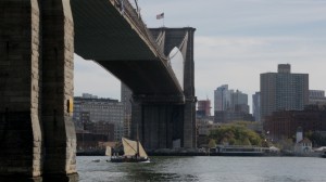
“Ceres,” vessel of Vermont Sail Freight Project, found resonance in many river communities and in New York City. Image: Vermont Sail Freight Project.

While the tiny nature of this initiative was evident to us as we passed under the huge Hudson River bridges like the George Washington and Tappan Zee, each of which was carrying thousands of times our cargo capacity per minute over the river in trucks, we still found it meaningful, and discovered that our initiative had surprising resonance in many river communities and in New York City. The river and harbor were once the preeminent conduit of life and trade, yet are now almost entirely overlooked for everything except recreation. With the addition of fairly modest docks and warehouses suited to this type of trade, we can envision not so much a re-enactment of our past, but more a carrying forward to meet contemporary challenges. The Vermont Sail Freight Project is now exploring avenues for the continuation and expansion of this work in the 2015 season, with some exciting new partnerships.

– Eric Andrus, founder of Vermont Sail Freight Project

Voice of the Future, 2014

Voice of the Future, 2014: Erik Andrus


“An about-face on the subject of transportation and infrastructure,” Erik Andrus, founder of Vermont Sail Freight Project. Photo above: vessel “Ceres.” Image: courtesy of www.vermontsailfreightproject.com.

Infrastructure. The word implies awesomeness, technical complexity, hard hats, and the oversight of engineers. For those not involved in its planning or creation, our built environment can seem largely the individual’s ability to participate or comprehend. The Vermont Sail Freight Project was conceived as an about-face on the subject of transportation and infrastructure, an attempt to borrow heavily on historical patterns and to utilize public commons to perform a service of contemporary economic relevance, and in so doing to set a mold for an alternate way of transporting and doing business that is more in tune with the limitations of our planet.

~ Erik Andrus, Founder, Vermont Sail Freight Project

Voice of the Future, 2014

Voice of the Future


Wedding of the Waters

DeWitt Clinton pours water from Erie Canal into Atlantic Ocean, marking “the wedding of the waters.” Artist: C.Y.Turner, 1905. Image credit: eriecanal.org

Connecting Lake Erie with the Hudson River, the Erie Canal created a trade route from the Great Lakes region to the Atlantic coast. The waterway facilitated development of the Midwest and accelerated leadership of New York City, located at the mouth of the Hudson on the Atlantic Ocean, as a world urban center. Credit for building the canal goes to DeWitt Clinton, political leader who served as a state senator, U.S. senator, and mayor of New York City, before becoming governor of New York State. On April 15, 1817, the New York State Legislature provided funding for Navigable Communications between the Great Western and Northern Lakes and the Atlantic Ocean. How does the Erie Canal link to Atlantic Studies and to the Atlantic Rim Network, whose mission serves “global issues, local solutions, and regional connections?” What other areas of the world, with powerful lakes and rivers that could be connected to oceans, might arrange a beneficial “wedding of the waters?”

For more on the Atlantic Rim Network:

James H. Barron, Jessica C. McWade, “Toward a New ‘New Atlanticism’,” Parallax: Journal of International Perspectives, Vol. No 1, Fall 2003, pp. 75-89.

On the Erie Canal:

eriecanalmuseum.org

Building the World Blog by Kathleen Lusk Brooke and Zoe G Quinn is licensed under a Creative Commons Attribution-NonCommercial-NoDerivs 3.0 Unported License.
45.3N x 34.4E: Power of Ports

The Crimea. Image courtesy of wikimedia.

Popular with the ancient Greeks, who called its main river Borysthenes, favored by the Romans, Bulgars, Goths and Huns, the Crimea offers port access on the northern border of the Black Sea, with the advantage of also being on the western shores of the Sea of Azov. In medieval times, the Crimean Khanate united the area, but later it became the Taurida Oblast in 1783, and still later the Soviet Crimean Oblast, transferred to Ukraine in 1954. Finally, in 1991, the Autonomous Republic of Crimea was born, only to be challenged in 2014. Why so many changes ? Advantageous port territory, milder winters, access to the Dnieper River (fourth largest in Europe). Today operating more than 12 seaports, the Crimea demonstrates the power of ports. The importance of waterways and ports can also be seen in the Canal des Deux Mers and the Erie Canal. Another famous port,  St. Petersburg, once the capital and Russia’s largest seaport, still carries the cultural imprint of its founder, Czar Peter the Great, in 1703. Can present day Crimea take inspiration from aspects of St. Petersburg’s success, including business monopolies? Perhaps in partial explanation of why the game’s greats are often Russian, St. Petersburg was once the only source of chessboards. What strategies for economic and cultural success should the Crimea envision for coordinates 45.3N by 34.4E?

Building the World Blog by Kathleen Lusk Brooke and Zoe G Quinn is licensed under a Creative Commons Attribution-NonCommercial-NoDerivs 3.0 Unported License.

Baghdad: Madinat-as-Salam

Peace Symbol. Courtesy: wikimedia commons.

Riding a white horse, Caliph al-Mansur lept from his steed, unsheathed his sword, and drew three concentric circles in the sands of the land shining before him, proclaiming: “Here we will build the City of Peace, Madinat-as-Salam.” Calendar year 145 (or A.D. 762) proved auspicious; the Caliph had indeed found advantageous terrain. On the Tigris River, a trade nexus was born, at one time the wealthiest in the world and one of the most beautiful. Since then, the world has known that city under a different name: Baghdad. It is a place now rebuilding: new infrastructure, new water and energy systems, and perhaps a new vision. New Baghdad has an opportunity to claim its destiny of Madinat-as-Salam, City of Peace.

Building the World Blog by Kathleen Lusk Brooke and Zoe G Quinn is licensed under a Creative Commons Attribution-NonCommercial-NoDerivs 3.0 Unported License.

Power in Egypt

Giza pyramids and Sphynx, Library of Congress at loc.gov

As Egypt forms a new cabinet, will Prime Minister Hazem el-Beblawi consider rights — human and environmental? Electricity Minister Ahmed Imam, initially appointed by Morsi, must now address Egypt’s growing power needs (http://www.aljazeera.com/indepth/spotlight/egypt/2013/07/20137195138823979.html). Might Egypt draw lessons from the High Dam at Aswan?

Creative Commons License
Building the World Blog by Kathleen Lusk Brooke and Zoe G Quinn is licensed under a Creative Commons Attribution-NonCommercial-NoDerivs 3.0 Unported License.

Bright Idea – TVA

http://www.publicdomainfiles.com/images_view/51/13525742419998.png

Did the United States become a society driven by electricity because of the Tennessee Valley Authority (TVA)? Tesla proved water could produce electricity;  the Hoover Dam, followed closely by the Tennessee Valley Authority, supplied it. But it took Norris town to show people how to use this new energy. Designed as housing for the women, men and families who came to the Knoxville area to work on the TVA, Norris was a showcase for electricity. At a time when few homes had wired power, the town offered refrigerators in every kitchen, and overhead lights on the porches of every house (porches were a hallmark of Tennessee life and remain popular today, evidenced by Porch Rocker and Parton songs). Well-lighted public schools invited new environments for learning. Peak/off-peak and low rate/high use policies were another innovation, encouraging development of all things electric. Can Norris and the TVA reveal ways to demonstrate products and power from new energy sources, such as solar? What is the next bright idea?

Building the World Blog by Kathleen Lusk Brooke and Zoe G Quinn is licensed under a Creative Commons Attribution-NonCommercial-NoDerivs 3.0 Unported License.

Agua – Colorado River

Colorado River in Mexico. Library of Congress, United States, LC-DIG-stereo-1s00953.

Minute 319 might not solve the problem. Some say Mexico and the United States need to take a radically different approach. The November 10, 2012 decision of the International Boundary and Water Commission of the United States and Mexico tried to address effects of the 2010 earthquake in the Mexicali Valley, Baja California, on the Colorado River Basin (www.ibcw.gov/Files/Minutes/Minute_319.pdf). In 1922, the Colorado River was parceled among the Upper Basin United States of Wyoming, Colorado, Utah and New Mexico (9.25 billion cubic meters per annum) and the Lower Basin Arizona, California, Nevada (10.45 billion cubic meters. By 1944, Mexico claimed their, previously unspecified, water rights (1.85 billion cubic meters per annum). Rights of Native Americans, including the Navaho, would follow, determined decades later, perhaps advantageously in this age of water valuation. In 1922, it was not easy to estimate water needs; original allocation of the Colorado River was set above projected needs. Add to that the fact that in the 1920’s the river’s flow was above-normal (http://www.forbes.com/sites/stratfor/2013/05/14/u-s-mexico-the-decline-of-the-colorado-river/). Organizational structure and management of the river lacks basin-wide coordination. Many might agree with Professor of Law Gabriel Eckstein’s recommendation that Mexican and United States “subnational entities at the regional and local level pursue cooperation in the form of locally-specific, cross-border arrangements” (www.internationalwaterlaw.org). For example, Nogales, Sonora businesses have cooperated with the public water authority of Nogales, Arizona, for more than 40 years. Deciding sustainable use policies of transboundary water resources might be part of the future of Tratado de Libre Comercio de America del Norte (TLCAN) or also known as NAFTA, upon its 20th anniversary on January 1, 2014. What is the future of water rights in North America? Other regions? What is the destiny of water? Agua de mayo, pan para todo el año.

Building the World Blog by Kathleen Lusk Brooke and Zoe G Quinn is licensed under a Creative Commons Attribution-NonCommercial-NoDerivs 3.0 Unported License.

Connection and Innovation

Worker on the Erie Canal, From Library of Congress, at loc.gov.

Linking Lake Erie via the Hudson River to New York City, the Erie Canal changed the economy of the United States. Internal waterways have stimulated advances in culture and exchange dating back to China’s Grand Canal. Many jobs were created; workers flocked to construction sites along the route. They lived together in camps, developing team organizational skills that would characterize American business. Innovation flourished; Erie saw the first hydraulic cement used in the United States. Open for business in 1825, the waterway was an instant success. Before it cost $100 per ton to transport goods over land; now, $10 per ton. A museum dedicated to the Erie Canal is housed in the only existing weighlock building in the United States (http://eriecanalmuseum.org). The Erie Canal could be called the Internet of its day: both were connection routes financed by government but developed by the private sector. Entrepreneurial ventures sprang up, soon exceeding initial cost of building the route. How does connection stimulate innovation? What’s beyond the Internet?

Creative Commons License
Building the World Blog by Kathleen Lusk Brooke and Zoe G. Quinn is licensed under a Creative Commons Attribution-NonCommercial-NoDerivs 3.0 Unported License.

Charles Ives’ “The New River”

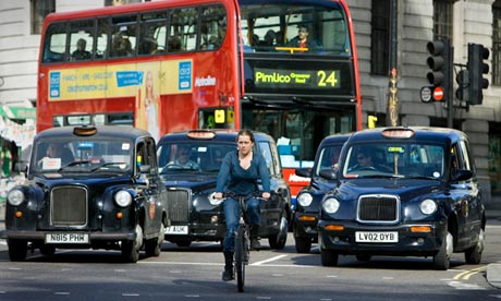
London traffic, from The Guardian, at guardian.co.uk.

The American composer’s “The New River” is a song that in title might sound as if it were about England’s human-made waterway, but instead Ives talks about a different kind of river, one of noise. The song for voice and piano has these lyrics:

“Down the river comes a noise!

It is not the voice of rolling waters.

It’s only the sound of man,

phonographs and gasoline,

dancing halls and tambourine;

Killed is the blare of the hunting horn.

The River Gods are gone.

Fortunately, the New River in England continues to preserve its bucolic nature through walking paths designed to help the public admire the English countryside not too far from London. In fact, some would say that without the beauty of the walking paths and their healthy lifestyle, Britain could have been less attractive due to the river of noise. Consider London Monday morning traffic reports.

Creative Commons License
Building the World Blog by Kathleen Lusk Brooke and Zoe G. Quinn is licensed under a Creative Commons Attribution-NonCommercial-NoDerivs 3.0 Unported License.