Treasure Hunt: Grand Canal


King Wen, Zhou Dynasty. Image: wikimedia commons.


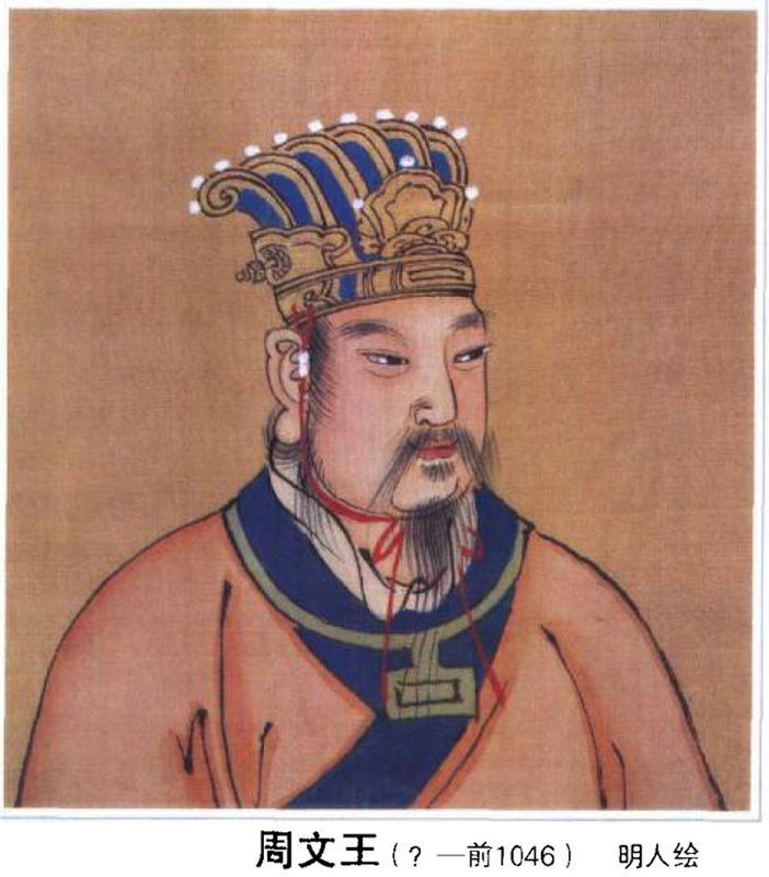
Yang Junxi, aged eleven, was just washing his hands, but he touched history. When the lad dipped digits into China’s Laozhoulin River, he felt an object, pulled it out and brought home a 3,000-year-old bronze sword of 10-inches (26cm) length. It was probably never used for fighting, but instead is judged by the Gaoyou Cultural Relics Bureau to be an artistic rendering, perhaps belonging to an official of the Shang or Zhou dynasties. Junxi’s father, Jinhai, and his son who donated the precious relic, have been heralded. Perhaps more treasures will be found as China plans an archeological exploration in this river that formed part of the Grand Canal. In Egypt, a similar expedition might discover Nubian art hidden beneath the High Dam at Aswan. In the future, should Lares be placed in significant infrastructure?

For more: http://www.bbc.com/news/blogs-news-from-elsewhere-29108764

Building the World Blog by Kathleen Lusk Brooke and Zoe G Quinn is licensed under a Creative Commons Attribution-NonCommercial-NoDerivs 3.0 Unported License.


Nicaragua v. Panama

Panama and Nicaragua will both offer canals. Image: wikimedia.

Nicaragua, once intended site for a canal that changed location due in part to a postage stamp, has announced the building of a waterway that will challenge the Panama Canal. The controversial decision weighs benefits of employment and commerce with environmental and other concerns. What might Nicaragua learn from Panama and Suez?

For more on the proposed Nicaraguan canal:

http://www.bbc.com/news/world-latin-america-28206683

http://www.huffingtonpost.com/2013/12/14/nicaragua-canal-repercuss_n_4445707.html

Building the World Blog by Kathleen Lusk Brooke and Zoe G Quinn is licensed under a Creative Commons Attribution-NonCommercial-NoDerivs 3.0 Unported License.


Horse that Changed History

Kentucky Derby winner, 1912. Image: wikimedia.org.

When friends pitched their tent against a high wall to shelter from winds, during their reunion expedition, campfire conversation soon accelerated to boasts and dares. To prove his point, one of the group jumped upon his steed, prepared for a gallop and jumped the wall. No one else dared attempt such a feat. The party’s organizer offered the horse-rider anything in his power to grant. The answer: permission to build the Suez Canal. It was thus that Mohammed Pasha al-Said of Egypt gave authorization to Ferdinand de Lesseps to build the Suez Canal. Many years later, a very different story resulted in a very different canal, Panama. First envisioned by Sesostris, used by the Egyptians in 1380 BCE, connected to the Red Sea a millennium later by Ptolemy Philadelphus, the Suez Canal opened to great fanfare in 1869. Verdi’s opera “Aida” was commissioned to celebrate the waterway.

Building the World Blog by Kathleen Lusk Brooke and Zoe G Quinn is licensed under a Creative Commons Attribution-NonCommercial-NoDerivs 3.0 Unported License.

Wedding of the Waters

DeWitt Clinton pours water from Erie Canal into Atlantic Ocean, marking “the wedding of the waters.” Artist: C.Y.Turner, 1905. Image credit: eriecanal.org

Connecting Lake Erie with the Hudson River, the Erie Canal created a trade route from the Great Lakes region to the Atlantic coast. The waterway facilitated development of the Midwest and accelerated leadership of New York City, located at the mouth of the Hudson on the Atlantic Ocean, as a world urban center. Credit for building the canal goes to DeWitt Clinton, political leader who served as a state senator, U.S. senator, and mayor of New York City, before becoming governor of New York State. On April 15, 1817, the New York State Legislature provided funding for Navigable Communications between the Great Western and Northern Lakes and the Atlantic Ocean. How does the Erie Canal link to Atlantic Studies and to the Atlantic Rim Network, whose mission serves “global issues, local solutions, and regional connections?” What other areas of the world, with powerful lakes and rivers that could be connected to oceans, might arrange a beneficial “wedding of the waters?”

For more on the Atlantic Rim Network:

James H. Barron, Jessica C. McWade, “Toward a New ‘New Atlanticism’,” Parallax: Journal of International Perspectives, Vol. No 1, Fall 2003, pp. 75-89.

On the Erie Canal:

eriecanalmuseum.org

Building the World Blog by Kathleen Lusk Brooke and Zoe G Quinn is licensed under a Creative Commons Attribution-NonCommercial-NoDerivs 3.0 Unported License.

45.3N x 34.4E: Power of Ports

The Crimea. Image courtesy of wikimedia.

Popular with the ancient Greeks, who called its main river Borysthenes, favored by the Romans, Bulgars, Goths and Huns, the Crimea offers port access on the northern border of the Black Sea, with the advantage of also being on the western shores of the Sea of Azov. In medieval times, the Crimean Khanate united the area, but later it became the Taurida Oblast in 1783, and still later the Soviet Crimean Oblast, transferred to Ukraine in 1954. Finally, in 1991, the Autonomous Republic of Crimea was born, only to be challenged in 2014. Why so many changes ? Advantageous port territory, milder winters, access to the Dnieper River (fourth largest in Europe). Today operating more than 12 seaports, the Crimea demonstrates the power of ports. The importance of waterways and ports can also be seen in the Canal des Deux Mers and the Erie Canal. Another famous port,  St. Petersburg, once the capital and Russia’s largest seaport, still carries the cultural imprint of its founder, Czar Peter the Great, in 1703. Can present day Crimea take inspiration from aspects of St. Petersburg’s success, including business monopolies? Perhaps in partial explanation of why the game’s greats are often Russian, St. Petersburg was once the only source of chessboards. What strategies for economic and cultural success should the Crimea envision for coordinates 45.3N by 34.4E?

Building the World Blog by Kathleen Lusk Brooke and Zoe G Quinn is licensed under a Creative Commons Attribution-NonCommercial-NoDerivs 3.0 Unported License.

Special Economic Zones – SEZ

Canal des Deux Mers. Image: Wikimedia Commons.

Historians might trace the first SEZ to 1666, citing the Canal des Deux Mers or Canal between the Two Seas. Connecting the Atlantic to the Mediterranean, the Canal was an economic success; using a medieval model, Pierre-Paul Riquet worked with the French government to make the route an independent fief. Special Economic Zones (SEZ) in more recent times must include Puerto Rico in 1942, and economists point to Shenzhen as the very important first SEZ in China; once a village, Shenzhen grew rapidly when advantageous business and tax laws were granted in the 1980’s to promote commerce. Recent research by the World Bank explores SEZ success factors. It must be noted that many Special Economic Zones involve water locations. The Canal des Deux Mers is not just an economic but also an environmental achievement, preserving and enhancing a waterway that today is a World Heritage Site. Can France’s Canal des Deux Mers inspire new forms of environmentally wise SEZ development? Might the Dutch success of protective dikes and land reclamation be emulated in coastal environments?  Will Frank Davidson and Ernst Frankel prove visionary in proposing a free-trade zone enhanced by artificial islands or reclaimed land from the sea offshore Israel and Jordan?

Building the World Blog by Kathleen Lusk Brooke and Zoe G Quinn is licensed under a Creative Commons Attribution-NonCommercial-NoDerivs 3.0 Unported License.

China’s Waterway of Destiny

Emperor Wen of Sui, by artist Yan Liben. Image, Wikimedia.

Longest artificial river in the world, China’s Grand Canal may also be the longest construction project in history. Begun by Emperor Wen of Sui (pictured above) and improved by Kublai Khan, the waterway stretches 1,1118 miles (1,800 kilometers). A new program announced in 2002, to reverse the flow of water with a south-to-north diversion to bring hydration from the moist, agricultural south to the drier north, will be completed in 2050. Scholars believe the Grand Canal may have transformed a region into a nation: the inland waterway encouraged communication among diverse groups, leading to standardization of the written form of a language that came to be called Chinese; encouraged trade and exchange; and created a common culture. The destiny of a nation, or a region, may be found in the value, and use, of its water. For more on China, visit http://www.umb.edu/confucius/.

Building the World Blog by Kathleen Lusk Brooke and Zoe G Quinn is licensed under a Creative Commons Attribution-NonCommercial-NoDerivs 3.0 Unported License.

Fruits of Exchange: Solomon’s Temple


Image: wikimedia commons

Solomon’s Temple was built through an exchange organization. Hebrews met Phoenicians at the dock to receive cedars from barges sailed from Tyre; ships returned laden with grain and oil. Fast forward to the sailing freighter that arrived from rural Vermont to urban New York City on October 26, 2013. In the Kickstarter and Willowell Foundation success that recalls an exchange 3,000 years earlier, Ceres docks in New York City with organic farm bounty; upon return, supplies and materials are welcomed by rural Vermonters (http://vermontsailfreightproject.wordpress.com/). But Solomon’s Temple is inspiring for another reason: the cedars mentioned above were from Lebanon. Solomon’s Temple is one of the first organizations in recorded history to feature cooperative exchange and technology transfer between neighboring nations. Today, where might similar exchange organizations contribute to education and technology, shared natural resources including water, food security, energy, public health and regional disaster response, transport and trail systems, and perhaps even peace?

Building the World Blog by Kathleen Lusk Brooke and Zoe G Quinn is licensed under a Creative Commons Attribution-NonCommercial-NoDerivs 3.0 Unported License.

Pipelines: Trans-Alaska and Beyond


What do you think of the proposed Keystone XL Pipeline? Image courtesy of senate.gov

When the Trans-Alaska Pipeline opened in 1977, 20,000 people had contributed to the project. Results were mixed: revenue benefit brought $900 million to Alaska’s economy but exploitation of the large petroleum deposits discovered in 1968 at Prudhoe Bay in Alaska’s North Slope were scene to the largest oil spill in United States history at that time: the Exxon Valdez released a flood of pollution with long-lasting effects. But Yoshihiro Kyotani, Japanese engineer and innovator, proposed that pipelines need not be filled with just oil. Why not float transoceanic pipelines as transport tubes for container shipping or vactrains? Along with the Channel Tunnel‘s Frank P. Davidson, Yoshihiro Kyotani designed tubetrains that may be the original version of Elon Musk’s 2013 Hyperloop. For more on Kyotani, please see: http://www.ieeeghn.org/wiki/index.php/Oral-History:Yoshihiro_Kyotani. But today all eyes are on a pipeline in the news: Keystone XL. It’s a complex issue; for more, visit http://www.newyorker.com/reporting/2013/09/16/130916fa_fact_lizza?mbid=social_retweet. Then please return to our blog and let your voice be heard regarding pipelines transporting energy, or perhaps floating as a vactrain from Boston to Cadiz.

Building the World Blog by Kathleen Lusk Brooke and Zoe G Quinn is licensed under a Creative Commons Attribution-NonCommercial-NoDerivs 3.0 Unported License.

Connection and Innovation

Worker on the Erie Canal, From Library of Congress, at loc.gov.

Linking Lake Erie via the Hudson River to New York City, the Erie Canal changed the economy of the United States. Internal waterways have stimulated advances in culture and exchange dating back to China’s Grand Canal. Many jobs were created; workers flocked to construction sites along the route. They lived together in camps, developing team organizational skills that would characterize American business. Innovation flourished; Erie saw the first hydraulic cement used in the United States. Open for business in 1825, the waterway was an instant success. Before it cost $100 per ton to transport goods over land; now, $10 per ton. A museum dedicated to the Erie Canal is housed in the only existing weighlock building in the United States (http://eriecanalmuseum.org). The Erie Canal could be called the Internet of its day: both were connection routes financed by government but developed by the private sector. Entrepreneurial ventures sprang up, soon exceeding initial cost of building the route. How does connection stimulate innovation? What’s beyond the Internet?

Creative Commons License
Building the World Blog by Kathleen Lusk Brooke and Zoe G. Quinn is licensed under a Creative Commons Attribution-NonCommercial-NoDerivs 3.0 Unported License.