The Fiske Center Blog

Weblog for the Fiske Center for Archaeological Research at the University of Massachusetts Boston.

September 24, 2019
by katherinealbert001
4 Comments

Working in a New Medium: Filming the Burial Hill Excavations

By Kati Albert

Early in the morning during the last week of the Plymouth Field School, a general question went out to the students: “Does anyone know how to use a video camera?” Tentatively, I raised my hand. I didn’t tell anyone I had only edited films before, was a self-taught home-movie maker, and only had experience taking still shots. Still, I volunteered myself, because in my mind there was a first time for everything, including shooting footage with a video camera I had never worked with before. Ten minutes later, I had a new video camera in my hands and the mission to begin filming the excavations in progress.


There was a reason for the video equipment on the site. As part of the exhibit for the Plimoth Plantation Museum, the Fiske Center for Archaeological Research wanted to create a short film to complement the artifacts and text on display in a new exhibit that in the works. The film would also explain why we are studying Burial Hill, what we are looking for, and what some of the finds were from the 2019 field season. My vision for the film was to be a showcase for the students’ work as they excavated, screened, drew illustrations of the stratigraphy, and found artifacts in the field.

I felt honored to be given the task of documenting the excavations “on film”. It was a phenomenal opportunity to be creative and to hone my skills as a filmmaker. I was given free reign to wander the site, capturing both the exciting discoveries, and turning the mundane processes of archaeology into visually compelling art. Everyone was very supportive of my efforts, and willing to explain what they were doing, or give a short interview about their experiences at the field school.


Filming on an open excavation site was challenging to say the least, especially without any time to plan what I wanted to record. As such, I had little choice but to film “guerrilla style”, with the camera clutched in my hands and my ears and eyes constantly on alert for any interesting find or insightful conversation. I was poised at the ready for something worthy of being documented to happen anywhere on the site.
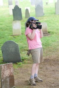
Photo by Melody Henkel

Of course, I was only a one-woman crew, and the field was not a soundstage, nor anything close to a controlled environment for filming, and this was reflected in the daily footage. For every great scene I shot were dozens of shots that were unusable because of too much background noise, too much shaking, or the action was caught just a split-second too late. I could not get as close to the some excavations as I wanted to which cost me informative visuals and precious explanatory dialog. I regretted letting those opportunities slip past my lens.


Nevertheless, I was proud of what I shot. In total, I had recorded about 35 gigs (several hours) of footage over the course of a day and a half.  I caught so many interesting and beautiful moments that show the hard work of the excavators and the complex nature of Burial Hill. So much of the archaeology translated well to a visual medium, including screening, sampling, and stratigraphy profiling. Additionally, I was glad that footage captured the feeling of being in the field, as well as the efforts of the students as they dug. This was because I had been adamant that I did not want to recreate any scenes of discovery, but instead I wanted to create an atmosphere of authenticity. I would rush over and try to capture scenes and exchanges between the students as they were happening.


Now that I had finished shooting, the next step was editing—a process that still has not ended.

Screenshot of the editing software with several clips queued up. Photo by author

Screenshot of the editing software with several clips queued up. Photo by author


Much like the unofficial rule of thumb for archaeology, “for every day in the field you can expect 3 or 4 days in the lab”, the same is true for filmmaking. Editing and post-production has been a long, slow, and meticulous process. I have been using iMovie to go through my footage and turn it into a viewable film. This software allows me to trim the video clips, arrange and rearrange the clips to be convey a narrative, edit the sound to take out the background noise or enhance the voices, and add subtitles and voice over. My goal is to make a film that is both informative and visually engaging; something that is appealing to both archaeologists and to the general public.

The final version of the film will be released in late 2019. Also in progress are two other short films that were shot during the Burial Hill excavations this summer: one showing the work of the survey crew performing a geo-physical survey of Burial Hill, and one with student interviews of their experiences on Burial Hill. These films, I hope, will allow us to share the Plymouth Project to a wider audience, and show the broader public the all processes of archaeological excavation and the dedicated crew who worked on recovering Plymouth’s early history.

June 13, 2019
by katherinealbert001
0 comments

The View from the Hill: A Brief Progress Report on the Burial Hill Excavations

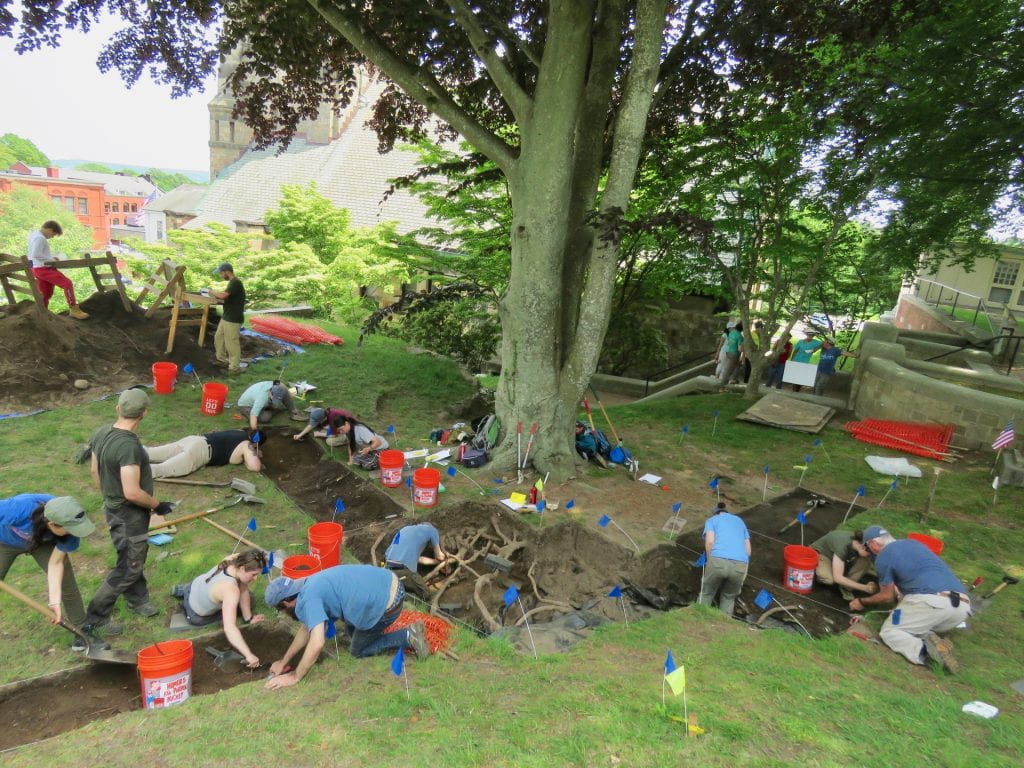
The view from Burial Hill looking down on several excavation units

Greetings from Plymouth, MA! The excavations on Burial Hill are in full swing, and there is quite a lot happening. Every day the piles of dirt grow, and every day, as the students dig deeper in their excavation units, more artifacts from the 17th, 18th, and 19thcenturies are recovered. Though we’ve had a few set backs from rain days, we have accomplished a lot during our week and a half on the Hill.

It may be dirty but the view sure is nice

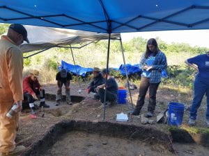
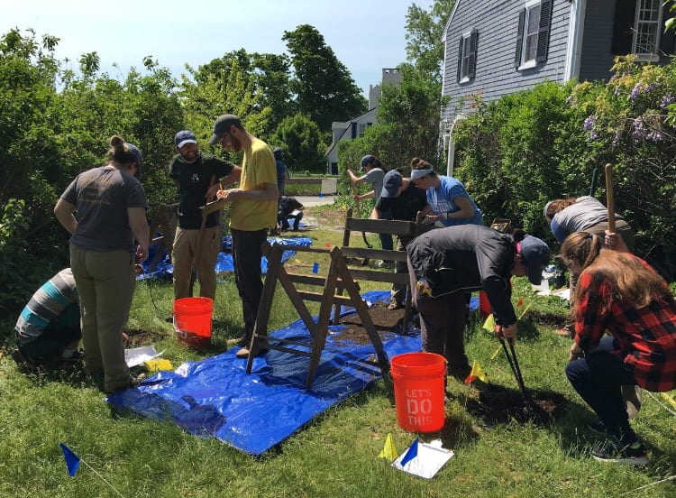
Students screening the soil from their excavation units looking for artifacts


The excavation site on Burial Hill is located at the edge of the cemetery on one side, and a crypt dating to the 1830s on the other. Though the slope can be intense, we still have plenty of room for our 24-person crew of students, TAs, Fiske Center faculty, members from the Mashpee Wampanoag, and local volunteers to work.

Broadly speaking, there are two components of the site we are looking into: an intact Native American site (most likely a Wampanoag occupation from the 16thor 17thcentury) on the northern edge of the Hill, and on the south side, a structure dating to the 17thcentury. As we dig, we hope to learn the how large these two areas of interest are and crucially, how they relate to each other in space and time.

Additionally, we are also looking for evidence of the 17thcentury palisade, a barricade that would have enclosed the early settlement. Though we’ve dug in some likely locations for the palisade, we’ve had no luck so far finding any evidence. Now, new units have been opened up that connect the northern half of the site to the southern half, with the hope of showing not only what the soil layering looks like across the hill, but also increased odds that we will find the stains in the soil from the posts of the palisade.


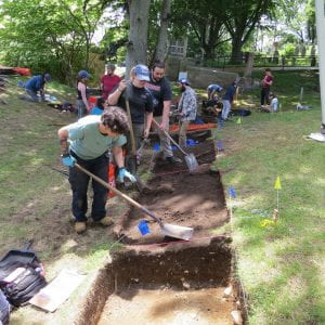
Work begins connecting the two halves of the site together with two more excavation units


On the northern half, several excavation units have been opened to recover the extent of the Native American site that was excavated in 2016 and 2017, and to see if there is a clear definition between the inside of the Pilgrim settlement, and outside of the settlement. So far, the students have recovered only a few pieces of Native American ceramic and flakes from stone tool making, and very few artifacts that are likely from the colonial period, which seems to support our hunch that as we move towards the structure, we are moving inside the Pilgrim’s settlement. All we need to do is find evidence of the Pilgrim’s palisade and we’re golden!


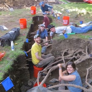
Excavation units which contain a 17th-structure

Excavation units which contain a 17th-structure

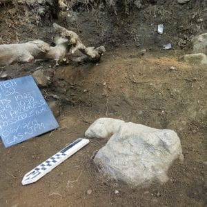
On the southern end of the site, in the shade of a large copper beech tree, there is evidence of a 17thcentury structure on the southern side. Stains in the soil from last year’s excavation suggest that a building stood on the side of the hill in the mid-17thcentury. This year, the students are not only working in last year’s excavation units to continue digging down to 17thcentury soils, but also expanding the previous seasons’ excavation units to find the extent of this structure. However, most of the artifacts recovered so far from these new units have been from the 19thcentury, but as we dig deeper we are finding more materials from the 17thcentury. Notable finds from these excavations include some beautiful pieces of pottery, a button, and lots of glass, nails, and daub (plaster used for insulation in early houses). These will undergo cleaning and analysis in our labs.


There’s still plenty of more work to be done and only 2 weeks left here in Plymouth. Feel free to come visit us on Burial Hill during the week for daily updates on our progress and to see archaeology in action!

The possible foundations of a wall inside an excavation unit with architectural artifacts

The possible foundations of a wall inside an excavation unit with architectural artifacts

Photo Credits: Christa Beranek

June 13, 2019
by ericalang001
0 comments

The 2019 Hassanamesit Field School

On May 29th, Hassanamesit Woods Field School students returned to Grafton, Massachusetts to continue work at the Deb Newman site. Last year’s 2018 field school unearthed the remains of an eighteenth-century Nipmuc wetu, but due to time constraints they were unable to fully finish excavating the area. This year’s field school students will spend three weeks working at the Deb Newman site, and then travel to Shelter Island, New York to excavate at Sylvester Manor – a 17th century provisioning plantation that was an arena of interaction between its English owners, the Sylvesters, the enslaved Africans who lived and worked there, and the local indigenous populations who may have either traded with or worked for the Sylvesters as well.

Led by Dr. Stephen Mrozowski, Dr. Heather Trigg, and teaching assistant Gary Ellis, the field school students spent the first week in the field uncovering last year’s excavation units to finish photographing, drawing plan views and wall profiles of several units, and excavating features that were not finished last season. Features are an important component to archaeological sites, especially at this 2019 field school which is focused on unearthing a wetu. At Hassanamesit Woods, we typically find features such as post holes, hearths, stone walls, and other amorphous soil stains. These components are able to reveal more about the architecture and general use of the area by the Nipmuc.

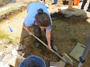
Claire excavating a unit level.

During the second week of the field school, students broke ground on five new units while also continuing to work in last year’s units. With the new units, we are hoping to find features that can provide insight into the layout of the wetu and how the Nipmuc were utilizing the space to better understand their lives. While excavating, the field school students need to be particularly careful. Because features are such an integral component of the Deb Newman site, everyone must watch for any subtle sign of change in soil color and texture, which can indicate a potential feature. So far, a few possible post holes have been unearthed and more features with charcoal, ash, and burnt soil were uncovered, suggesting the area could have been used for food preparation or as a heat source.

Among the various types of cultural material uncovered including pearlware, creamware, glazed redware, and iron nails, some of the particularly unique artifacts found thus far include two fragments of flat window glass with tooled edges. The tooled edges indicate that the Nipmuc were modifying consumer goods in order to use it as a tool. In this case, perhaps the worked glass was used as a scraper for woodworking or on animal hides.

Dennis describing the process of taking soil samples from the field to later analyze in his lab.

Archaeology is a highly collaborative discipline, and field school students experienced firsthand the ways that Fiske Center staff often lend their specialized skills to ongoing projects. For instance, this past week Dr. Trigg collected soil samples to examine phytoliths, or microscopic plant matter that usually survives well in the ground. In doing so, Dr. Trigg hopes to determine which organic materials were used by the Nipmuc when building the wetu. Dennis Piechota, the archaeological conservator of the Fiske Center, also joined the crew for a day in the field. He painstakingly carved out blocks of soil from features to take back to his lab, where the micro-stratigraphy of the samples can be analyzed to better understand the features, and by extension the people who created them.

As the field school enters its final week at Hassanamesit Woods, students and faculty are excited to continue unearthing the past to see what other features and artifacts will be revealed, so that we can learn more about the long history of the Nipmuc in Grafton.


June 6, 2019
by Christa Beranek
0 comments

Plymouth field school 2019: shovel test pits

Shovel test pit excavations

UMass is back in Plymouth for a 7th field season!

By Anya Gruber

Excavations are underway for UMass Boston’s 7th field season in Plymouth, MA! Over the years, UMass’s team has excavated in three areas across the town–Burial Hill, Brewster Gardens, and Cole’s Hill–and this year we’ve added a lot off Carver Street to the list, and have returned to Burial Hill to build off the very exciting discoveries we made last field season.


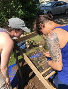
Screening

TA Megan (left) and Mariah, from the Mashpee Wampanoag Tribal Historic Preservation Office, look for artifacts in the screen.

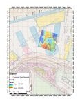
The Carver Street lot is actually two pieces of land; one is owned by Plymouth residents and local history enthusiasts, while the other is owned by the town. This spot is located just down the road from Cole’s Hill, in an area that has a long settlement history. Based on historic maps and records, oral history, and previous excavations at nearby sites, we believe that this may have been inside the eastern edge of the palisaded village established in the 1620s. The Fiske Center’s resident geophysics wizard Dr. John Steinberg, alongside graduate students Melissa and Megan, conducted an extensive GPR (ground penetrating radar) survey to better understand what lies beneath the soil here. The GPR data showed a few anomalies that may belong to a building foundation, or perhaps a stone wall. But we won’t know until we dig a little further!
 

GPR survey

John, Megan, and Melissa walk the GPR unit on Burial Hill to create maps which inform our excavation plans for the summer.

Once we’re done on Carver Street, we’ll move on to our main site at Burial Hill. This location has seen the majority of UMass’s work in Plymouth, and has yielded incredible insights into the early colonial and Native histories from the deep to the recent past. Last year, we concentrated most of our work on the western side of the crypt, and we will continue that pattern this year. We’re keeping our fingers crossed that we’ll find some more 17th century artifacts and preserved features this summer!

January 15, 2019
by John Steinberg
0 comments

The Langone Park Ceremony: Marking 100 Years Since The Great Molasses Flood

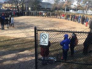
Circle of people forming the outline of the tank that burst 100 years ago today.

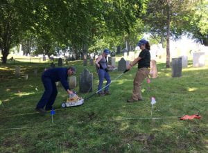
Based on the work of Fiske Center Archaeologists, Joe Bagley (The Boston City Archaeologist) was able to recreate the outside edge of the tank that burst and caused the Molasses Flood disaster.   Joe asked folks to stand along that circle during the ceremony of remembrance.  This happened at 10:30 AM on Tuesday January 15, 2019 at Langone Park, marking  100 years since the Great Molasses Flood.  John Steinberg, Melissa Ritchey, & Jocelyn Lee represented the Fiske Center and demonstrated how the GPR worked after the ceremony.

Memorial wreath with Joe talking in the Background

Jocelyn Lee & Melissa Ritchey demonstrating the GPR unit

Melissa Ritchey & Jocelyn Lee standing in the circle with the GPR unit.

(update Jan 16, 2019) The event received some press coverage:

An article by  in the Boston Globe — Boston officials remember the Great Molasses Flood, 100 years later 

An article by Matt Conti in the North End Waterfront – Human Circle Commemorates 100th Anniversary of Great Molasses Flood

January 14, 2019
by John Steinberg
0 comments

Results of Geophysical survey at Langone Park: 100 Years since the Great Molasses Flood

By John M. Steinberg & Grace E. Bello

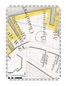
View of softball diamond at Langone Park.  The infield  and pitcher’s mound is outlined in brown, which helps to orient the following geophysical images.

As we said in our previous post,  the City Archaeologist, Joe Bagley asked us at the Fiske Center if we could conduct a geophysical survey over the area of Langone Park that, 100 years ago, had a tank which ruptured and caused The Great Molasses Flood of 1919.  This is in preparation for Tuesday January 15th, 2019—the 100th anniversary of the disaster.

Grace Bello beginning to set up the geophysical grid by placing PVC flags along the first base line.

For our archaeological geophysical survey, we used two common techniques: ground penetrating radar (GPR) and electromagnetic (EM) conductivity.  The area was first prepared for the survey by placing out a grid of PVC flags.  Because the grid was oriented to the softball diamond, the locations of each of the corner flags (and many of the intermediate flags) were recorded with a survey grade GPS.

John Steinberg walking along the third base line with the CMD-Mini.

First, John used the CMD-MiniExplorer conductivity meter, which requires the operator to walk across the target area holding the unit just above the ground.  These transects are then combined to create a  conductivity map of the subsurface. The CMD-Mini creates a data set with two components at three different “depths.”   The different depths are from the three different receivers in the orange tube at various distances from the single transmitter.  The farther apart the receiver from the transmitter, the “deeper” the reading (1 is the closest, 3 is the farthest and thus deepest).   The two components are complex.  The Quadrature component, usually called bulk conductivity (Con) represents the apparent conductivity of the volume of earth under the unit and is measured in milli-Siemens per meter (mS/m).   Good conductors (e.g., salty wet earth) have high conductivity, while poor conductors (e.g., rocks) have low conductivity.  The in-phase component (IP) is usually expressed in parts per thousand (ppt) and is very sensitive to buried metal.  Thus, we have a total of  six different maps from the CMD-Mini: Con1 & IP1, Con2 & IP2, and Con3 & IP3.

Grace Bello with the Malå GPR unit.

Second,  Grace and John walked back and forth dragging the Malå GPR unit with a 500 MHz antenna.  The GPR unit sends out microwaves and if there is a change in soil moisture (or some other similar property) some of the microwave energy will be reflected back up to the GPR unit, which also has a receiver.  The GPR unit then, like the CMD, collects data along transects which produce a data stream called a radargram. Multiple transects are combined and then sliced at different depths, which allows us to create a series of maps that depict some of the aspects of the changes in the subsurface at different depths.   We created 25 different slices, but only present two below.

Example radargram from the transect 5 m (16.5 ft) north of the third base line.

Outlines of  all the structures from the maps described in our previous blog post

In our recent blog post, we describe the georeferencing of various historic maps of Langone park.  When all of the various structures depicted on these maps are combined, you can get a sense of just how complex this lot is.  Many of the structures may be the same structure, but  with slightly different locations provided by different maps, and we do not know how accurate any of them are.  In this case, we have been asked to identify one of the last structures on the lot.  Generally, the construction of  later structures compromises or destroys the earlier structures.  Thus, our most likely potential target is an area where there is a broad, consistent absence of distinct structures. Furthermore, given the hasty construction of the tank, any remements are probably shallow.  This approach is in stark contrast to our usual method—where we are trying to identify remnants of the earliest structures.

GPR slice 50 cm (about 20 in) below the ground surface.

GPR slice 150 cm  (about 60 in) below the ground surface.

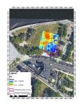
Starting with the GPR results, there is a distinct hard reflector 50 cm below the ground surface (bgs). This hard reflector is circled in pink.  This infield hard reflector is distinct from the outer edge of the infield (marked in brown).  This hard reflector is potentially caused by the remnants of the tank in question.  That being said, we want to be a little careful, because this hard reflector is almost the same as the grass infield area from when this was a little league diamond.  However, this slice is a little too deep to show that contrast.  Furthermore, the wide dirt path from the mound to home plate is not visible in this slice.  Both of these lines of evidence suggest that this hard reflector is a result of current or recent landscaping. The deepest GPR slices do not seem to show remnants the tank but instead show some of the potential dock and landfill boundaries, just to the north of first base.  Interestingly, this dominant southeast angle does not reflect any of the structures or orientations seen in our georeferenced maps.

In-phase for the most shallow CMD-Mini readings (IP1). The potential tank location is in pink.

In-phase for the middle  CMD-Mini readings (IP2).

The CMD-Mini yields much more complex results that correspond to many of the structures outlined in the georeferenced maps.  Starting with the IP components, IP1 shows a blue (high IP) area in the infield that corresponds to the area identified in the GPR (again circled in pink).  Just north of the first base line, in right field, is a rectangular blue area that has the same general dimensions and orientation as the structure seen in the 1917 map, just north of the tank in question.  That structure has an add on (in brown) that curves along the curve of the tank that touches 1st base. The potential tank area is more distinct in the deeper components (IP2 & IP3), while the building in right field is less distinct.

Conductivity for the most shallow CMD-Mini Readings (Con1).

The bulk conductivity component of the data from the CMD-Mini is much more complex, but all three sensor-transmitter distances show the same basic map.

In-phase for the deepest CMD-Mini readings (IP3). The potential tank location is in pink

Conductivity for the middle CMD-Mini Readings (Con2).

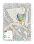
The Slatter 1852 Map with Con3 superimposed.

The Bromley 1917 map with Con3 superimposed.

Unlike the IP, the Con does not hint at the tank location, there are three high (blue) conductivity areas that seem to correspond to the distribution and orientation of structures in some of  the georeferenced maps.  The blue area in left center field matches quite closely with the angled structure drawn in the 1852 Slatter map.  Some of the low conductivity lines (which could be lines of rocks) correspond to lines drawn in that 1852 map.  Once a property orientation is established, it tends to persist.  Thus, it is not surprising that the geophysics can correspond to more than one map.  Specifically, the three blue areas in the outfield roughly correspond to the three drawn structures abutting the tank in question depicted in the 1917 Bromley map.

Proposed location of tank superimposed on air photo.

While in both the 1852 and 1917 maps the correspondences with geophysical readings and drawn structures  are not exact, they are well within the range of accuracy that we usually see with these kinds of maps.

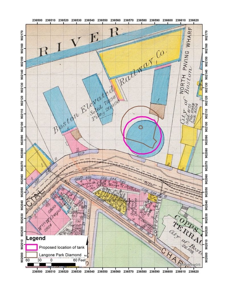
When all of our data is combined (the georeferenced maps, the GPR and the Electromagnetic Conductivity) and tried to make fit, our best guess as to the specific location of the remnants of the tank that caused the Great Molasses Flood, is 3 meters northwest of the location drawn in the 1917 Bromley map—at least by our georeferencing of that map.  Obviously, we would need to excavate this dynamic and interesting area to begin to refine the location further, but the geophysical results suggest that the 1917 map is generally accurate.  There is no evidence of a consistent bias in the locations of structures as compared to the geophysics, so as georeferenced, the 1917 map is accurate to better than 5 m (16 ft).  As always, more research is necessary.
The 1917 Broomly map with the proposed actual location of the tank in pink.


Langone Park and Great Molasses Flood of 1919

January 13, 2019 by gracebello001 | 0 comments

By Grace E. Bello & John M. Steinberg

Areal image of what the waterfront looks like today.

The City Archaeologist, Joe Bagley, asked us at the Fiske Center if we could conduct a geophysical survey over the area of Langone Park that, 100 years ago, had a tank which ruptured and caused The Great Molasses Flood of 1919.  This is in preparation for Tuesday January 15th, the 100th anniversary of the disaster.

For our archaeological geophysical survey we used two common techniques: ground penetrating radar (GPR) and electromagnetic (EM) conductivity.   The results will be presented in the next post.

Before we interpret the results of a geophysical survey, we try and georeference every map we can of the area in question.  The georeferenced maps allows us to better understand the geophysical results.  Thus, below is a sample of some of the many maps that we looked at, to understand the complex history of this park.  Today, the park has a little league / softball diamond, and the outline of that feature is shown in brown on each of the georeferenced maps (which are mostly from the Norman B. Leventhal Map & Education Center at the Boston Public Library).  In  great article in the Boston Globe Magazine, you can see a georeferenced 1917 map showing that the location of the tank is in the general area of the diamond.   However, the Wikipedia map shows a smaller tank more north and a building between the tank and Commercial street.  Joe Bagley wanted us to see if we could refine the location of the tank that ruptured in 1919. Over time, maps generally become more accurate, but just how accurate, and how well out team has georeferenced them is and issue that we study intently.  Geophysical results can sometimes help us better georeference the maps and understand what parts are accurate, and what parts might require a little change.   This is akin to the work we have been doing in Plymouth, combining geophysics and georeferenced maps,  getting ready for the 400th anniversary of that colony.

1775 Map depicting the shipyard that occupied the area where the tank collapse

The landscape of Boston has been altered heavily over the past four hundred years.  The evolution of Boston’s landscape is evident in historic maps that depict the city’s waterfront property.  Maps, such as the ones shown in this sequence, are extraordinarily important sources of data about the past. These maps detail the dynamic history of the North End in Boston.

The Great Molasses Flood of 1919, took place in a relatively small portion of the North End’s extensive history and has hardly left a mark on the landscape. The flood occurred on January 15th, 1919, when a 50 ft. tall and 90 ft. in diameter molasses storage tank, owned by the Purity Distilling Company, collapsed.  The collapsed tank then tipped over creating a wave of molasses close to 25 ft. tall which killed 21 people and injured up to 150. Today this is what the area looks like.

1814 Map.  surveyed by J.G. Hales ; J.R. & Penniman.

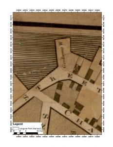
Starting with the 1722 Captain John Bonner map of the, then, town of Boston, which shows the then active docks that occupied much of the Boston shoreline.  This map was a monumental beginning to modern cartographic detailing that documented Boston’s shoreline. The docks, that are clear in the 1722 map, suggesting  dry and wet docks in the 18th century.  In a redrawn 1775 map, the area where the tank was located in the 20th century, was occupied by Hunts and Whites Ship yard.  In this georeference, the park diamond is centered on the “ar” of Ship Yard.

In an 1814 map, Commercial Street was labeled Lynn Street and the softball diamond seems to be on the mostly dry land with a building to the east.  According to an

1852 Map surveyed and drawn by J. Slatter & B. Callan.

1852 map the adjacent street is now Commercial Street and a substantial amount of land has been added in the form of docks.   It is not clear if the building along the first base line is the same one depicted in the 1814 map, but certainly the building curving around 3rd base seems to be new. The two border lines

1861 map made by Boston City Council, city engineer James Slade

coming together at the pitching mound may be visible in some of the geophysics, and will be seen in many of the later maps.

The same basic configuration is also visible in the 1861 map, made by the City.

1867 Sanborn Insurance map of Boston : volume 1 : plate 1
Cartographer: Daniel Alfred Sanborn

An 1867 map is the first real detailed map of the area. It is also one of the early famous Sanborn fire insurance maps.  It shows several coal sheds and hints that the building along the first base line, first seen in the 1814 map, might still be there 50 years later.

George Washington Bromley 1890 map

The  1890 Bromley map suggests that the “V” of two docks,  meeting at the pitchers mound, first seen in the 1852 map, is still present but that the building  that used to be along the first base line, is now substantially larger.  The docks are also very different.  A image of these kinds of docks can be seen in the birds eye view of downtown Boston dated 1877.  These docks were an active hot spot for landscape change during

Bachman 1877 birds eye view

the 18th and 19th centuries.  Further construction of larger docks and land masses were very common during these centuries by building cribbing or sinking ships to artificially fill in the harbor

By the 1908 map, the lot will take on the

1908 George Washington Bromley map

basic shape, the distilling company is labeled as the owner, and a small tank is indicated in the middle of the lot.

1912 George Washington Bromley map

This may be where the Wikipedia map gets its layout.  In this initial 1908 map one large building can be seen in pink that is replaced by multiple buildings in the following 1912 map.  The 1912 map shows a similar small tank but smaller building on Commercial St, and tracks going into the adjacent lot. To the right of the new park area is the soon to be location of the Purity Distilling Company which seems to have built larger molasses tanks as the business grew. This map shows the first distillery’s tank with two new buildings along side a new above ground railway.

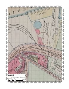
1917 Bromley Map probably showing the tank before destruction.

A 1917 map shows the distillery buildings and the large molasses tank before the accident.   The 1917 map is what we will base much of our interpretation on.  It almost surely shows the large molasses tank that burst during the 1919 disaster as well as two new buildings.  This is the final map that the distillery appears on.  A 1922 map shows the absence of a distillery and tank, replaced with reused buildings by railway operations. Our final map, from 1938, again shows all of the buildings in the 1917 map, with the addition of a small shed where the pitcher’s mound is today.  In 1973 Langone park  was created.

1922 Bromley map

1938 Bromley map

In our next installment we will present the geophysical results from Langone Park.


November 27, 2018
by gracebello001
0 comments

Updating Cape Cod 3-D Model

Our work with the Cape Cod National Sea Shore  continues as we monitor erosion trajectories.  This 3-D model was built to aid in quantifying beach erosion over time. While the data is collected for purely scientific reasons, I made a fly through movie using photos and GPS control points taken by John Schoenfelder, John Steinberg, Melissa Ritchey, and Jocelyn Lee.

September 24, 2018
by gracebello001
0 comments

Summer Field Work on the Cape Cod National Seashore


This past summer has been a busy and productive one for the members of the Fiske Center. In conjunction with the National Park Service (NPS), Cape Cod National Seashore one of the more interesting projects was to assess and to aid in management of a series of potentially endangered archaeological sites in Wellfleet, MA.  The project area is on Great Island and Great Beach Hill, which are the two largest sandy areas that make up the peninsula that defines the western side of Wellfleet harbor and separates it from Cape Cod Bay. This is a dynamic area and one of the island towns in the area has already been submerged. These islands have been found to have both Native American and European Colonial archaeological sites. The most famous site in the area is the Samuel Smith Tavern. This site was excavated by James Deetz in 1969 and 1970.  More recently, in 2012, the area around the Samuel Smith Tavern was explored by The Public Archaeology Laboratory in cooperation with the NPS. Reassessing the extent and preservation of the Tavern site was a central part of the current joint project. As part of that work we georeferenced the 1969 and 1970 excavation datum and the earlier excavations boundaries were redefined, in light of later, much more extensive work.

During the PAL survey, there were several large shell middens identified that were eroding out of sea bluffs on Great Island and Great Beach Hill. Shell middens are trash piles, and as the name suggests, consist of mostly shell. Several of the eroding shell middens are on sandy cliffs that are 80 feet high and at the same time deeply buried by wind-blown sand. These conditions make the sites difficult to assess, let alone excavate. One of the outcomes of the joint NPS-Fiske Center project will be to assess the shell middens likelihood of suffering further erosion as well as to define their areas.

Thus, for three weeks in August the crew set out on the two and a half mile hike every morning to develop answers to these questions. Stay tuned for what we found.

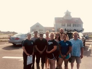
Some of the Wellfleet excavation crew

Some of the Wellfleet excavation crew

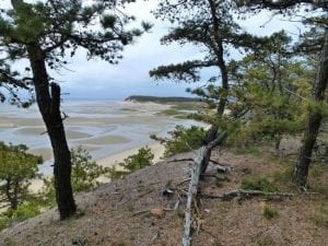
Great Island and Great Beach Hill in Wellfleet, MA

Great Island and Great Beach Hill in Wellfleet, MA

August 22, 2018
by Fiske Center
2 Comments

Digitizing the Allerton/Cushman Collection at Plimoth Plantation

Photo by Plimoth Plantation.

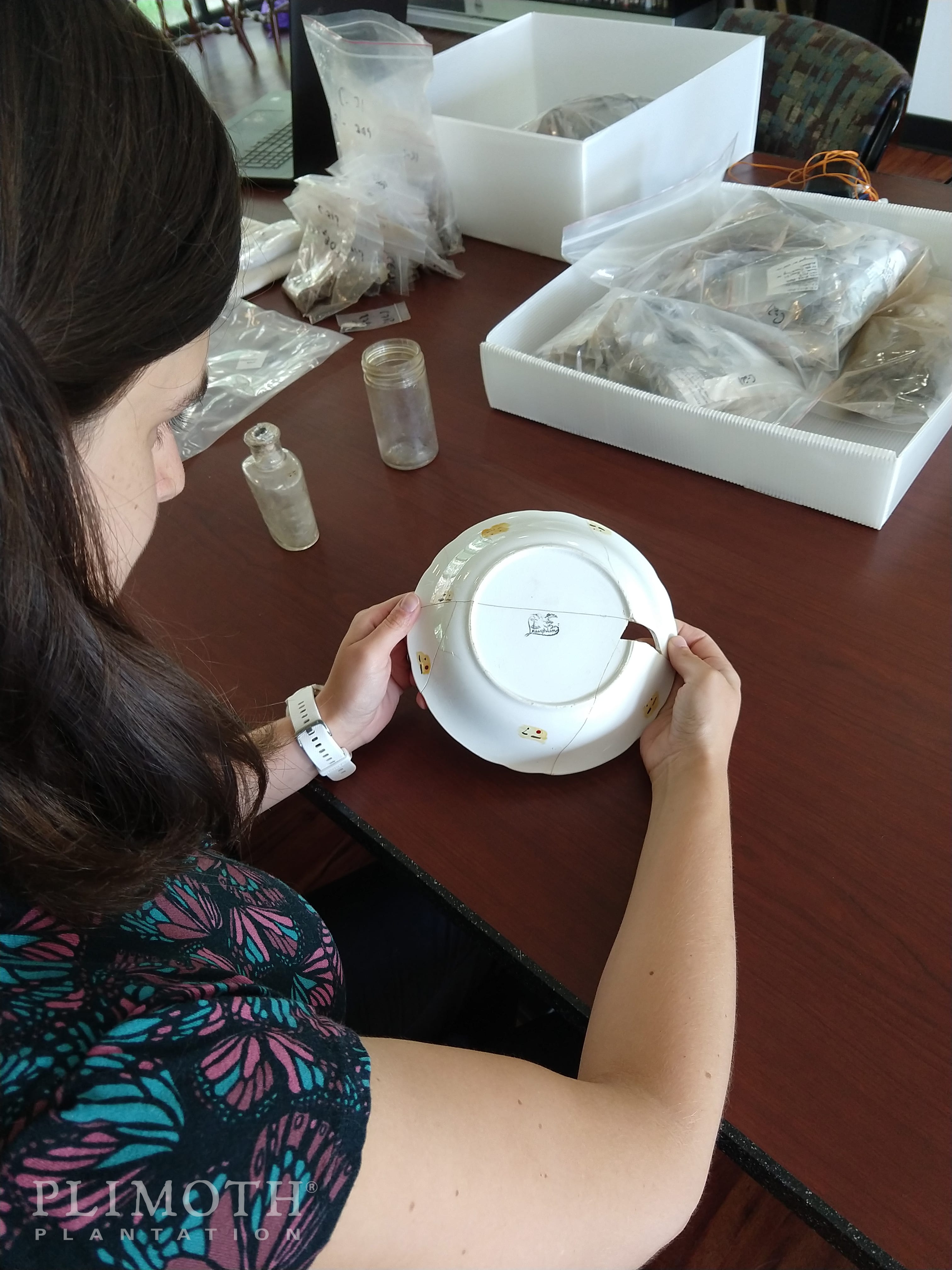
Grad student Elizabeth Tarulis working on later period artifacts from the 17th-century Allerton/Cushman site.

This summer Anya Gruber and Elizabeth Tarulis, graduate students in UMass Boston’s Historical Archaeology program, have been working at Plimoth Plantation to digitize the Allerton/Cushman collection. This work is part of an ongoing collaborative project funded by a grant from the National Endowment for the Humanities, discussed in a previous blog post.

The Allerton/Cushman site is believed to be the home site of Isaac Allerton, merchant and official representative of Plymouth Colony. Located in Kingston, MA this was probably one of the first residences established by settlers immediately outside of Plymouth Colony. It was owned by several others over the years including Allerton’s son-in-law, Thomas Cushman.

The site was discovered in the 1970s when a couple purchased the land to build their home. As the topsoil was stripped, the architect for the construction project recognized that some artifacts were turning up which looked very old. He brought them to Dr. James Deetz, the Assistant Director of Plimoth Plantation at the time. Deetz realized that the construction crew had identified a significant 17th-century colonial site. He took a team out to excavate the site, and the majority of the artifacts they found are still at Plimoth Plantation. A small portion of the collection is also at the Kingston Public Library.

Photo by Plimoth Plantation.

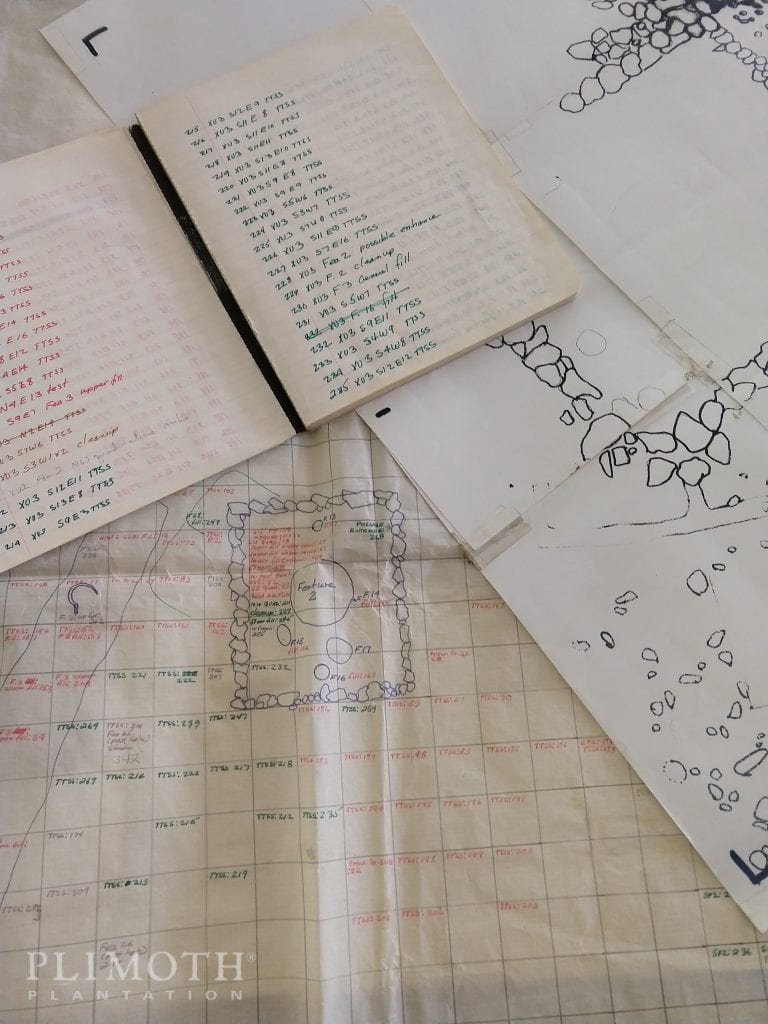
Site documentation from the Allerton/Cushman site, being digitized as part of this project.

We are working to make Deetz’ work available to a wider audience by digitizing this collection. We have already completed the first step by scanning the site documents. We have very detailed site maps, but appear to be missing some field notes and inventories that are mentioned in a later report. Currently we are cataloging the artifacts and entering this information into a database. We began with the “19th and 20th-century materials” box, which has almost anything you can think of from dozens of cigarette butts to a plastic cowboy to two 20th-century rat nests.

Photo by Plimoth Plantation.

The dot/dash provenience labeling system.

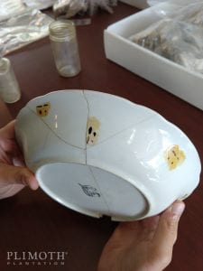
As with any older collection, this one has a few quirks. All of these artifacts are labeled with color-coded dots and dashes to indicate their provenience, or the location within the site where they were found. While it is fabulous to have the provenience information, this paint system did not survive well on some of the artifacts. The colors have faded, which proves challenging when you need to distinguish between white and grey or yellow and gold. Further, the coating on top of the painted dots has yellowed, making it difficult to distinguish between green and blue or white and yellow.

These artifacts are also sorted by material rather than provenience (where they were found). Sorting by provenience is the current best practice, and one of the most time-consuming tasks of the digitization process has been to organize the color-coded artifacts from large bags of glass or plastic into their respective proveniences.  The end result of this process will be that artifacts that were found together will be once again stored together.

Despite these issues, this collection is in good shape for its age. We plan to fully catalog these artifacts, reorganize them by provenience, photograph the objects, and make this information accessible online to scholars and members of the public. Although we have not yet started working on the earlier materials, previous research suggests that this is a rich 17th-century site. It will be a valuable resource for future researchers, and we look forward to seeing what is yet to come.

Skip to toolbar