
In April of 2022 the Fiske Center for Archaeological Research began an exciting project in Marblehead Massachusetts. The Marblehead Museum is interested in understanding the yard space around the Jeremiah Lee Mansion, a Georgian mansion built in 1768 for Jeremiah Lee, the wealthiest merchant in colonial Massachusetts at the time.
More specifically, the project seeks to investigate the space on the east side of the house, between the Mansion and the Brick Kitchen. This brick building dates to the same time period and may have housed the mansion’s enslaved residents or domestic servants. By investigating this lot, we are hoping to encounter older 18th century archaeological deposits, deposits from the Lee period, or deposits and foundations from later buildings that occupied this space.
In preparation for a ground penetrating radar survey in late April and excavations in June, the first step was to georeference all the old maps, which was described in a previous post. The next step is to create an orthophoto. This is an aerial image that has been geometrically corrected (ortho-rectified) so that the image has uniform distance measurements across the entire photo and is perfectly top down. Unrectified aerial or satellite images suffer from terrain effects and distortion from the camera lens and the angle that the photo was taken, which can cause problems in later processing steps. You can see these kinds of images on google earth- notice the sides of the buildings.
To create the orthophoto, ground control points were laid out across the site and a large number of drone photographs were taken.
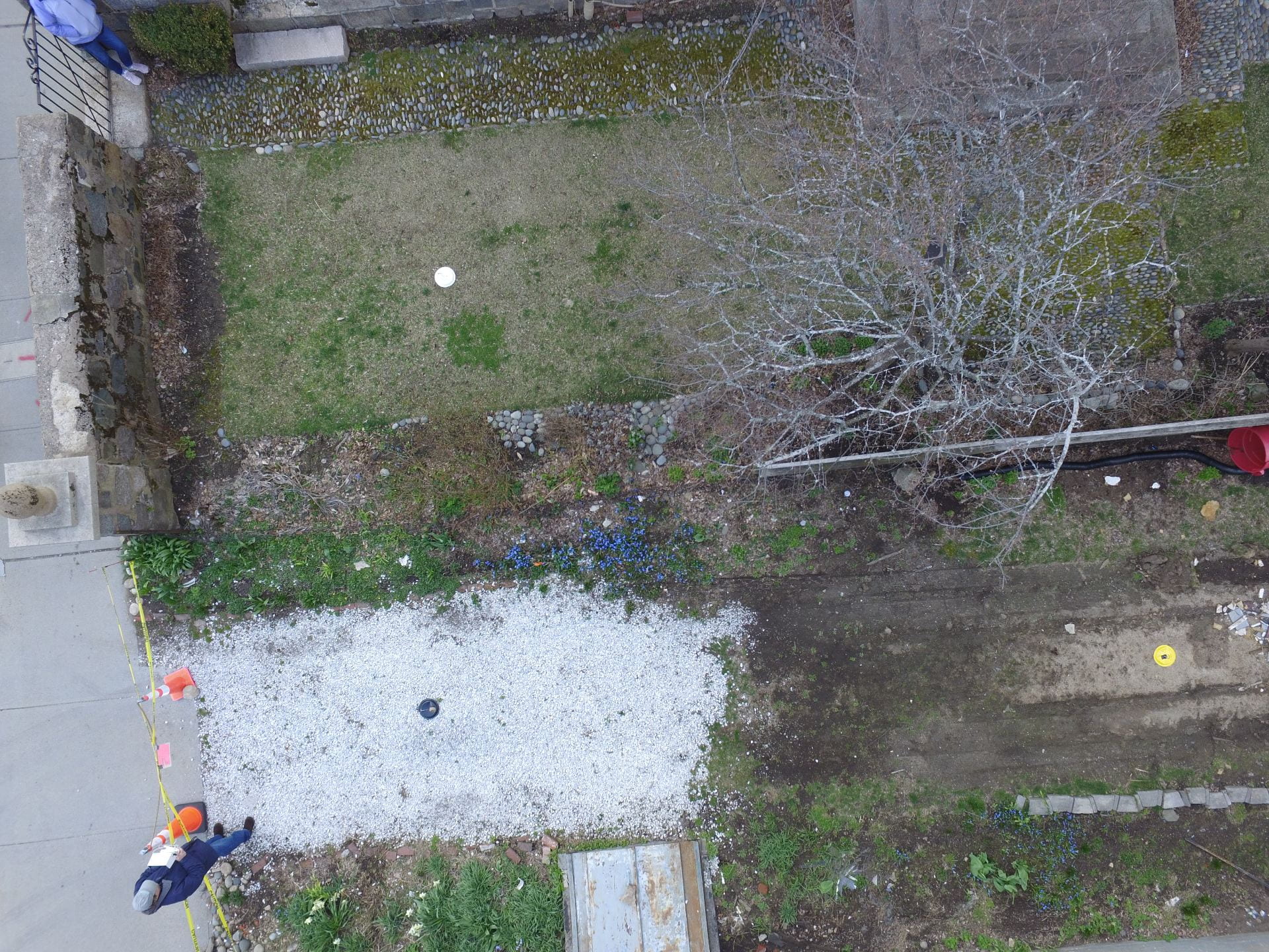
Ground control points are places on the ground (in this case paper plates) with known coordinates associated with them. These points are used to tie map coordinates from the aerial photos to precise points on the earth, thereby yielding an accurate product. John Schoenfelder flew the drone and did much of the mapping.

Using the photogrammetry software Agisoft Metashape, we created an orthophoto of the Lee Mansion grounds. This software requires you to build a “sparse cloud” and a “dense cloud”, which are used to generate the orthophoto.
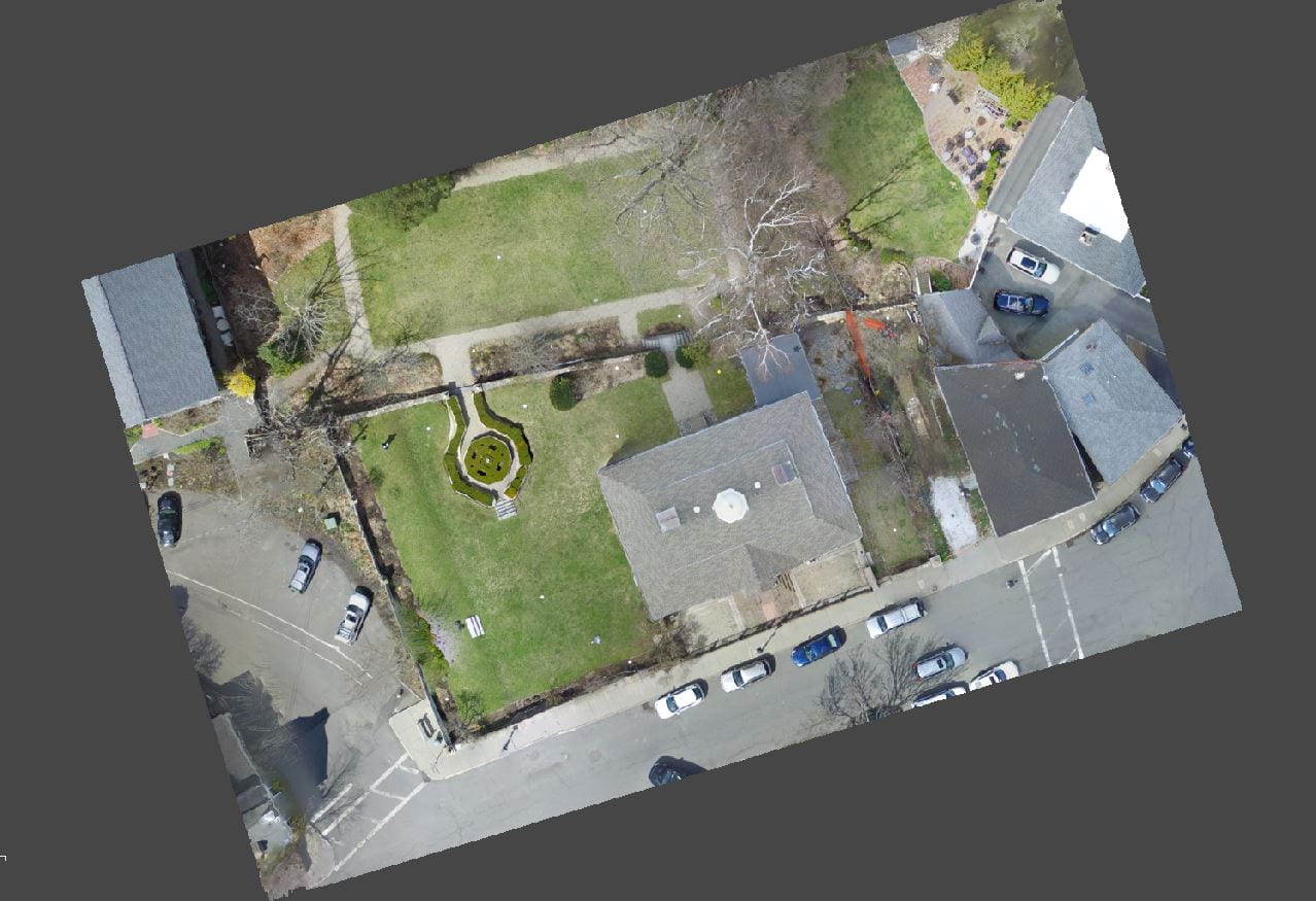

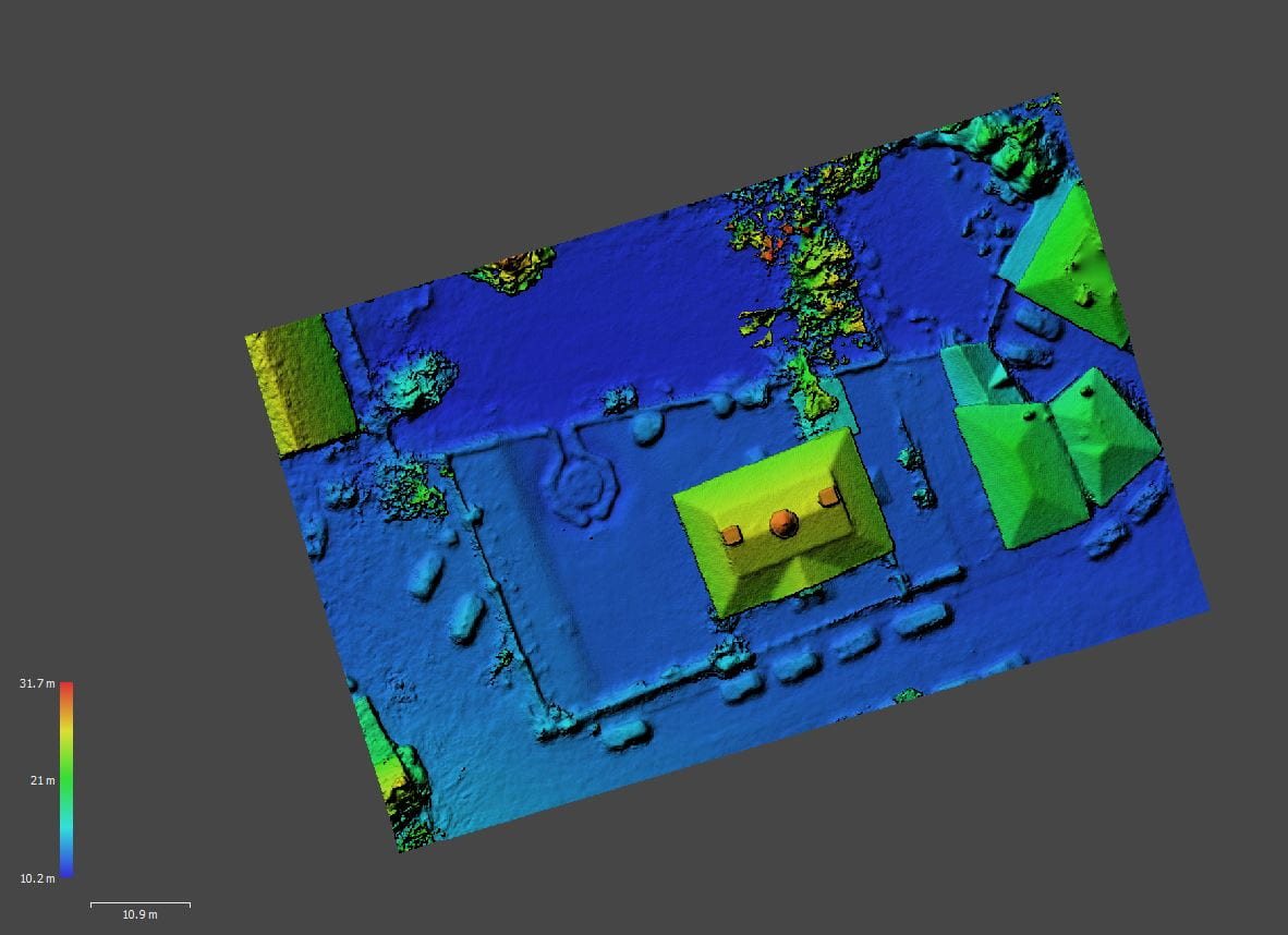
These are both types of point clouds that exist in three-dimensional space. The sparse cloud represents the tie points for overlapping image pairs while the dense cloud generates depth maps for these overlapping pairs and merges them together to create a three-dimensional model of the site. The dense cloud was used to create a digital elevation model of the site, which was then used to create the final orthophoto.
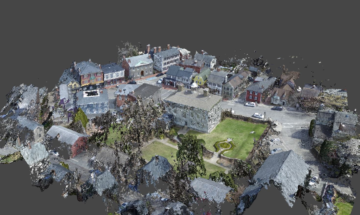
While not really needed for our work, a byproduct of the orthorectification process is that with just a few additional processing steps, we refined the three-dimensional model of the site and created a “fly-through” animation.