SASS – UMass Boston – Fiske Center – Archaeology

Blog of the Skagafjordur Archaeological Settlement Survey

April 12, 2013
by John Steinberg
0 comments

Grétar Magni Guðbergsson 1934 – 2013

We have lost a great friend.  Grétar Guðbergsson passed away last week at the age of 78. Grétar, who called himself an agricultural geologist, set the stage for our archaeological work in Skagafjörður by understanding the nature of the erosion and soil deposition.  His findings were published in three important works:

1975    Myndun móajarðvegs í Skagafirði. Íslenzkar Landnúnaðarrannsóknir 7(1-2):20-45.

1994    Myndun móajarðvegs í Skagafirði. Rit Landverndar 10:133-157.

1996    Í norðlenskri vist. Um gróður, jarðveg, búskaparlög og sögu. Búvísindi 10:31-89.


Grétar taught us to use a fishing knife rather than a Marshalltown trowel to investigate the tephra and the soil.  In the future, when I get out my knife, I will think of him.

I already miss his good nature, his quick wit, and his inquisitive mind.  Our thoughts are with his wife Guðný and his family.

August 2, 2012
by Kathryn Catlin
0 comments

My last day

Today was my last day of fieldwork in Iceland for 2012!  (Don’t worry, everyone else is staying for a few more days, and they’ll keep blogging.)  I’m sorry to leave just when so many exciting things are coming in to view at Seyla – a few more grave cuts are exposed, and the church in the center of the yard is beginning to take shape.

Over the weekend we traveled to Kumlabrekka, an early Viking Age boat burial on the side of a pseudocrater, to test the CMD and GPR through volcanic scoria.  The Mývatn region is one of the most beautiful in Iceland.  But Mývatn means “midge lake,” and when the wind dies down, the midges come out!  They are everywhere and they bite.

Brian surveying with the CMD at Mývatn while Doug takes GPS points. You can’t see Doug’s face, because it is covered with mosquito netting.

The survey went great – which I’m especially happy about, because I carried the CMD for most of it!

This afternoon I spent some time showing Guðmundur, an archaeologist who works at the museum here in Sauðarkrókur, how to work our float machine so he can process macrobotanical samples after we leave.  We decorated the Minja Husið sign with beautiful pink and blue chiffon!

Floating beside the museum. The chiffon bags catch the botanicals as they float over the top of the machine, and then we air dry them before inspecting them under a microscope. Tiny preserved seeds tell us which plants may have been used by the people who lived at Stóra-Seyla in the 11th century.

The float tank in action! The freshly painted tank (just the white parts are fresh) was designed by John and constructed by a local welder in SASS’s early days. You can also see the magnificent swamp we’ve created beside the museum …

Early tomorrow morning I leave for England, where I’ll be doing some survey work with Matthew Johnson’s project at Bodiam and Scotney Castles.  Then I’m moving from Boston to Chicago to start my first quarter as a PhD student at Northwestern University.  I’m very excited about all of this, but sad to leave Iceland (and UMass) behind.  I hope to be back in Skagafjörður next summer!

Stay tuned to this blog for more about the last week of excavation at Seyla!

August 1, 2012
by John Schoenfelder
0 comments

Kite Photo of Seyla

Excavation at Seyla has been continuing right along.  I put the kite up again yesterday afternoon, and got some shots that give a nice overview of what we’ve got.  North is at about one o’clock in this photo:

In the northwestern quadrant (at the top), you can see Doug and some of the UMB/Kenyon team investigating the deposits that are over and around what should turn out to be the church at the center of the yard.  In the southeast (at the bottom), Guðný and her Icelandic colleagues are working near the cut of the grave that was excavated in 2009 (the darkest, deepest hole).  As you might be able to make out, they’ve uncovered several other graves adjacent to that one.  So far, these new graves have proved to be largely empty.  There’s much more to do, though!

Surrounding all of us (and clearest on the eastern side of the excavation), there are the stones of the circular wall that defines the churchyard.  This is the same wall that we first saw in the ground penetrating radar data in 2009!

There’s a lot of detail in the linked version of the above photo, so try zooming in!


July 26, 2012
by Kathryn Catlin
0 comments

Excavation at Seyla

Over the past few days, we’ve started to clear off the churchyard wall and some of the other buried features at Seyla.  We’re slowly mapping out the features that correspond to the anomalies we’ve seen in the geophysical results, including the central structure.

Brian, John, and Guðný contemplate some complex stratigraphy.

Viking Age floors in Iceland are thick, compacted, somewhat greasy layers composed of pink peat ash, black charcoal, white wood ash, and other colorful detritus of everyday life.  This morning as I was tracing out the edges of the floor that seems to go with a later phase of the central structure, a small silver pin appeared under my trowel:

Me photographing a small (about 1″ diameter) silver pin or brooch from the center of the Viking Age churchyard at Stóra-Seyla. The pink stuff behind me is the floor!

This afternoon, John and Brian visited Keflavík and Mið-grund, two other farms in Skagafjörður where we will be testing our geophysical instruments early next week.  Tomorrow we’re back at Seyla, then it’s a weekend trip to Mývatn to survey a boat burial and see the sights!

July 23, 2012
by Kathryn Catlin
0 comments

Kites, Rocks, and a Backhoe

Yesterday was beautiful weather, and while we finished up the DUALEM survey John was able to get the kite flying and took some outstanding photos of the grid.  More on that later – meanwhile, here’s an action shot!

John brings the kite back to earth after a successful flight


Rocks, especially large rocks, can influence the electromagnetic field produced by our geophysical instruments.  To make sure we only sensed buried archaeological features, we had to move part of a large rock pile away from our survey grid.  Some readers may remember moving this rock out of the excavation in 2009 – Doug, John, Myra and Hannah moved it again!

Experimental archaeology! We had to move this very heavy rock out of range of the survey instruments. It was quite an operation.


Today it was cold, windy, and rainy, and we had a visit from our friendly local backhoe operator!  Before Guðný starts to excavate, we needed to remove the soil down to the level of the 2009 excavation (which we had covered with a geotextile before backfilling).  John directed operations while the rest of us started shovel scraping.

John directing the backhoe driver to clear off the soil down to our 2009 excavation.


Tomorrow: backhoe and shovels, part II!

July 21, 2012
by Kathryn Catlin
0 comments

Trying out the DUALEM

John and Brian using the DUALEM-21 at Stóra-Seyla

Today we finished our first survey with the DUALEM-21.  This is just half of the 4-meter-long DUALEM-421 – the instrument that John brought on the bus from Reykjavik.  Tomorrow we’ll be surveying the grid at Seyla again in the opposite direction, and then we’ll take a look at the data.  We will probably be using the full 4-meter DUALEM-421 later in the season.

We’ve already finished surveying in both directions with the CMD, a smaller multi-sensor EM instrument (see the photo in the last post).  These multi-sensor EMs allow us to penetrate multiple different depths at the same time.  A single survey with the CMD gives us six complete data sets to analyze.  Preliminarily, what we’ve seen from the CMD data looks very good!

Today we are also welcoming the rest of our crew, who are joining us from Kenyon College – Dr. Kimmarie Murphy and two students, Hannah and Myra, who will be helping with the cemetery excavation and skeletal analysis as well as geophysical survey.  It’s great to have them here with us!

As for me, I’m thrilled to be back in Iceland again.  This is one of my favorite places in the world, and I have a really good feeling about this summer!

July 21, 2012
by John Steinberg
0 comments

RAPID: Testing Geophysical Prospection and Mapping Methods for Early Christian Cemeteries in Iceland

John using the CMD mini explorer at Stora Seyla

To give you some idea of what we are doing, and why we have been bringing all this equipment to  Iceland and using it, below is the abstract of the NSF grant we were awarded.  The PI on the grant is Doug Bolender and the grant was awarded to the Field Museum in Chicago.

RAPID: Testing Geophysical Prospection and Mapping Methods for Early Christian Cemeteries in Iceland

This award will support geophysical investigation of the early Christian cemetery at the farm of Stora-Seyla in Iceland by Drs. Douglas Bolender, Brian Damiata, John Steinberg, and their colleagues with the Skagafjordur Archaeological Settlement Survey (SASS) prior to excavation by Gudny Zoega and the Skagafjordur Heritage Museum. Complete archaeological excavations of Viking Age Christian cemeteries occur very infrequently and NSF support provides a unique opportunity to collect geophysical data prior to excavation. Currently there is no method to find buried churches and cemeteries that can be applied on a regional scale in Iceland. By conducting a series of shallow geophysical surveys before excavation, SASS will be able to determine if new multi-sensor electromagnetic (EM) instrumentation can reliably find buried cemeteries and characterize individual graves. Precise spatial measurement and GIS systems will be used to record and correlate excavation and geophysical datasets. The project will result in two significant advances: (1) new geophysical techniques to identify buried churches and cemeteries in Iceland; and (2) a systematic evaluation of the capability of geophysical methods and techniques to produce detailed maps of church complexes including individual graves.

The methodological advances in this small RAPID award will open early Christian cemeteries to regional study and allow for household-level information on demography, human health, and diet to be integrated into future research projects. The marginal environment of Iceland makes it an excellent place to study the impacts of environmental degradation, climate change, and dietary transitions on human health and society. The populations represented in these early Christian cemeteries coincide with key transitions in farming practices in Iceland and with the climatic deterioration associated with the onset of the Little Ice Age. Additionally, recovered skeletal material holds the potential for DNA analysis which can shed light on the nature of household composition, the role that family relationships played in the process of land division following the initial settlement of the island, and on how evolutionary processes have shaped the relatively isolated Icelandic gene pool. Assessing the distribution of early Christian cemeteries and graves will increase the value of these analyses with better information on the context of sampled populations. The multi-sensor EM techniques that will be tested in this project have applications beyond the North Atlantic as well as in other fields. Therefore this work has important applications for heritage management and forensic sciences. The broad integration of disciplines and multiregional experience brought by the team will enrich: a) training and educational experiences for participating undergraduate and graduate students; b) develop international scholarly collaboration; and c) facilitate local outreach and communication of research results through collaboration with the Skagafjordur Heritage Museum.

July 18, 2012
by John Steinberg
0 comments

Now on the Bus

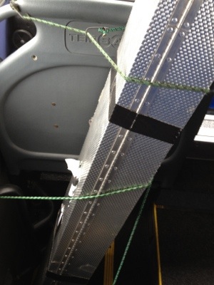
Icelandair did let the 421 on. They did not even charge us much. Now we need to get it to the north of Iceland. It is too big to fit in the wagon we have rented. Therefore, I am taking the bus, so I have some time.

We are testing the Dualem 421 out in a bunch of different places. (http://www.dualem.com). We are also trying the CMD mini-explorer (www.gfinstruments.cz) but that is a much smaller piece. In particular we are testing these at the lower Seyla churchyard.

20120720-100341.jpg

October 28, 2011
by John Steinberg
0 comments

Preliminary Report on Greenland

Front Page

Front Page

We recently put up our preliminary report from our 2010 experimental season in Greenland.  The title is “Evaluating the Potential of Archaeogeophysical Surveying on Viking Age and Medieval Sites in Greenland. October 2011” and it is Cultural Resource Management Study No. 51.  Many of the Fiske Center’s reports can be found on our Reports and Publications page.  The report is by Douglas J. Bolender, John M. Steinberg, Brian N. Damiata, John W. Schoenfelder, and Kathryn Caitlin.

To sum up. our preliminary investigation suggests that archaeogeophysics will be hard pressed to identify buried Viking Age turf walls that do not have stone foundations.  We have found that both magnetometry and the in-phase component of electromagnetics are well suited to identify buried Viking Age stone foundations and other important cultural features and that GPR is effective for identifying Viking Age Christian graves.

John Steinberg

Skip to toolbar