The Fiske Center Blog

Weblog for the Fiske Center for Archaeological Research at the University of Massachusetts Boston.

June 23, 2018
by elizabethquinlan002
0 comments

The Penultimate Week at Hassanamesit Woods

It’s been a busy penultimate week out at Hassanamesit Woods, with three areas of excavation and quite a few interesting site features being discovered by the field school students.
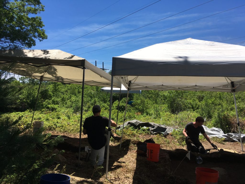
A view of students excavating under a beautiful blue sky

Graduate students Gary (left) and Brian (right) work on paperwork and profile straightening for their respective units under a brilliant blue sky. The weather this past week has been amazing out in Hassanamesit Woods.

Over at the Augustus Salisbury site graduate student Rick and Dr. Trigg have continued to excavate units associated with the extant Salisbury foundation, finding several architectural features as they’ve gone. The most important has been what appears to be the continuation of the wall still visible on the surface, which will give us a better idea of the extent of enclosure on the property. This is especially important for Rick, as his thesis is focused on the utilization of land surrounding Keith’s Hill in Grafton. Dr. Trigg and Rick also found an interesting bone-related mystery for graduate student Liz to ponder. Liz is a faunal analyst, and is working with Dr. Trigg to solve the mystery– a rare opportunity at Hassanamesit Woods, as the preservation for organic material is not the best.
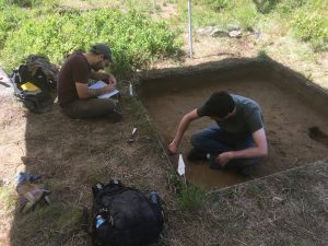
Field school students prepare to draw the profile of their unit.

Tyler (left) and Andrew prepare to draw the east profile of their unit. Tyler is marking out the grid for drawing, and Andrew is using a brush to clarify stratigraphy changes in the unit wall.
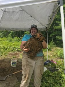
A student holds a massive chunk of top level duff.

Graduate student Liz holds a particularly stubborn (and massive) chunk of duff removed from her unit. Due to the densely packed bushes, lichens, and other plant material on the hilltop, the top level of soil can only be removed in chunks and broken up manually.


Over at the Deb Newman site graduate students Brian, Gary, Tyler, and Liz, along with undergraduates Andrew, Bryn, and Alex continued to open and fully excavate several units surrounding metal detector hits marked by Brian in earlier weeks. As the week progressed, first Tyler and Andrew, and then Liz and visiting grad student Ivana moved over to a nearby hilltop about 300 yards from the Deb Newman site proper, to excavate some promising units surrounding glacial erratics (boulders) that would have been on the surface when the site was occupied. Unfortunately with the exception of a more recent hearth and a single possible posthole, these units have not revealed as much as hoped, and the plan for the final week of excavation is for Tyler and Andrew to move back over to the Salisbury site while Liz finishes up on the hill. 

Graduate student Melissa started the week mapping with Lauren, refining coordinates, shooting in elevations and datum points, and, with the help of Dr. Schoenfelder, teaching all of the field school students the basics of using a total station. Melissa then moved back to the Deb Newman site and has been working on another excavation unit near one of Brian’s metal detector hits.
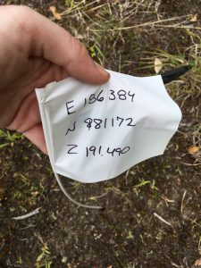
A corner flag for a unit showing easting, northing, and elevation.

One of the many new flags shot in by Lauren and Melissa, showing easting, northing, and elevation information for a unit.


As this brilliantly hot and sunny week wrapped up, Dr. Mrozowski urged his students to not only consider the artifacts coming out of the ground, but the impact of both time and space on the sites they are excavating. He stressed that the most important information about site usage can come from holistic interpretation of recovered artifacts, oral and written history, and the consideration of how change and use over time intersects with the space inhabited by people at the site.

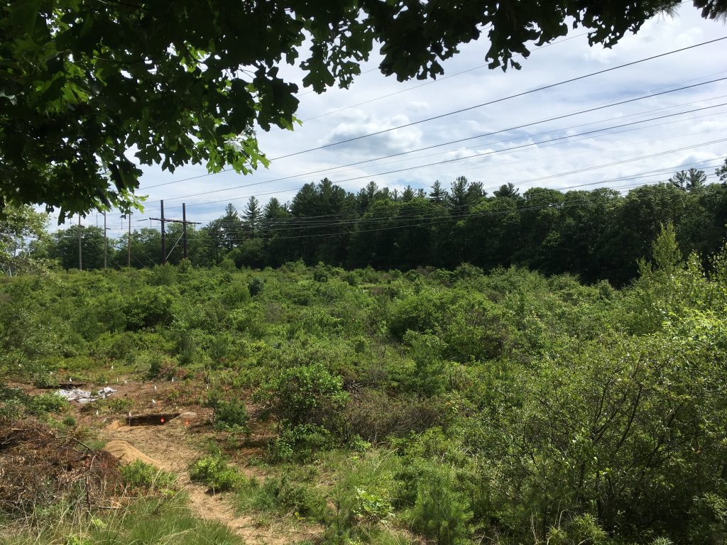
A view of a large field bordered by trees where the excavation is taking place.

A view of the Deb Newman site after cleaning up for the day.


Next week is our last week at Hassanamesit woods, and as we wrap up this blog will post exit interviews from some of the field school students to get an idea of how the experience has benefited them. We hope you’ve enjoyed following along with our progress, and we’ll update again soon! 

June 15, 2018
by elizabethquinlan002
0 comments

Chasing Color Changes at Hassanamesit Woods

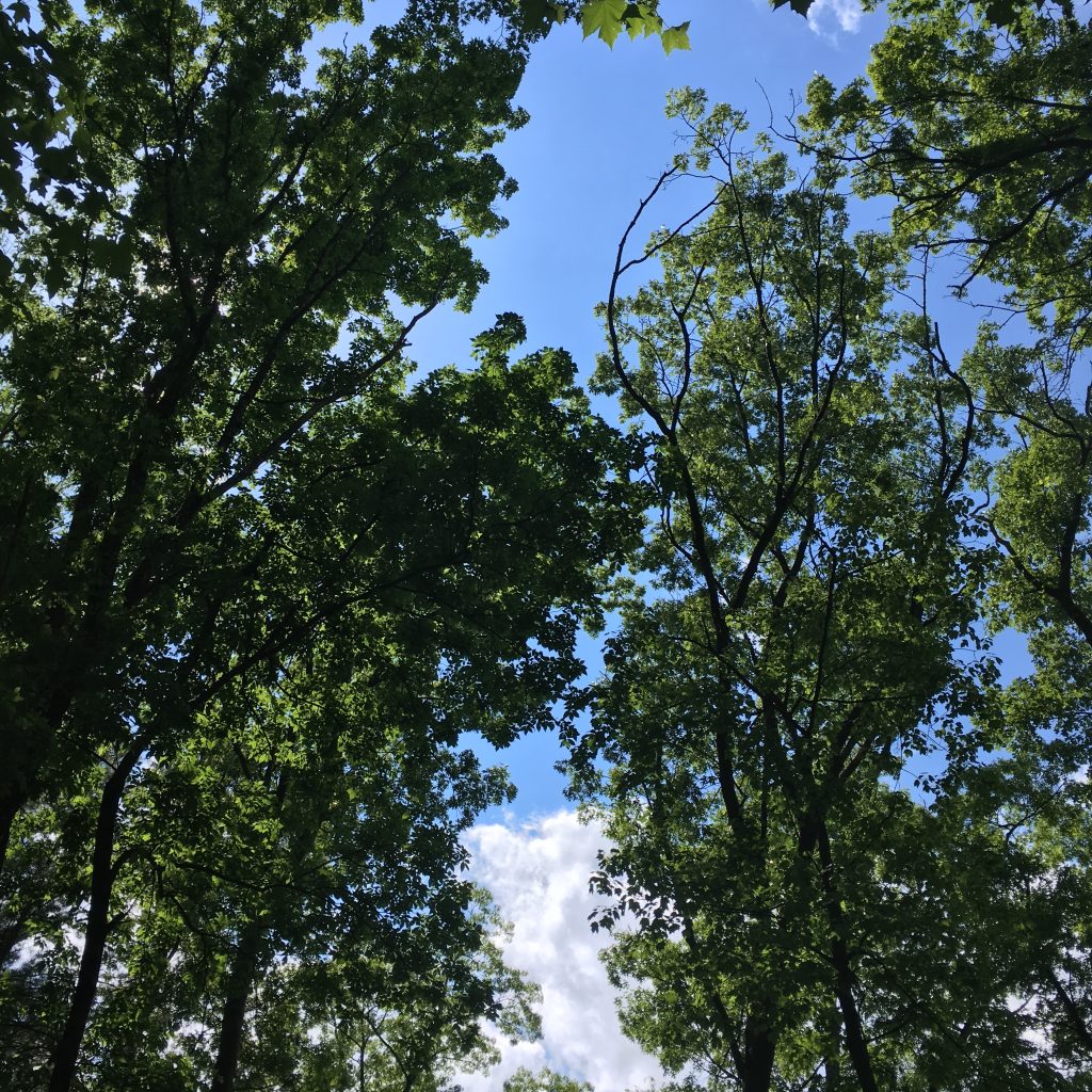
A view of the summer sky above Hassanamesit Woods

The first few weeks out in Hassanamesit Woods have been marked by (mostly) great weather and even better field experiences. Despite a rain day spent in the lab cleaning recovered artifacts on Monday the 4th, the second week of work gave the students a look at how changing stratigraphy within a unit can both puzzle and inform an excavator. Graduate students Melissa and Liz, joined by graduate student Ivana, began seeing some interesting soil changes as they brought their unit down to roughly 35-45cm below datum. These stratigraphic changes continued as they  followed the strata down to a final depth of about 75cm below datum. As this unit is located right up against the Augustus Salisbury foundation, it was hoped that these soil changes might indicate a builder’s trench in the unit.

View of the Northwest corner of Unit E448 N274

The northwest profile pictured above shows the bands of color that indicate stratigraphic changes. The C horizon is characterized by the greenish-grey sandy layer in the middle.

During construction of a building with a stone foundation it was often the case that builders would dig down into the sterile subsoil (known in this case as the ‘C horizon’ or ‘C strata’) in order to lay the foundation well below the contemporary ground surface. The soil displaced from this digging would then be loosely filled back in, along with building debris and other trash from the time period, so it could be dug out again later if repairs to the foundation were needed. The soil is often put back “out of order”, and areas of clear disturbance in the natural stratigraphy can clue in archaeologists to construction activities at a site. These trenches, and the artifacts recovered from them, can also help date the completion of a foundation.

By the beginning of the 3rd week it became clear that the stratigraphic changes observed in Melissa, Ivana and Liz’s unit were not being found in Rick and Alex’s adjacent unit, meaning the changes must be associated with the foundation rather than the wider yard space. Over in Tyler and Andrew’s unit, however, they began spotting some unusual stone placements, which also continued into Rick and Alex’s unit. At first it was thought they must have been placed deliberately by people in the area, as they were almost all propped up in an ‘upright’ manner. However, upon discussion with environmental archaeologist Dr. Trigg, Dr. Mrozowski, and the discovery of a large amount of loose frost fractured stones, it was decided that they most likely were the result of New England’s at-times violent freeze-thaw cycles.

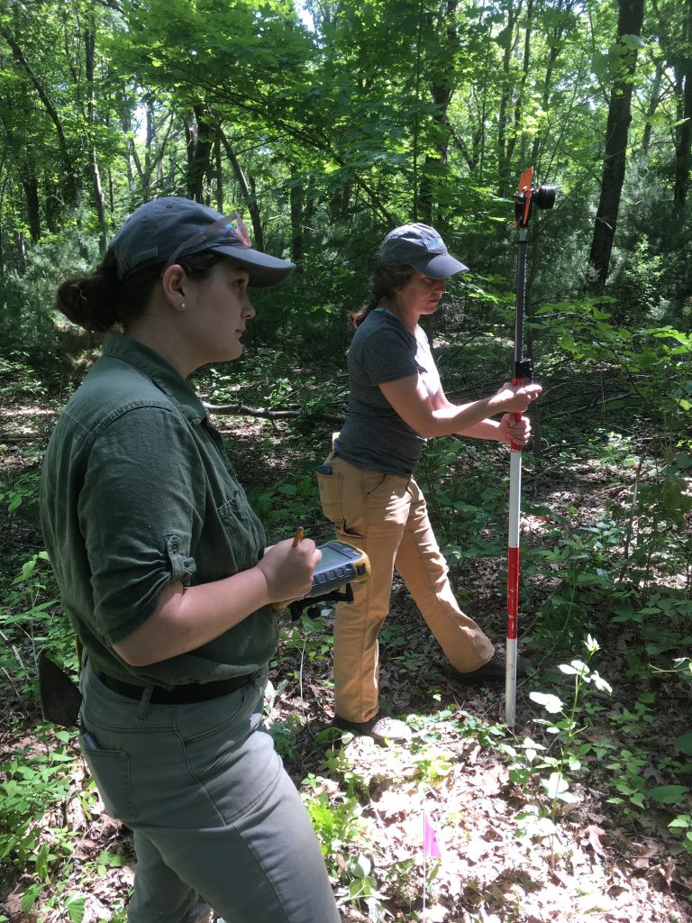
Melissa and Lauren take elevations using a data collection unit and a prism pole

UMass Boston Historical Archaeology graduate students Melissa (left) and Lauren (right) use a data collection unit a prism pole to take elevations and lay out new units. These tools are used with a total station, operated by Dr. Schoenfelder (not pictured) to accurately map site coordinates.

Monday and Tuesday of week three also saw the arrival of Dr. John Schoenfelder and UMass Boston graduate student Lauren to the site. They worked with field school students to map further units near the Salisbury foundation, establish datum points at the Deb Newman site, and take some elevation measurements. This gave students attending the field school the opportunity to learn how to operate a total station and precisely map site coordinate

As this mapping was going on, Gary and Bryn finished their unit at the Augustus Salisbury site and moved over to the Deb Newman site to open the first unit there. This unit corresponds with some of the marked metal detection hits made by Brian in the first week. By Thursday they were joined by Liz and Melissa, while Alex, Andrew, Rick, and Tyler remain at the Salisbury site to finish their units.

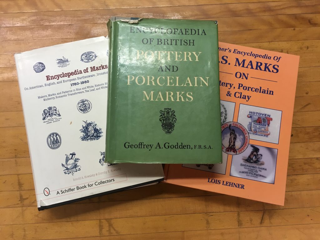
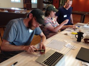
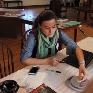
While field work is generally supplemented by research and analysis after the season has officially ended, there are still times when you need to go home after a long day of excavating and consult a few books. After the discovery of a piece of pearlware or ironstone with a unique maker’s mark in a level suspected to be contemporaneous with the completion of the foundation, everyone ran to their phones to search the many online ceramic databases. When this proved to be too big a task for a quick in-the-field search it was decided that everyone would spend some time looking for the mark in online and print databases. Luckily the Fiske Center library is fully equipped for such a search. Three books containing examples of British and US pottery marksWhile the mark has yet to be identified, Dr. Mrozowski hopes that when it is it will give us a reliable TPQ (terminus post quem, or earliest possible date) for the Augustus Salisbury foundation’s completion. Perhaps the remaining units at the Salisbury site will provide more identifiable ceramic pieces from the same time period to aid in the TPQ determination.

The dual focus of this field school on both the Deb Newman and Augustus Salisbury sites provides an opportunity for comparative excavation and should prove very interesting in the coming weeks.


June 11, 2018
by elizabethquinlan002
2 Comments

2018 Hassanamesit Woods Field School Begins

Hassanamesit Woods LogoOn Wednesday May 30th the Hassanamesit Woods Field School crew officially broke ground at the Augustus Salisbury site and began the 2018 field season. This year’s focus is mainly on the 19th century Salisbury homestead, and the  18th-century Nipmuc deposits underlying the property. Under the careful direction of Dr.’s Mrozowski and Trigg, three undergraduate students and six UMass Boston graduate students have begun excavation of four 2x2m units.

Image of two tubes of Tecnu Extreme Poison Ivy Scrub

Removing poison ivy from both the Augustus Salisbury and Deb Newman sites will be a major part of this field work, so the appropriate precautions are needed.

Graduate students Melissa and Liz are working closest to the poison-ivy
covered 
Salisbury foundation, and have thus both acquired their own personal bottles of Tecnu.

Graduate student Rick, whose thesis will be focusing on the changes in land use of this site and others in the surrounding area, is working with URI undergraduate Alex in the next unit over from the Salisbury foundation. UMass undergraduate Andrew is working with grad student Tyler in a unit with stunningly meticulous sidewalls, which lies in the middle of the focus area. Right next to them is UMass undergrad Bryn and grad student Gary (another student working on Hassanamesit Woods data for his thesis), who are working closest to the “Hawk Foundation”. Together these units run from the north of the site area, near the visible Salisbury foundation, to the south where the “Hawk Foundation” was discovered in a previous season. The area in between, covered by three of the units, is thought to be where the Nipmuc community of Hassanamisco may have built a meetinghouse and/or school. The hope is that by excavating these previously untouched middle units, the underlying Nipmuc sites may be identified, shedding more light on the physical erasure of Nipmuc land and community represented by the Salisbury site

The students have been digging for two weeks now, however progress has been slow due to a deep layer of forest overgrowth and root mats. The site had to be cleared on the first day, necessitating many tick checks and poison ivy near-misses. Most objects coming out of the first few layers of the excavation units are architectural iron like nails and brackets, with small bits and pieces of ceramics here and there. Melissa and Liz are looking for a possible builder’s trench near the Salisbury foundation, while Rick, Alex, Tyler, Andrew, Bryn and Gary are all trying working down to the levels where Nipmuc sites may still be intact.

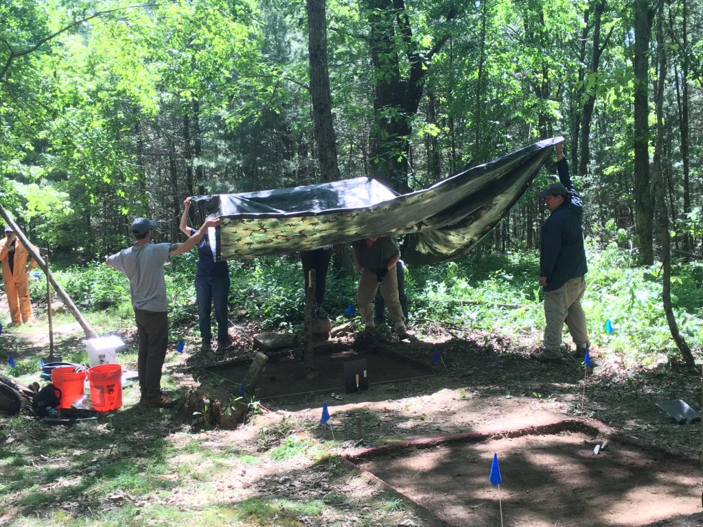
Archaeologists hold a tarp over an open excavation unit in order to take a photo

In the above photo, Gary, Dr. Trigg, Bryn, Alex, Melissa and Rick work to shade a cleaned and finished level within Gary and Bryn’s unit so it can be photographed for the site records. Photographing each level allows researchers to go back and look at the level-by-level changes in stratigraphy as a unit is fully dug down to the subsoil.  Dr. Mrozowski can be seen in the background in his blaze orange jumpsuit, contemplating a previously excavated unit. After discussions with Dr. Trigg, and consulting the site paperwork, he decided to open up the older unit to follow a previously discovered feature that had not been fully excavated the past year.

But what about the sixth graduate student? Brian has been over at the Deb Newman site, not far from the Salisbury site excavation, trying to definitively locate her dwelling using a new application of metal detection. Brian has past experience with metal detection use in archaeology on battlefield sites, but noticed some patterns in his previous work involving domestic sites and the types of metal artifacts that produce positive results from metal detectors. Using this method he is carefully covering the area around the Deb Newman site, and is marking out areas for later excavation. It is expected that some of the students currently at the Salisbury site will soon move over to the Newman site to begin further excavations there.

All in all it’s shaping up to be an exciting month of excavation at the Newman and Salisbury sites at Hassanamesit Woods, and we’re looking forward to updating you on the progress we make.


May 18, 2018
by John Steinberg
0 comments

Twelve MA Theses in Historical Archaeology Defended in School Year 2017-2018


Kelton Sheridan talks about her MA thesis

Today at about 3 PM the Master of Arts Program in Historical Archaeology at UMass Boston will achieve a significant milestone:

More MA Theses were defended than new students accepted this year.

While the difference was only 2, it is important that this achievement be celebrated.   In addition to the 3 students that defended today:
Anya Gruber
Kelton Sheridan
Joe Trebilcock

And the 4 students who defended on Wednesday :
Sarah Johnson
Victoria Cacchione
Caitlin Connick
Leigh Koszarsky


We had 5 other students who defended earlier in the school year:
Caroline Gardiner
Alexandra Crowder
Ashby Sturgis
Jessica Hughston
Nadia Kline

This means 12 students defended during the 2017-18 school year. There are 10 graduate students in the 2017-18 matriculating Historical Archaeology class. There will always be some attenuation, thus having more students defend than enter will remain a very rare occurrence (as long as our program is thriving).  Our goal is that all of our students will finish their MA’s with an outstanding thesis and they will do it in a timely manner.

The Anthropology faculty and Fiske Center staff are constantly assessing the success of our MA program, not just by career path after leaving UMass Boston, but also looking at the time to degree.  The changes implemented over the last few years have probably made the MA even more rigorous.  At the same time, expectations and time tables have been more formally and clearly defined in the last few years.  That being said, most of the credit for this milestone goes to the hard-working students!

Just today there was an opinion piece in the New York Times by Ellen Ruppel Shell describing the financial consequences of not finishing an undergraduate degree.  While there are no statistics for Archaeology MAs, I suppose the costs of failing to complete the requirements are similar, though probably not as extreme. The success of our program depends on producing well-trained students who control the local archaeological sequences they are studying, deeply understand the unique and challenging archaeological methods they are using, and contribute to the theoretical problems in archaeology.   We will continue to work to put our students in a position to be successful.  Congratulations to all involved!

May 13, 2018
by John Steinberg
0 comments

Spring MA thesis defenses for the Historical Archaeology program

Ground Penetrating Radar radargram from Chapter 4 of Joe’s Thesis

**Please join us for spring MA thesis defenses for the Historical Archaeology program.**

All defenses will be held in McCormack, 1-503. 


Wednesday, May 16, 2018

10 am, Sarah Johnson, “The True Spirit of Service”: Ceramics and Toys as Tools of Ideology at the Dorchester Industrial School for Girls.
 
11:30 am, Victoria Cacchione, “There are among the coloured people of this place remains of the Nantucket Indians”: Identity through Ceramics at the Boston-Higginbotham House.
 
1 pm, Caitlin Connick, An Analysis of Form and Function of Ceramic Rim Sherds from La 20,000, a 17th Century Estancia Outside Santa Fe, New Mexico.
 
2:30 pm, Leigh Koszarsky, Understanding Epidemic and Encampment: Yellow Fever and the Soldiers of Smallpox Bay, Bermuda. 

Friday, May 18, 2018

10 am, Anya Gruber, Palynological Investigations of 17th Century Agro-Pastoralism and Ecological Change at LA 20,000, New Mexico.
 
11:30 am, Kelton Sheridan, A Century of Ceramics: A Study of Household Practices on the Eastern Pequot Reservation. 
 
1 pm, Joe Trebilcock, Quantifying the Reliability of Ground Penetrating Radar at Archaeological Sites. 

April 27, 2018
by John Steinberg
0 comments

Wellfleet beach bluff 3D images

As part of our work for the Cape Cod National Sea Shore, we are beginning to monitor  erosion trajectories.  Thus, we have begun to make 3D models of some of the beaches.  While the data is collected for purely scientific reasons, UMass Boston Historical Archaeology Graduate Student Grace Bello made a fly through movie using photos taken by John Schoenfelder.

April 10, 2018
by Christa Beranek
1 Comment

NEH Grant for Digitization


We are excited to announce that the Fiske Center for Archaeological Research at UMass Boston, in partnership with Plimoth Plantation, has received a grant from the National Endowment for the Humanities, Division of Preservation and Access!  This grant, Digitizing Plimoth Plantation’s 17th-Century Historical Archaeology Collections, will support the creation of digital catalogs of four important collections: the RM, Allerton/Cushman, Winslow, and William Bradford II sites.  These sites were the homes of first and second-generation settlers in Plymouth Colony.  Excavated between 1940 and 1972, these archaeological collections remain some of the most significant primary sources for interpreting the first 80 years of English settlement in Massachusetts.

UMass students working in the Plimoth Plantation lab.

This project will make the collections and data drawn from them accessible to scholars, educators, and the general public.  The grant funded work, which will take place over the 400th anniversary of the Mayflower’s arrival (1620-2020), will produce digital catalogs with accompanying photographs and on-line site descriptions and finding aids.  In the process, the collections will be re-sorted and re-housed.

Image courtesy of Plimoth Plantation.

Dr. Ness in the Plimoth lab.

This project builds on the results of a Survey and Planning Grant completed for the Massachusetts Historical Commission which surveyed all of the Museum’s historical archaeological collections, and a Creative Economy grant from the University of Massachusetts which piloted the digitization standards and workflow that will be used in this project.

The project is directed by Dr. Christa Beranek at UMass and Dr. Kate Ness at Plimoth Plantation.  UMass students will work on these collections at Plimoth Plantation.

December 14, 2017
by John Steinberg
0 comments

Taxing Science?

One of the piles constructed as part of the Manhattan Project

Two interesting opinion pieces in the Washington Post gave complementary perspectives on the UMass opposition to the Federal Tax Reform package. Both opinion pieces focus on the House of Representatives’ proposal of taxing graduate student waivers.

The first, by vice provost David Nirenberg at the University of Chicago, highlights the critical role that graduate students play in American prosperity.  Interestingly, he specifically calls out universities for not doing “a very good job of explaining the importance of graduate education to society.”  The second, by graduate student Sarah Arveson at Yale, argues that the charging and subsequent waiving of tuition that would now be taxed is part of a Yale University “pretense” that graduate students “are students liable for tuition, rather than employees, creating value for the institution and our fields of knowledge.”

I think some explanation is in order and since one of the assignments in David Landon’s Archaeological Methods graduate class was a proposal that includes a budget, I thought I would use these opinion pieces about the potential tax package as an opportunity to talk about some of my favorite subjects: grants and budgeting, and how they relate to tuition waivers.

There is some logic to the tuition and waiver process.  That process takes into account that the resources for students come from a variety of sources including grants, university funds, and endowment funds.  There is lots of room for improvement in how we budget and account for grant money, and the way we explain that to students. But the basic premise of tuition and waivers does work across educational institutions, whether in underfunded small state schools or large well-endowed private schools.  To make the system work, the tuition and waivers are variable, and they can be cobbled together in many different combinations.

Some funding agencies, across the spectrum of private, local, state, and federal, require cost matching or cost sharing to be eligible for their grants.  In these grants, a university would have to pay, or get from some other source, 10 to 50% of the budget.  Conversely, some agencies prohibit cost sharing (what the National Science Foundation calls “voluntary committed cost sharing”) so that the full cost of the grant is obvious.  Prohibiting cost sharing can help to reduce the advantage of richer schools in getting grants.  However, cost sharing demonstrates a university’s commitment to the specific research enterprise.  Often, the university uses tuition waivers as a portion of cost sharing.

Funding agencies also have overhead rates, sometimes referred to as “facilities and administration” or “indirect costs”.  Overhead is a part of the budget of a project, but is not used directly for the project but goes to the university to keep the lights on and fund other general expenses, that would be prohibitive to enumerate in a project budget.  Overhead rates vary dramatically; for some nonprofits the university rate can be as low as 10% but can be as high as 100% of the direct budget costs.  Overhead rates also depend on where most of the work is performed–on or off campus.  A small portion of the overhead may be given to the recipient and/or their department for other research expenses not outlined in the budget.  Generally, tuition waivers, while part of the direct costs, are not included in the total grant cost from which the overhead is calculated.

In a 1995 paper, that folks interested in grant budgets will find enthralling, Carol Gruber argues that the practice of universities contracting with the government, and the resulting overhead that came out of the “no-profit-no-loss” for universities approach, profoundly altered the research university landscape. The contract for research approach that provides overhead, an arrangement that was created during World War II, has helped to create the US university system as we know it today.  The principle behind no-profit-no-loss fits right into a university’s nonprofit status and like it or not—and Arveson clearly does not like it—students are part of that nonprofit approach.  Taxing graduate students’ tuition waivers is not just cruel to graduate students and harmful to academic pursuits, but a fundamental rebuke to the no-profit-no-loss university-government contracting relationship that was born out of the Manhattan Project.


Carol Gruber
“The Overhead System in Government-Sponsored Academic Science: Origins and Early Development”
Historical Studies in the Physical and Biological Sciences Vol. 25, No. 2 (1995), pp. 241-268


UPDATE:  December 17, 2017 –
The final draft of the Republican tax bill kills a proposed tax on tuition waivers.

December 4, 2017
by John Steinberg
1 Comment

Fiske Center in Cooperative Agreement with the National Park Service

Fiske Center Director Steve Mrozowski looks at an eroding beach bluff on Great Island.

The Fiske Center has recently entered into a cooperative agreement with the Cape Cod National Seashore to conduct environmental monitoring, geophysical survey, coring, and limited excavations at several archeological sites on the Outer Cape. The project focuses on the history and prehistory of the Wellfleet area, the threat of coastal erosion, and methodologies of archaeological site assessment. This exciting project will add to the broad range of Fiske Center funded projects that investigate the cultural and biological dimensions of colonization.

One of the goals of the project is to complete an intensive inventory of archaeological sites threatened by significant erosion and inundation due to climate change located along the bluffs above the Atlantic Ocean at Great Island and Great Beach Hill.

As part of this cooperative agreement with the National Park Service, the Fiske Center will have Graduate Assistantships for students in the  Historical Archaeology MA program for work on the cooperative agreement. Duties for the Research Assistants will include performing background research, processing data and artifacts in a laboratory setting, and entering data into computer programs. The Research Assistants will also participate in the fieldwork and aid in report preparation. It is hoped that student research that takes place as part of this agreement will produce conference presentations, papers, and master’s thesis topics.

Fiske Center conservator, Dennis Piechota, examines the bluffs on Great Island for potential micromorphological samples.

Steve Mrozowski will oversee the project and direct the fieldwork in collaboration with John Steinberg (geophysical survey), Dennis Piechota (micromorphology), and Christa Beranek (historic period deposits). Students applying to the Historical Archaeology Master of Arts program who are interested in working on the Cape Cod project should mention it in their personal statement. For more information contact John.Steinberg@umb.edu or see the Fiske Center Website.

August 29, 2017
by Christa Beranek
1 Comment

Upcoming Fieldwork at Louisa May Alcott’s Orchard House

Orchard House, Concord, MA. Image courtesy of Louisa May Alcott’s Orchard House.

A team of staff and students from the Fiske Center at UMass Boston will be working at Louisa May Alcott’s Orchard House in Concord, Massachusetts, this fall, conducting archaeological excavations in advance of the construction of a geothermal heating system for the historic buildings. The purpose of the excavation is to study any important archaeological deposits that are in the path of the construction. We will be looking for evidence of previous outbuildings, trash deposits, information about landscape changes, and data that shed light on people who lived in this area in any time period.

Orchard House is best known as the historic home of the Alcott family including Louisa May Alcott, author of Little Women (1868), and her father Bronson Alcott, a member of the Transcendentalist movement. Since 1912, the house has been maintained as a historic site by the Louisa May Alcott Memorial Association, now as Louisa May Alcott’s Orchard House, Inc. The Alcotts lived on the property from 1857 to 1877 and were responsible for the current configuration of the house (older structures that were altered during the Alcotts’ tenure) as well as many landscape changes. We know about some of these activities from the family members’ journals – they were prolific writers – and from two previous phases of archaeological excavation on the property.

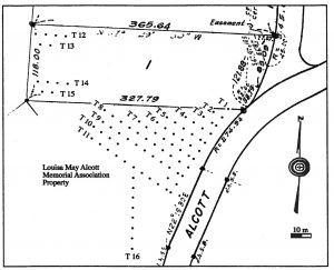
Map of the 1999 STP transects north and northeast of the house.

The previous excavations in 1999 and 2001/2002 had two different goals. The 1999 work was a shovel test pit (STP) survey, a grid of small excavation areas regularly spaced, north and northeast of the house. These small test pits are used to gather the first round of archaeological information about an area to learn what kinds of landscape changes have taken place, what kinds of trash deposits or features (foundations or pits, for example) are present in an area, and to begin to put dates on the different deposits and activities. At Orchard House, the 1999 survey uncovered a lot of evidence of activity during the Alcotts’ occupation and shortly thereafter, including evidence of moving top soil from one part of the property to another and of re-landscaping the area around the house. The STPs also found areas with high concentrations of trash and building materials. The STP survey provided a general picture of uses of areas north of the house that had archaeological potential – the possibility for deposits that would provide significant information about residents of the property. Since the property is preserved and protected, none of these deposits were further excavated at the time.

The 2001/2002 excavations were focused on the areas directly around the house and were carried out in anticipation of work one the house’s foundation. In this case, since we knew that the area was going to be disturbed by necessary construction, rather than just identifying the locations of archaeological deposits, we excavated large portions of them to gather information before it was lost. This phase of work resulted in the excavation of a large Alcott period trash deposit just behind the house which was studied in detail by UMB student Allison Conner for her MA thesis.

Some of the ceramic vessels excavated in 2001.

This year, we are returning to the area covered by the 1999 STP survey. Since the geothermal heating system will cross this area, we need to excavate larger portions of the areas identified as having high archaeological potential. We will use the results of the earlier work, and the construction plans, to put targeted, larger excavation units in places where the work area crosses locations identified as significant. We will also test some new areas not covered in 1999.

The first activity on site will be to establish a site grid. We do our work in the Massachusetts State Plane grid using GPS units and a total station, which ensures that excavation unit locations are accurately mapped and that any researcher could find them again in the future. In preparation for this, we put the old excavation maps into Geographic Information System (GIS) software which will allow us to display all of the excavation units from multiple years on a single, layered map.

After Labor Day, we will begin excavation. We excavate stratigraphically, meaning that we remove each different soil layer separately. The soil from each layer is screened, and all artifacts from a soil layer are kept together. The archaeologists will also spend a lot of time drawing, mapping, and documenting their findings. Once the excavation is complete, artifacts will go to the lab at UMass to be cleaned, identified, and studied before eventually returning to Orchard House. We will share updates from the field and lab work here or on our Facebook page or Instagram account at UMBArchaeology. If you are visiting Orchard House, you can also ask the Orchard House staff or the archaeologists questions about the work. You can also ask a question in the comments here!

Skip to toolbar