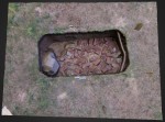
 We were out taking pictures of the bricks in Excavation Unit 7 on Burial Hill in Plymouth yesterday and Doug Bolender put together another 3D view. This one is can be viewed on the web, and does not require downloading like the last one. EU7 is where, according to the 1874 Beers map stood a school, probably the one that gave the street its name. You can see the whole map at the Boston Public Library (Leventhal Map Center).

Dr. John Steinberg has been a Research Scientist at the Fiske Center since 2006. He received his PhD in Anthropology from UCLA in 1997. Before coming to UMass Boston, John taught at UCLA and California State University Northridge. He is interested in the economic problems of colonization, both in New England and across the North Atlantic. He uses GIS and shallow geophysics to study settlement patterns to understand broad trends over the landscape. In addition to John's New England work, he has been studying the settlement patterns of Viking Age Iceland. John is the director of the Digital Archaeology Laboratory at the Fiske Center.
 We were out taking pictures of the bricks in Excavation Unit 7 on Burial Hill in Plymouth yesterday and Doug Bolender put together another 3D view. This one is can be viewed on the web, and does not require downloading like the last one. EU7 is where, according to the 1874 Beers map stood a school, probably the one that gave the street its name. You can see the whole map at the Boston Public Library (Leventhal Map Center).