Category Archives: Understanding the Peninsula and the Harbor

Boston Sewerage Past and Present: Other Local Treatment Facilities


View Calf Pasture Pumping Station in a larger map

This map shows sites related to the Calf Pasture Pumping Station, including:

  • the Calf Pasture Pumping Station (no longer in operation) – which includes locations of Shaft Entrance building and Switchhouse as well as main Pumping Station building
  • the Moon Island facility in Quincy, MA  (no longer in operation)
  • the Nut Island sewage treatment facility in Quincy, MA (currently in operation)
  • the Deer Island sewage treatment facility in Boston Harbor (currently in operation)


Moon Island
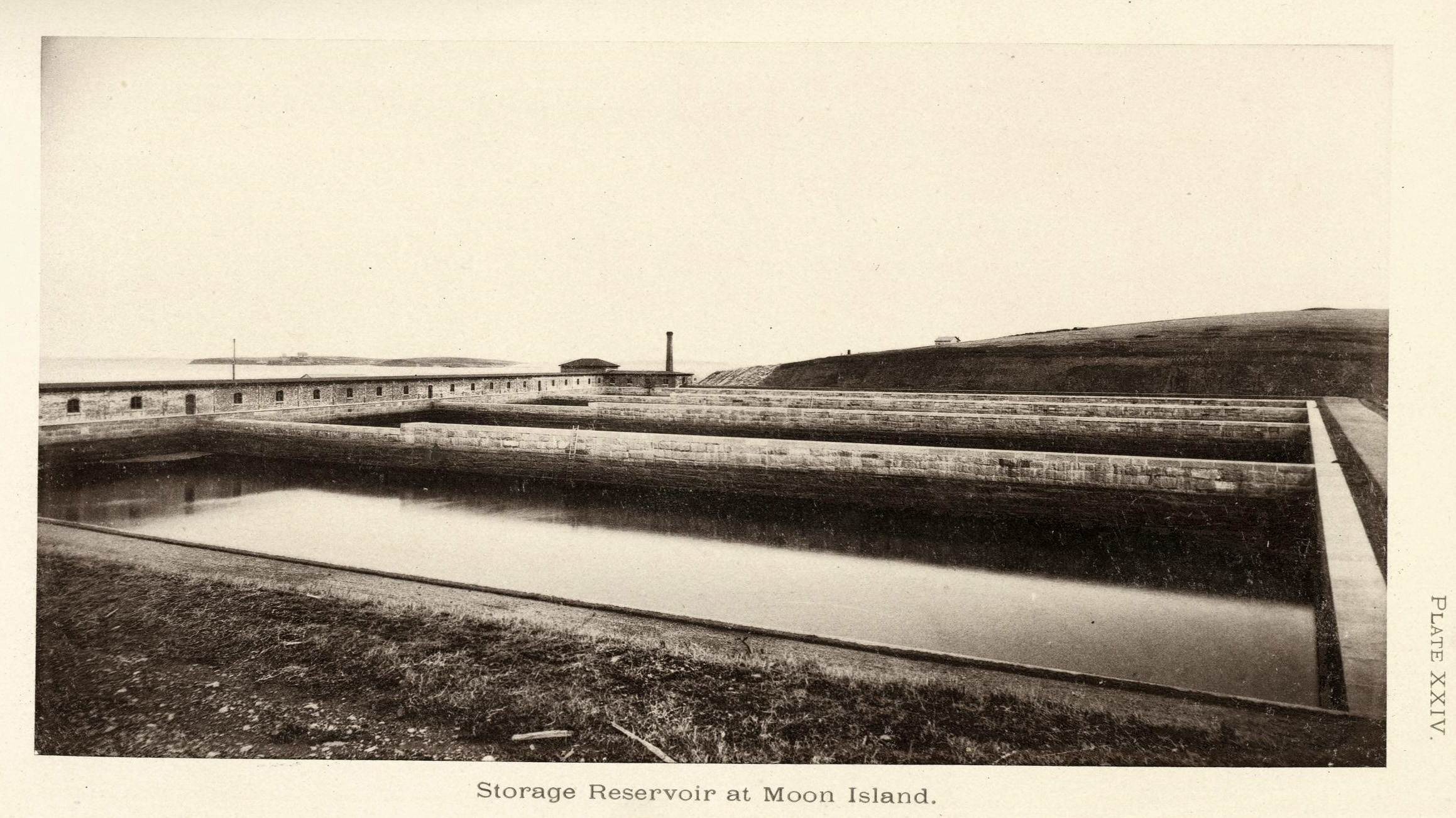
The reservoirs on Moon Island where the untreated sewage from the Calf Pasture Pumping Station was held until it was released into the Harbor.
(Source: Clark, Eliot C. Main Drainage Works of the City of Boston, 1888.) (Click to enlarge image)

The City of Quincy housed the Moon Island sewerage facility. Moon Island served as the final destination for Boston’s sewage until 1968 when the city updated the Deer Island facility to handle the main drainage sewage.  Reservoirs on Moon Island collected the raw sewage transported from the Calf Pasture Pumping Station. Here, reservoirs held sewage until releasing it into Boston Harbor with the outgoing tide.

Decades of dumping the city’s untreated sewage had negative impacts on  Boston Harbor and local communities.  Attempts to redress this pollution began In 1941, with the design of a waste treatment facility at Nut Island. Ernest efforts to clean the harbor began in the 1970s.


Nut Island
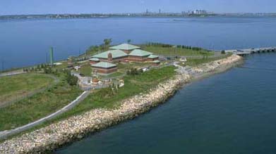
Aerial shot of the Nut Island facility in Quincy, MA. (Source: Massachusetts Water Resources Authority)
Aerial shot of the Nut Island facility in Quincy, MA.
(Source: Massachusetts Water Resources Authority). (Click to enlarge image)


It took seven years to build the sewerage treatment plant at Nut Island, in the City of Quincy; construction began in 1945, and operations commenced in May 1952.  Total construction costs were approximately $10 million.  

Engineers designed the Nut Island sewerage facility to address environmental problems created by the release of untreated sewage into Boston Harbor.  The Nut Island plant built in 1952 could not provide sufficient sewage treatment to protect the waters of Boston Harbor, however.  Prompted by a lawsuit and investigation in 1982, the 1952 facility at Nut Island was demolished, and a new Nut Island Headworks facility opened in 1998.  This newer facility can complete a  secondary treatment of sewage, and thus remains in operation today. The Massachusetts Water Resource Authority maintains a public park on the island.


Deer Island
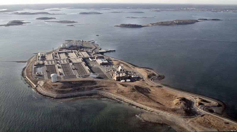
Aerial view of Deer Island in Boston Harbor, home of currently operating sewerage treatment facilities for Boston.
(Source: Doc Searls via Creative Commons) (Click to enlarge image)

The facility on Deer Island in Boston Harbor is perhaps the most easily recognizable sewerage treatment plant in Boston. The distinctive large round tanks are readily spotted from airplanes, boats, and land across the harbor.  The first primary treatment plant at Deer Island was built in 1968.  In 1982, the establishment of the Massachusetts Water Resources Authority (MWRA) led to the rehabilitation of sewerage treatment facilities on both Nut Island and Deer Island to create plants that could sufficiently treat Boston’s sewage for safe release into the Harbor.  


Sources Consulted:

  1. Massachusetts Water Resources Authority
  2. Kennison, Karl R. “Sewage Works Development in the Massachusetts Metropolitan District.” Sewage and Industrial Wastes 22.4 (1950): 477-89. JSTOR. Web. 06 Mar. 2013.
  3. Hanlon, Joseph B. “Screenings and Grit Complicate Starting Operations at Nut Island Sewage Treatment Plant.” Sewage and Industrial Wastes 26.10 (1954): 1290-1301. JSTOR. Web. 06 Mar. 2013.
  4. Flynn, Kevin C. “Turning the Tide in Boston Harbor.” Water Pollution Control Federation. 57.11 (1985): 1048-1054. JSTOR. Web. 06 Mar. 2013.

Photo Credits:

  1. Map hosted by Google Maps
  2. Clark, Eliot C. Main Drainage Works of the City of Boston
  3. Massachusetts Water Resources Authority
  4. Massachusetts Water Resources Authority


History of the Calf Pasture Peninsula

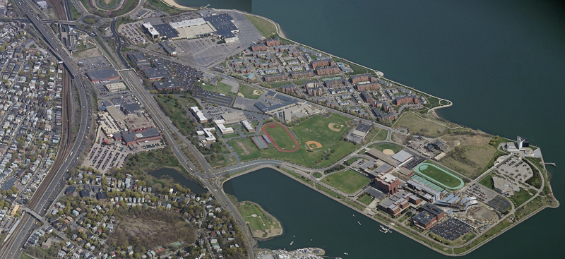
An aerial view of Columbia Point, 2007. (Click to enlarge image)

Before 1879, the Boston peninsula today known as Columbia Point, consisted of fourteen acres of marshy land. During the 19th century Dorchester residents used this land for grazing cattle, and was thus known by residents as simply the “Calf Pasture.”  The Puritans first landed nearby at the place known as Mattaponnock, today’s Savin Hill.

In the 1879s, city leaders and commissioners chose the Calf Pasture for the site of the pumping station that was vital to the new sewerage system.  Why here?  The peninsula  was distant from the more heavily populated areas of Boston, and the city could acquire it at a low cost.  It was also close to the water and Moon Island, south of the city in Quincy, where the sewage would be released.    

In 1879, the city initiated several land making projects on the peninsula, to prepare the area for the construction of the new sewage pumping station that would be the centerpiece of Boston’s Main Drainage Works sewerage system. The system was completed in 1884, when the Calf Pasture Pumping Station began working continuously to remove waste away from Boston.

In 1884, the Main Drainage Pumping Station and its several outbuildings were the only structures on the peninsula. The castle-like structure of the Pumping Station stood out on the marshy lands of Calf Pasture; it was accessible only by “Mile Road,” today known as Mount Vernon Street. During the 1880s, landmaking accommodated the construction of several Bay State Gas Company gas tanks just south of the Calf Pasture.

In the 20th century, more land resulted from filling in the flats at the end of the Calf Pasture and along the coast between Calf Pasture and Savin Hill for the construction of “Old Colony Boulevard,” now William T. Morrissey Boulevard, which  opened to automobile traffic in 1928.

In 1942, a military camp was built on the peninsula. During the Second World War, Camp McKay housed Italian prisoners of war. After the war, the camp’s barracks were  repurposed as public housing, known as the “Columbia Village housing project”.  

Boston College High School  relocated from the South End to Dorchester in 1950. In 1958, the Boston Globe relocated its operations to Morrissey Boulevard, just across the street from the Boston College High School, at the edge of Columbia Point. The barracks-turned-public housing were demolished soon after to make way for a shopping center and the Calf Pasture thus became known as Columbia Point.

The peninsula saw even further changes in the last quarter of the 20th century.  In 1974, the pumping station (by then unused), had another new neighbor when University of Massachusetts Boston officially opened its doors to students on their new campus at Columbia Point. The John F. Kennedy Presidential Library and Museum was established in 1979, and the Massachusetts State Archives opened in 1985. In the late 1980s, developers transformed the Columbia Point housing project into the Harbor Point community.  By 1990, Calf Pasture was a vastly different place than when the pumping station was built. Certainly entirely different from when the Puritans first landed nearby the place known as Mattaponnock, the peninsula’s modern day neighbor, Savin Hill.

Sources:

  1. Clark, Eliot C. Main Drainage Works of the City of Boston. Boston: Rockwell and Churchill, 1885.
  2. Roessner, Jane. A Decent Place to Live: From Columbia Point to Harbor Point: A Community History. Boston: Northeastern UP, 2000.
  3. Taylor, Earl. “Calf Pasture Pumping Station.” Dorchester Atheneum. Dorchester Historical Society, 30 May 2005. Web. 06 March 2013.
  4. “Urban Transformations: Columbia Point – Harbor Point Boston.” <http://004e136.netsolhost.com/images/7HP.pdf>.

Photo Credits:

  1. Boston Redevelopment Authority; www.bostonredevelopmentauthority.org
  2. Map hosted by Google Maps. Please click on the image to be directed to the map.