
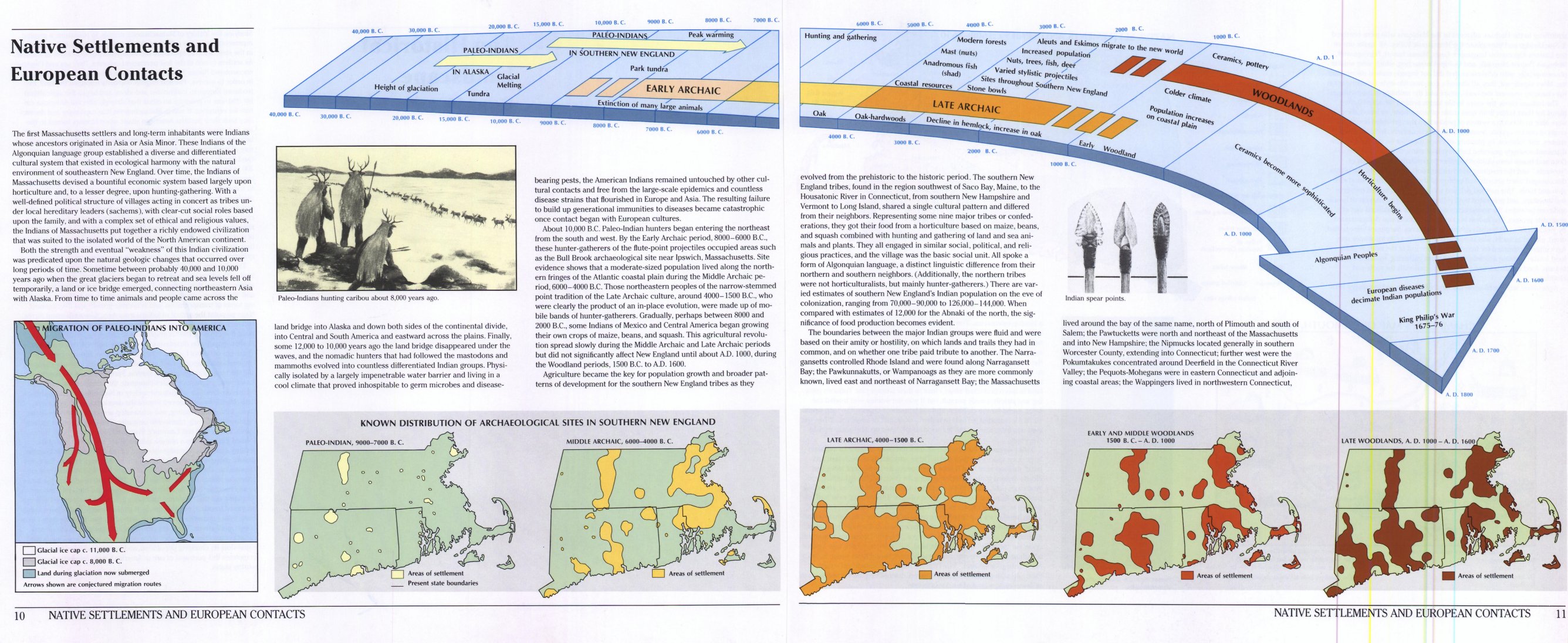
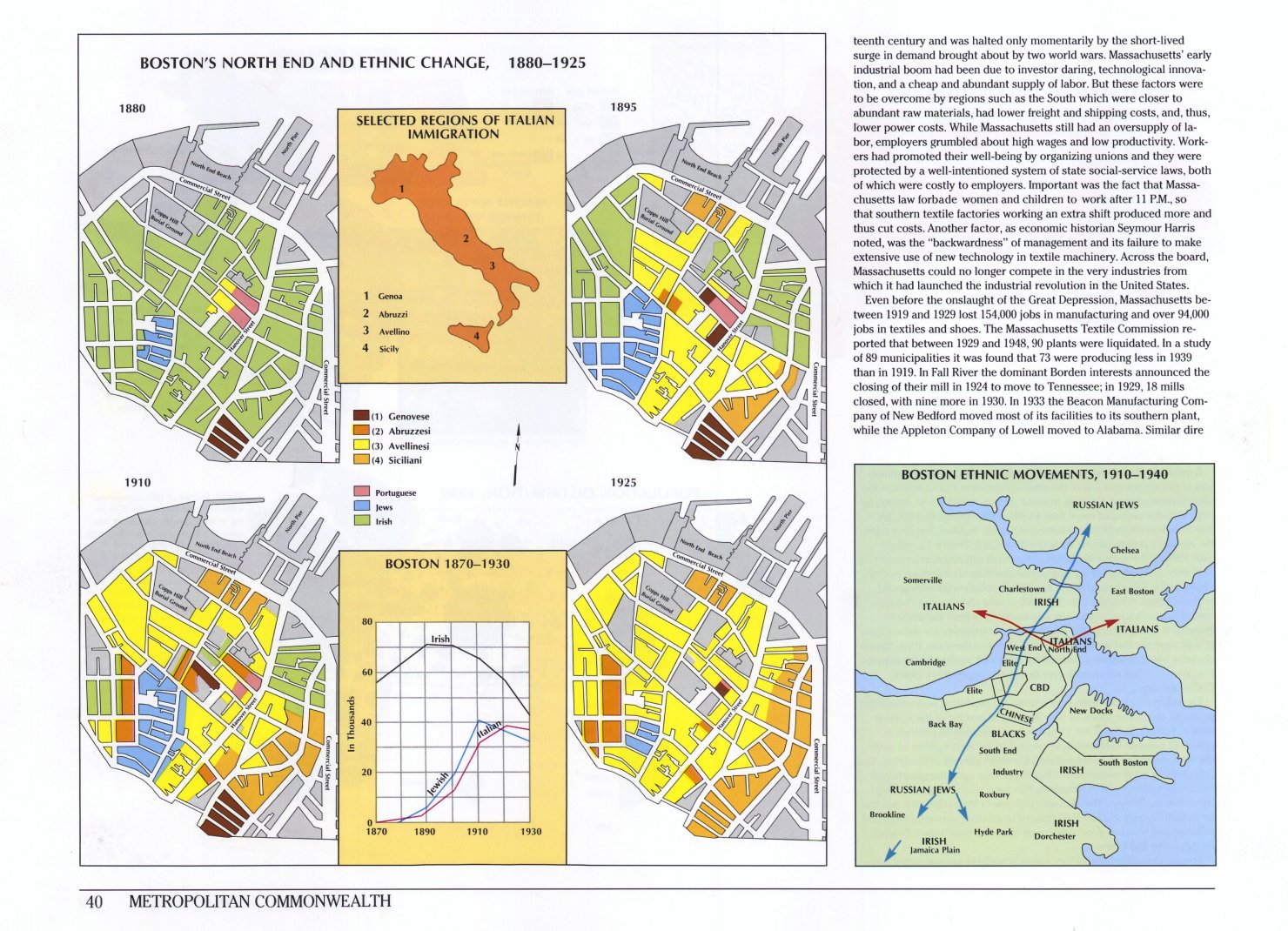
LInks to beautiful full-page images of maps and charts from the splendid Historical Atlas of Massachusetts, by Richard W. Wilkie and Jack Tager. Examples: Native Settlements and European Contacts, The Railroad in 1892, Boston’s North End and Ethnic Change, 1880-1925 and many more.
Historical Atlas of Massachusetts
January 15, 2007 | 5 Comments
.jpg)
March 8, 2021 at 8:05 am
exam bank
Mmm.. good to be here in your article or post, whatever, I think I should also work hard for my own website like I see some good and updated working in your site.
March 19, 2021 at 7:55 am
in stream advertisement
I am genuinely thankful to the holder of this web page who has shared this wonderful paragraph at at this place
December 23, 2024 at 8:15 am
Hello to all, how is the whole thing, I think every one
is getting more from this site, and your views are good designed for new users.
Here is my web-site … ngentot sekertaris bank
January 14, 2025 at 12:34 am
You can certainly see your expertise within the article you write.
The arena hopes for more passionate writers like you who aren’t afraid to
say how they believe. All the time follow your heart.
Check out my website; Bokep Ngewe Kaka dan adik tiri karena nggak bayar kosan
January 30, 2025 at 1:12 am
Great work! This is the kind of information that should be shared across the internet.
Shame on the search engines for now not positioning this
submit upper! Come on over and talk over with my site .
Thank you =)
Look into my webpage; Buy iOS Developer Accounts – VCCSturm.Com