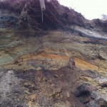
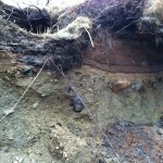
This week, we wrapped up hydrology. We will be missing Professor Douglas and learning about the water cycle. In hydrology, we had a guest speaker named Crystal who has worked with NASA and she treated all the students to Kitty Murtagh’s, which was awesome. The test Friday covered material throughout the short semester, I hope everyone does well on it. Gotta start my biology reading, so more updates down the road!
No Way, XL pipeline, Get Real
Its time to speak up against the Key Stone XL pipeline to support serious response to climate change. If you want your voice to be heard just click Here to send a message to Obama and get more info.
Here is NASA’s Hansen’s view from: http://insideclimatenews.org/news/20110826/james-hansen-nasa-climate-change-scientist-keystone-xl-oil-sands-pipeline-protests-mckibben-white-house
Now 70, Hansen heads the NASA Goddard Institute for Space Studies in New York City. In June he joined an effort spearheaded by Bill McKibben, the Vermont author, professor and founder of the advocacy organization 350.org, to coordinate a two-week protest against Keystone XL. They want the Obama administration to reject a Canadian company’s application to construct the $7 billion, 1,702-mile pipeline, which would carry heavy crude from the oil sands mines of Alberta to refineries along the Gulf Coast.
On Friday, State Department officials released their final environmental analysis of TransCanada’s proposed pipeline, saying the project will have “limited adverse environmental impacts.” The administration is expected to approve or reject Keystone XL by the end of the year.
Take a second to voice your opinion and help our government realize that people care about the environment.
Monitoring Groundwater
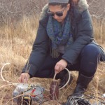
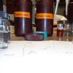
Yesterday I began my independent study field work. My project involves sampling groundwater from various locations on Nantucket for Nitrate and Phosphate, two nutrients that are added to water via human activities. I went around to three groundwater wells with Emily MacKinnon of the Nantucket Land Council. We stopped and took various measurements including conductivity, salinity, dissolved oxygen, dissolved solids, pH, and temperature at the Umass Boston Field Station, Clarke’s Cove, and Hummock Pond. Emily was super helpful and showed me how to measure the depth of the groundwater and how to use all of the instruments. After taking water samples from the three locations, I then went back to the Field Station to perform Nitrate and Phosphate tests using the spectrophotometer. I did the tests multiple times to ensure accurate results. I found that nitrate levels were extremely low in all three locations while phosphate was prominent, especially at the Field Station well where I got a reading of 1.11 mg/L of Phosphate in the sample. This is a high level, most likely due to fertilizers seeping into the groundwater. I look forward to doing these tests weekly to find out where the problem areas are on Nantucket, so I can inform the community and hopefully measures can be taken to reduce these nutrients in our drinking water.
- Pumping groundwater from a well at Clarke’s Cove.
- Collecting a water sample from Clarke’s Cove.
- Nitrate and Phosphate waste bottles at the Field Station.
- Some samples from the Field Station and Clarke’s Cove.
- Just doing science-y things.
- The water in the bottle on the right turned blue due to Phosphate contamination.
Northern Lapwings at Bartlett Farm Nantucket
Last Tuesday at Bartlett’s farm resident birding expert Vern Laux and I scouted the goose laden fields for two rare “accidentals”, Northern Lapwings that had blown over the Atlantic’s expanse from coastal Europe. He had been keeping an eye on these birds as no more than two have ever been spotted in the same location in North America.
Behold – There were three at Bartlett’s farm! A historic sighting, and a great experience in the field.
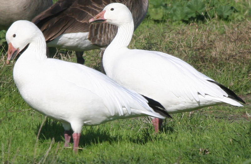
Among hundreds of Canada Geese I also spotted two Snow Geese in brilliant white plumage.

Getting our ‘Stuff’ together – With Ashley Bulseco-McKim!
Many of the students in the LivingLab program are getting excited about future employment and internship opportunities that are now within reach, given the valuable experience we are obtaining here on Nantucket. As summer internship deadlines are approaching, people are working on updating resumes and filling out applications. Sunday night our Program Assistant, Ashley Bulseco-McKim, took the time to prepare and present a thorough PowerPoint on creating good quality resumes and CVs, as well as how to seize some upcoming opportunities. We learned some great tips for customizing our resumes to the job we are applying for, such as including keywords from the actual job post to boost hits, and being quantitative as well as descriptive when listing skills. Many of us haven’t updated our resumes in a while, as we’ve been full-time students, so her presentation was very useful and greatly appreciated. Ashley is a PhD student, so much of her spare time is focused on her research and projects on shellfish larvae. We feel very lucky to have such an ambitious and accomplished woman amongst us, sharing time, knowledge, and helping us succeed with our individual studies.
- A slide from Ashley’s PowerPoint
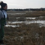
- Ashley in the marsh
- A slide from Ashley’s PowerPoint
Squam Swamp
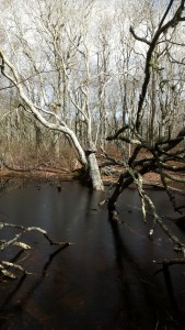
Thursday the group went on a field trip to Squam Swamp and it was beautiful to walk around a forest in the winter. The abundant amount of Tupelo surrounded us, so it felt like a dimension distorting funhouse. The Black Beach in the picture above stuck out among all the other forestry, the trunk low to the ground with long windy tree branches distinguished itself from all other trees. The vernal pools we passed were calm while life hibernates under the water, as well as the stream clear of ferns that usually blockade any access to it. Even in the winter the life of the forest was calm and unseen, but still stirring.
Nantucket Geology Lesson with Dr. H
- Sand Layering by Storm Wash
- Old Beach Berm
- Glacial Deposits Near Pocomo
- Profile of a Beach
A few weeks I was lucky enough to join Dr. Sarah Oktay, Amy Meloski and Llewin Froome to take measurements of a Common Dolphin that had died and washed up onshore near Pocomo Beach. Amy is a volunteer at the New England Aquarium and she gets calls for dead and stranded animals. Last week she recieved a call for another Common Dolphin near Siasconset(pronounced simply Sconset by the locals). Before checking out the new one we went back to Pocomo to see if the first one we saw was still there, in order to help determine if they could be the same animal that just floated with tides and currents. The one at Pocomo was no longer there but due to the location of the new one and the shape of the island we were pretty sure there was no way for them be the same. As we walked down the beach at Pocomo we realized the extent of Nemo’s wrath on Nantucket’s coasts. About ten feet of the bluff along most Polpis Harbor had just dropped off onto the beach, nearly twenty feet below.
The picture titled “Profile of a Beach” is a diagram of the different geological features that make up the beaches on Nantucket. It was drawn by Dr. Robyn Hannigan-(emphasis on the DR.-not artist 😉 HAHA)
The picture on the top left, “Sand Layering by Storm Wash”, is what is found beneath the UMass Boston Field Station. It shows thin layers of sand that were deposited by storms. The bluff near Pocomo also lost the same amount but revealed some more interesting geology.
The “Old Beach Berm” picture shows a profile of beach face that has been subsequently covered over through time. The fact that we can see this profile from this view, looking from the current beach, suggests that the beach from that time extended in opposite directions than it does today. The white layer near the top is called Caliche and consists only of sand that has completely leached everything that can possibly be leached out. The dark layer below that is an older B-horizon(basically just a fancy word for distinct layer in soil), and consists of oxygenated minerals, or iron-oxides. The middle of the picture is the profile of the berm itself, and would have a beach ridge and runnel extending in each direction.
The picture titled “Glacial Deposits Near Pocomo” shows what is know in geology as a conglomerate. A conglomerate is a type of sedimentary rock that consists of many different grain sizes, from sand to boulder, cemented together. This type of formation found here on Nantucket is evidence as to the islands formation, as it can only be deposited by a glacier. Around 12.000-19,000 years ago the Laurentide Ice Sheet stopped here, and began to retreat northward. As it receded, it left behind what is called a terminal moraine, forming Nantucket, Martha’s Vinyard to the west and Cape Cod to the north. The layers above the conglomerate show that sediments have been piling up on the moraine, along with accretion by wave and tidal action, shaping Nantucket into what it is today.
I want to thank Dr. Hannigan for coming out in the rain with Sarah Jacobs, Rubio Rodriguez and myself to explain this to us. You are a great teacher, advisor and friend. Can’t wait for you to make it back to the island. The bacon will be ready when you get here!!!
During our Hydrology Field Trip we visited a neighborhood that is being affected by erosion. This also pertains to my independent study. These houses are 10-20 feet away from these bluffs and are in danger of being swept away into the ocean. My study is focusing on how sea level rise is affecting the erosion and how it affects the Nantucket communities. This field trip was a great way to see the houses literally on the edge of the island. It is such an amazing sight to see but is also terrifying for these home owners.
Erosion
We have had the privilege to see many locations on this amazing Island thus far. The impact of erosion was clearly seen in the aftermath of Nemo, which caused damage across the island. The locations of erosion that I have personally seen this week included Siasconset beach, Sankaty Head Light, Umass Field Station and the beach off of Lauretta Lane. These locations made me realize erosion as a significant problem on Nantucket.
- Erosion at Siasconset beach
- Erosion at beach off of Lauretta Lane
Seminar on How to Read a Scientific Paper
Today Dr Hannigan graced us with her presence at a poetry brunch with Len at the field station. She also gave a seminar on how to read and write scientific papers which I found to be very helpful. We cleaned up the beach a little and it was an overall informative and environment friendly day. I can’t wait to see how the last week of hydrology unfolds as this this month winds down to an end.

