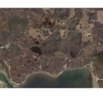
I have made substantial progress with my independent study over the last few weeks. I have spent plenty of time on the computer researching documents and analyzing aerial photographs on Arc GIS software with the help of Eddie Saenz and Steve Nye. Below is my abstract and sample photographs I will be analyzing.
Salt Marshes are unique coastal habitats that provide ecosystem services and hold important roles to the surrounding environment. The services and roles consist of providing nutrients to the coastal ocean, protection to the mainland, filtering pollutants and decomposition. Medouie Creek salt marsh is located on the northeast portion of Nantucket Island along Polpis Harbor, which is currently being restored. Mosquito ditches and a dike road have changed the hydrology of the area being studied. The main objective of the restoration projected conducted by the Nantucket Conservation Foundation (NCF) was to increase tidal action by installing a low flow box culvert, which increased the salinity and decreased the abundance of the non-native invasive plant Phragmites australis, also known as the Common reed. Improving tidal exchange has been done in hopes of restoring the salt marsh to a suitable state. The trend of this salt marsh shows the changes it has encountered over time from both human and natural activities. An analysis of this specific area using Arc Geographical Information Systems (GIS) will show physical coastal habitat alterations by comparing historic and current aerial photographs of Medouie Creek salt marsh. GIS will also be used to examine the impact of the restoration project and possible management techniques for future success.
- 1938 Aerial Photograph of Medouie Creek salt marsh
- 2012 Aerial Photograph of Medouie Creek salt marsh


