
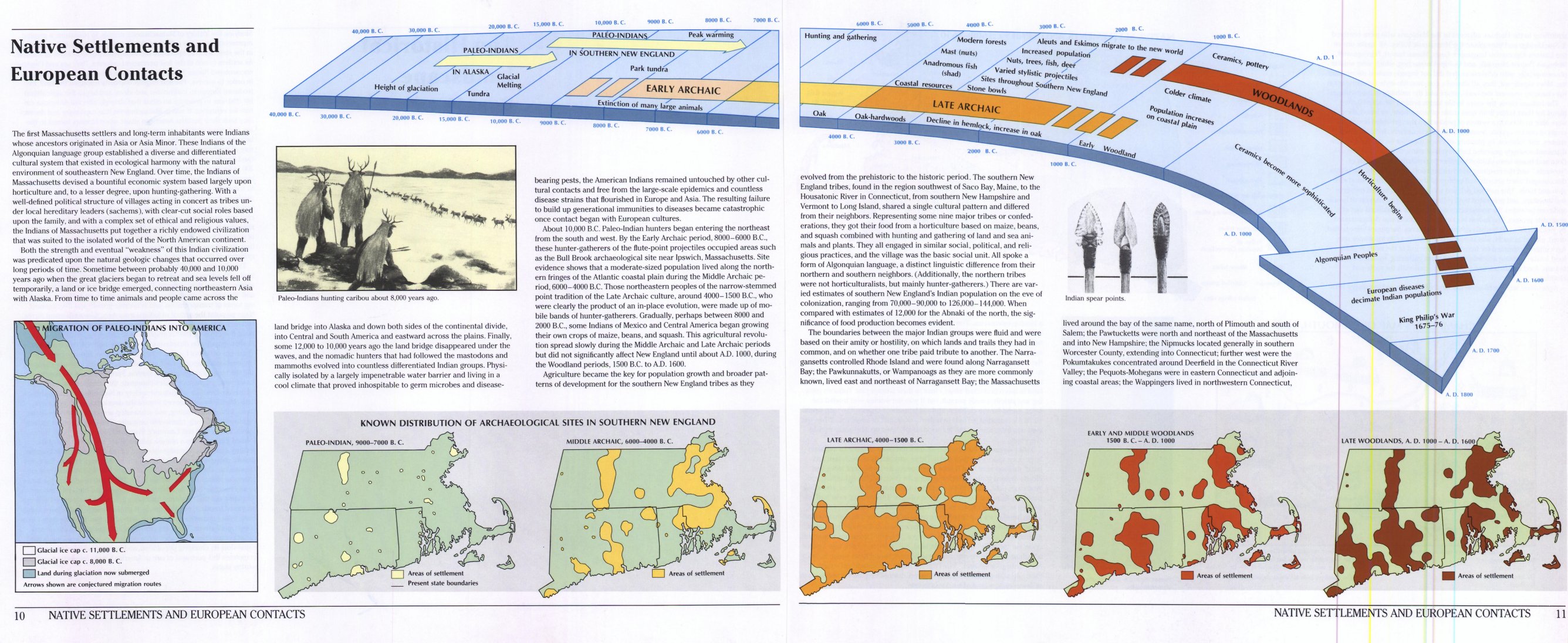
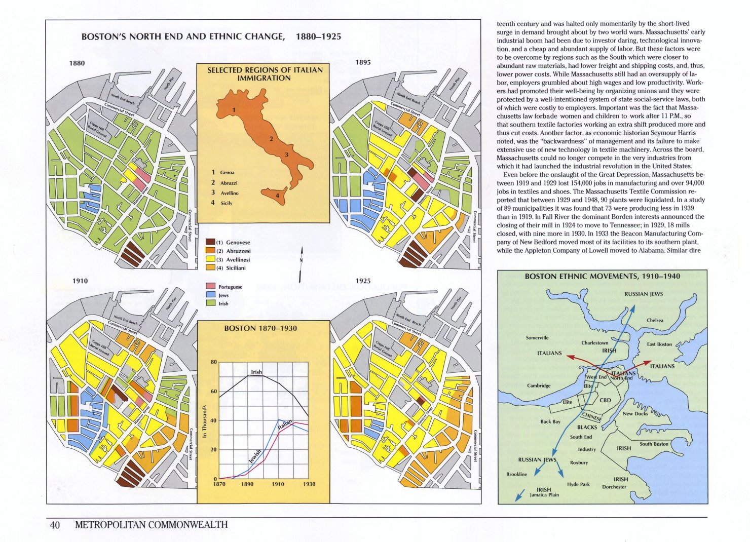
LInks to beautiful full-page images of maps and charts from the splendid Historical Atlas of Massachusetts, by Richard W. Wilkie and Jack Tager. Examples: Native Settlements and European Contacts, The Railroad in 1892, Boston’s North End and Ethnic Change, 1880-1925 and many more.
Historical Atlas of Massachusetts
January 15, 2007 | 2 Comments
.jpg)
March 8, 2021 at 8:05 am
exam bank
Mmm.. good to be here in your article or post, whatever, I think I should also work hard for my own website like I see some good and updated working in your site.
March 19, 2021 at 7:55 am
in stream advertisement
I am genuinely thankful to the holder of this web page who has shared this wonderful paragraph at at this place