
The first few weeks out in Hassanamesit Woods have been marked by (mostly) great weather and even better field experiences. Despite a rain day spent in the lab cleaning recovered artifacts on Monday the 4th, the second week of work gave the students a look at how changing stratigraphy within a unit can both puzzle and inform an excavator. Graduate students Melissa and Liz, joined by graduate student Ivana, began seeing some interesting soil changes as they brought their unit down to roughly 35-45cm below datum. These stratigraphic changes continued as they followed the strata down to a final depth of about 75cm below datum. As this unit is located right up against the Augustus Salisbury foundation, it was hoped that these soil changes might indicate a builder’s trench in the unit.

The northwest profile pictured above shows the bands of color that indicate stratigraphic changes. The C horizon is characterized by the greenish-grey sandy layer in the middle.
During construction of a building with a stone foundation it was often the case that builders would dig down into the sterile subsoil (known in this case as the ‘C horizon’ or ‘C strata’) in order to lay the foundation well below the contemporary ground surface. The soil displaced from this digging would then be loosely filled back in, along with building debris and other trash from the time period, so it could be dug out again later if repairs to the foundation were needed. The soil is often put back “out of order”, and areas of clear disturbance in the natural stratigraphy can clue in archaeologists to construction activities at a site. These trenches, and the artifacts recovered from them, can also help date the completion of a foundation.
By the beginning of the 3rd week it became clear that the stratigraphic changes observed in Melissa, Ivana and Liz’s unit were not being found in Rick and Alex’s adjacent unit, meaning the changes must be associated with the foundation rather than the wider yard space. Over in Tyler and Andrew’s unit, however, they began spotting some unusual stone placements, which also continued into Rick and Alex’s unit. At first it was thought they must have been placed deliberately by people in the area, as they were almost all propped up in an ‘upright’ manner. However, upon discussion with environmental archaeologist Dr. Trigg, Dr. Mrozowski, and the discovery of a large amount of loose frost fractured stones, it was decided that they most likely were the result of New England’s at-times violent freeze-thaw cycles.
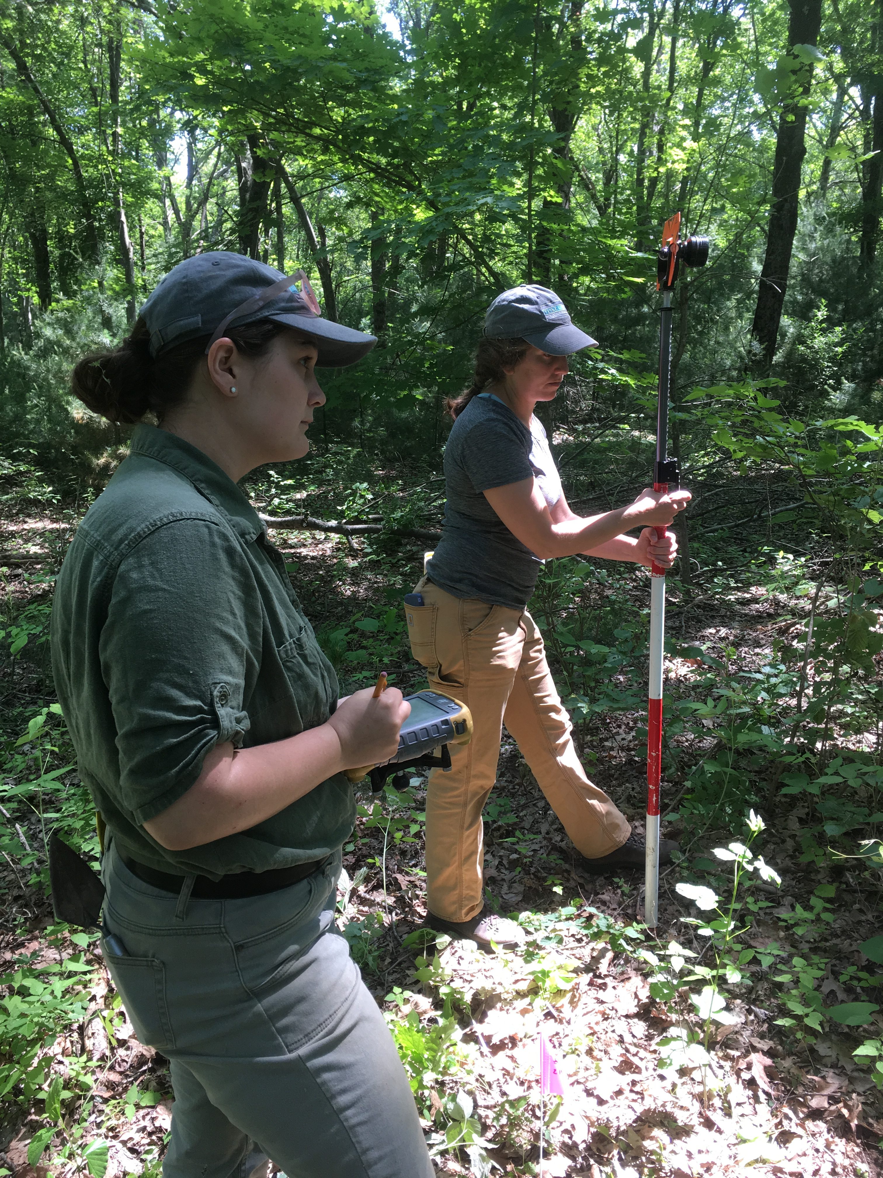
UMass Boston Historical Archaeology graduate students Melissa (left) and Lauren (right) use a data collection unit a prism pole to take elevations and lay out new units. These tools are used with a total station, operated by Dr. Schoenfelder (not pictured) to accurately map site coordinates.
Monday and Tuesday of week three also saw the arrival of Dr. John Schoenfelder and UMass Boston graduate student Lauren to the site. They worked with field school students to map further units near the Salisbury foundation, establish datum points at the Deb Newman site, and take some elevation measurements. This gave students attending the field school the opportunity to learn how to operate a total station and precisely map site coordinate
As this mapping was going on, Gary and Bryn finished their unit at the Augustus Salisbury site and moved over to the Deb Newman site to open the first unit there. This unit corresponds with some of the marked metal detection hits made by Brian in the first week. By Thursday they were joined by Liz and Melissa, while Alex, Andrew, Rick, and Tyler remain at the Salisbury site to finish their units.
While field work is generally supplemented by research and analysis after the season has officially ended, there are still times when you need to go home after a long day of excavating and consult a few books. After the discovery of a piece of pearlware or ironstone with a unique maker’s mark in a level suspected to be contemporaneous with the completion of the foundation, everyone ran to their phones to search the many online ceramic databases. When this proved to be too big a task for a quick in-the-field search it was decided that everyone would spend some time looking for the mark in online and print databases. Luckily the Fiske Center library is fully equipped for such a search. 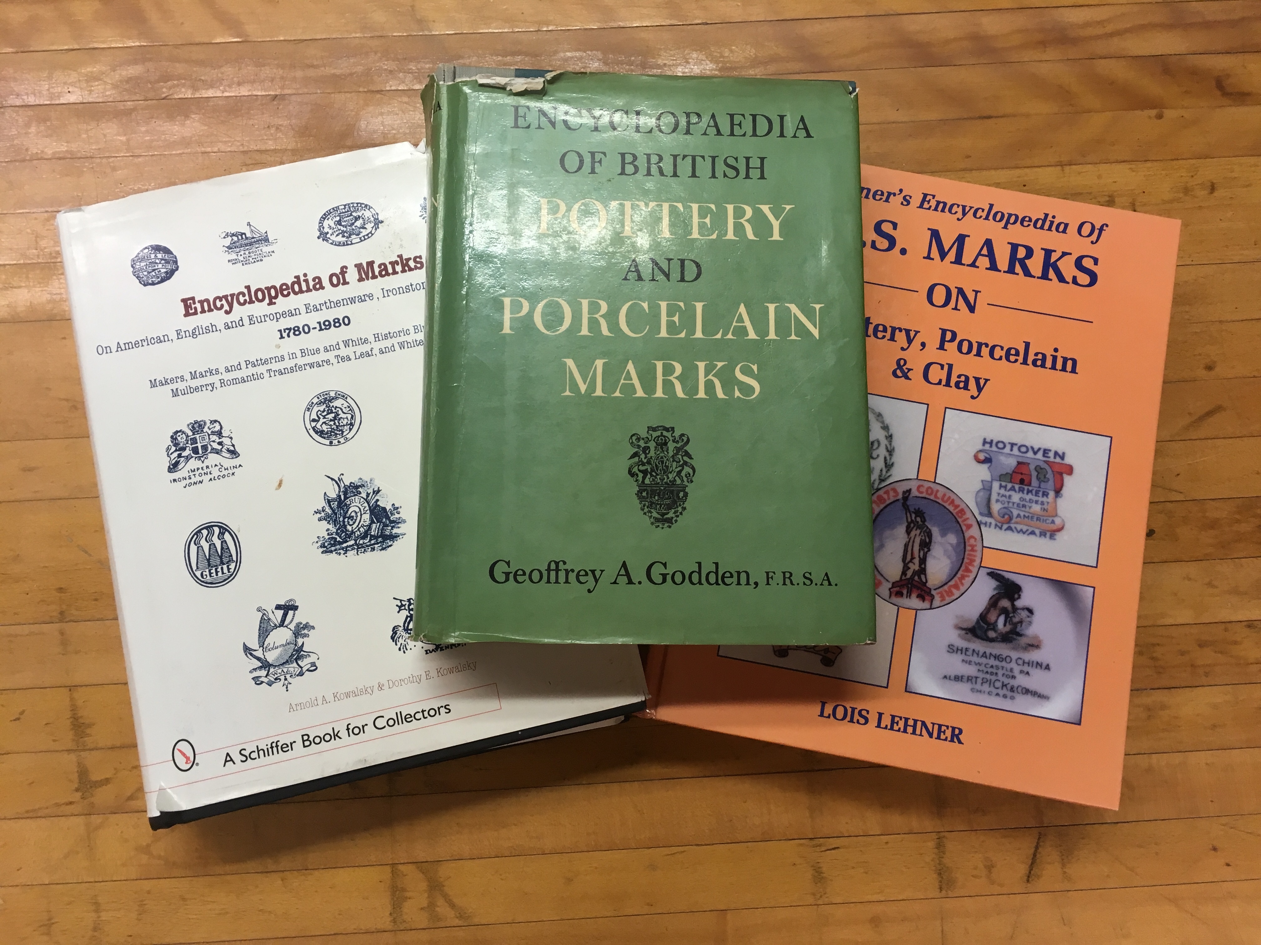 While the mark has yet to be identified, Dr. Mrozowski hopes that when it is it will give us a reliable TPQ (terminus post quem, or earliest possible date) for the Augustus Salisbury foundation’s completion. Perhaps the remaining units at the Salisbury site will provide more identifiable ceramic pieces from the same time period to aid in the TPQ determination.
The dual focus of this field school on both the Deb Newman and Augustus Salisbury sites provides an opportunity for comparative excavation and should prove very interesting in the coming weeks.