
Deed Research
This post is part of the Further Research series (see here for an explanation) and is continued from Part 1.
In researching the building foundations we uncovered during the 2014 excavations on Burial Hill in Plymouth, we georferenced historic maps and also did extensive deed research to determine who owned them and what were they used for. There are maps from 1874 and 1885 that show the buildings along this stretch of School Street, but the two maps do not completely agree with each other, and one map contained a number of inconsistencies regarding building ownership, suggesting that we couldn’t use it to determine who owned the different buildings.
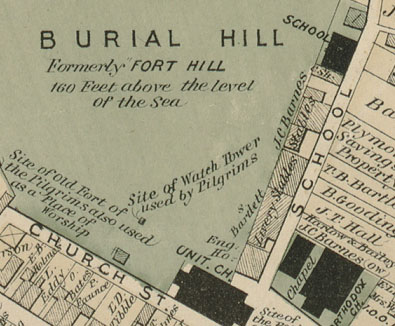
A section of the 1874 Beers map of Plymouth showing the buildings along School Street. However, based on deed research the building owners listed on this map appear not to be correct in all cases.

A section of the 1885 Sanborn map showing buildings on School Street. Note that some buildings have been demolished since the 1874 map and others have been reconfigured.
Over the course of the 2015-2015 academic year, we conducted deed research to trace the history of the properties in the excavation area. The task was complicated here because the modern property, owned by the Town of Plymouth, is made up of 10 separate 18th and 19th-century lots that were only consolidated in the early 20th century. We had to trace a lot of parcels to reconstruct the history of ownership along School Street! Usually, we needed to go back to a late 18th or early 19th-century deed to find parcel dimensions that allowed us to fit the historic parcels onto the modern landscape.
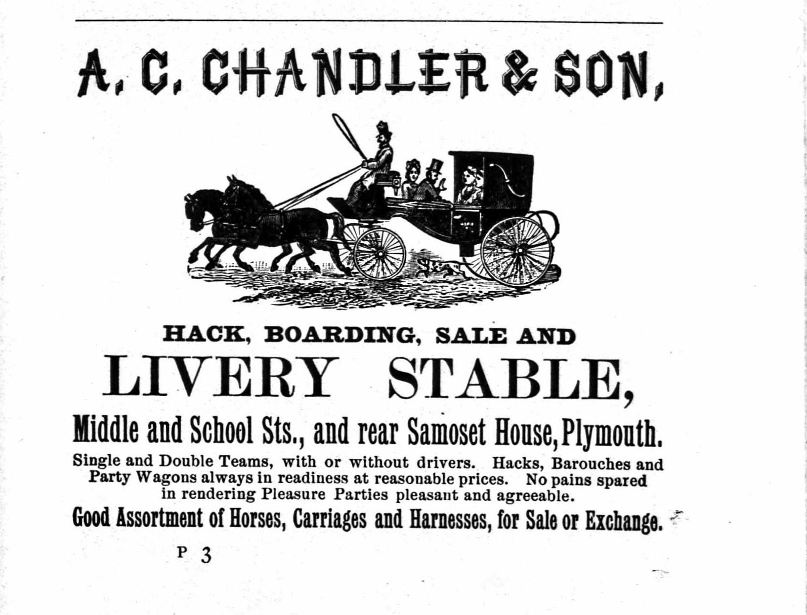
Advertizement from the 1890 Plymouth Directory for the Chandler Livery Stables. We did not uncover the foundations of this building, but excavation units 1 and 8 were inside the footprint of Albert and William Chandler’s “new stable” built between 1882 and 1884.
Ownership of the core of Burial Hill was always been retained by the Town of Plymouth, and the area was used for burials beginning in the late 17th century. However, in 1722, the Town began selling off parcels of land on the northern and eastern boundaries of Burial Hill, along present-day South Russell and School Streets, with most initial public sales of Town land on Burial Hill taking place between 1775 and 1825. Most of the lots along South Russell Street and the northern part of School Street were residential. School Street took its name from a grammar school, sometimes referred to as the central school, established in 1765 north of the Unitarian church at the south end of the street (the lot labeled “Engine House” on the 1874 Beers map). A second school, sometimes called the “town school” was established in 1827 in the middle of School Street, just south of the path up to Burial Hill, after the Central School District purchased a plot of land in 1826. This lot is still labeled as “School” on the 1874 Beers map. South of this school, the properties were primarily barns and stables (such as the Chandler Livery stable), many of them built by landowners living on the opposite side of School Street from the cemetery. In 2014, we found the foundations of two of these buildings as well as deposits relating to the 1827 school (which will be discussed in a later post).
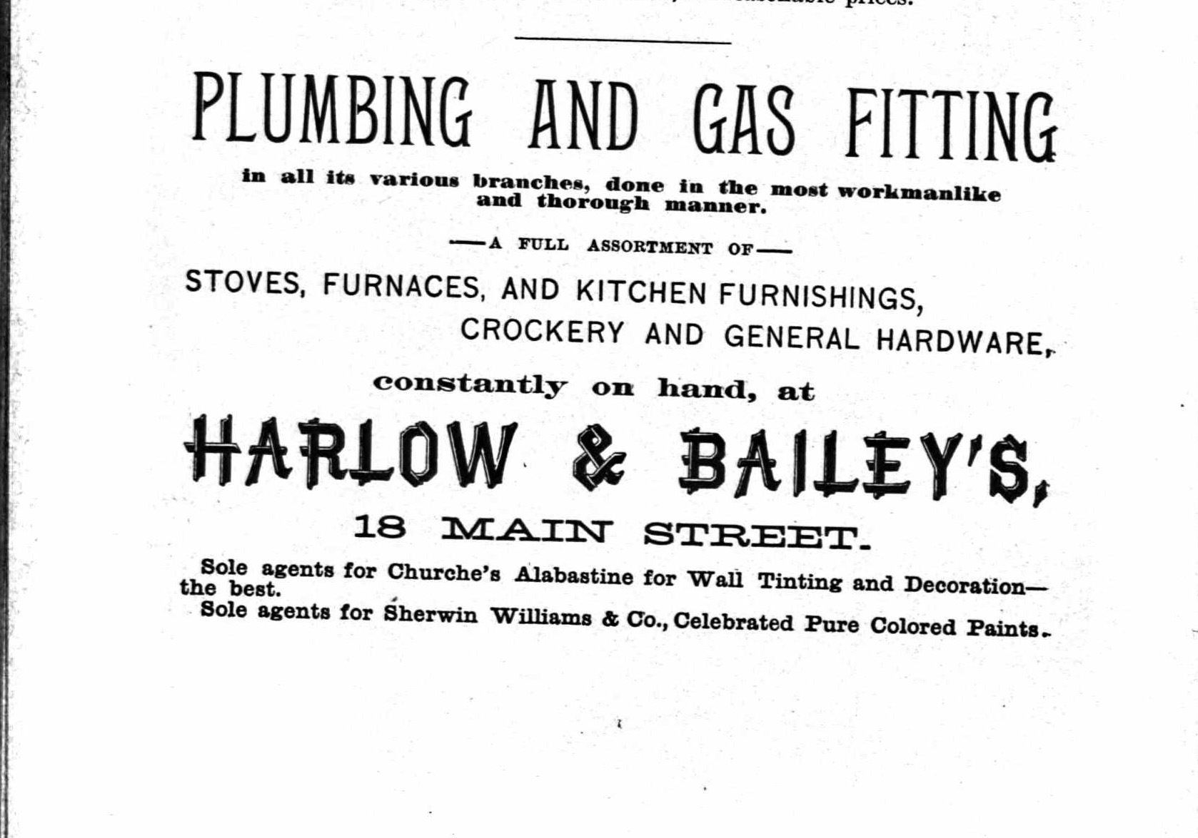
Ad for Harlow and Baily in the 1890 Plymouth Directory.
Excavation unit 2 crossed the back wall of a building that we identified as belonging to the firm of Harlow and Bailey. The land was first sold by the town in 1736 and 1740 and came under the ownership of the Jackson family in 1787 and 1790. After a number of intermediate transactions with the heirs of the Jacksons in the 1860s, the property, including a barn, was acquired by the firm of Samuel Harlow and J. C. Barnes, which became Harlow and Horace P. Bailey. Harlow and Bailey sold “stoves, furnaces, and kitchen furnishings, crockery and general hardware” at 18 Main Street. Harlow and Bailey seem to have encountered financial trouble in the 1890s and transferred all of their corporate property to a trustee in 1898 (PRCD 775: 122) with instructions to sell the property for cash to satisfy their creditors. Harlow and Bailey owned a business elsewhere in Plymouth and may have used this building for storage, which is how it is labeled on the 1885 Sanborn map, or they may have stabled horses that were used in support of their business.
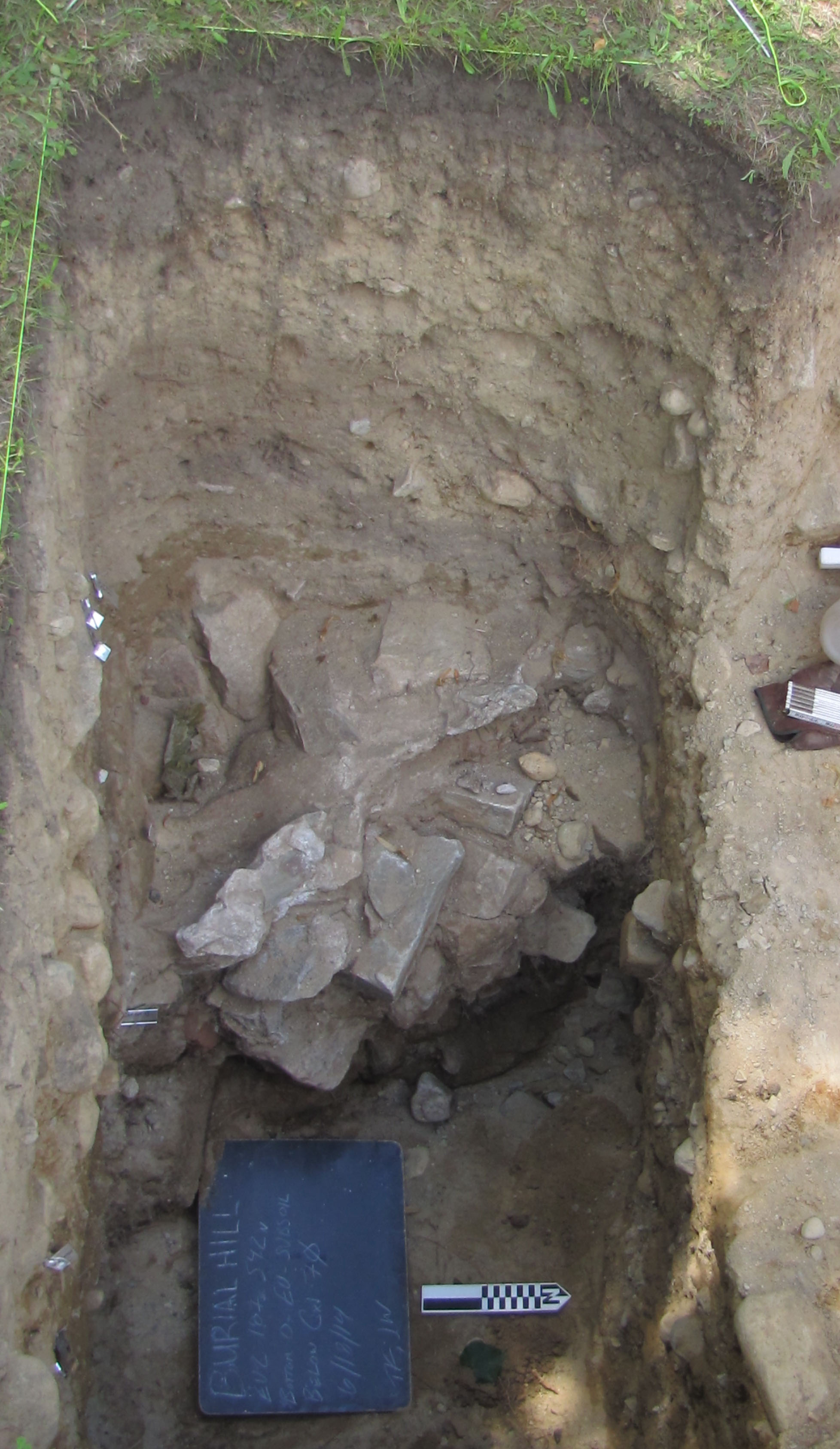
Foundation of the Harlow and Bailey building in EU2.
Excavation unit 3 crossed the back wall of a building last owned by Zenas F. Leach. Leach owned land in several places along School Street, and was the last private owner of three lots at the south end of the street, which he sold to the town in 1884 at which time they contained “old stable buildings.” Davis outlines the complex early history of these lots in Ancient Landmarks of Plymouth (1899). They were all acquired by Caleb Rider in 1833 and 1843. The three lots were held by Rider until the 1860s, then all transferred several more times in the 1870s and 1880s before being purchased by Leach in 1882. These were among the first buildings on School Street to be demolished, probably soon after they were acquired by the town since they are absent from the 1885 Sanborn map.