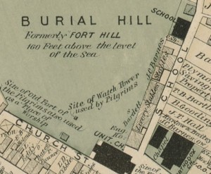
The field school has been in session for three weeks, and we have discovered that the units we are working on are deep! This is often the case in urban areas that people have been using intensively for hundreds of years. Burial Hill is no exception. There were likely Native American settlements in this general area; the Pilgrims built the core of their colony here starting in 1620 and used the hill as the high point of a fortified town until the 1670s. Parts of the hill became a cemetery in the 1680s, and the area along School Street, where we are working, became the location of houses, stables, warehouses, a school, and other buildings during the later 18th century and throughout the 19th century. All of these buildings were taken down during the last decades of the 19th century and first decades of the 20th century.
One of the primary questions that we are trying to answer this year is what effect the 19th-century buildings that lined the street had on older archaeological deposits. Did they cap and preserve them, or cut through them? Are there areas in the back yards of the buildings with good preservation, or should we look under the building footprints?
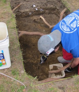
We have opened 5 excavation units (or EUs) so far. Three of these are pretty far along, and so far are all very different. EU1 is located in an area that seems to have been between two buildings on the 1874 map and was within the foot print of a large building on the 1885 map. Here we found a thick mottled deposit containing a mix of 19th-century material such as coal and older, mid-18th century ceramic fragments. There are large tree roots running through the unit, and we have not reached the bottom yet, so don’t know if there are earlier layers below.
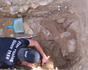
EU2 was placed to cross the back wall of one of the buildings. For a long time, we thought that the wall must have been completely destroyed when the building was demolished, because the unit contained only a clean sand and gravel fill with very few artifacts. But there were a few artifacts, so we kept excavating and eventually found a deposit of iron objects, cans and possibly horse harness pieces, and then below that, just over a meter below the surface, finally located a mortared stone foundation! The material above it suggests that when the building was demolished, someone brought in cart loads upon cart loads of clean sand and gravel to cover the area.
We also expected EU3 to cross a building wall, and it seems like that is proving to be the case as well. This wall is only partially uncovered, but seems not to be mortared and to be only partially intact. One of the striking differences between EU2 and EU3 is the material used to cover over the demolished foundations. While in EU2 it was very clean, in EU3 it was filled with slag from an iron foundry which was probably brought in from another location in Plymouth and dumped here. EU3 has been challenging to excavate because it is on a part of the hill with a very steep slope.
We just started EUs 4 and 5 this week, so it’s too soon to say much about them, but they are located in what would have been the back yards of the buildings.


